Catalog Archive
Auction 101, Lot 125

"Map of the United States of North America, Upper & Lower Canada New Brunswick, Nova Scotia & British Columbia. Mexico Cuba, Jamaica, St. Domingo and the Bahama Islands", Ettling, Theodor

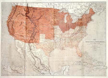
Subject: United States - Civil War

Period: 1861 (dated)

Publication: Illustrated London News

Color: Printed Color

Size:
36.5 x 25.8 inches
92.7 x 65.5 cm
Download High Resolution Image
(or just click on image to launch the Zoom viewer)

Great Civil War map of the United States. The eastern part shows the division of the country into pro-slavery and Union sections, with the border states of Missouri and Kentucky classified as part of the South. In the West, the proposed Arizona Territory is shown south of New Mexico, Nevada is shown with an early proposed boundary with Utah, and both Washington and Oregon are shown with their eastern boundaries in the Rocky Mountains. The emphasis of the map is the lines of communication and transportation. Several proposed railways are shown, interestingly noting the number of miles each was to span.

References: Wheat (TMW) #1025.

Condition: A

Folding as issued. Minor offsetting in margins. Professional repair of small tear at centerfold.

Estimate: $240 - $275

Sold for: $180

Closed on 12/4/2002

Archived