Filtered by Category:Canada(Show All Categories)
Showing results for:Auction 191
Catalog Archive
27 lots
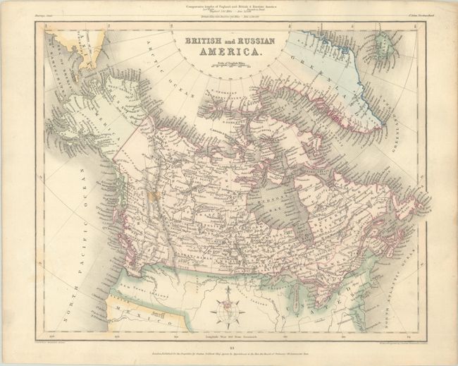
Auction 191, Lot 109
Subject: Canada
Grattan & Gilbert
British and Russian America, 1841
Size: 11.4 x 9.1 inches (29 x 23.1 cm)
Estimate: $100 - $130
NO RESERVE
Sold for: $220
Closed on 2/8/2023
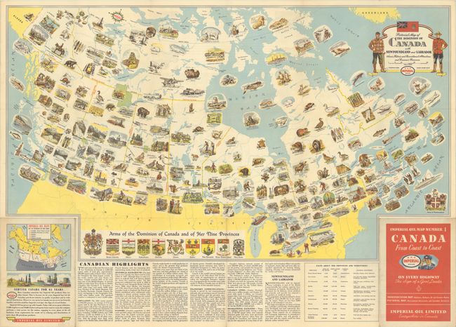
Auction 191, Lot 110
Subject: Canada
Pictorial Map of the Dominion of Canada with Newfoundland and Labrador Scenic, Historic and Recreational Attractions and Economic Resources, 1946
Size: 28.6 x 16.5 inches (72.6 x 41.9 cm)
Estimate: $140 - $170
Sold for: $300
Closed on 2/8/2023
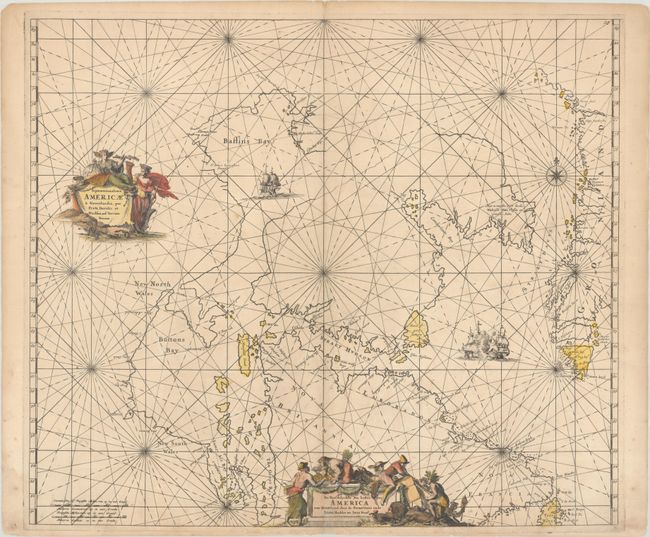
Auction 191, Lot 111
Subject: Northern Canada & Greenland
Wit, Frederick de
Septemtrionaliora Americae a Groenlandia, per Freta Davidis et Hudson, ad Terram Novam / De Noordelyckste Zee Kusten van America van Groenland door de Straet Davis ende Straet Hudson tot Terra Neuf, 1680
Size: 22.3 x 19.2 inches (56.6 x 48.8 cm)
Estimate: $600 - $750
Unsold
Closed on 2/8/2023
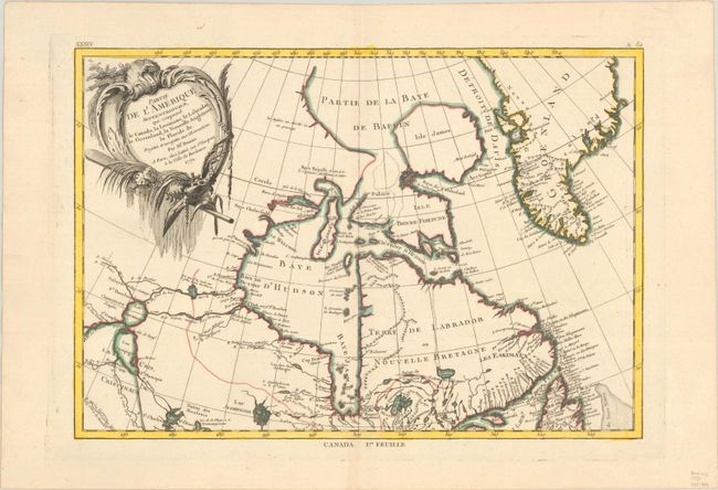
Auction 191, Lot 112
Subject: Eastern Canada & Greenland
Bonne, Rigobert
Partie de l'Amerique Septentrionale, qui Comprend le Canada, la Louisiane, le Labrador, le Groenland, la Nouvelle Angleterre, la Floride &c..., 1771
Size: 17 x 11.8 inches (43.2 x 30 cm)
Estimate: $160 - $190
Sold for: $120
Closed on 2/8/2023
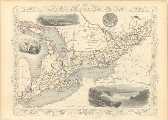
Auction 191, Lot 113
Subject: Eastern Canada
Tallis, John
[Lot of 2] West Canada [and] Nova Scotia and Newfoundland, 1850
Size: 12.9 x 9.9 inches (32.8 x 25.1 cm)
Estimate: $160 - $190
Sold for: $160
Closed on 2/8/2023
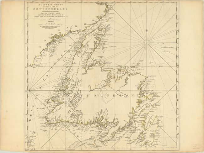
Auction 191, Lot 114
Subject: Newfoundland, Canada
Jefferys/Sayer & Bennett
A General Chart of the Island of Newfoundland with the Rocks & Soundings. Drawn from Surveys Taken by Order of the Right Honourable the Lords Commissioners of the Admiralty..., 1775
Size: 22 x 21.4 inches (55.9 x 54.4 cm)
Estimate: $350 - $425
Sold for: $250
Closed on 2/8/2023
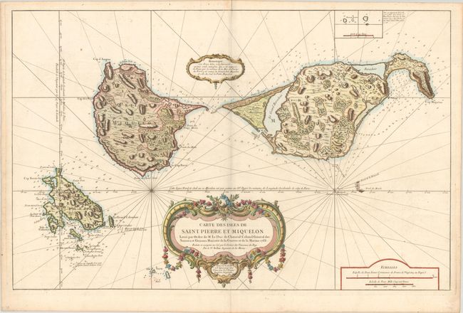
Auction 191, Lot 115
Subject: St. Pierre & Miquelon, Canada
Bellin, Jacques Nicolas
Carte des Isles de Saint Pierre et Miquelon Levee par Ordre de M. Le Duc de Choiseul Colonel General des Suisses et Grisons Ministre de la Guerre et de la Marine, 1763
Size: 33.9 x 21.8 inches (86.1 x 55.4 cm)
Estimate: $275 - $350
Sold for: $140
Closed on 2/8/2023
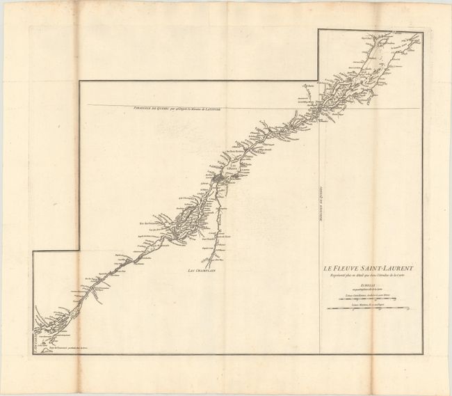
Auction 191, Lot 116
Subject: St. Lawrence River, Canada
Anville, Jean Baptiste Bourguignon d'
Le Fleuve Saint-Laurent Represente Plus en Detail que dans l'Etendue de la Carte, 1755
Size: 22.1 x 18.2 inches (56.1 x 46.2 cm)
Estimate: $140 - $180
NO RESERVE
Sold for: $30
Closed on 2/8/2023
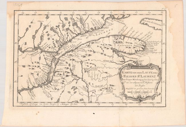
Auction 191, Lot 117
Subject: St. Lawrence River, Canada
Bellin, Jacques Nicolas
Karte von dem Laufe des Flusses St. Laurenz von Seiner Mundung an bis Uber Quebece zu der Allgemeinen Historie der Reisen, 1757
Size: 11.9 x 7.6 inches (30.2 x 19.3 cm)
Estimate: $100 - $130
Sold for: $65
Closed on 2/8/2023
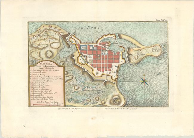
Auction 191, Lot 118
Subject: Louisbourg, Canada
Bellin, Jacques Nicolas
[Lot of 2] Plan de la Ville de Louisbourg dans l'Isle Royale [and] Port de Louisbourg dans l'Isle Royale, 1764
Size: See Description
Estimate: $250 - $325
Sold for: $180
Closed on 2/8/2023
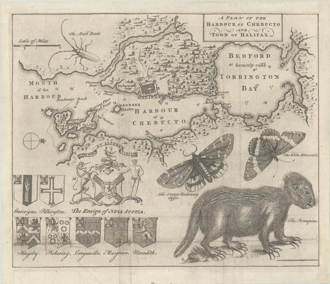
Auction 191, Lot 119
Subject: Halifax, Canada
A Plan of the Harbour of Chebucto and Town of Halifax, 1750
Size: 10.4 x 8.6 inches (26.4 x 21.8 cm)
Estimate: $700 - $850
Unsold
Closed on 2/8/2023
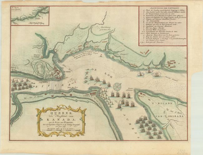
Auction 191, Lot 120
Subject: Quebec, Canada
Tirion, Isaac
Quebek, de Hoofdstad van Kanada; aan de Rivier van St. Laurens: door de Engelschen Belegerd en by Verdrag Bemagtigd, in't Jaar 1759, 1769
Size: 17.1 x 13 inches (43.4 x 33 cm)
Estimate: $300 - $375
Sold for: $220
Closed on 2/8/2023
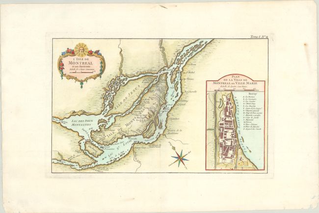
Auction 191, Lot 121
Subject: Montreal, Canada
Bellin, Jacques Nicolas
L'Isle de Montreal et ses Environs, 1764
Size: 13.6 x 8.5 inches (34.5 x 21.6 cm)
Estimate: $400 - $475
Sold for: $200
Closed on 2/8/2023
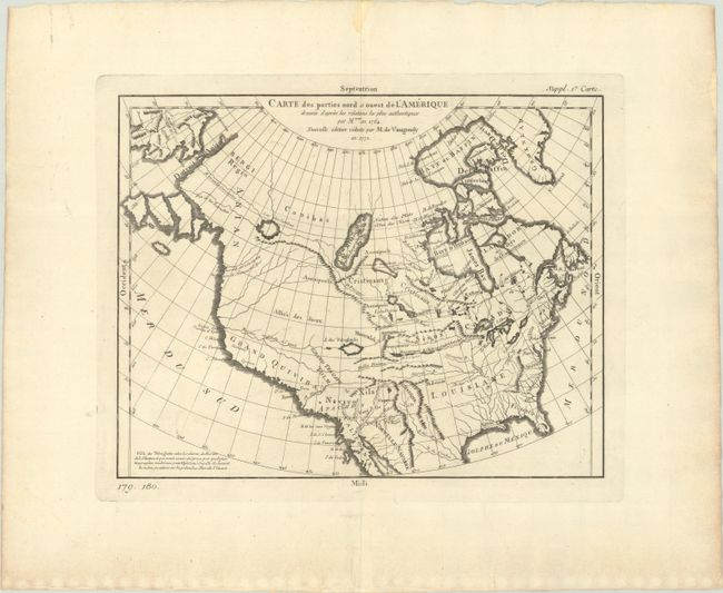
Auction 191, Lot 122
Subject: Colonial United States & Canada
Robert de Vaugondy, Didier
Carte des Parties Nord et Ouest de l'Amerique Dressee d'Apres les Relations les Plus Authentiques par M... en 1764, 1772
Size: 14.4 x 11.3 inches (36.6 x 28.7 cm)
Estimate: $220 - $250
Sold for: $160
Closed on 2/8/2023
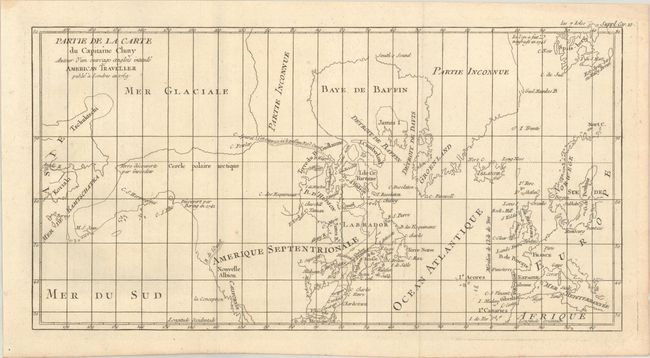
Auction 191, Lot 123
Subject: United States & Canada, Arctic
[Lot of 2] Partie de la Carte du Capitaine Cluny Auteur d'un Ouvrage Anglois Intitule American Traveller Publie a Londres en 1769 [and] Arctic Regions and British America, 1772-1853
Size: See Description
Estimate: $180 - $220
Sold for: $70
Closed on 2/8/2023
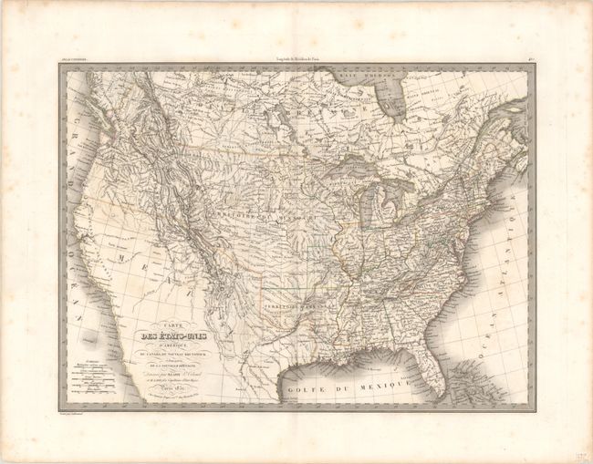
Auction 191, Lot 124
Subject: United States & Canada
Lapie, Alexander Emile & Pierre
Carte des Etats-Unis d'Amerique, du Canada, du Nouveau Brunswick et d'une Partie de la Nouvelle Bretagne, 1832
Size: 21.2 x 15.5 inches (53.8 x 39.4 cm)
Estimate: $275 - $350
Sold for: $200
Closed on 2/8/2023
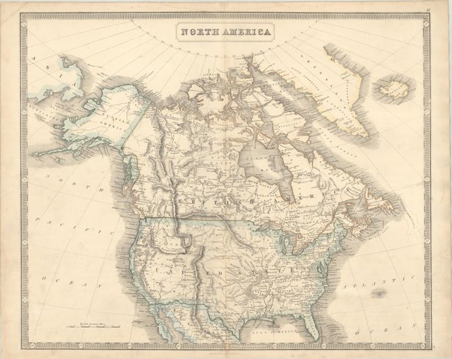
Auction 191, Lot 125
Subject: United States & Canada
Philip, George
North America, 1855
Size: 23.9 x 19.7 inches (60.7 x 50 cm)
Estimate: $160 - $190
Sold for: $210
Closed on 2/8/2023
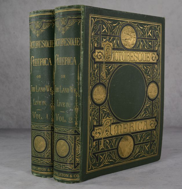
Auction 191, Lot 126
Subject: United States & Canada
Bryant, William C.
[2 Volumes] Picturesque America; or, the Land We Live In..., 1872-74
Size: 10.3 x 13.1 inches (26.2 x 33.3 cm)
Estimate: $550 - $700
Sold for: $400
Closed on 2/8/2023
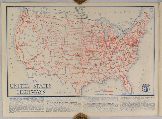
Auction 191, Lot 127
Subject: United States & Canada, Road Atlas
Clason Map Company
Clason's Touring Atlas of the United States with Road Maps of Every State and Ontario and Quebec, Canada, 1927
Size: 8.6 x 12 inches (21.8 x 30.5 cm)
Estimate: $150 - $180
Sold for: $110
Closed on 2/8/2023
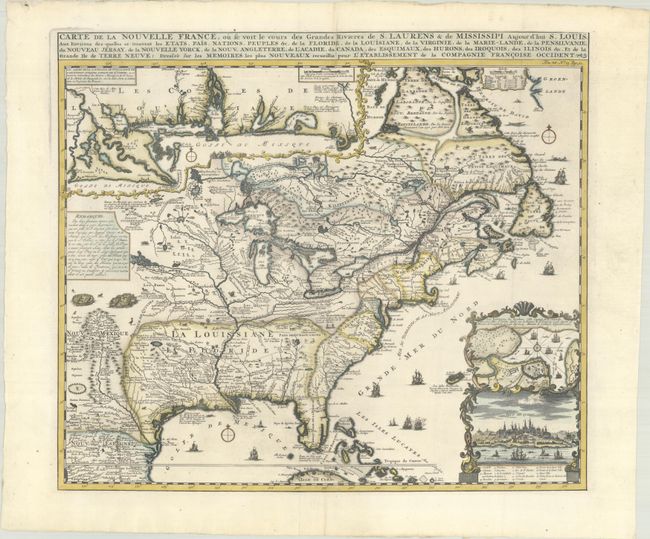
Auction 191, Lot 128
Subject: Colonial Eastern United States & Canada
Chatelain, Henry Abraham
Carte de la Nouvelle France, ou se Voit le Cours des Grandes Rivieres de S. Laurens & de Mississipi Aujour d'hui S. Louis, aux Environs des-quelles se Trouvent les Etats, Pais, Nations, Peuples &c. de la Floride..., 1720
Size: 19.1 x 16.6 inches (48.5 x 42.2 cm)
Estimate: $3,000 - $3,750
One of the Most Informative 18th Century Maps of the French Possessions in North America
Sold for: $3,000
Closed on 2/8/2023
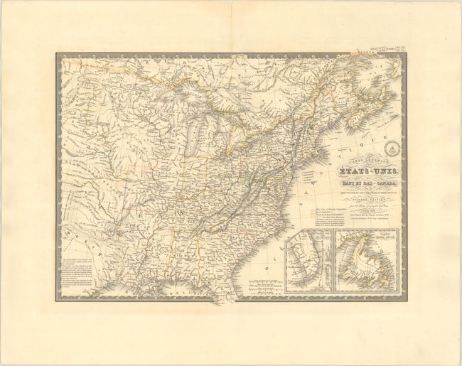
Auction 191, Lot 133
Subject: Eastern United States & Canada
Brue, Adrien Hubert
Carte Generale des Etats-Unis, du Haut et Bas-Canada, de la Nouvle. Ecosse du Nouvau. Brunswick de Terre Neuve &a. Seconde Edition, 1832
Size: 20.3 x 14.8 inches (51.6 x 37.6 cm)
Estimate: $230 - $275
Sold for: $170
Closed on 2/8/2023
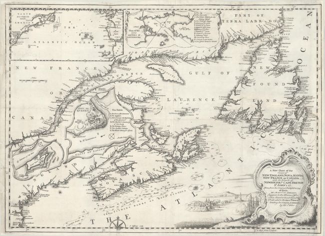
Auction 191, Lot 135
Subject: Colonial Northeastern United States & Canada
Jefferys, Thomas
A New Chart of the Coast of New England, Nova Scotia, New France or Canada, with the Islands of Newfoundld. Cape Breton St. John's &c..., 1746
Size: 18.6 x 13.5 inches (47.2 x 34.3 cm)
Estimate: $350 - $425
Sold for: $475
Closed on 2/8/2023
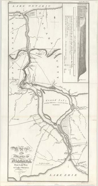
Auction 191, Lot 138
Subject: Niagara Falls, New York & Canada
Map of the Straits of Niagara from Lake Erie to Lake Ontario, 1818
Size: 6.9 x 15.1 inches (17.5 x 38.4 cm)
Estimate: $250 - $325
Sold for: $350
Closed on 2/8/2023
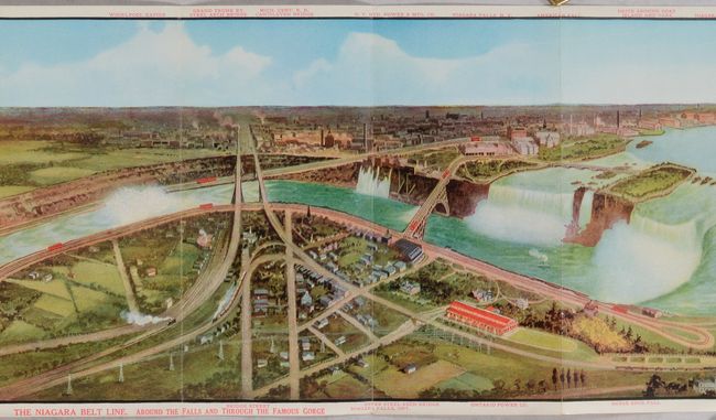
Auction 191, Lot 139
Subject: Niagara Falls, New York & Canada
Railroad Companies, (Various)
The Niagara Belt Line. Around the Falls And Through the Famous Gorge [and] One Way from Buffalo, Tonawanda, Niagara Falls and Lewiston to Toronto. By The “Niagara River Route.” [in] New York Central Lines "Travel Series No. 9" Niagara Falls..., 1912
Size: 4.3 x 8.5 inches (10.9 x 21.6 cm)
Estimate: $160 - $190
Sold for: $120
Closed on 2/8/2023
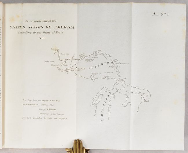
Auction 191, Lot 140
Subject: Central United States & Canada
U.S. Government
[19 Maps in Report] Boundary Between the United States and Great Britain. Message from the President of the United States..., 1838
Size: 5.6 x 8.9 inches (14.2 x 22.6 cm)
Estimate: $200 - $230
Sold for: $170
Closed on 2/8/2023
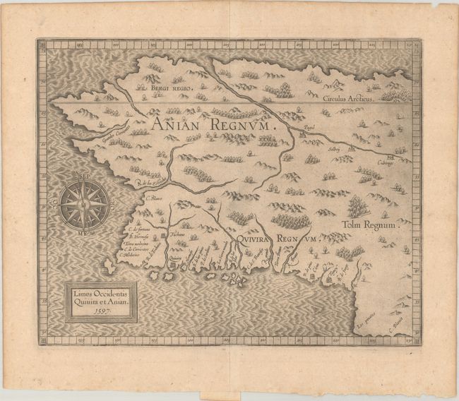
Auction 191, Lot 141
Subject: Alaska & Western Canada
Wytfliet, Cornelis
Limes Occidentis Quivira et Anian, 1597
Size: 11.5 x 9.3 inches (29.2 x 23.6 cm)
Estimate: $1,900 - $2,200
Early and Imaginary Map of Alaska and the Northwest Passage
Sold for: $1,400
Closed on 2/8/2023
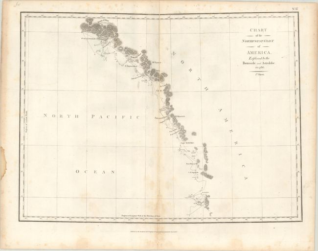
Auction 191, Lot 142
Subject: Western United States & Canada
La Perouse, Comte Jean F. Galoup, de
[On 3 Sheets] Chart of the North West Coast of America. Explored by the Boussole, and Astrolabe in 1786, 1798
Size: 19.3 x 14.3 inches (49 x 36.3 cm)
Estimate: $500 - $650
Sold for: $250
Closed on 2/8/2023
27 lots