"Carte des Isles de Saint Pierre et Miquelon Levee par Ordre de M. Le Duc de Choiseul Colonel General des Suisses et Grisons Ministre de la Guerre et de la Marine", Bellin, Jacques Nicolas
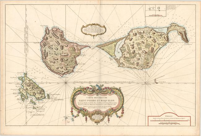
Subject: St. Pierre & Miquelon, Canada
Period: 1763 (dated)
Publication:
Color: Hand Color
Size:
33.9 x 21.8 inches
86.1 x 55.4 cm
Attractive, large-scale chart of St. Pierre and Miquelon Islands with superb detail of the islands, soundings and anchorages. These islands are a self-governing territorial overseas collectivity of France, and one of the few remaining vestiges of New France. The chart is embellished with a huge garland-draped title cartouche, a smaller cartouche with a note about the islands, rhumb lines, and a fleur-de-lis showing the deviation from magnetic north - orienting the chart with north to the right.
References:
Condition: B+
A nice impression on a sturdy, bright sheet with a large double-headed eagle watermark. There is minor offsetting, a bit of soiling, and light toning along the edges of the sheet.