Subject: United States & Canada, Road Atlas
Period: 1927 (published)
Publication:
Color: Printed Color
Size:
8.6 x 12 inches
21.8 x 30.5 cm
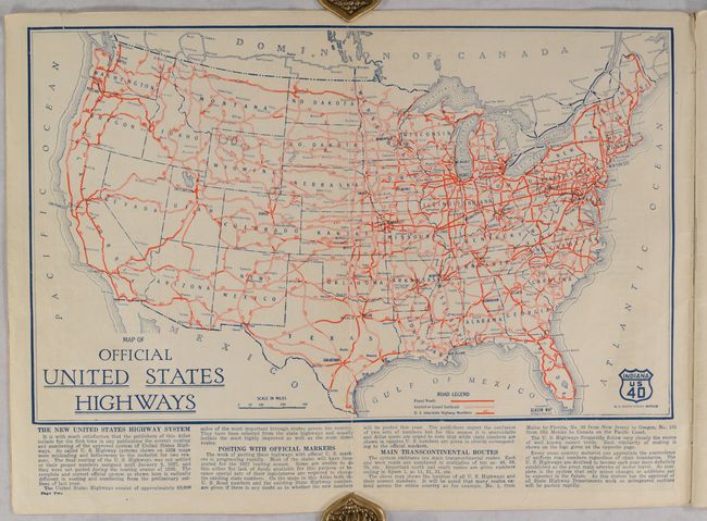
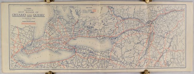
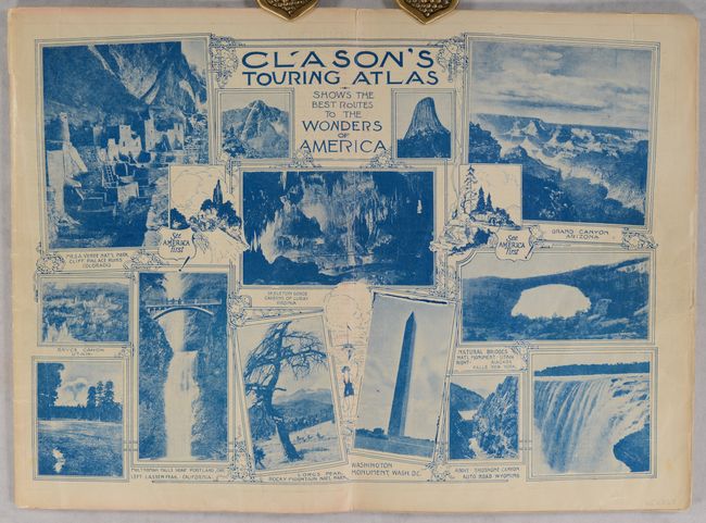
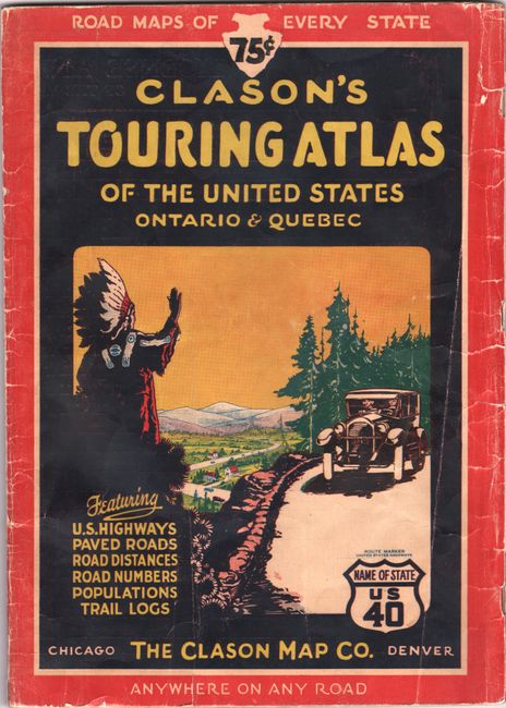
This early automobile road atlas features 45 maps tracing the American network of highways. The maps include a general map of the United States, individual state maps, and a double-page map showing the "Best Roads of Ontario and Quebec," that stretches from the western bank of Lake Erie to Quebec City. Each map is in blue ink with the highways depicted in red. From 1923 to 1931, the Clason Map Company published updated road atlases, reflecting the year-by-year changes of the United States' burgeoning highway system. As the text below the United States map notes, this new edition amends the "misleading and bothersome" 1926 maps for maps that accurately reflect the final routing and proper numbering of the U.S. highway system that went into effect on January 2, 1927. On the inside front cover is a double-page showcase of the "Wonders of America," including the Cliff Palace Ruins in Colorado, the Washington Monument, the Grand Canyon, and Niagara Falls. Text opposite the title page provides advice on how to handle car troubles that may come up on the road, and a table on the title page notes the shortest motor distances between various notable destinations. 48 pages. Soft covers, with an evocative illustration on the front cover showing an Indigenous man in a headdress waving to passing motorists.
References:
Condition: B+
The maps are generally very good with short edge tears that are mostly confined to the blank margins and a few areas with minor color offsetting. The covers have light shelf wear and a number of tears along the edges and spine.