Catalog Archive
Auction 191, Lot 141

Early and Imaginary Map of Alaska and the Northwest Passage

"Limes Occidentis Quivira et Anian", Wytfliet, Cornelis

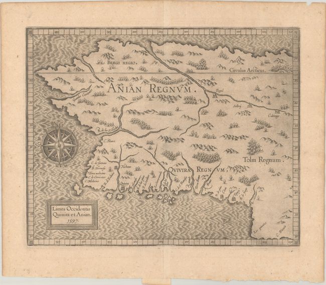
Subject: Alaska & Western Canada

Period: 1597 (dated)

Publication: Descriptionis Ptolemaicae Augmentum

Color: Black & White

Size:
11.5 x 9.3 inches
29.2 x 23.6 cm
Download High Resolution Image
(or just click on image to launch the Zoom viewer)

This early copper plate engraving depicts the northwestern coast of North America and is generally considered the first map of Alaska, even though it is mostly an imaginary depiction. The general shape of the map is based on Gerard Mercator's world map of 1569. The mythical realms of Anian, Quivera and Tolm fill the interior and numerous place names are shown along the coastline. Several rivers are shown including a large one that flows into the sea to the north, which forms the fabled Northwest Passage. Map is adorned with a spectacular compass rose. First state with date present in cartouche.

References: Burden #107; Mickwitz & Miekkavaara #307-14; Wagner (NW) #189.

Condition: A

A dark impression on a watermarked sheet with minor toning.

Estimate: $1,900 - $2,200

Sold for: $1,400

Closed on 2/8/2023

Archived