Subject: Canada
Period: 1946 (dated)
Publication:
Color: Printed Color
Size:
28.6 x 16.5 inches
72.6 x 41.9 cm
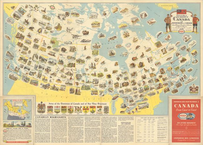
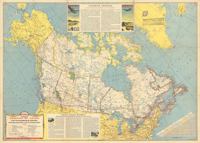
This pictorial map of Canada was issued by Imperial Oil Limited. It shows the Canadian landscape filled with small illustrations depicting the culture, history, landmarks, and wildlife of the country. Among the assorted sights to be seen are the Niagara Falls, salmon fishing, maple syrup, moose, Royal Canadian Mounted Police headquarters, Henry Hudson, black bears, caribou, various parliament buildings, Hudson's Bay Company posts, national parks, and city views. The arms of Canada and her nine provinces appear along the bottom of the map. The title cartouche features a lumberjack, a Mountie, and the flag. Text below the map offers information about population, history, cities, and more, and a table presents facts about the provinces and territories. On verso is another map, Dominion of Canada with Newfoundland & Labrador Featuring Land, Water, and Air Transportation (28.5 x 20.4"), which delineates various transportation routes and includes additional information on Canadian aviation and the Trans-Canada Highway. Self-folds into a pamphlet titled "Imperial Oil Map Number 1 Canada from Coast to Coast." This example was offered by Melville Travel Service in Toronto, whose inked stamp appears in Greenland.
References:
Condition: A
Issued folding with minor wear along the folds and a bit of soil along the edges of pamphlet covers.