Subject: Louisbourg, Canada
Period: 1764 (circa)
Publication:
Color: Hand Color
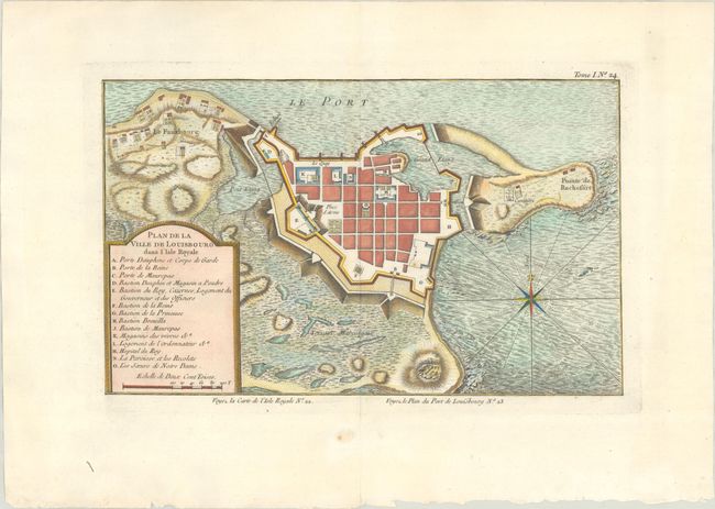
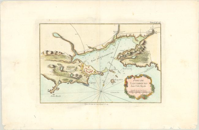
This lot features two copper engraved charts focusing on Cape Breton Island - here called l'Isle Royale. War broke out between France and England in 1744 and a large number of maps were produced to describe the areas involved. Louisbourg was the center of the lucrative cod fishery and a mercantile shipping point between Europe and the New World. The French lost Louisbourg to a determined British army, but the treaty of Aix-la-Chappelle returned Louisbourg to the French in 1749. By 1758 Louisbourg was once again attacked by the British and in 1760 the fortification walls were dismantled.
A. Plan de la Ville de Louisbourg dans l'Isle Royale (13.4 x 8.3"). This map details the fortified town of Louisbourg. Within the title cartouche is a legend that locates 14 important buildings within the fortress including the magazine, hospital, gates, and much more. A handsome chart with fully engraved seas and compass rose with fleur-de-lys.
B. Port de Louisbourg dans l'Isle Royale (12.3 x 8.1"). The harbor of Louisbourg in the southeast portion of the island is portrayed in great detail, locating Cap Noir, Plaine, the lighthouse, and the fortified town. Rhumb lines with fleur-de-lys and a rococo-style title cartouche decorate the map.
References: Kershaw #927 & #928.
Condition: A
Crisp impressions on bright sheets with a few minor edge chips and tears confined to the far blank margins.