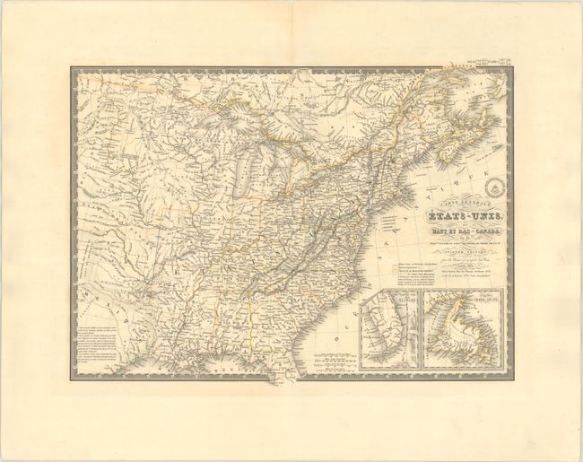
Subject: Eastern United States & Canada
Period: 1832 (dated)
Publication:
Color: Hand Color
Size:
20.3 x 14.8 inches
51.6 x 37.6 cm
An uncommon and finely engraved map covering all the eastern United States to about the 100th meridian, including a little of southern Canada. The western territories include Terre du Nord Ouest that encompasses present-day Wisconsin, the Upper Peninsula of Michigan, and Minnesota. The rest of the west beyond Missouri and Arkansas is designated as Indian Districts. Texas is shown as a Mexican possession. Insets of the tip of Florida and Newfoundland are located in the lower right corner. Surrounded by a decorative keyboard-style border that indicates longitude from Paris. The handsome map includes fancy title lettering embellished with flourishes and Brue's embossed seal.
References:
Condition: B+
Contemporary outline color with some faint foxing and offsetting. There is a short centerfold separation confined to the top blank margin that has been archivally repaired on verso.