Filtered by Category:Canada(Show All Categories)
Showing results for:Auction 172
Catalog Archive
32 lots
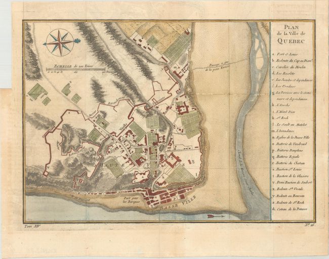
Auction 172, Lot 82
Subject: Canada
[Lot of 2] Plan de la Ville de Quebec [and] British America, 1757-1850
Size: See Description
Estimate: $200 - $250
Sold for: $120
Closed on 4/17/2019
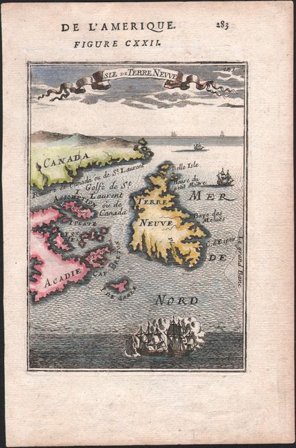
Auction 172, Lot 83
Subject: Eastern Canada
Mallet, Alain Manesson
Isle de Terre Neuve, 1683
Size: 4.1 x 5.8 inches (10.4 x 14.7 cm)
Estimate: $140 - $170
Sold for: $80
Closed on 4/17/2019
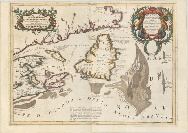
Auction 172, Lot 84
Subject: Eastern Canada
Coronelli, Vincenzo Maria
Canada Orientale nell' America Settentrionale Descritta..., 1695
Size: 24 x 17.6 inches (61 x 44.7 cm)
Estimate: $900 - $1,100
Sold for: $500
Closed on 4/17/2019
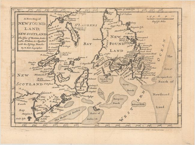
Auction 172, Lot 85
Subject: Eastern Canada
[Lot of 2] A New Map of Newfound Land, New Scotland the Isles of Breton, Anticoste, St. Iohns &c... [and] An Accurate Map of the Islands of New Found Land, Cape Breton, &c. with the Adjacent Province of Nova Scotia, 1708-60
Size: See Description
Estimate: $250 - $325
Sold for: $180
Closed on 4/17/2019
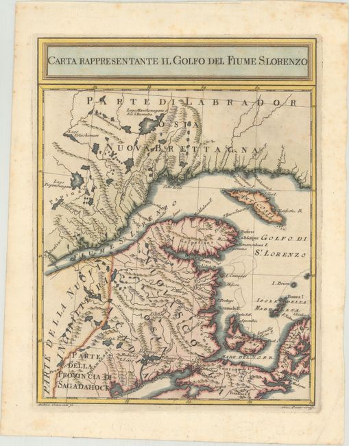
Auction 172, Lot 86
Subject: Eastern Canada
Pazzi, Giuseppe
Carta Rappresentante il Golfo del Fiume S. Lorenzo, 1763
Size: 7.6 x 9.9 inches (19.3 x 25.1 cm)
Estimate: $200 - $230
Unsold
Closed on 4/17/2019
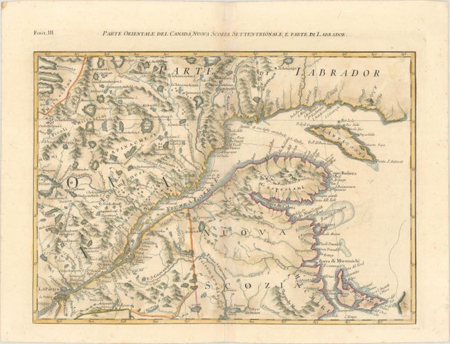
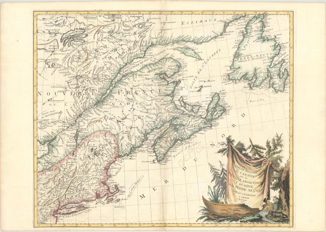
Auction 172, Lot 87
Subject: Eastern Canada
Zatta, Antonio
Parte Orientale del Canada, Nuova Scozia Settentrionale, e Parte di Labrador, 1779
Size: 16.8 x 12 inches (42.7 x 30.5 cm)
Estimate: $240 - $300
Unsold
Closed on 4/17/2019
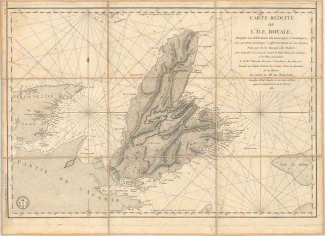
Auction 172, Lot 88
Subject: Eastern Canada
Depot de la Marine
[Lot of 2] Carte Reduite de l'Ile Royale... [and] Plans Particuliers Dependans de l'Ile Royale, 1780
Size: See Description
Estimate: $350 - $425
Sold for: $250
Closed on 4/17/2019
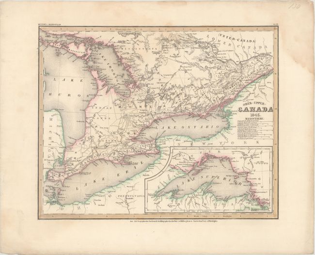
Auction 172, Lot 89
Subject: Eastern Canada, Great Lakes
Hildburghausen Biblio Institut
[Lot of 2] Ober- (Upper-) Canada [and] Neueste Karte von Lower Canada. (Unter-Canada)..., 1844-45
Size: 14.6 x 11.8 inches (37.1 x 30 cm)
Estimate: $80 - $110
Unsold
Closed on 4/17/2019
Auction 172, Lot 90
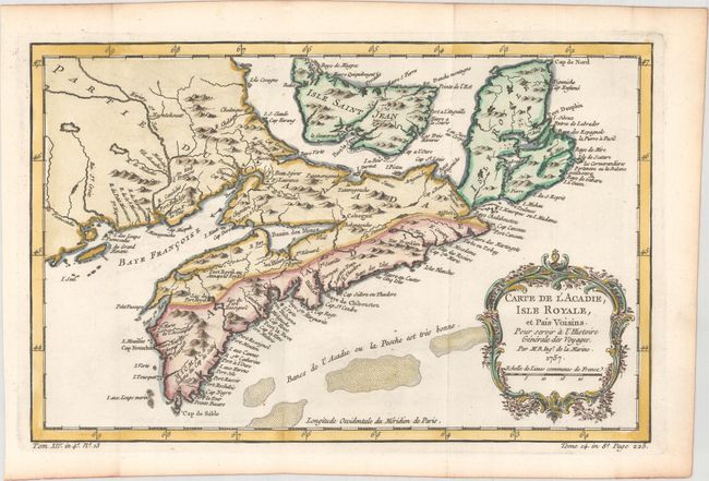
Subject: Nova Scotia, Canada
Bellin, Jacques Nicolas
Carte de l'Acadie, Isle Royale, et Pais Voisins. Pour Servir a l'Histoire Generale des Voyages, 1757
Size: 13 x 8.3 inches (33 x 21.1 cm)
Estimate: $140 - $170
Sold for: $110
Closed on 4/17/2019
Auction 172, Lot 91
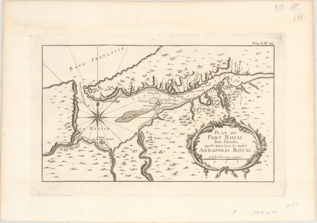
Subject: Nova Scotia, Canada
Bellin, Jacques Nicolas
Plan du Port Royal dans l'Acadie Appelle Aujourd' par les Anglois Annapolis Royal, 1764
Size: 13.3 x 7.8 inches (33.8 x 19.8 cm)
Estimate: $120 - $150
Sold for: $90
Closed on 4/17/2019
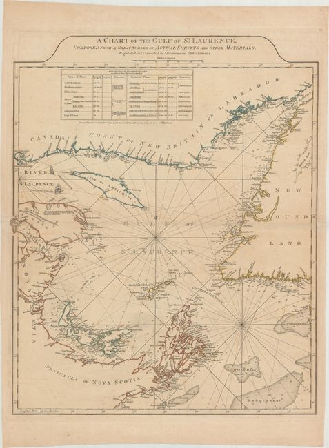
Auction 172, Lot 92
Subject: Gulf of St. Lawrence, Canada
Jefferys/Sayer & Bennett
A Chart of the Gulf of St. Laurence, Composed from a Great Number of Actual Surveys and Other Materials, Regulated and Connected by Astronomical Observations, 1775
Size: 19.6 x 24.1 inches (49.8 x 61.2 cm)
Estimate: $400 - $475
Sold for: $200
Closed on 4/17/2019
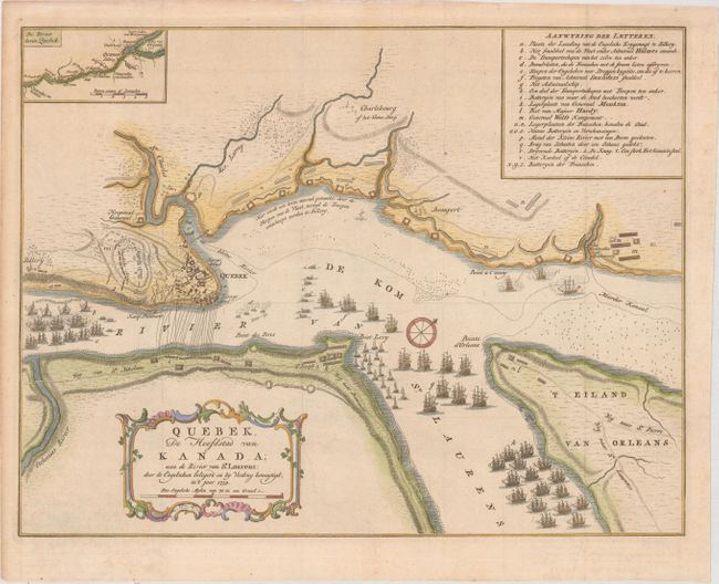
Auction 172, Lot 93
Subject: Quebec City, Canada
Tirion, Isaac
Quebek, de Hoofdstad van Kanada; aan de Rivier van St. Laurens: door de Engelschen Belegerd en by Verdrag Bemagtigd, in 't Jaar 1759, 1759
Size: 16.8 x 12.9 inches (42.7 x 32.8 cm)
Estimate: $275 - $350
Sold for: $275
Closed on 4/17/2019
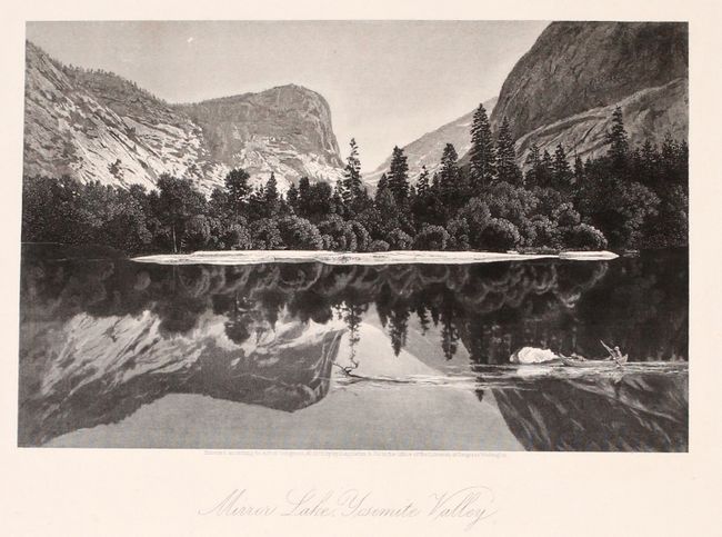
Auction 172, Lot 94
Subject: United States & Canada
Bryant, William C.
[2 Volumes] Picturesque America; or, The Land We Live In..., 1872-74
Size: 10.3 x 13 inches (26.2 x 33 cm)
Estimate: $400 - $475
Sold for: $500
Closed on 4/17/2019
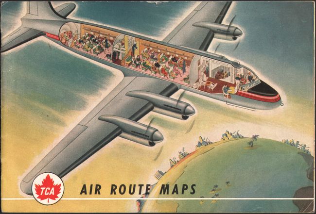
Auction 172, Lot 95
Subject: United States & Canada, Flight Maps
[Lot of 3] TCA Air Route Maps [and] Trans-Canada Air Lines Air Canada [and] Route Map Vancouver to Amsterdam, 1950-60
Size: See Description
Estimate: $100 - $130
Unsold
Closed on 4/17/2019
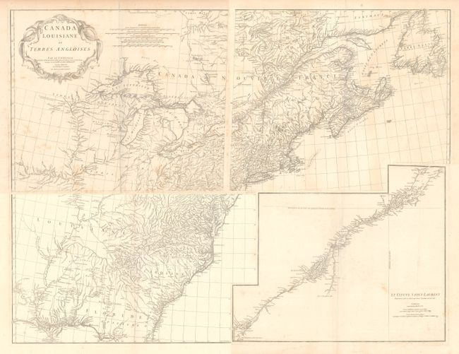
Auction 172, Lot 96
Subject: Colonial Eastern United States & Canada
Anville, Jean Baptiste Bourguignon d'
[On 4 Sheets] Canada Louisiane et Terres Angloises, 1755
Size: 22 x 18.8 inches (55.9 x 47.8 cm)
Estimate: $1,400 - $1,700
D'Anville's Spectacular Map of Eastern Seaboard
Unsold
Closed on 4/17/2019
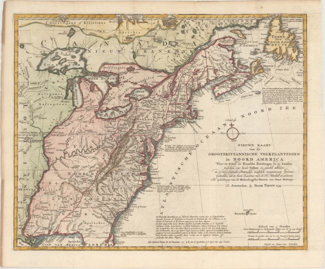
Auction 172, Lot 97
Subject: Colonial Eastern United States & Canada
Tirion, Isaac
Nieuwe Kaart van de Grootbrittannische Volkplantingen in Noord America..., 1755
Size: 17.8 x 14.4 inches (45.2 x 36.6 cm)
Estimate: $600 - $750
Sold for: $400
Closed on 4/17/2019
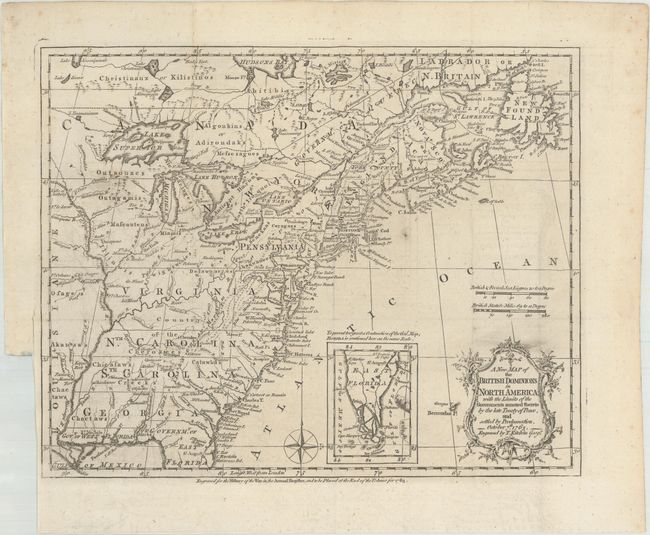
Auction 172, Lot 98
Subject: Colonial Eastern United States & Canada
Kitchin, Thomas
A New Map of the British Dominions in North America; with the Limits of the Governments Annexed Thereto by the Late Treaty of Peace, and Settled by Proclamation, October 7th, 1763, 1763
Size: 12 x 9.6 inches (30.5 x 24.4 cm)
Estimate: $400 - $475
Sold for: $375
Closed on 4/17/2019
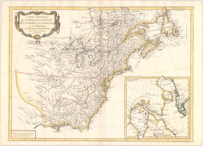
Auction 172, Lot 99
Subject: Colonial Eastern United States & Canada
D'Anville/Santini
Carte Generale du Canada, de la Louisiane, de la Floride, de la Caroline, de la Virginie, de la Nouvelle Angleterre Etc., 1776
Size: 26.1 x 18.9 inches (66.3 x 48 cm)
Estimate: $600 - $750
Sold for: $225
Closed on 4/17/2019
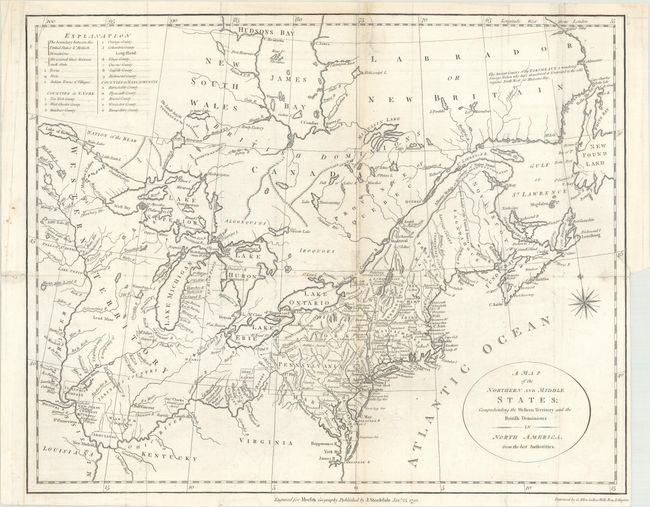
Auction 172, Lot 100
Subject: Eastern United States & Canada
Stockdale, John
A Map of the Northern and Middle States; Comprehending the Western Territory and the British Dominions in North America from the Best Authorities, 1792
Size: 15.5 x 12.4 inches (39.4 x 31.5 cm)
Estimate: $325 - $400
Sold for: $240
Closed on 4/17/2019
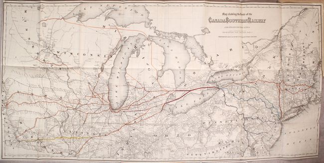
Auction 172, Lot 101
Subject: Eastern United States & Canada
Colton, G.W. & C.B.
Map Showing the Route of the Canada Southern Railway and Its Connecting Lines [bound in] The Canada Southern Railway Company. Prospectus, Reports and Other Documents, 1872
Size: 38.5 x 18.4 inches (97.8 x 46.7 cm)
Estimate: $200 - $250
Sold for: $150
Closed on 4/17/2019
Auction 172, Lot 102
Subject: Colonial Northeastern United States & Canada
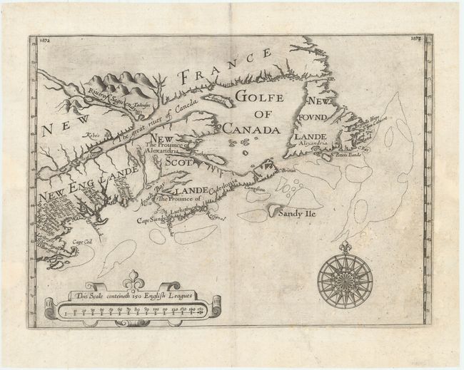
Alexander, William (Sir)
[Untitled - Northeastern United States & Canada], 1625
Size: 13.5 x 9.8 inches (34.3 x 24.9 cm)
Estimate: $6,000 - $7,500
The First Map to Name New Scotland
Unsold
Closed on 4/17/2019
Auction 172, Lot 103
Subject: Colonial Northeastern United States & Canada
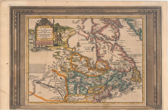
Aa, Pieter van der
Canada ou Nouvelle France, Suivant les Nouvelles Observations de Messrs. de l'Academie Royale des Sciences, Etc. Augmentees de Nouveau, 1730
Size: 15.1 x 10.3 inches (38.4 x 26.2 cm)
Estimate: $550 - $700
Unusual Picture-Frame Style Border
Sold for: $275
Closed on 4/17/2019
Auction 172, Lot 104
Subject: Colonial Northeastern United States & Canada, Great Lakes
Robert de Vaugondy, Didier
Partie de l'Amerique Septent? qui Comprend la Nouvelle France ou le Canada, 1755
Size: 23.9 x 19 inches (60.7 x 48.3 cm)
Estimate: $550 - $700
Sold for: $300
Closed on 4/17/2019
Auction 172, Lot 105
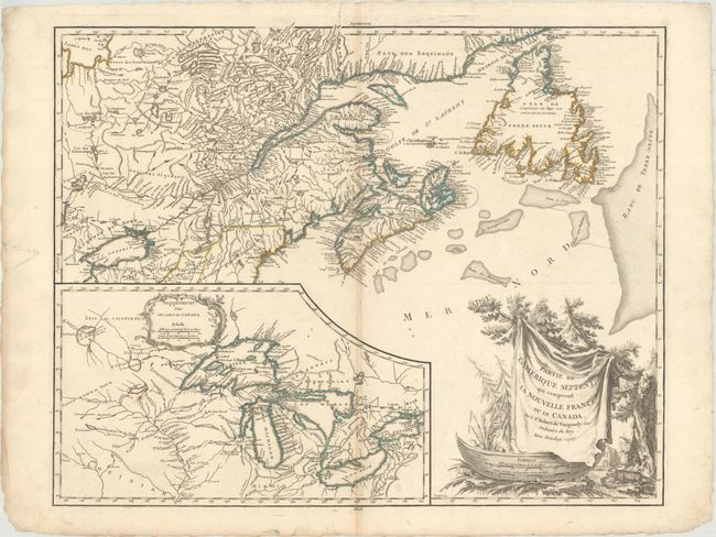
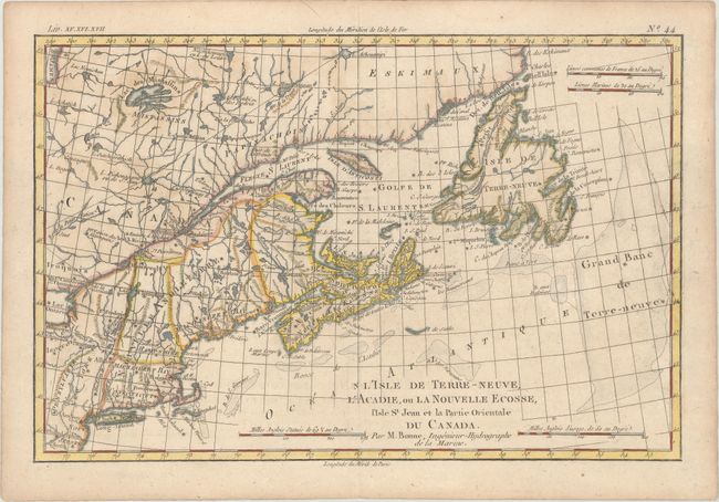
Subject: Colonial Northeastern United States & Canada
Bonne, Rigobert
L'Isle de Terre-Neuve, l'Acadie, ou la Nouvelle Ecosse, l'Isle St Jean et la Partie Orientale du Canada, 1775
Size: 12.7 x 8.4 inches (32.3 x 21.3 cm)
Estimate: $140 - $170
Unsold
Closed on 4/17/2019
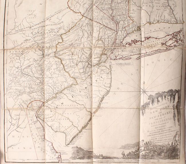
Auction 172, Lot 106
Subject: Colonial Northeastern United States & Quebec
Holland/Pownal
The Provinces of New York, and New Jersey; with Part of Pensilvania, and the Province of Quebec..., 1776
Size: 21.5 x 53.3 inches (54.6 x 135.4 cm)
Estimate: $5,000 - $6,500
Thomas Jefferys' Important Revolutionary War Period Map
Unsold
Closed on 4/17/2019
Auction 172, Lot 107
Subject: Colonial Northeastern United States & Canada
D'Anville/Santini
Partie Orientale du Canada, avec la Nouvelle Angleterre, l'Acadie, et la Terre-Neuve, 1776
Size: 22.9 x 19.1 inches (58.2 x 48.5 cm)
Estimate: $450 - $550
Sold for: $300
Closed on 4/17/2019
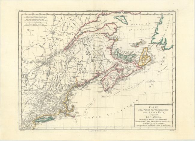
Auction 172, Lot 108
Subject: Northeastern United States & Canada
Tardieu, Pierre Francois
Carte de la Partie Septentrionale des Etats Unis, Comprenant le Canada, la Nouvelle Ecosse, New Hampshire, Massachuset's Bay, Rhode-Island, Connecticut, New-Yorck, Etat de Vermont..., 1797
Size: 16.6 x 12.7 inches (42.2 x 32.3 cm)
Estimate: $190 - $220
Sold for: $100
Closed on 4/17/2019
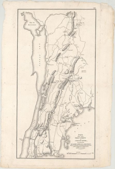
Auction 172, Lot 109
Subject: Northeastern United States & Eastern Canada
Marshall, John
[Lot of 2] Pays Situe Entre Frog's Point et Croton River, et Position des Armees Americaine et Britannique, Depuis le 12 Octobre 1776... [and] Theatre des Operations de l'Armee du Nord, et Desert que le General Arnold Traversa en Marchant Contre Quebec, 1807
Size: See Description
Estimate: $180 - $220
Unsold
Closed on 4/17/2019
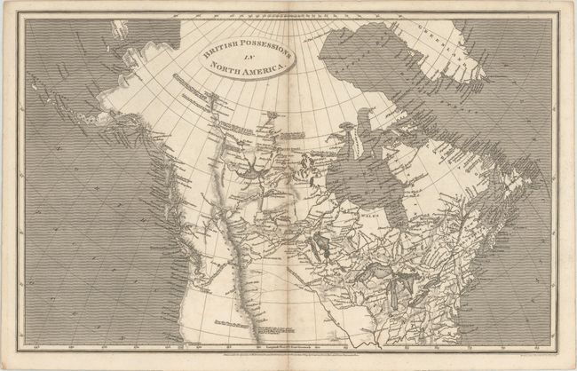
Auction 172, Lot 110
Subject: Northern United States & Canada
Arrowsmith, Aaron, Sr.
British Possessions in North America, 1809
Size: 15.4 x 9.7 inches (39.1 x 24.6 cm)
Estimate: $160 - $190
Sold for: $140
Closed on 4/17/2019
Auction 172, Lot 111
Subject: Colonial Central United States & Canada, Great Lakes
D'Anville/Santini
Partie Occidentale du Canada et Septentrionale de la Louisiane avec une Partie de la Pensilvanie, 1775
Size: 22.6 x 19 inches (57.4 x 48.3 cm)
Estimate: $900 - $1,100
Sold for: $650
Closed on 4/17/2019
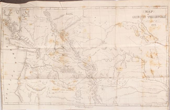
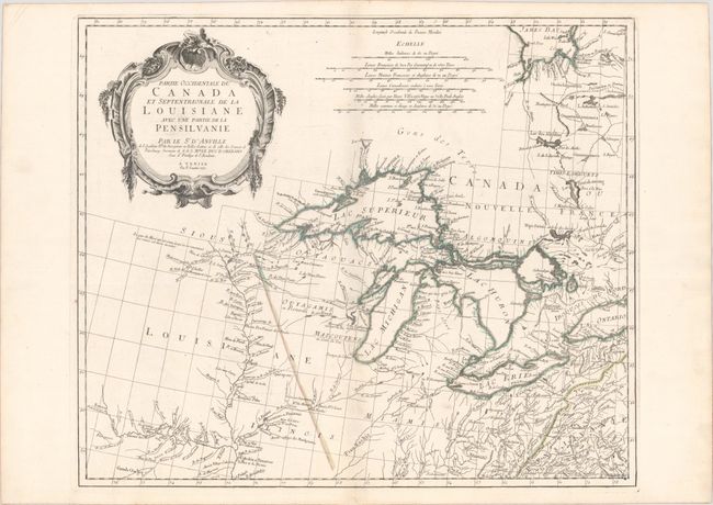
Auction 172, Lot 112
Subject: Western United States & Canada
Parker, Samuel (Rev.)
Map of Oregon Territory [bound in] Journal of an Exploring Tour Beyond the Rocky Mountains…, 1844
Size: 23 x 13.6 inches (58.4 x 34.5 cm)
Estimate: $475 - $600
Sold for: $350
Closed on 4/17/2019
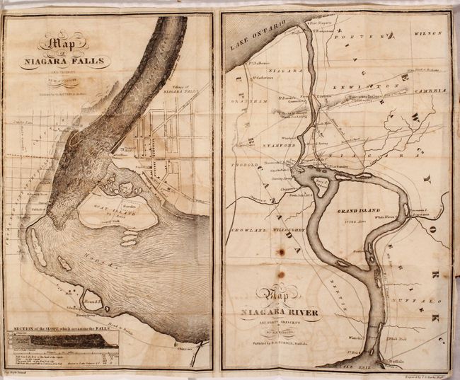
Auction 172, Lot 113
Subject: Niagara Falls, New York, Canada
[Lot of 2] A Guide to Travelers Visiting the Falls of Niagara... [and] The Travellers' Own Book, to Saratoga Springs, Niagara Falls and Canada..., 1835-41
Size: 3.8 x 5.9 inches (9.7 x 15 cm)
Estimate: $180 - $220
Sold for: $120
Closed on 4/17/2019
32 lots