Subject: Eastern Canada
Period: 1780 (circa)
Publication:
Color: Black & White
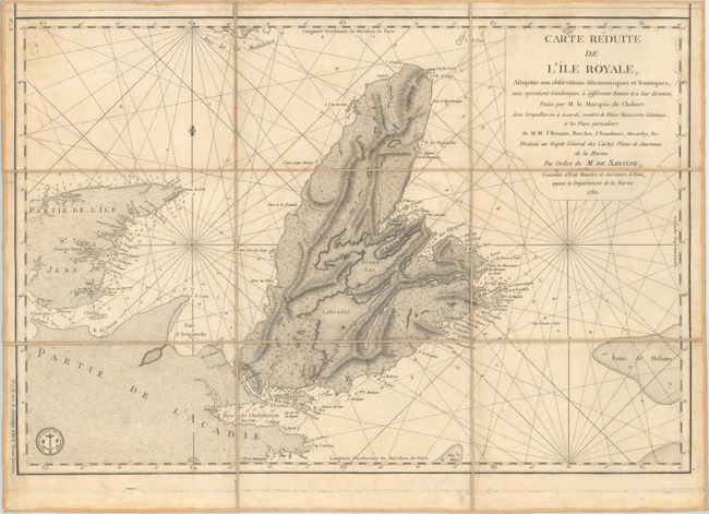
A. Carte Reduite de l'Ile Royale, Assujettie aux Observations Astronomiques et Nautiques... (23.3 x 15.8"). This attractive chart depicts Cape Breton Island along with portions of Nova Scotia and Prince Edward Island. It was produced only a few years before the signing of the Treaty of Versailles (1783) in which the French relinquished their claims in the region. The chart provides excellent detail including coastal place names, bays, offshore islands, numerous soundings, and radiating rhumb lines. According to Kershaw, this is the second state of the map with all land areas finely stippled.
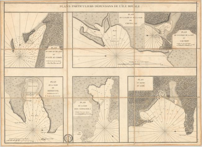
B. Plans Particuliers Dependans de l'Ile Royale (23.3 x 17.1"). This sheet includes five insets showing various bays, ports, and harbors on Cape Breton Island. Each is filled with detail to aid in navigation including soundings, shoals, anchorages, and rhumb lines.
Both maps have been dissected and backed with linen and contain French manuscript title labels on verso.
References: Kershaw #880.
Condition: B+
There is light scattered foxing and some minor printer's ink residue. Dissected and backed with linen with manuscript title labels on verso.