Subject: Eastern Canada
Period: 1708-60 (circa)
Publication:
Color: Black & White
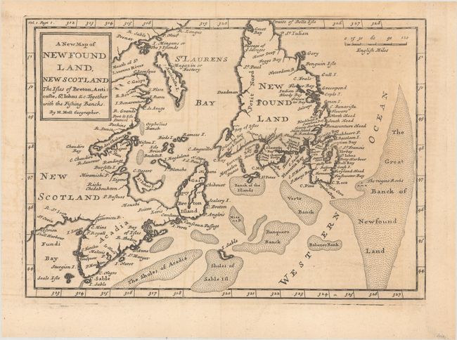
A. A New Map of Newfound Land, New Scotland the Isles of Breton, Anticoste, St. Iohns &c. Together with the Fishing Bancks, by Herman Moll, circa 1708 (10.1 x 7.0"). This is the first state of Moll's map of the Gulf of St. Lawrence, which was first published in The British Empire in America in 1708. This map appears to be based on Thornton's two maps of 1676 and 1689, in which Acadia has a triangular shape and Newfoundland has a truncated top. The map shows particularly good detail of the fishing banks and coastlines. Reference: Kershaw #564. Condition: Issued folding with light toning and offsetting. Remargined at right with tissue.
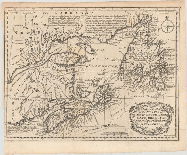
B. An Accurate Map of the Islands of New Found Land, Cape Breton, &c. with the Adjacent Province of Nova Scotia, by John Gibson, circa 1760 (10.0 x 7.6"). An attractive and detailed map of the region surrounding the Gulf of St. Lawrence. The map locates numerous place names along the coasts and delineates the major fishing banks in the Atlantic. Includes several notations describing the division of lands between the French and English according to the Treaty of Utrecht (1713). Condition: Issued folding with a few faint spots and a binding trim at lower left.
References:
Condition: B+
See description above.