Filtered by Category:Atlantic & Arctic(Show All Categories)
Showing results for:Auction 172
Catalog Archive
4 lots
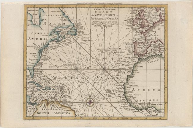
Auction 172, Lot 369
Subject: North Atlantic Ocean
Bowen, Thomas
A New & Accurate Chart of the Western or Atlantic Ocean Drawn from the Most Approved Modern Maps &c, 1778
Size: 10.5 x 8.4 inches (26.7 x 21.3 cm)
Estimate: $200 - $230
Sold for: $150
Closed on 4/17/2019
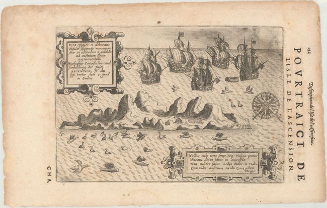
Auction 172, Lot 370
Subject: Ascension Island
Bry, Theodore de
Vera Effigies et Delineatio Insulae Ascenstio Nuncupate Sitae in Altitudine 8 Graduum..., 1610
Size: 8.7 x 5.9 inches (22.1 x 15 cm)
Estimate: $200 - $230
Unsold
Closed on 4/17/2019
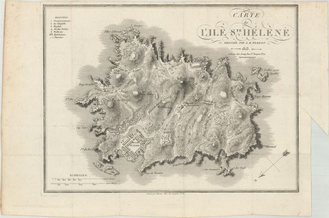
Auction 172, Lot 371
Subject: St. Helena
Perrot, Aristide Michel
Carte de l'Ile Ste. Helene, 1815
Size: 12.4 x 9.2 inches (31.5 x 23.4 cm)
Estimate: $100 - $130
Sold for: $75
Closed on 4/17/2019
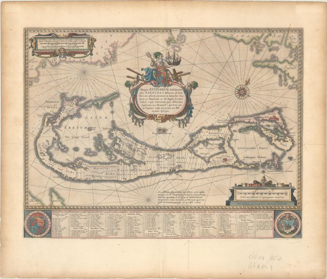
Auction 172, Lot 372
Subject: Bermuda
Blaeu, Willem
Mappa Aestivarum Insularum, Alias Barmudas Dictarum, ad Ostia Mexicani Aestuary..., 1642
Size: 21 x 15.9 inches (53.3 x 40.4 cm)
Estimate: $1,700 - $2,000
Map of Bermuda Based on Richard Norwood's Famous Survey
Unsold
Closed on 4/17/2019
4 lots