Subject: Colonial Eastern United States & Canada
Period: 1763 (published)
Publication: History of the War in the Annual Register
Color: Black & White
Size:
12 x 9.6 inches
30.5 x 24.4 cm
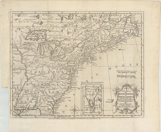
This very historical map illustrates the British colonies after the Treaty of Paris and at the conclusion of the French and Indian War in America. The treaty ended French colonial ambitions in North America with minor exceptions. As a result, Spain ceded East and West Florida to Great Britain, France relinquished the title to the Louisiana Territory to Spain, and the Mississippi River was established as the British-Spanish Boundary. The map reflects the claims of the southern colonies that their charters extended to the Mississippi River. Also of interest are the names and locations of many Indian tribes and nations located away from the more populated areas of English settlements. An inset of East Florida on the same scale lies between the coastline and the decorative rococo-style title cartouche. A simple compass rose rests in the Atlantic.
References: McCorkle #763.5; Sellers & Van Ee #103; Jolly #ANNREG-3.
Condition: A
A nice impression, issued folding on a bright sheet of paper with a large medallion watermark, some printer's ink residue above the title, one small spot east of Cape Cod, and minor offsetting. There is a binding trim and an archivally repaired binding tear that are both confined to the left blank margin.