Subject: Colonial Eastern United States & Canada
Period: 1776 (dated)
Publication: Atlas Universel...
Color: Hand Color
Size:
26.1 x 18.9 inches
66.3 x 48 cm
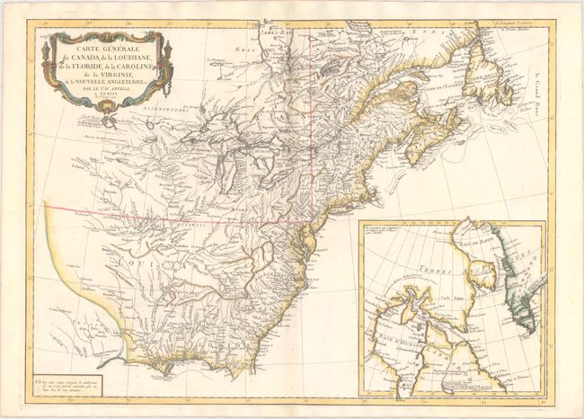
This striking map is an Italian edition of d'Anville's map, published in the first year of the American Revolution. The map is filled with detail of rivers and topography, with particular focus on the Great Lakes. Lake Superior is shown attached to a convoluted river system reaching across the continent, reminiscent of the Riviere Longue of Baron Lahontan's memoirs. On the Gulf Coast the region of Tecas (Texas) is named with a nearby note about the Atac-apa tribe of Indians, who are noted as Antrophages (Cannibals) and Indiens errans (Wild Indians). The inset at lower right is a detailed map of Hudson and Baffin Bays illustrating Christopher Middleton's discoveries in 1742 in his search for the fabled Northwest Passage.
References: McCorkle #776.3; Phillips (A) #647-45; Sellers & Van Ee #136.
Condition: A
A nice impression on watermarked paper with a hint of offsetting along the upper centerfold.