Showing No Reserve Lots(remove filter)
Showing results for:Auction 95
Catalog Archive
61 lots
Page 1 of 2
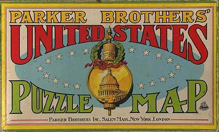
Auction 95, Lot 49
Subject: Map Puzzle
Parker Brothers
Parker Brothers' United States Puzzle Map, 1915
Size: 20 x 12 inches (50.8 x 30.5 cm)
Estimate: $75 - $100
Sold for: $120
Closed on 6/13/2001
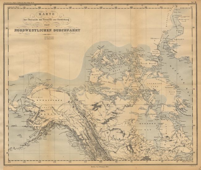
Auction 95, Lot 82
Subject: Northern North America
Reimer, Dietrich
Karte zur Ubersicht der Versuche zur Entdecking einer Nordwestlichen Durchfahrt, 1857
Size: 18 x 15 inches (45.7 x 38.1 cm)
Estimate: $100 - $120
Sold for: $95
Closed on 6/13/2001
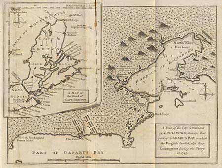
Auction 95, Lot 99
Subject: Colonial Canada
Anon.
A Plan of the City & Harbour of Louisburg; shewing that part of Gabarus Bay in which the English landed, also their Encampment during the Siege in 1745, 1758
Size: 10 x 7.5 inches (25.4 x 19.1 cm)
Estimate: $75 - $100
Sold for: $120
Closed on 6/13/2001
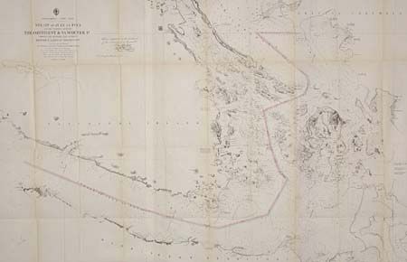
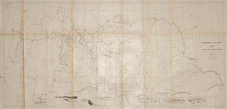
Auction 95, Lot 103
Subject: Northwestern United States and Canada
U.S. Coast Survey
Strait of Juan de Fuca and the channels between the Continent and Vancouver Id. showing the boundary line between British and American Possessions, 1872
Size: 43 x 29 inches (109.2 x 73.7 cm)
Estimate: $200 - $300
Sold for: $600
Closed on 6/13/2001
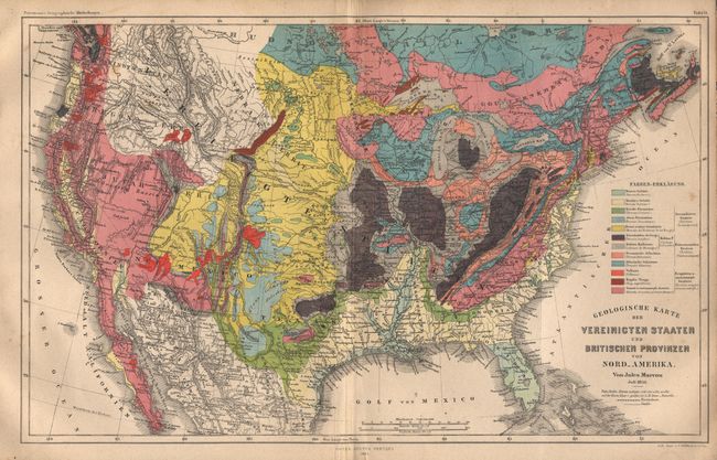
Auction 95, Lot 105
Subject: United States
Perthes, Justus
Geologische Karte der Vereinigten Staaten und Britischen Provinzen von Nord-Amerika, 1855
Size: 15.2 x 9.6 inches (38.6 x 24.4 cm)
Estimate: $75 - $100
Sold for: $650
Closed on 6/13/2001
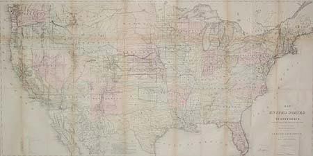
Auction 95, Lot 106
Subject: United States
General Land Office
Map of the United States and Territories Showing the extent of Public Surveys and other details constructed from the Plats and official sources of the General Land Office…, 1870
Size: 55.7 x 28.5 inches (141.5 x 72.4 cm)
Estimate: $350 - $400
Sold for: $375
Closed on 6/13/2001
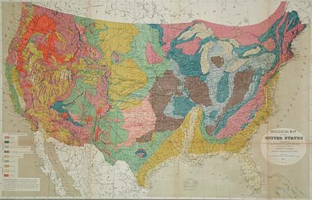
Auction 95, Lot 107
Subject: United States
Hitchcock, Charles Henry
Geological Map of the United States, 1873
Size: 33.2 x 21.2 inches (84.3 x 53.8 cm)
Estimate: $200 - $300
Sold for: $300
Closed on 6/13/2001
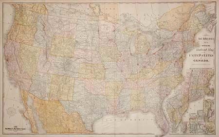
Auction 95, Lot 109
Subject: United States
Rand McNally & Co.
New Official Railroad Map of the United States and Canada, 1885
Size: 42.5 x 26.5 inches (108 x 67.3 cm)
Estimate: $400 - $500
Sold for: $230
Closed on 6/13/2001
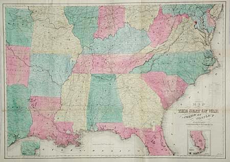
Auction 95, Lot 117
Subject: Southern United States
Case & Company
Map of the Seat of War to Accompany the American Conflict, 1865
Size: 36.8 x 25.8 inches (93.5 x 65.5 cm)
Estimate: $450 - $500
Sold for: $230
Closed on 6/13/2001
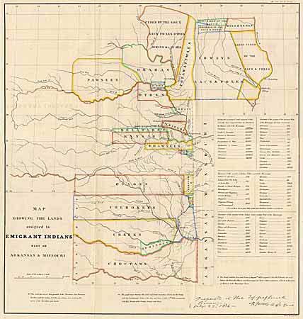
Auction 95, Lot 118
Subject: Central United States
U.S. War Dept.
Map Showing the Lands assigned to Emigrant Indians West of Arkansas & Missouri, 1860
Size: 17.7 x 18.7 inches (45 x 47.5 cm)
Estimate: $325 - $375
Sold for: $350
Closed on 6/13/2001
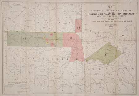
Auction 95, Lot 121
Subject: Central United States
Royce, C. C.
Map of the Former Territorial Limits of the Cherokee Nation of Indians… [together with] Map Showing the Territory Originally Assigned to the Cherokee Nation of Indians West of the Mississippi…, 1884
Size: 30 x 20.7 inches (76.2 x 52.6 cm)
Estimate: $300 - $350
Sold for: $350
Closed on 6/13/2001
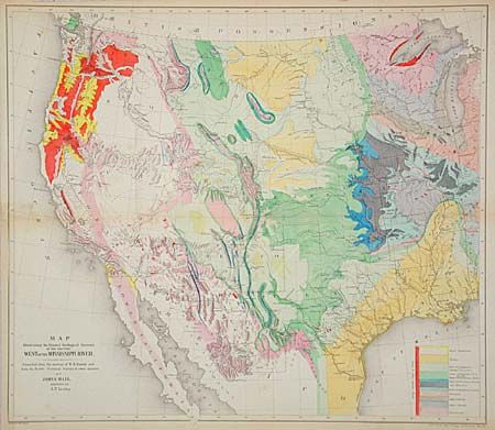
Auction 95, Lot 123
Subject: Western United States
Hall, James
Map Illustrating the General Geological Features of the Country West of the Mississippi River - Compiled from the Surveys of W.H. Emory and from the Pacific Railroad Surveys & other sources., 1857
Size: 23 x 20 inches (58.4 x 50.8 cm)
Estimate: $300 - $400
Sold for: $650
Closed on 6/13/2001
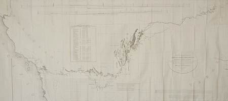
Auction 95, Lot 124
Subject: Western United States
U.S. War Dept.
Map of the Nez Perce Indian Campaign. Bbr. Gen. O.O. Howard, Commanding, 1877
Size: 45.5 x 21.4 inches (115.6 x 54.4 cm)
Estimate: $300 - $400
Sold for: $400
Closed on 6/13/2001
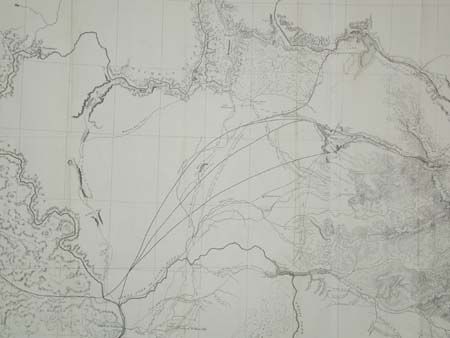
Auction 95, Lot 125
Subject: Northwestern United States
U.S. Railroad Surveys
Milk R. to the Crossing of the Columbia R…, 1855
Size: 61 x 24 inches (154.9 x 61 cm)
Estimate: $200 - $250
Sold for: $120
Closed on 6/13/2001
Auction 95, Lot 127
Subject: Western United States
Emory, William Hemsley
Military Reconnaissance of the Arkansas, Rio del Norte and Rio Gila…, 1847
Size: 67 x 30 inches (170.2 x 76.2 cm)
Estimate: $400 - $500
Sold for: $220
Closed on 6/13/2001
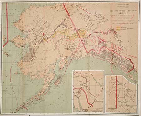
Auction 95, Lot 129
Subject: Alaska
U.S. Geological Survey (USGS)
The Gold and Coal Fields of Alaska Together with the Principal Steamer Routes and Trails, 1898
Size: 28.5 x 23.5 inches (72.4 x 59.7 cm)
Estimate: $200 - $300
Sold for: $210
Closed on 6/13/2001
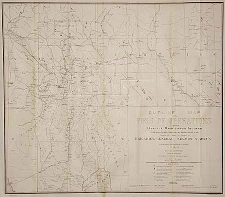
Auction 95, Lot 131
Subject: Arizona and New Mexico
U.S. War Dept.
Outline map of the Field of Operations against hostile Chiricahua Indians, 1886
Size: 28.8 x 25.2 inches (73.2 x 64 cm)
Estimate: $350 - $400
Sold for: $325
Closed on 6/13/2001

Auction 95, Lot 132
Subject: Arizona
Baumann, Jules
Prescott and Tributary Mining Districts, Yavapai County, Arizona, 1895
Size: 35 x 26.7 inches (88.9 x 67.8 cm)
Estimate: $250 - $350
Sold for: $130
Closed on 6/13/2001
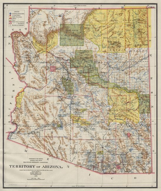
Auction 95, Lot 133
Subject: Arizona
General Land Office
Map of the Territory of Arizona, 1899
Size: 16.7 x 20 inches (42.4 x 50.8 cm)
Estimate: $100 - $125
Sold for: $110
Closed on 6/13/2001
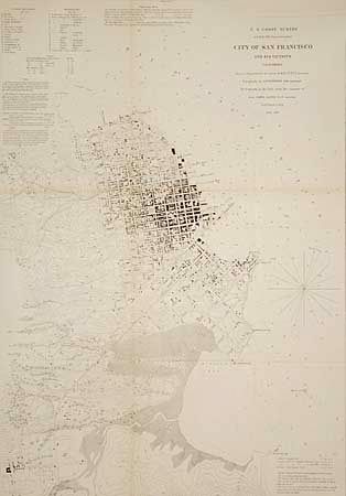
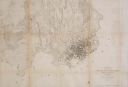
Auction 95, Lot 134
Subject: San Francisco, California
U.S. Coast Survey
City of San Francisco and its Vicinity California, 1853
Size: 17.8 x 25.3 inches (45.2 x 64.3 cm)
Estimate: $300 - $400
Sold for: $375
Closed on 6/13/2001
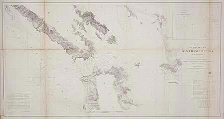
Auction 95, Lot 135
Subject: California
U.S. Coast Survey
Preliminary Chart of Entrance to San Francisco Bay California, 1856
Size: 37 x 20 inches (94 x 50.8 cm)
Estimate: $150 - $200
Sold for: $130
Closed on 6/13/2001
Auction 95, Lot 136
Subject: San Francisco, California
U.S. Coast Survey
City of San Francisco and its Vicinity California, 1859
Size: 34.6 x 23.7 inches (87.9 x 60.2 cm)
Estimate: $300 - $400
Sold for: $240
Closed on 6/13/2001
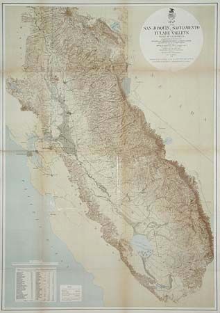
Auction 95, Lot 138
Subject: California
U.S. Army
Map of the San Joaquin, Sacramento and Tulare Valleys State of California…, 1873
Size: 24 x 34 inches (61 x 86.4 cm)
Estimate: $250 - $350
Sold for: $190
Closed on 6/13/2001
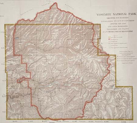
Auction 95, Lot 139
Subject: California
General Land Office
Yosemite National Park Showing Boundaries Established by Act of Congress approved Feb. 7,1905 and Lands Eliminated therefrom and placed in the Sierra Forest Reservation, 1905
Size: 27 x 24 inches (68.6 x 61 cm)
Estimate: $300 - $400
Sold for: $150
Closed on 6/13/2001
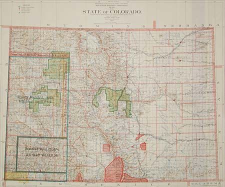
Auction 95, Lot 140
Subject: Colorado
King, Harry
Map of the State of Colorado, 1902
Size: 34 x 28.5 inches (86.4 x 72.4 cm)
Estimate: $150 - $200
Sold for: $170
Closed on 6/13/2001
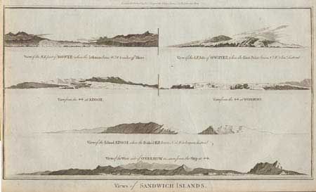
Auction 95, Lot 142
Subject: Hawaii
Hogg, Alexander
Views of Sandwich Islands, 1784
Size: 14.2 x 8.2 inches (36.1 x 20.8 cm)
Estimate: $80 - $100
Sold for: $170
Closed on 6/13/2001
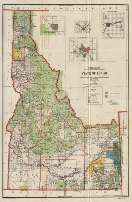
Auction 95, Lot 143
Subject: Idaho
General Land Office
Map of the State of Idaho, 1905
Size: 14.2 x 21.7 inches (36.1 x 55.1 cm)
Estimate: $60 - $80
Sold for: $0
Closed on 6/13/2001
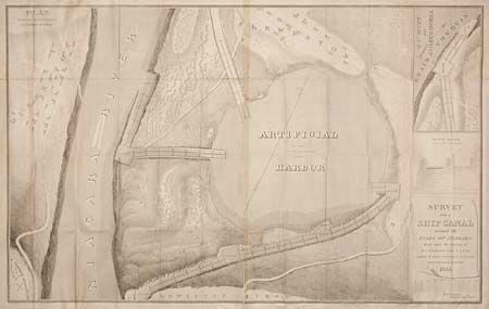
Auction 95, Lot 160
Subject: New York
U.S. Coast Survey
Survey for a Ship Canal Around the Falls of Niagara, 1835
Size: 46 x 29 inches (116.8 x 73.7 cm)
Estimate: $150 - $200
Sold for: $75
Closed on 6/13/2001
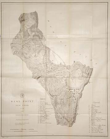
Auction 95, Lot 162
Subject: New York
U.S. Government
West Point, 1883
Size: 20.5 x 26 inches (52.1 x 66 cm)
Estimate: $80 - $100
Sold for: $130
Closed on 6/13/2001
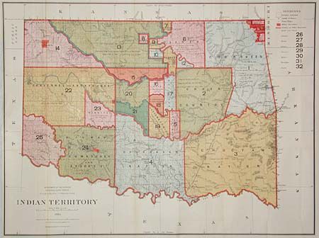
Auction 95, Lot 163
Subject: Oklahoma
General Land Office
Indian Territory, 1885
Size: 32.3 x 24 inches (82 x 61 cm)
Estimate: $150 - $200
Sold for: $170
Closed on 6/13/2001
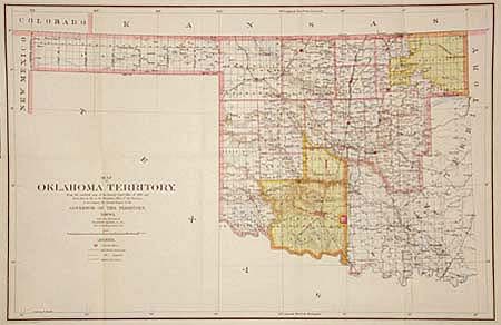
Auction 95, Lot 164
Subject: Oklahoma
King, Harry
Map of the Oklahoma Territory, 1900
Size: 22 x 14.5 inches (55.9 x 36.8 cm)
Estimate: $100 - $150
Sold for: $75
Closed on 6/13/2001
Auction 95, Lot 165
Subject: Oregon and Washington
Dixon, Joseph (Lt)
Map Showing the Routes travelled by the Command of Majr E. Steen, U. S. Drags., against the Snake Indians in 1860, 1860
Size: 34 x 24.5 inches (86.4 x 62.2 cm)
Estimate: $150 - $250
Sold for: $190
Closed on 6/13/2001
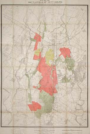
Auction 95, Lot 168
Subject: Pennsylvania
U.S. War Department
Map of the Battlefield of Gettysburg…, 1903
Size: 33 x 46 inches (83.8 x 116.8 cm)
Estimate: $300 - $350
Sold for: $450
Closed on 6/13/2001
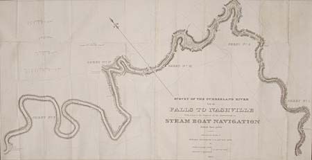
Auction 95, Lot 171
Subject: Tennessee
Stansbury, M. Howard (Capt.)
Survey of the Cumberland River from the Falls to Nashville with a view to the removal of the obstructions to Steam Boat Navigation between those points, 1834
Size: 44.5 x 23 inches (113 x 58.4 cm)
Estimate: $200 - $300
Sold for: $190
Closed on 6/13/2001
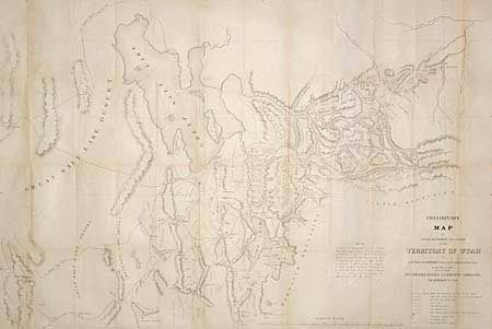
Auction 95, Lot 174
Subject: Utah
U.S. Government
Preliminary Map of Routes Reconnoitered and Opened in the Territory of Utah…, 1859
Size: 44 x 29.7 inches (111.8 x 75.4 cm)
Estimate: $250 - $300
Sold for: $150
Closed on 6/13/2001
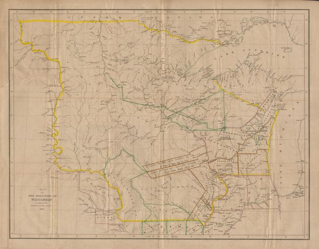
Auction 95, Lot 176
Subject: Central United States - Wisconsin
Burr, David H.
Map of the Territory of Wisconsin by David H. Burr Draughtsman to the House of Reps. U.S. 1836, 1836
Size: 26.5 x 20.5 inches (67.3 x 52.1 cm)
Estimate: $600 - $800
Sold for: $900
Closed on 6/13/2001
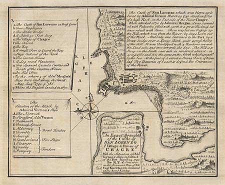
Auction 95, Lot 187
Subject: Panama
Jefferys, Thomas
An Exact Draught of the Castle of San Lorenzo Village & River of Chagre With the Situation of Adml Vernon's Ships in ye Attack of the Fort March 24, 1740…, 1740
Size: 6.6 x 5.4 inches (16.8 x 13.7 cm)
Estimate: $60 - $80
Sold for: $90
Closed on 6/13/2001
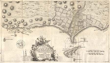
Auction 95, Lot 205
Subject: Peru
Jefferys, Thomas
The Port of Callao, in the South Sea; with the Adjacent islands, Rocks & Coasts to Windward and Leeward, and the Soundings in Fathoms, 1753
Size: 14.3 x 8.1 inches (36.3 x 20.6 cm)
Estimate: $80 - $100
Sold for: $45
Closed on 6/13/2001
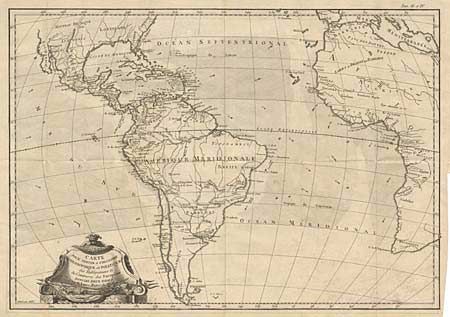
Auction 95, Lot 220
Subject: Atlantic
Bonne, Rigobert
Carte pour Servir a l'Histoire Philosophique et Politique des Etablissemens et du Commerce des Europeens dans les Deux Indes, 1780
Size: 18.2 x 12.7 inches (46.2 x 32.3 cm)
Estimate: $100 - $120
Sold for: $65
Closed on 6/13/2001

Auction 95, Lot 222
Subject: Europe
Jefferys, Thomas
A New & Correct Chart of Europe, 1756
Size: 14.6 x 12.4 inches (37.1 x 31.5 cm)
Estimate: $60 - $80
Unsold
Closed on 6/13/2001

Auction 95, Lot 225
Subject: Northern Europe
Bowen, Emanuel
An Accurate Chart of the English Channel, wherein all the Sea Port Cities, and Towns, Bays & Harbours are carefully laid down from London to the Lands End &c…, 1757
Size: 13 x 13.3 inches (33 x 33.8 cm)
Estimate: $250 - $300
Unsold
Closed on 6/13/2001
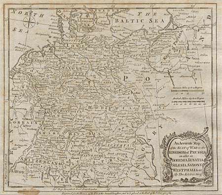
Auction 95, Lot 228
Subject: Central Europe
Kitchin, Thomas
An Accurate Map of the Seat of War in the Kingdom of Prussia as also in Bohemia, Lusatia, Silesia, Saxony, Westphalia &c., 1763
Size: 8.9 x 7.8 inches (22.6 x 19.8 cm)
Estimate: $80 - $100
Sold for: $65
Closed on 6/13/2001
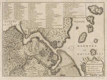
Auction 95, Lot 286
Subject: Turkey
Lodge, John
A Plan of Constantinople, Places adjacent and Canal of the Black Sea, 1770
Size: 9.5 x 6.8 inches (24.1 x 17.3 cm)
Estimate: $60 - $80
Sold for: $65
Closed on 6/13/2001
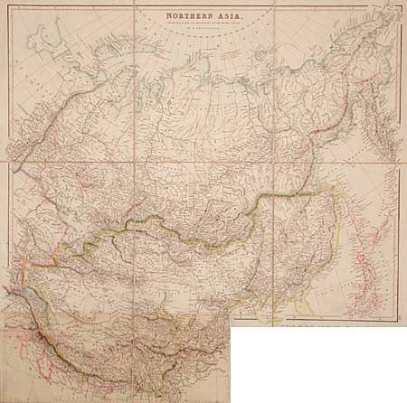
Auction 95, Lot 305
Subject: Northern Asia
Arrowsmith, John
Northern Asia from the Himalaya Mountains to the Arctic Ocean, 1840
Size: 23.2 x 23.7 inches (58.9 x 60.2 cm)
Estimate: $200 - $230
Sold for: $210
Closed on 6/13/2001
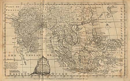
Auction 95, Lot 328
Subject: Southeast Asia
Bowen, Emanuel
An Accurate Map of the East Indies, in which ye European Forts, Factories, and Settlements are inserted & distinguished, 1757
Size: 11.5 x 7.1 inches (29.2 x 18 cm)
Estimate: $200 - $250
Sold for: $110
Closed on 6/13/2001
Auction 95, Lot 412
Subject: Atlas
Black, Adam & Charles
School Atlas of Modern Geography, Including the principal maps required for instruction in physical, ancient, and scripture geography, 1857
Size: 9 x 11.7 inches (22.9 x 29.7 cm)
Estimate: $75 - $100
Sold for: $180
Closed on 6/13/2001
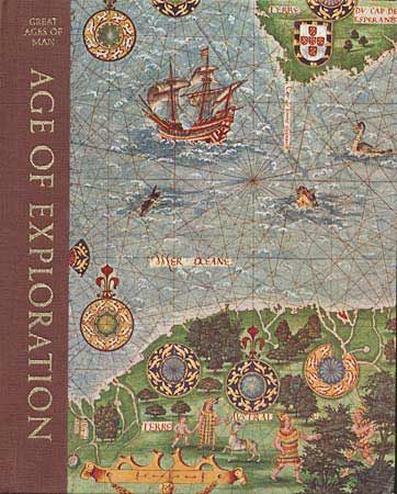
Auction 95, Lot 429
Subject: Exploration
Hale, John R.
Age of Exploration, 1974
Size: 8.7 x 10.7 inches (22.1 x 27.2 cm)
Estimate: $15 - $25
Sold for: $0
Closed on 6/13/2001
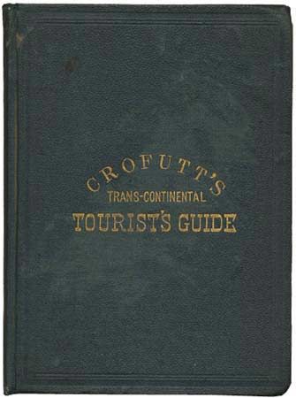
Auction 95, Lot 433
Subject: Guide Book
Crofutt, George A.
Crofutt's Trans-Continental Tourist's Guide, 1873
Size: 5.2 x 6.6 inches (13.2 x 16.8 cm)
Estimate: $300 - $400
Sold for: $300
Closed on 6/13/2001
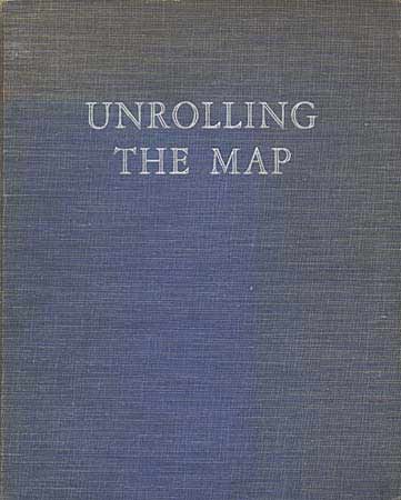
Auction 95, Lot 439
Subject: Cartographic Reference
Outhwaite, Leonard
Unrolling the Map - The Story of Exploration, 1935
Size: 8.6 x 10.3 inches (21.8 x 26.2 cm)
Estimate: $30 - $40
Sold for: $0
Closed on 6/13/2001
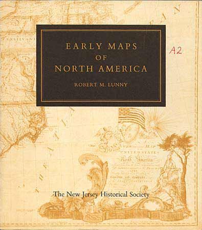
Auction 95, Lot 441
Subject: Cartographic Reference
Lunny, Robert M.
Early Maps of North America, 1961
Size: 8.4 x 9.5 inches (21.3 x 24.1 cm)
Estimate: $30 - $40
Sold for: $80
Closed on 6/13/2001
61 lots
Page 1 of 2