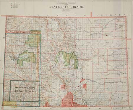
Subject: Colorado
Period: 1902 (dated)
Publication: Government Land Office
Color: Printed Color
Size:
34 x 28.5 inches
86.4 x 72.4 cm
This large edition (scale of 12 miles per inch) of this map is not often seen. Huge amount of detail including RR's, land grants, forts and military reservations, Indian reservations, forest reserves, un-subdivided land sections, and treaty land with notations on date and document number. Adams county is not shown indicating county development is current through 1901. Folding as issued. An large map in extraordinary condition that provides a detailed look at the state just after the turn of the century.
References:
Condition: A+
Folding as issued. An large map in extraordinary condition that provides a detailed look at the state just after the turn of the century.