Catalog Archive
Auction 95, Lot 176

"Map of the Territory of Wisconsin by David H. Burr Draughtsman to the House of Reps. U.S. 1836", Burr, David H.

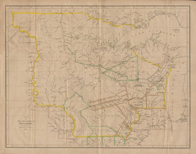
Subject: Central United States - Wisconsin

Period: 1836 (dated)

Publication: Hon. Z. Casey's Report.

Color: Hand Color

Size:
26.5 x 20.5 inches
67.3 x 52.1 cm
Download High Resolution Image
(or just click on image to launch the Zoom viewer)

A scarce, important and large map of Wisconsin Territory showing its extents to include all of present day Minnesota and most of the Dakota's. The western extent is the Missouri River up to the White Earth River. Outline coloring shows 8 districts and numerous land parcels allocated to the various Indian tribes and areas ceded by the Sioux, Sac, and Fox. Filled with detail including forts, ferries, towns and villages including Wisconsin City and Milwaukee. Hydrology is well developed and there is considerable geographic data.

References: Phillips (M) p.1075; Phillips (A) 1384-19.

Condition: B

Backed with Japanese tissue, full margins with light offsetting and toned along one fold.

Estimate: $600 - $800

Sold for: $900

Closed on 6/13/2001

Archived