Catalog Archive
Auction 95, Lot 168

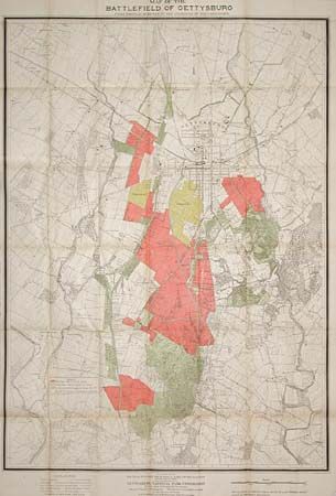
"Map of the Battlefield of Gettysburg…", U.S. War Department

Subject: Pennsylvania

Period: 1903 (dated)

Publication:

Color: Printed Color

Size:
33 x 46 inches
83.8 x 116.8 cm
Download High Resolution Image
(or just click on image to launch the Zoom viewer)

This huge and detailed map was produced as part of the preparations for the 50th anniversary of the Civil War battle. Color coded and filled with fascinating detail of monuments, markers, railroads, stone walls, fence types, etc. The names of present and past landowners are also noted. Published under the direction of the Gettysburg National Park Commission and drawn by the S.A. Hammond. A very historical map with amazing detail.

References:

Condition: A

Map is folded, as issued, with a little fold toning and a couple of small intersection splits. However, for a map of this size we consider it very good.

Estimate: $300 - $350

Sold for: $450

Closed on 6/13/2001

Archived