Catalog Archive
Auction 95, Lot 160

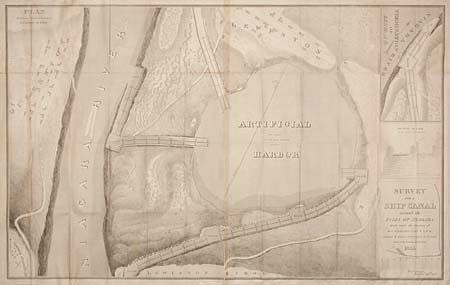
"Survey for a Ship Canal Around the Falls of Niagara", U.S. Coast Survey

Subject: New York

Period: 1835 (dated)

Publication: HR ex doc 214, 24th Cong., 1st Sess.

Color: Black & White

Size:
46 x 29 inches
116.8 x 73.7 cm
Download High Resolution Image
(or just click on image to launch the Zoom viewer)

Large sheet that shows a scheme to lower ships down Lewiston Ridge via locks, basins and an artificial harbor. Inset is an extension of the basin and locks (at the same scale) to the Niagara River (Line A-B). The main map is titled "Plan artificial harbor & project for descent of ridge" and is fully engraved. The artificial harbor is shown at center to occupy 100 acres and is projected to lay about 120 feet above the level of the river. Another inset shows a cross-section of proposed lock.

References:

Condition: B

Folding as issued, the map is made on two joined sheets with a little toning along joint.

Estimate: $150 - $200

Sold for: $75

Closed on 6/13/2001

Archived