Showing results for:Auction 163
Catalog Archive
441 lots
Page 1 of 9
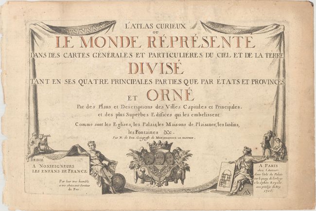
Auction 163, Lot 1
Subject: Title Pages
Fer, Nicolas de
L'Atlas Curieux ou le Monde Represente dans des Cartes Generales et Particulieres du Ciel et de la Terre..., 1705
Size: 13.5 x 9.1 inches (34.3 x 23.1 cm)
Estimate: $150 - $180
Sold for: $180
Closed on 6/14/2017
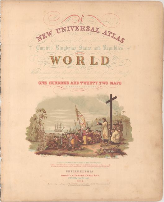
Auction 163, Lot 2
Subject: Title Pages
Thomas, Cowperthwait & Co.
[Lot of 2] A New Universal Atlas Containing Maps of the Various Empires, Kingdoms, States and Republics of the World... [and] Table of Contents, 1854
Size: 8.7 x 14.5 inches (22.1 x 36.8 cm)
Estimate: $70 - $90
Sold for: $35
Closed on 6/14/2017
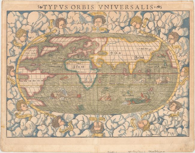
Auction 163, Lot 3
Subject: World
Munster, Sebastian
Typus Orbis Universalis, 1550
Size: 15 x 10.4 inches (38.1 x 26.4 cm)
Estimate: $2,000 - $2,300
Sold for: $2,200
Closed on 6/14/2017
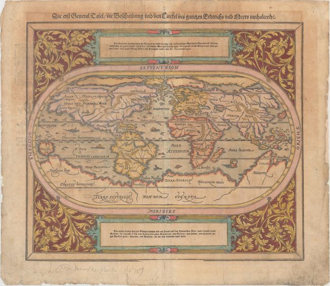
Auction 163, Lot 4
Subject: World
Munster/Petri
Die Erst General Tafel / die Beschreibung und den Circkel des Gantzen Erdtrichs und Meers Innhaltende, 1588
Size: 14.2 x 12.3 inches (36.1 x 31.2 cm)
Estimate: $850 - $1,000
Sold for: $800
Closed on 6/14/2017
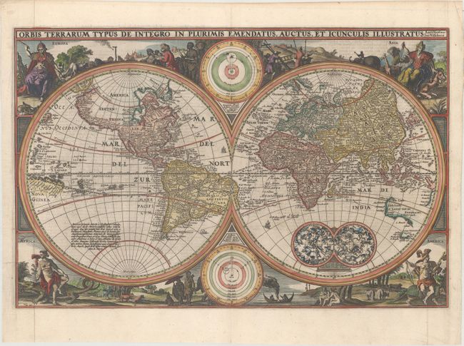
Auction 163, Lot 5
Subject: World
Visscher, Nicolas
Orbis Terrarum Typus de Integro in Plurimis Emendatus, Auctus, et Icunculis Illustratus, 1657
Size: 18.7 x 12.2 inches (47.5 x 31 cm)
Estimate: $1,800 - $2,100
Sold for: $1,800
Closed on 6/14/2017
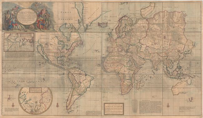
Auction 163, Lot 6
Subject: World
Moll, Herman
A New & Correct Map of the Whole World Shewing ye Situation of Its Principal Parts. Viz the Oceans, Kingdoms, Rivers, Capes, Ports, Mountains, Woods, Trade-Winds, Monsoons, Variations of ye Compass, Climats, &c..., 1719
Size: 47.8 x 27.7 inches (121.4 x 70.4 cm)
Estimate: $4,750 - $6,000
Moll's Large-Scale Map of the World
Sold for: $3,500
Closed on 6/14/2017
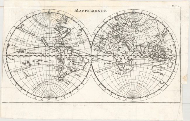
Auction 163, Lot 7
Subject: World
Dampier, William (Capt.)
Mappe-Monde, 1723
Size: 11.5 x 6.3 inches (29.2 x 16 cm)
Estimate: $275 - $350
Sold for: $200
Closed on 6/14/2017
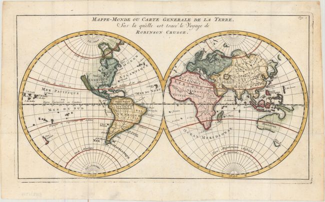
Auction 163, Lot 8
Subject: World
Mappe-Monde ou Carte Generale de la Terre, sur la Quelle est Trace le Voyage de Robinson Crusoe, 1725
Size: 12.2 x 6.9 inches (31 x 17.5 cm)
Estimate: $275 - $350
Map Showing Robinson Crusoe's Route
Sold for: $170
Closed on 6/14/2017
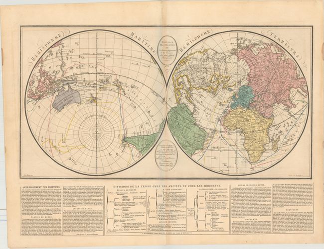
Auction 163, Lot 9
Subject: World
Molini, Giuseppe
Nouvelle Mappemonde avec les Dernieres Decouvertes et les Voyages des Plus Celebres Voyageurs, 1807
Size: 25.2 x 13.3 inches (64 x 33.8 cm)
Estimate: $475 - $600
Sold for: $250
Closed on 6/14/2017
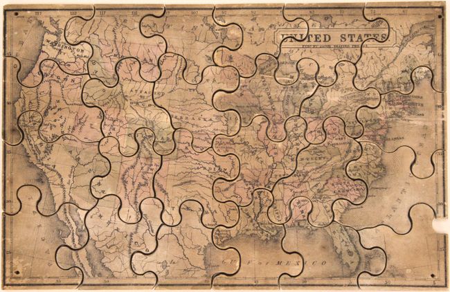
Auction 163, Lot 10
Subject: Cartographic Miscellany, United States Puzzle
New Dissected Map of the United States, 1865
Size: 10.8 x 6.9 inches (27.4 x 17.5 cm)
Estimate: $400 - $500
Early, Uncommon American Puzzle Map
Unsold
Closed on 6/14/2017
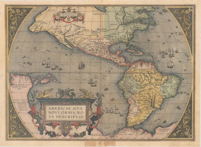
Auction 163, Lot 11
Subject: Western Hemisphere - America
Ortelius, Abraham
Americae sive Novi Orbis, Nova Descriptio, 1587
Size: 19.1 x 13.9 inches (48.5 x 35.3 cm)
Estimate: $4,750 - $6,000
Ortelius' Influential Map of the New World
Sold for: $3,125
Closed on 6/14/2017
Auction 163, Lot 12
Subject: Western Hemisphere - America
Botero, Giovanni
America, 1598
Size: 9.7 x 6.8 inches (24.6 x 17.3 cm)
Estimate: $900 - $1,100
Sold for: $525
Closed on 6/14/2017
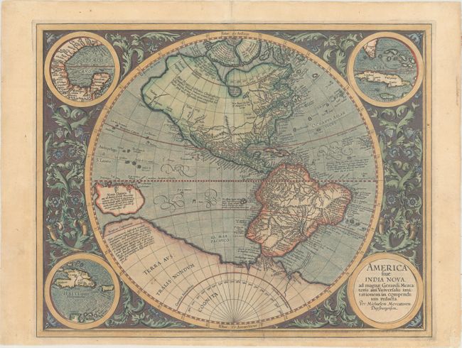
Auction 163, Lot 13
Subject: Western Hemisphere - America
Mercator/Hondius
America sive India Nova, ad Magnae Gerardi Mercatoris aui Universalis Imitationem in Compendium Redacta, 1606
Size: 18.1 x 14.5 inches (46 x 36.8 cm)
Estimate: $3,500 - $4,500
Mercator's Foundation Map for the Americas
Sold for: $2,350
Closed on 6/14/2017
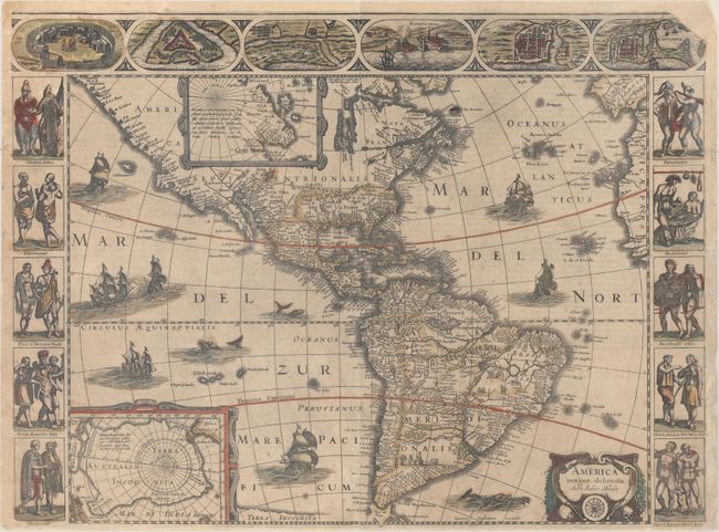
Auction 163, Lot 14
Subject: Western Hemisphere - America
Hondius/Jansson
America Noviter Delineata, 1638
Size: 21.9 x 16.3 inches (55.6 x 41.4 cm)
Estimate: $4,000 - $5,000
Jansson's Rare Carte-a-Figures Map of the Americas
Sold for: $3,000
Closed on 6/14/2017
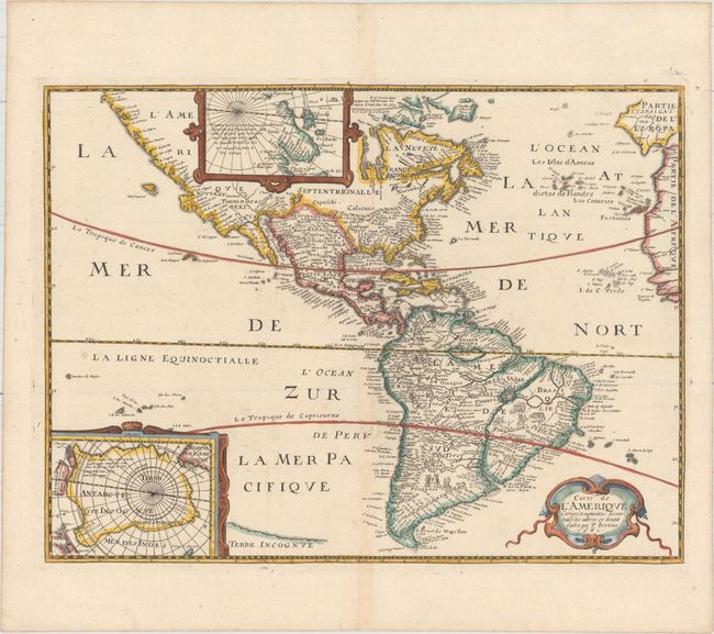
Auction 163, Lot 15
Subject: Western Hemisphere - America
Bertius/Tavernier
Carte de l'Amerique Corrigee et Augmentee; Dessus Toutes les Aultres cy Devant Faictes par P. Bertius, 1661
Size: 14.4 x 10.8 inches (36.6 x 27.4 cm)
Estimate: $1,500 - $1,800
Rare Derivative of Hondius' Influential Map
Unsold
Closed on 6/14/2017
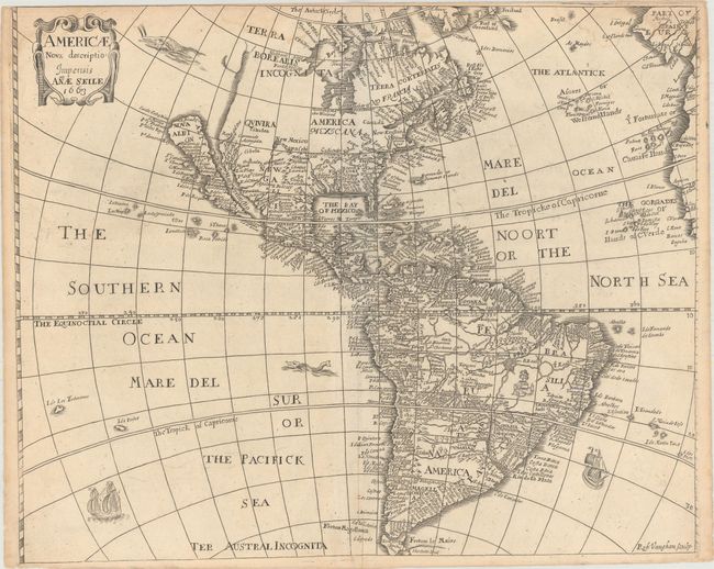
Auction 163, Lot 16
Subject: Western Hemisphere - America
Seile, Anae
Americae Nova Descriptio , 1663
Size: 16.4 x 13.3 inches (41.7 x 33.8 cm)
Estimate: $1,000 - $1,500
Unsold
Closed on 6/14/2017
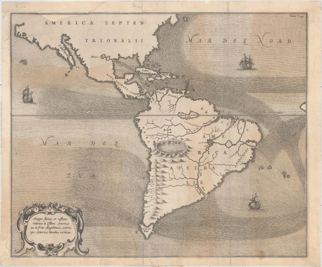
Auction 163, Lot 17
Subject: Western Hemisphere - America
Kircher, Athanasius
Mappa Fluxus et Refluxus Rationes in Isthmo Americano, in Freto Magellanico, Caeterisque Americae Litoribus Exhibens, 1665
Size: 16.4 x 13.6 inches (41.7 x 34.5 cm)
Estimate: $475 - $600
Sold for: $350
Closed on 6/14/2017
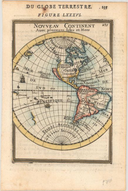
Auction 163, Lot 18
Subject: Western Hemisphere - America
Mallet, Alain Manesson
Nouveau Continent avec Plusieurs Isles et Mers, 1683
Size: 4.1 x 5.8 inches (10.4 x 14.7 cm)
Estimate: $160 - $190
Sold for: $120
Closed on 6/14/2017
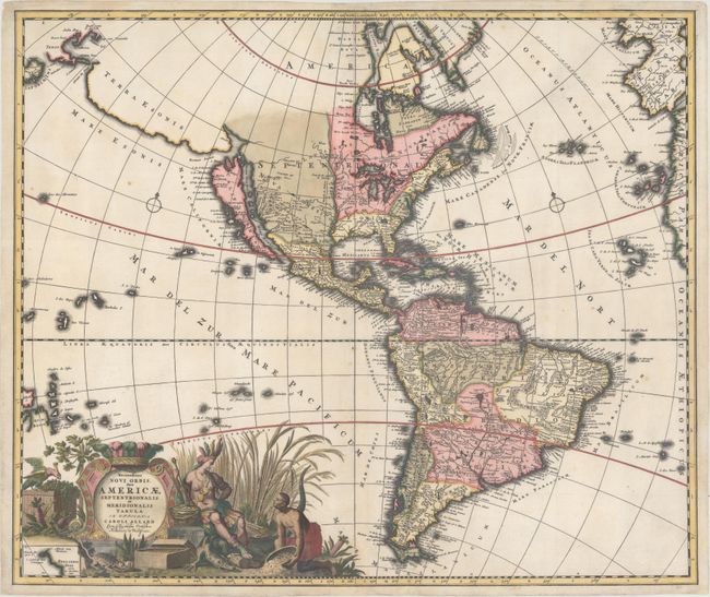
Auction 163, Lot 19
Subject: Western Hemisphere - America
Allard, Carel
Recentissima Novi Orbis, sive Americae Septentrionalis et Meridionalis Tabula, 1697
Size: 23.2 x 19.6 inches (58.9 x 49.8 cm)
Estimate: $1,800 - $2,100
Allard's Elaborate Map of the Western Hemisphere
Sold for: $1,300
Closed on 6/14/2017
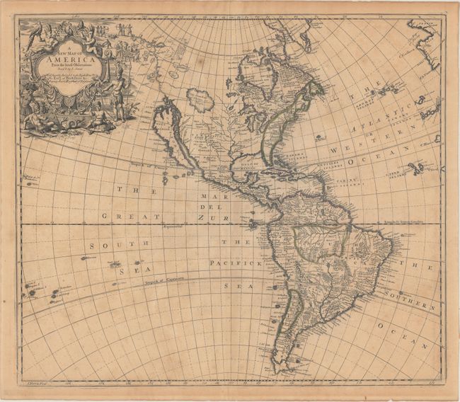
Auction 163, Lot 20
Subject: Western Hemisphere - America
Senex, John
A New Map of America from the Latest Observations, 1719
Size: 22.1 x 19.2 inches (56.1 x 48.8 cm)
Estimate: $1,200 - $1,500
Fascinating Map of the Americas with Unusual Features
Unsold
Closed on 6/14/2017
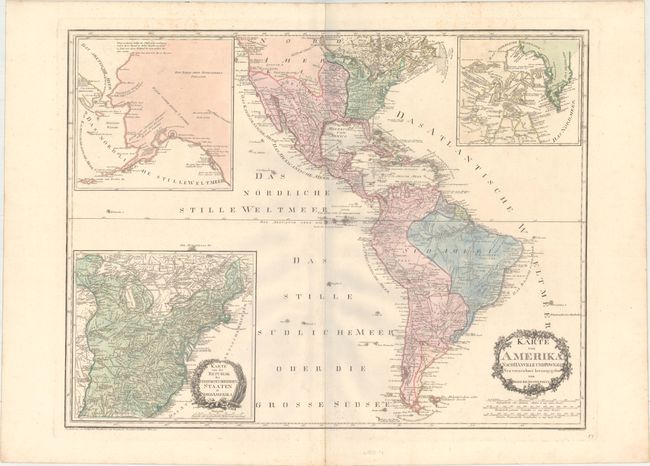
Auction 163, Lot 21
Subject: Western Hemisphere - America
Reilly, Franz Johann Joseph von
Karte von Amerika. Nach d'Anville und Pownall Neu Verzeichnet Herausgegeben, 1795
Size: 30.1 x 23.1 inches (76.5 x 58.7 cm)
Estimate: $450 - $550
Unsold
Closed on 6/14/2017
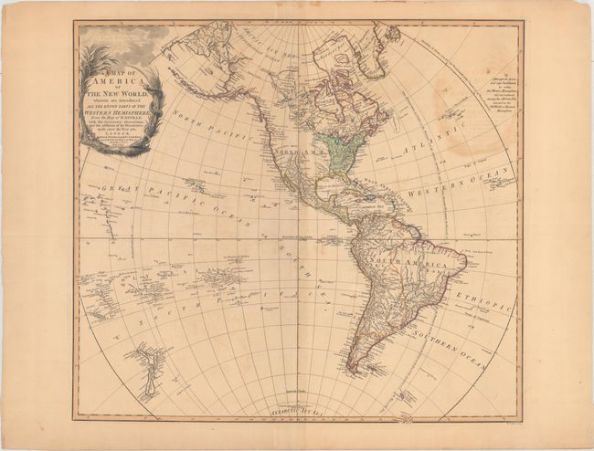
Auction 163, Lot 22
Subject: Western Hemisphere - America
Faden, William
A Map of America, or the New World, Wherein Are Introduced All the Known Parts of the Western Hemisphere, from the Map of d'Anville..., 1797
Size: 23 x 20.9 inches (58.4 x 53.1 cm)
Estimate: $550 - $700
Unsold
Closed on 6/14/2017
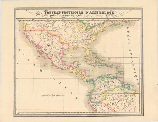
Auction 163, Lot 23
Subject: Western Hemisphere - America
Vandermaelen, Philippe Marie Guillaume
Tableau Provisoire d'Assemblage d'une Partie de l'Amerique Seple. & d'une Partie de l'Amerique Meridionale [with Title Page], 1825-27
Size: 22.3 x 18.8 inches (56.6 x 47.8 cm)
Estimate: $220 - $250
Sold for: $150
Closed on 6/14/2017
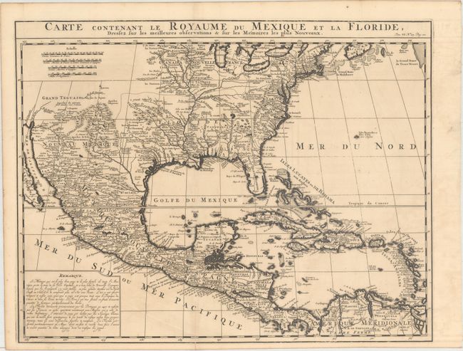
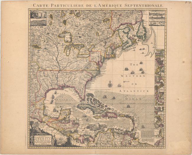
Auction 163, Lot 24
Subject: Colonial North America & West Indies
Chatelain, Henry Abraham
Carte Contenant le Royaume du Mexique et la Floride, Dressez sur les Meilleures Observations & sur les Memoires les Plus Nouveaux, 1719
Size: 20.4 x 15.9 inches (51.8 x 40.4 cm)
Estimate: $750 - $900
Unsold
Closed on 6/14/2017
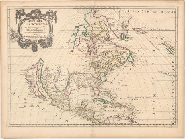
Auction 163, Lot 25
Subject: Colonial North America
Sanson/Mariette
Amerique Septentrionale par N. Sanson..., 1669
Size: 21.9 x 15.6 inches (55.6 x 39.6 cm)
Estimate: $2,400 - $3,000
Important Map for Great Lakes Collectors
Unsold
Closed on 6/14/2017
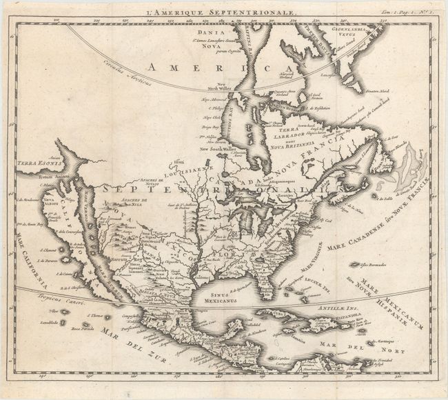
Auction 163, Lot 26
Subject: Colonial North America
Anon.
L'Amerique Septentrionale, 1690
Size: 11.7 x 9.9 inches (29.7 x 25.1 cm)
Estimate: $400 - $500
Sold for: $300
Closed on 6/14/2017
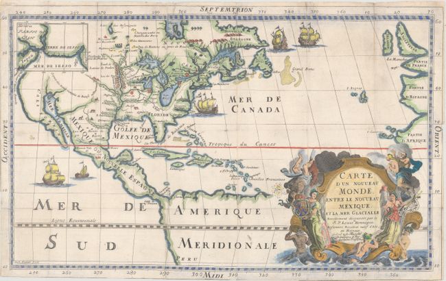
Auction 163, Lot 27
Subject: Colonial North America
Hennepin, Louis de (Fr.)
Carte d'un Nouveau Monde, Entre le Nouveau Mexique, et la Mer Glacialle, 1698
Size: 18.4 x 11.5 inches (46.7 x 29.2 cm)
Estimate: $2,750 - $3,500
Hennepin's Important, Updated Map of North America
Sold for: $1,600
Closed on 6/14/2017
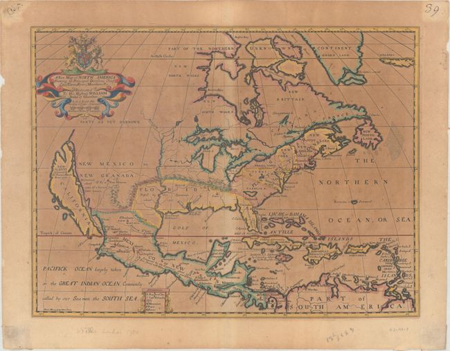
Auction 163, Lot 28
Subject: Colonial North America
Wells, Edward
A New Map of North America Shewing Its Principal Divisions, Chief Cities, Townes, Rivers, Mountains &c., 1704
Size: 19.2 x 14.5 inches (48.8 x 36.8 cm)
Estimate: $800 - $1,000
Wells' Map of North America Featuring California as an Island
Sold for: $650
Closed on 6/14/2017
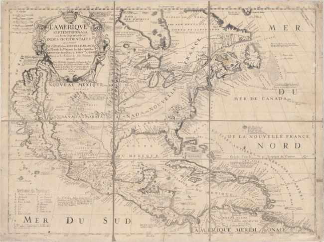
Auction 163, Lot 29
Subject: Colonial North America
Coronelli/Nolin
L'Amerique Septentrionale, ou la Partie Septentrionale des Indes Occidentales ou se Trouve le Canada ou Nouvelle France la Floride la Virginie les Isles Antilles..., 1704
Size: 23.3 x 17.6 inches (59.2 x 44.7 cm)
Estimate: $2,750 - $3,500
Nolin's Spectacular Version of Coronelli's Map of North America
Unsold
Closed on 6/14/2017
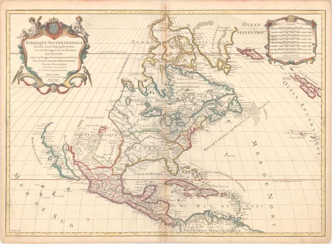
Auction 163, Lot 30
Subject: Colonial North America
Sanson/Jaillot
Amerique Septentrionale Divisee en ses Principales Parties, ou sont Distingues les uns des Autres les Estats..., 1719
Size: 25.3 x 18 inches (64.3 x 45.7 cm)
Estimate: $1,400 - $1,700
Sanson/Jaillot's Map of North America
Unsold
Closed on 6/14/2017
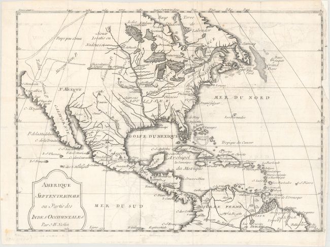
Auction 163, Lot 31
Subject: Colonial North America
Nolin, Jean Batiste
Amerique Septentrionale ou Partie des Indes Occidentales, 1722
Size: 11.6 x 8.4 inches (29.5 x 21.3 cm)
Estimate: $300 - $375
Sold for: $170
Closed on 6/14/2017
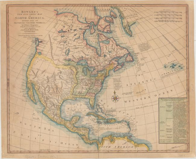
Auction 163, Lot 32
Subject: North America
Palairet/Delarouchette
Bowles's New One-Sheet Map of North America, Divided into It's Provinces, Colonies, States, &c., 1792
Size: 22.8 x 18.6 inches (57.9 x 47.2 cm)
Estimate: $1,500 - $1,800
Rare Map Showing Colonial Possessions and Interesting Geography West of the Mississippi River
Sold for: $650
Closed on 6/14/2017
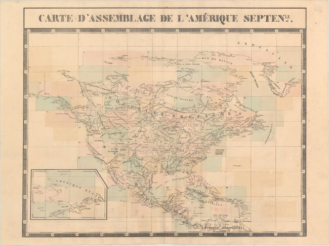
Auction 163, Lot 33
Subject: North America
Vandermaelen, Philippe Marie Guillaume
Carte d'Assemblage de l'Amerique Septenle., 1825-27
Size: 24.3 x 19.5 inches (61.7 x 49.5 cm)
Estimate: $200 - $230
Sold for: $150
Closed on 6/14/2017
Auction 163, Lot 34
Subject: North America, Texas
Morse & Breese
North America, 1842
Size: 12.4 x 14.9 inches (31.5 x 37.8 cm)
Estimate: $140 - $170
Sold for: $100
Closed on 6/14/2017
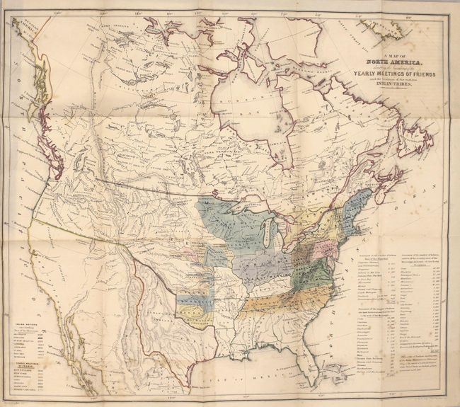
Auction 163, Lot 35
Subject: North America, Texas
Religious Society of Friends
A Map of North America, Denoting the Boundaries of the Yearly Meetings of Friends and the Locations of the Various Indian Tribes [and] Aboriginal America, East of the Mississippi [complete with report], 1844
Size: 5.8 x 9 inches (14.7 x 22.9 cm)
Estimate: $400 - $500
Sold for: $300
Closed on 6/14/2017
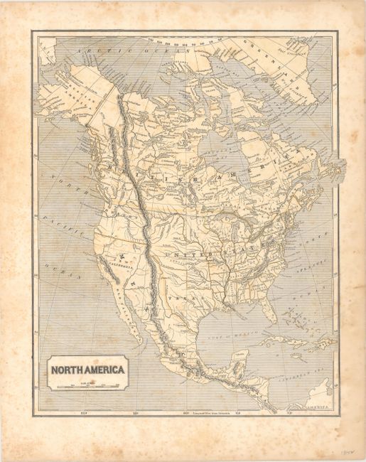
Auction 163, Lot 36
Subject: North America, Texas
Johnston, W. & A.K.
North America, 1845
Size: 19.4 x 23.6 inches (49.3 x 59.9 cm)
Estimate: $250 - $325
Sold for: $180
Closed on 6/14/2017
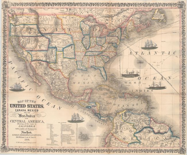
Auction 163, Lot 37
Subject: North America
Ensign, Bridgman & Fanning
Map of the United States, Canada, Mexico and the West Indies with Central America, Showing All the Routes to California with a Table of Distances, 1854
Size: 26 x 21.7 inches (66 x 55.1 cm)
Estimate: $1,800 - $2,100
Decorative Map Published During the California Gold Rush
Sold for: $1,200
Closed on 6/14/2017
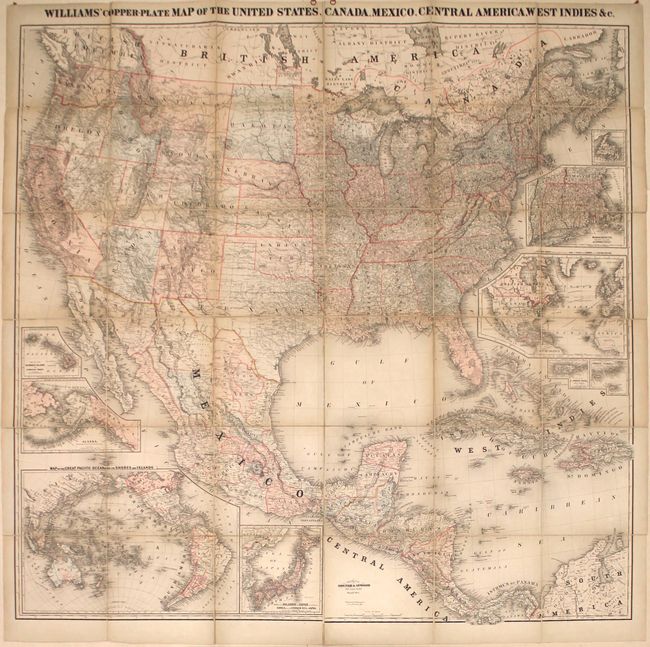
Auction 163, Lot 38
Subject: North America
Williams' Copper-Plate Map of the United States, Canada, Mexico, Central America, West Indies &c., 1876
Size: 63.1 x 61.9 inches (160.3 x 157.2 cm)
Estimate: $1,900 - $2,200
Rare Wall Map of North America
Unsold
Closed on 6/14/2017
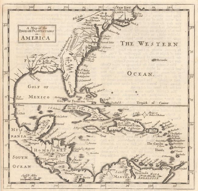
Auction 163, Lot 39
Subject: Colonial Eastern North America & West Indies
Moll, Herman
A Map of the English Plantations in America, 1701
Size: 7.4 x 7.1 inches (18.8 x 18 cm)
Estimate: $240 - $300
Unsold
Closed on 6/14/2017
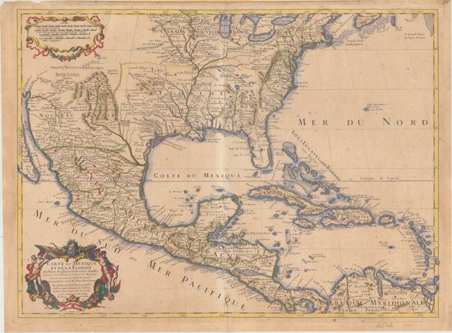
Auction 163, Lot 40
Subject: Colonial Eastern North America & West Indies
Delisle, Guillaume
Carte du Mexique et de la Floride des Terres Angloises et des Isles Antilles du Cours et des Environs de la Riviere de Mississipi..., 1703
Size: 25.6 x 18.7 inches (65 x 47.5 cm)
Estimate: $3,500 - $5,000
Rare First Issue of Landmark in American Cartography - First Printed Map to Accurately Depict the Mouth of the Mississippi River
Sold for: $2,500
Closed on 6/14/2017
Auction 163, Lot 41
Subject: Colonial Eastern North America & West Indies
Popple/Covens & Mortier
A Map of the British Empire in America with the French, Spanish and Hollandish Settlements Adjacent Thereto by Henry Popple, 1741
Size: 19 x 19.4 inches (48.3 x 49.3 cm)
Estimate: $2,750 - $3,500
Index Sheet of Popple's Map
Sold for: $2,400
Closed on 6/14/2017
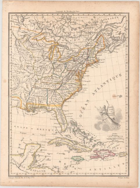
Auction 163, Lot 42
Subject: Eastern North America & West Indies
Chamouin, Jean Baptiste Marie
Etats Unis et Grandes Antilles, 1805
Size: 8.7 x 11.8 inches (22.1 x 30 cm)
Estimate: $120 - $150
Sold for: $80
Closed on 6/14/2017
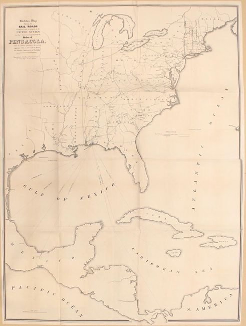
Auction 163, Lot 43
Subject: Eastern North America & West Indies
U.S. Government
Skeleton Map Showing the Rail Roads Completed and in Progress in the United States and Their Connection as Proposed with the Harbor of Pensacola..., 1847-48
Size: 36.1 x 48.9 inches (91.7 x 124.2 cm)
Estimate: $220 - $250
Unsold
Closed on 6/14/2017
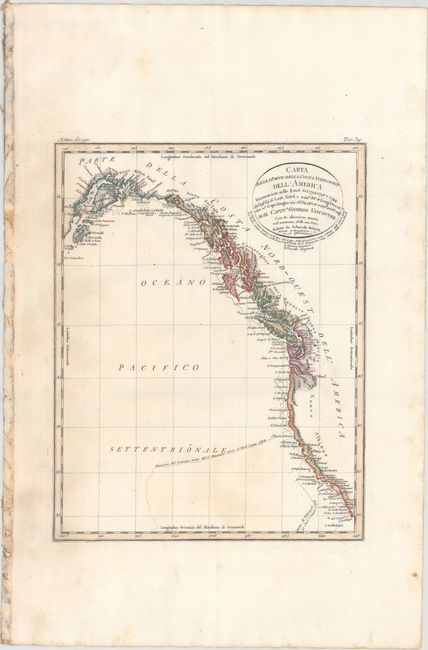
Auction 163, Lot 44
Subject: Western North America
Rossi, Luigi
Carta della Parte della Costa Nord-Ouest dell' America..., 1820
Size: 8.3 x 10.6 inches (21.1 x 26.9 cm)
Estimate: $200 - $230
Sold for: $170
Closed on 6/14/2017
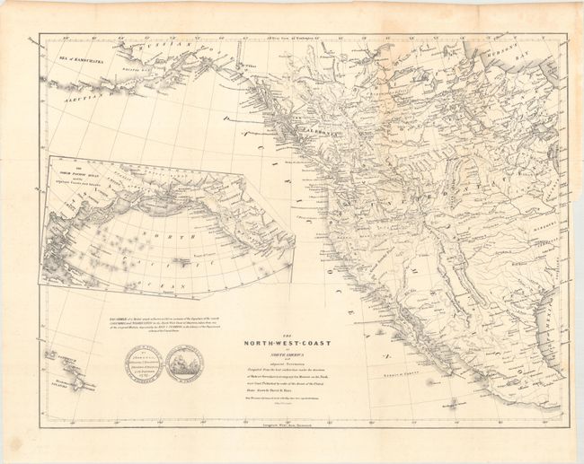
Auction 163, Lot 45
Subject: Western North America
Burr, David H.
The North-West-Coast of North America and Adjacent Territories Compiled from the Best Authorities Under the Direction of Robert Greenhow..., 1840
Size: 21.1 x 16.3 inches (53.6 x 41.4 cm)
Estimate: $325 - $400
Sold for: $220
Closed on 6/14/2017
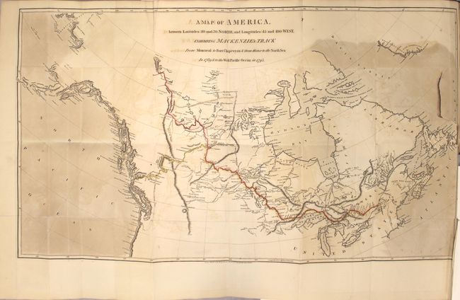
Auction 163, Lot 46
Subject: Canada
Mackenzie, Alexander
Voyages from Montreal, on the River St. Laurence, Through the Continent of North America, to the Frozen and Pacific Oceans; in the Years 1789 and 1793..., 1801
Size: 8.6 x 10.9 inches (21.8 x 27.7 cm)
Estimate: $5,500 - $6,500
First Edition of Mackenzie's Famous Account
Sold for: $4,000
Closed on 6/14/2017
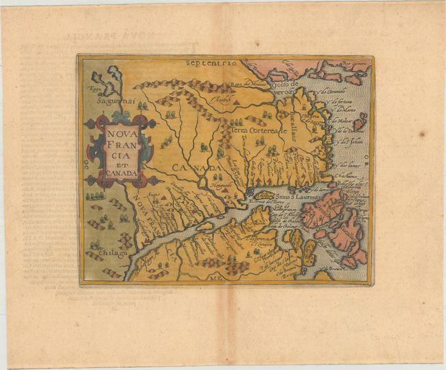
Auction 163, Lot 47
Subject: Eastern Canada
Metellus, Natalius Sequanus
Nova Francia et Canada, 1598
Size: 9.3 x 7.4 inches (23.6 x 18.8 cm)
Estimate: $1,300 - $1,600
Metellus's Rare Reduced Version of Wytfliet's Map of Eastern Canada
Sold for: $700
Closed on 6/14/2017
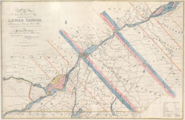
Auction 163, Lot 48
Subject: Eastern Canada, Quebec
Lay, Amos
A New Correct Map of the Seat of War in Lower Canada Protracted from Hollands Large Map Compiled from Actual Survey Made by Order of the Provincial Government..., 1814
Size: 33.1 x 21.6 inches (84.1 x 54.9 cm)
Estimate: $1,600 - $2,000
Lay's Update to Samuel Holland's Map
Unsold
Closed on 6/14/2017
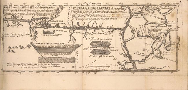
Auction 163, Lot 49
Subject: Colonial United States & Canada, Exploration, River Longue
Lahontan, Louis Armand, Baron de
[2 Volumes] Nouveaux Voyages de Mr Le Baron de Lahontan, dans l'Amerique Septentrionale... [and] Memoires de l'Amerique Septentrionale, ou la Suite des Voyages..., 1704-09
Size: 4 x 6.9 inches (10.2 x 17.5 cm)
Estimate: $1,400 - $1,700
Includes the Reduced, First State of Lahontan's Influential Map Depicting "Riviere Longue"
Sold for: $1,600
Closed on 6/14/2017
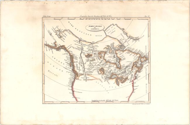
Auction 163, Lot 50
Subject: United States & Canada
Rossi, Luigi
Dominj Inglesi in America, 1820
Size: 9.8 x 7.8 inches (24.9 x 19.8 cm)
Estimate: $150 - $180
Unsold
Closed on 6/14/2017
441 lots
Page 1 of 9