Catalog Archive
Auction 163, Lot 47

Metellus's Rare Reduced Version of Wytfliet's Map of Eastern Canada

"Nova Francia et Canada", Metellus, Natalius Sequanus

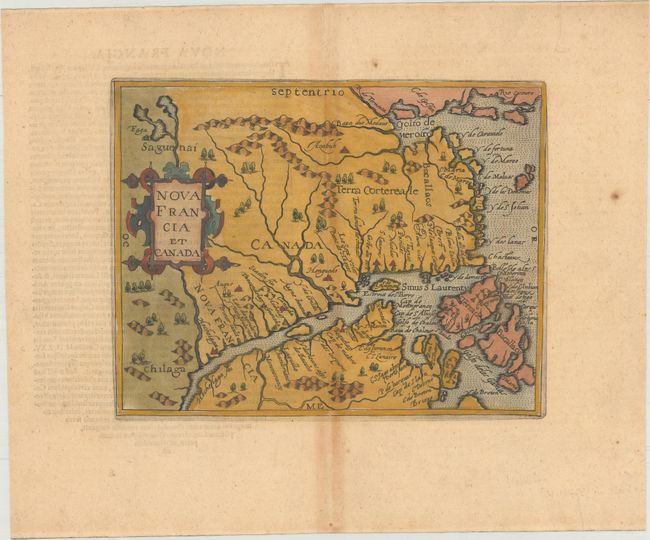
Subject: Eastern Canada

Period: 1598 (circa)

Publication: America sive Novus Orbis

Color: Hand Color

Size:
9.3 x 7.4 inches
23.6 x 18.8 cm
Download High Resolution Image
(or just click on image to launch the Zoom viewer)

This is the rare and slightly smaller version of the Wytfliet map of the same title. Wytfliet's map is cartographically important for a number of reasons - it was the first map to use Canada in its title, and the first to concentrate on the St. Lawrence River and gulf. The general outline of the map is derived from Gerard Mercator and summarizes sixteenth-century knowledge of the region. The region north of the St. Lawrence and east of the Saguenai River is labeled Canada, and Nova Francia is centered on the town of Hochelaga (present-day Montreal). Latin text on verso.

References: Burden #117; Kershaw #41.

Condition: B+

A dark impression on watermarked paper with light toning along the centerfold and a couple of spots of foxing in the blank margins.

Estimate: $1,300 - $1,600

Sold for: $700

Closed on 6/14/2017

Archived