Subject: Canada
Period: 1801 (published)
Publication:
Color: Black & White
Size:
8.6 x 10.9 inches
21.8 x 27.7 cm
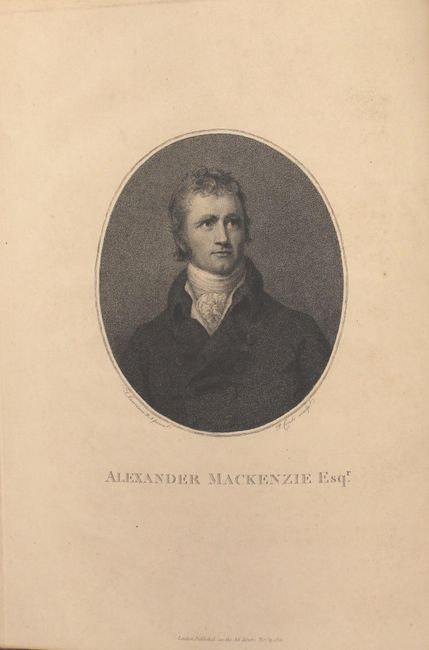
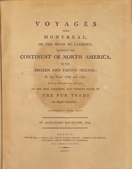
This is the first and finest edition of Mackenzie's famous account of his epic journeys to the North and Northwest composed in two volumes - first to the Arctic Ocean in 1789, and second to the Pacific Ocean in 1793. Alexander Mackenzie was the first white man to cross the North American continent north of Mexico and thus totally dispel the belief in a Northwest Passage from Hudson Bay. His courageous voyages were ones of incredible hardship and mark an important page in the cartographic history of North America. Mackenzie's writings on his journeys came to the attention of Thomas Jefferson and served as the catalyst to Lewis and Clark's famous expedition to the Pacific Northwest. Included in his remarkable account are three very important and rare maps:
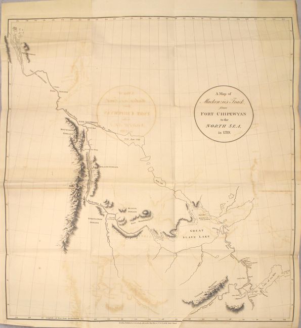
A. A Map of Mackenzie’s Track from Fort Chipewyan to the North Sea, in 1789 (22 x 23.4"). This basic map charts the 1,100-mile Mackenzie River, traveling from the Great Slave Lake to Mackenzie Bay in the Arctic Ocean. Mackenzie had been following Peter Pond's false prediction of a river that led from the Great Slave Lake west to the Pacific Ocean, but instead ended up in the Arctic.
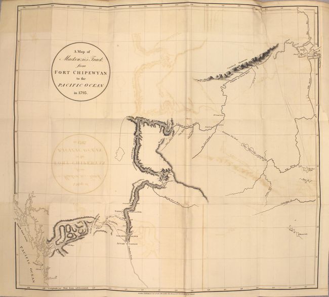
B. A Map of Mackenzie’s Track from Fort Chipewyan to the Pacific Ocean in 1793(22 x 23.6"). This map is sparsely engraved with detail only in the regions adjacent to his trek from Fort Chipewyan to Finlay Forks, south along the Parsnip River (headwater of the Peace River), then down the Herrick and McGregor Rivers to the Great Fork with the Fraser River (which he mistook for the upper Columbia). He followed the river until the rapids just above Williams Lake and then made his way on foot along established native trails to the Pacific at the mouth of the Bella Coola River.
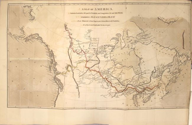
C. A Map of America, between Latitudes 40 and 70 North, and Longitudes 45 and 180 West, Exhibiting Mackenzie’s Track from Montreal to Fort Chipewyan & from thence onto the North Sea in 1789, & to the West Pacific Ocean in 1793, hand color (17.3 x 30.5"). Shows the entire track of both the 1789 and 1793 expeditions from Montreal to the Arctic Sea and then on to the Pacific Ocean. Inland detail is limited to the river system, lakes and Indian tribes mainly along his route.
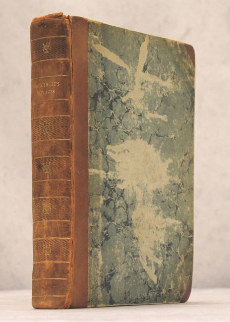
After his journeys, Mackenzie retired back to his native Scotland as a wealthy fur-trader, where he wrote the Voyages, published in London in 1801. 412 pages including three folding maps and an engraved portrait frontispiece. Quarto, hardbound in quarter leather with tips over marbled boards with gilt title and embossing on spine.
References: Wagner-Camp #1:1; Howes #M133; Sabin #43414; Streeter Sale #3653; Wheat (TMW) #251.
Condition: B
The three folding maps have light offsetting, a few tiny splits at fold intersections, and binding tears ranging from 1.5" to 3.5" in size. The Map of America also has uneven toning at left and right. Text has light toning and occasional minor foxing. A previous owner's bookplate is on the front pastedown, and there is offsetting of the frontispiece on the title page. There is moderate wear to the extremities with warped boards, bumped edges and cracking along both joints (separated at top).