Catalog Archive
Auction 182, Lot 162

"A New and Accurate Map of the Province of New York and Part of the Jerseys, New England and Canada, Shewing the Scenes of Our Military Operations During the Present War. Also the New Erected State of Vermont", Lodge, John

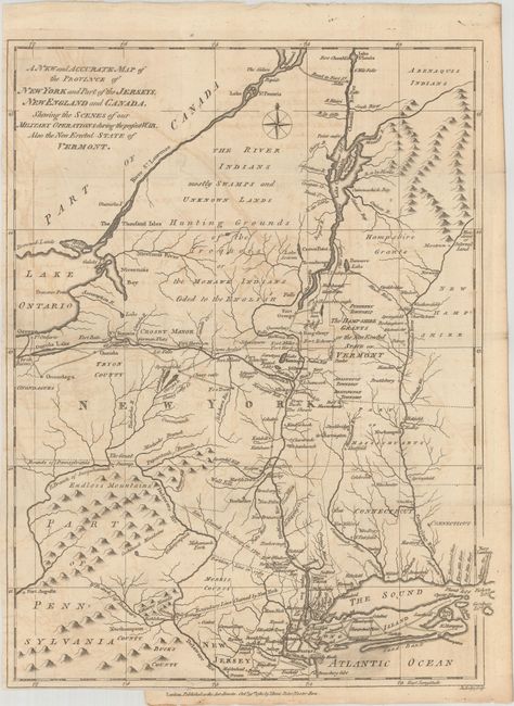
Subject: Colonial New England & Mid-Atlantic United States

Period: 1780 (dated)

Publication: Political Magazine

Color: Black & White

Size:
11 x 14.5 inches
27.9 x 36.8 cm
Download High Resolution Image
(or just click on image to launch the Zoom viewer)

A detailed map of the field of military operations during the Revolutionary War issued in the October 1780 issue of Political Magazine. It covers the region from the St. Lawrence River and Lake Champlain down to Long Island and west to Lake Ontario. It shows the various boundary disputes between New York and New Jersey, roads, forts, land grants and Indian territory. Vermont is labeled "The Hampshire Grants or the New Erected State of Vermont." The imprint below the neatline is dated October 31, 1780 by John Bew. Engraved by John Lodge.

References: Jolly #POL-14; Sellers & van Ee #176; McCorkle #780-9.

Condition: B

Issued folding with light offsetting and a short binding tear at bottom that has been closed on verso with archival tape.

Estimate: $800 - $950

Unsold

Closed on 4/28/2021

Archived