Subject: Northeastern United States & Canada
Period: 1831 (dated)
Publication:
Color: Hand Color
Size:
24.6 x 37.9 inches
62.5 x 96.3 cm
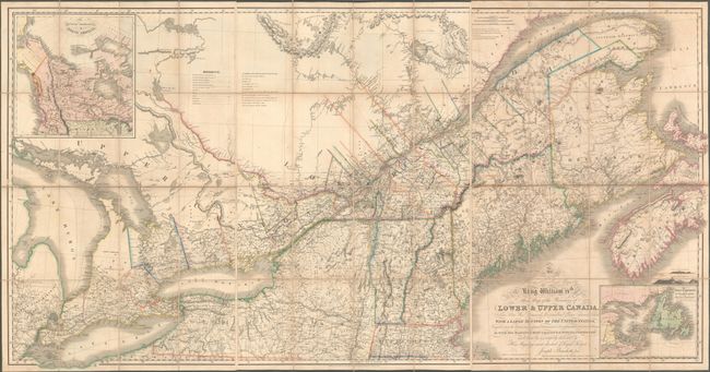
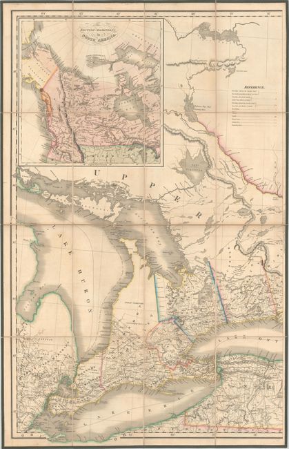
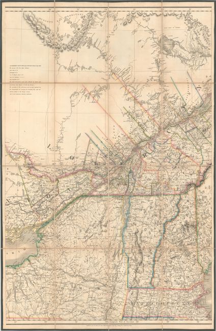
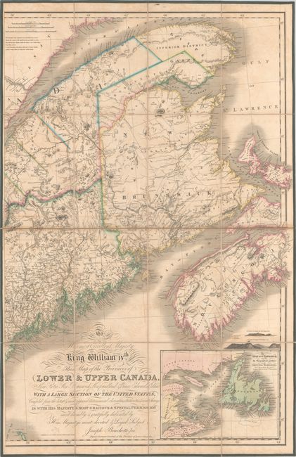
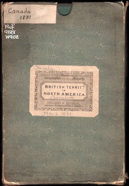
This important map of eastern Canada was intended to be published in conjunction with Joseph Bouchette Sr.'s British Dominions in North America: Or, A Topographical and Statistical Description of the Provinces of Lower and Upper Canada... but is apparently never found with the book. The map shows the provinces of Upper and Lower Canada, which had been established in 1791, with great detail of towns, roads, canals, county and district boundary lines, and lands designated to the Canada Company. After the American Revolution, Canadian military and civilian settlers were able to petition the Governor to obtain free or leased lands. In 1826, the Canada Company was given royal assent to help colonize Upper Canada, and townships that include Canada Company lands are marked on the map with an asterisk or a cross. Bouchette indicates a number of Canadian sources for the map, including Major Holland, Joseph Frederick DesBarres, and Bouchette Sr., as well as "several important American Authorities" who were not important enough to name. The map shows British interests in two boundary disputes with the United States, between Maine and present-day Washington. A note at the top of the eastern sheet acknowledges the boundary dispute with Maine, but there is no mention of the dispute in the west. Engraved by J. & C. Walker and published by James Wyld on May 2, 1831.
Although the map is often incorrectly attributed to Joseph Bouchette Sr., it was created by his son, Joseph Bouchette Jr., whose name appears in the title cartouche. In his 1831 book, British Dominions in North America, the father explains in the preface: "The geographical map of the British provinces, and of a section of the adjacent states of the American union, accompanying the work, will, it is hoped, be found an interesting adjunct, from the scope of the country it embraces, as well as an account of the sources of information whence it was compiled. This map was constructed by the author’s eldest son, Joseph Bouchette, Esq., Deputy Surveyor-General of Lower Canada, and must, like the other maps, be left in a great measure to speak for itself. It is but justice to the compiler, however, to mention the extreme laboriousness with which, during three years, he attached himself to its construction, in the midst of active professional duties—the close investigation as to the correctness of documents that preceded their application, and the science with which he was capable of graphically applying the information these documents contained. To this gentleman the author is also indebted for his scientific aid in the compilation of several parts of the topographical maps." It is likely that the map is often credited to the father due to his previous maps of the region, as well as the fact that the map was published in conjunction with the father's book on Upper and Lower Canada.
This map also served the political agenda of the Bouchettes. The depiction of Canada Company lands was important in encouraging immigration to Upper Canada, and the Bouchettes were strong advocates for the Canada Company, despite the mismanagement and corruption that plagued the group. Bouchette Sr. included an entire chapter on the Canada Company in his 1831 book, and described the Company thus: "The comprehensive magnitude of their judicious plans of settlement, and the promptness, intelligence, and vigour with which they were carried at once into effect, have given a prodigious impulse to the physical and moral energies of the province." In Bouchette Sr.'s opinion, the Canada Company was an essential part of the Canadian immigration plan and helped create Canadian loyalty to the United Kingdom. The Bouchette's own loyalty to the British crown did not endear them to the Canadian government. This sentiment was further exacerbated by the Bouchettes' belief that Upper and Lower Canada should be united as a single province, which was in line with Britain's desires but not those of the French Canadians. Although both Upper and Lower Canada are labeled on the map, there is not much distinction shown between the two, a common practice on the Bouchettes' maps.
Each of the three sheets is dissected and backed with contemporary linen with green ribbon edging. The map is housed in the original marbled paper slipcase with a printed paper title label on the front. The verso of each sheet also has an engraved paper label with the publisher's imprint: "James Wyld Successor to Mr. Faden, Geographer to His Majesty. Charing Cross, opposite Northumberland House."
This map is very rare, with only 3 known examples appearing on the market in the last 30 years.
References: Rumsey #4436.
Condition: B+
Bold, contemporary outline color with light toning and offsetting. Each sheet has a blindstamp for the Sondley Library in a blank area of the sheet at bottom, and there are stamps on the verso of each sheet from Pack Memorial Public Library, Asheville, North Carolina clearly counterstamped "withdrawn." The slipcase is stained and worn with short separations along several seams. A paper label and white ink were also added to the slipcase with library shelving information. The first image is a composite image - the map is in three separate sheets.