Subject: Maine & Eastern Canada
Period: 1838 (circa)
Publication: Sen. Doc. 431
Color: Black & White
Size:
13.3 x 13.7 inches
33.8 x 34.8 cm
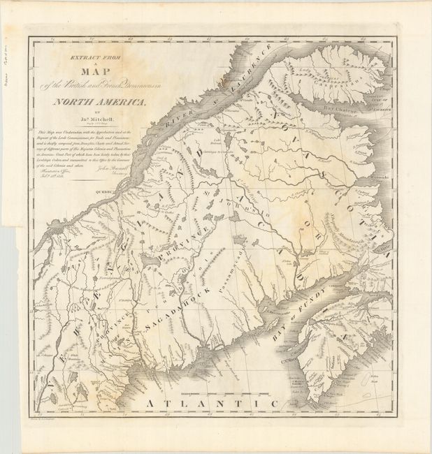
This map shows the region that was disputed between the United States and Canada prior to the border being established with the Webster-Ashburton Treaty of 1842. This is a copy of a section of John Mitchell's famous map that was used during the 1783 Treaty of Paris. That treaty did not clearly determine the boundary leaving a contested area of the Saint John River valley and its tributaries. In 1838-39 a confrontation, known as the Arroostook War, broke out between the United States and Great Britain. The dispute resulted in a mutually accepted border between the state of Maine and the provinces of New Brunswick and Quebec. The final treaty gave Maine most of the disputed area, and gave the British a militarily vital connection between Quebec and Nova Scotia by way of the Halifax Road. Drawn by S.L. Dashiell and engraved by J.V.N. Throop.
References: Claussen & Friis #219.
Condition: B
Issued folding with light toning and foxing.