Subject: United States
Period: 1805-52 (circa)
Publication:
Color:
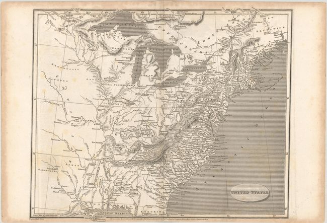
A. United States, by Aaron Arrowsmith, Sr., dated 1805, black & white (12.4 x 10.1"). A detailed map of the early United States with Georgia Territory extending from the coast to the Mississippi River, the early state of Tenassee, and the District of Main. The forts, native villages, and frontier settlements are noted with Jowa Town and Lower Jowa Town named near the fork of the Des Moines (River Moin) and Mississippi rivers. The land west of the Mississippi has only native names and simple topography noted. Engraved by E. Jones and published by Longman, Hurst, Rees, Orme at Paternoster Row, London. Condition: There are a couple of small dampstains along the bottom border and some additional foxing/staining along the sheet edges. (B+)
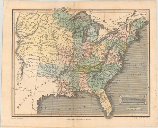
B. United States, by Thomas Tegg, circa 1828, hand color (10.3 x 8.4"). An attractive map of the young United States extending to the Rocky Mountains. Shows Arkansas Territory in its largest extent including present-day Oklahoma, and a large unnamed Northwest Territory includes the upper peninsula of Michigan, Wisconsin, and eastern Minnesota. To the west of the Mississippi River is a vast Western States. Condition: There is minor foxing, a couple of tiny holes along the centerfold, and a centerfold separation that has been closed on verso with archival tape. (B+)
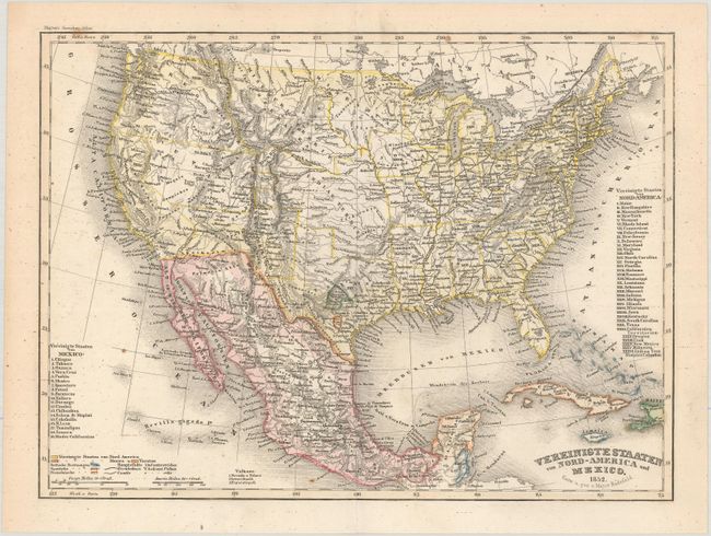
C. Vereinigte Staaten von Nord-America und Mexico, by Major Radefeld, from Meyer's Groschen Atlas, dated 1852, hand color (10.1 x 7.4"). This detailed map displays evolving configurations of the western territories with large New Mexico, Utah and Oregon territories. In Texas the French Franz Col. colony and the German Mainzer Verein colony are highlighted in text and separate hand coloring. The large Indian Territory encompasses today's Oklahoma, Kansas, and part of Nebraska. Missouri Territory is also identified as Nebraska. Finely engraved in the typical German style. Condition: A few minor spots, otherwise fine. (A)
References:
Condition:
See description above.