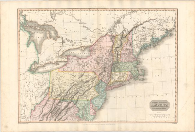
Subject: New England & Mid-Atlantic United States
Period: 1810 (dated)
Publication: Modern Atlas
Color: Hand Color
Size:
27.3 x 19.6 inches
69.3 x 49.8 cm
This attractive map of the Mid-Atlantic states and New England covers the area from Virginia north to the District of Main. A large Western Territory occupies the interior region which includes part of Kentucky, Indiana, and an early Michigan Territory. The detailed map identifies the Great Tract of Wood Land in today’s Michigan, the Connecticut Reserve south of Lake Erie, and the location of numerous Indian tribes and forts. Drawn by L. Hebert, engraved by Neele, and published by Cadell & Davies and Longman, Hurst, Rees, & Orme. .
References: Rumsey #0732.043.
Condition: A
Contemporary color on a sturdy sheet with minor offsetting and marginal soiling.