Filtered by Category:United States(Show All Categories)
Showing results for:Auction 174
Catalog Archive
160 lots
Page 1 of 4
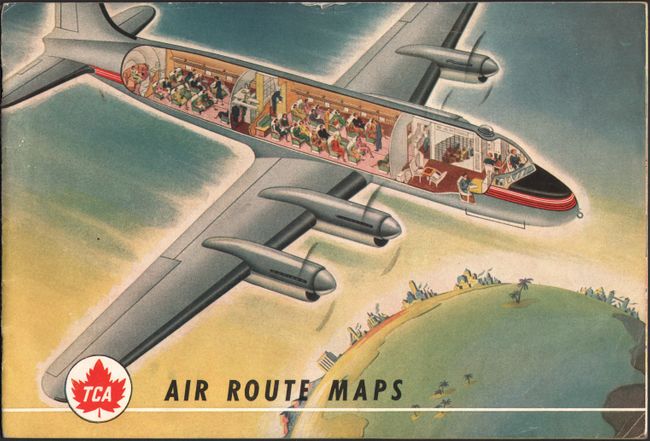
Auction 174, Lot 110
Subject: United States & Canada, Flight Maps
[Lot of 3] TCA Air Route Maps [and] Trans-Canada Air Lines Air Canada [and] Route Map Vancouver to Amsterdam, 1950-60
Size: See Description
Estimate: $80 - $100
Sold for: $40
Closed on 9/11/2019
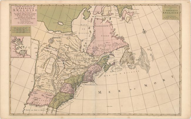
Auction 174, Lot 111
Subject: Colonial Eastern United States & Canada
Mortier, Pierre
Carte Nouvelle de l'Amerique Angloise Contenant la Virginie, Mary-Land, Caroline, Pensylvania Nouvelle Iorck. N: Iarsey N: France, et les Terres Nouvellement Decouerte..., 1700
Size: 35.9 x 23.5 inches (91.2 x 59.7 cm)
Estimate: $2,200 - $2,500
A Map Showing Fascinating Geographic Misconceptions in Colonial America
Sold for: $1,200
Closed on 9/11/2019
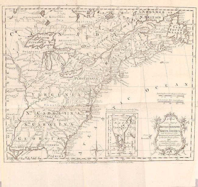
Auction 174, Lot 112
Subject: Colonial Eastern United States & Canada
Kitchin, Thomas
[Maps in Book] A New Map of the British Dominions in North America; with the Limits of the Governments Annexed Thereto by the Late Treaty of Peace... [bound in] The Annual Register, or a View of the History, Politicks, and Literature…, 1765
Size: 11.9 x 9.6 inches (30.2 x 24.4 cm)
Estimate: $650 - $800
Sold for: $550
Closed on 9/11/2019
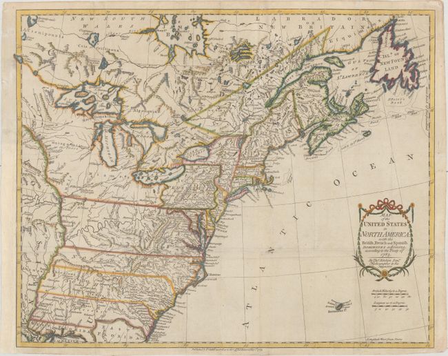
Auction 174, Lot 113
Subject: Eastern United States & Canada
Kitchin, Thomas
Map of the United States in North America: with the British, French and Spanish Dominions Adjoining, According to the Treaty of 1783, 1783
Size: 19.9 x 16.1 inches (50.5 x 40.9 cm)
Estimate: $1,400 - $1,700
One of the Earliest English-Produced Maps to Acknowledge the United States
Sold for: $1,400
Closed on 9/11/2019
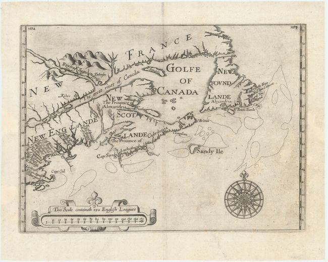
Auction 174, Lot 114
Subject: Colonial Northeastern United States & Canada
Alexander, William (Sir)
[Untitled - Northeastern United States & Canada], 1625
Size: 13.5 x 9.8 inches (34.3 x 24.9 cm)
Estimate: $5,500 - $7,000
The First Map to Name New Scotland
Sold for: $4,000
Closed on 9/11/2019
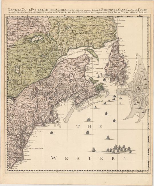
Auction 174, Lot 115
Subject: Colonial Northeastern United States & Canada
Popple/Covens & Mortier
Nouvelle Carte Particuliere de l'Amerique ou sont Exactement Marquees la Nouvelle Bretagne, le Canada ou Nouvelle France, la Nouvelle Ecosse, la Nouvelle Angleterre, la Nouvelle York, la Pensilvanie, Mary-Land, la Caroline Septentrionale..., 1741
Size: 20.7 x 22.5 inches (52.6 x 57.2 cm)
Estimate: $2,200 - $2,500
The Northeastern Sheet of the Reduced-Size Edition of Popple's Map
Sold for: $1,600
Closed on 9/11/2019
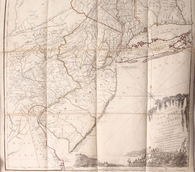
Auction 174, Lot 116
Subject: Colonial Northeastern United States & Quebec
Holland/Pownal
The Provinces of New York, and New Jersey; with Part of Pensilvania, and the Province of Quebec..., 1776
Size: 21.5 x 53.3 inches (54.6 x 135.4 cm)
Estimate: $4,000 - $4,750
Thomas Jefferys' Important Revolutionary War Period Map
Sold for: $2,500
Closed on 9/11/2019
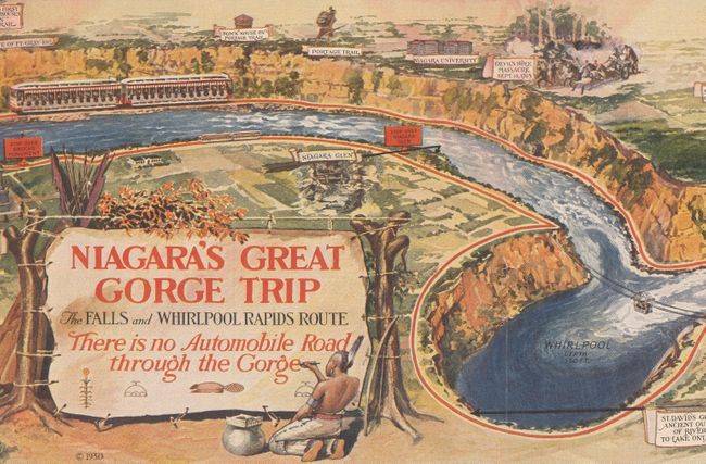
Auction 174, Lot 117
Subject: Niagara Falls, New York, Canada
Niagara's Great Gorge Trip - The Falls and Whirlpool Rapids Route, 1930
Size: 31.3 x 7.6 inches (79.5 x 19.3 cm)
Estimate: $60 - $80
NO RESERVE
Sold for: $85
Closed on 9/11/2019
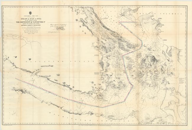
Auction 174, Lot 118
Subject: Washington, British Columbia
U.S. Hydrographic Office
Strait of Juan de Fuca and the Channels Between the Continent & Vancouver Id. Showing the Boundary Line Between British & American Possessions, 1872
Size: 44.2 x 28.8 inches (112.3 x 73.2 cm)
Estimate: $375 - $450
Sold for: $650
Closed on 9/11/2019
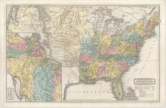
Auction 174, Lot 119
Subject: United States
Woodbridge, William Channing
Geographical & Statistical Map of the United States. Adapted to Woodbridge's Geography, 1831
Size: 16.8 x 10.6 inches (42.7 x 26.9 cm)
Estimate: $240 - $300
Sold for: $240
Closed on 9/11/2019
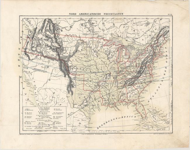
Auction 174, Lot 120
Subject: United States
Winckelmann, Edward
Nord Americanische Freistaaten, 1836
Size: 13 x 9.8 inches (33 x 24.9 cm)
Estimate: $220 - $250
Sold for: $130
Closed on 9/11/2019
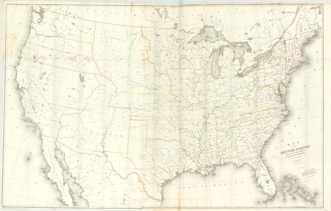
Auction 174, Lot 121
Subject: United States
Burr, David H.
Map of the United States Exhibiting the Several Collection Districts, 1854
Size: 49.3 x 31.3 inches (125.2 x 79.5 cm)
Estimate: $220 - $250
Sold for: $110
Closed on 9/11/2019
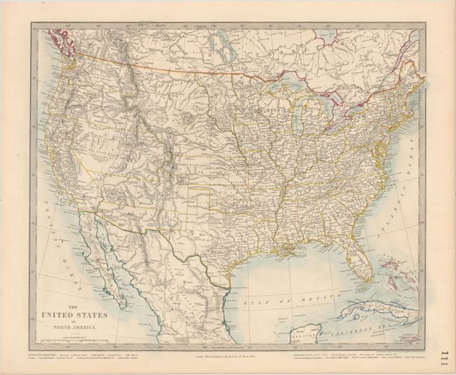
Auction 174, Lot 122
Subject: United States
[Lot of 3] The United States of North America [and] United States [and] Stati Uniti dell' America Settentrionale, 1858-60
Size: See Description
Estimate: $220 - $250
Sold for: $120
Closed on 9/11/2019
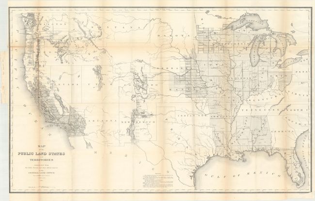
Auction 174, Lot 123
Subject: United States
General Land Office
Map of the Public Land States and Territories Constructed from the Public Surveys and Other Official Sources in the General Land Office, 1864
Size: 44.9 x 27.8 inches (114 x 70.6 cm)
Estimate: $140 - $170
Sold for: $100
Closed on 9/11/2019
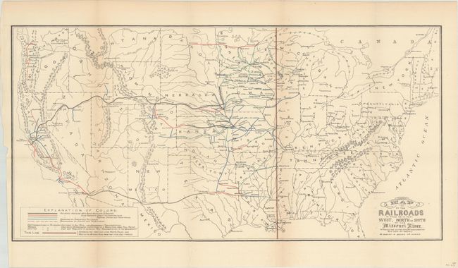
Auction 174, Lot 124
Subject: United States
Donaldson, Thomas
Map of the Railroads in Whole or in Part West, North or South of the Missouri River..., 1883
Size: 24 x 12 inches (61 x 30.5 cm)
Estimate: $70 - $90
NO RESERVE
Sold for: $49
Closed on 9/11/2019
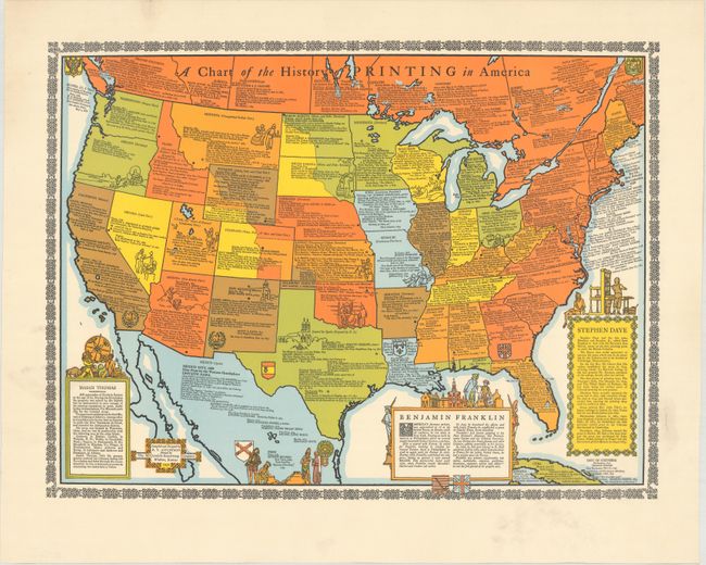
Auction 174, Lot 125
Subject: United States
A Chart of the History of Printing in America, 1932
Size: 19.9 x 14.9 inches (50.5 x 37.8 cm)
Estimate: $140 - $170
Sold for: $400
Closed on 9/11/2019
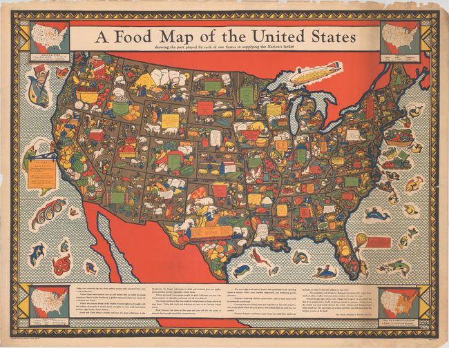
Auction 174, Lot 126
Subject: United States
A Food Map of the United States Showing the Part Played by Each of Our States in Supplying the Nation's Larder, 1932
Size: 43.1 x 33 inches (109.5 x 83.8 cm)
Estimate: $200 - $250
Sold for: $250
Closed on 9/11/2019
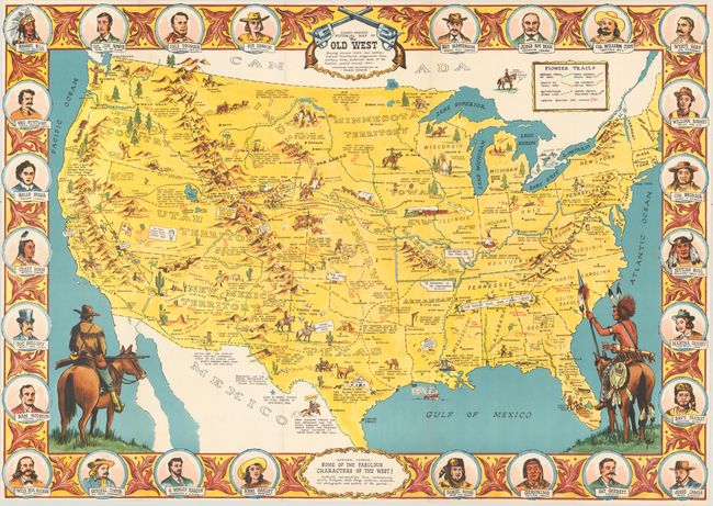
Auction 174, Lot 127
Subject: United States
Danny Arnold's Pictorial Map of the Old West Showing Pioneer Trails and Battles, Indian's Territories, Stagecoach Lines, Military Forts, Historical Data of the Frontier Period Around 1840, 1950
Size: 33.9 x 23.8 inches (86.1 x 60.5 cm)
Estimate: $240 - $300
Sold for: $350
Closed on 9/11/2019
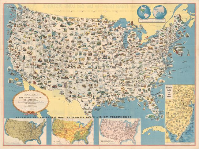
Auction 174, Lot 128
Subject: United States
A Pictorial Map of the United States of America Showing Principal Regional Resources, Products, and Natural Features, 1953
Size: 31.2 x 23.3 inches (79.2 x 59.2 cm)
Estimate: $180 - $220
Sold for: $120
Closed on 9/11/2019
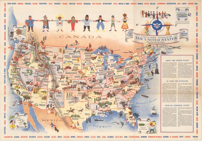
Auction 174, Lot 129
Subject: United States
The United States - The Land and the People , 1958
Size: 26 x 18.1 inches (66 x 46 cm)
Estimate: $100 - $130
Sold for: $375
Closed on 9/11/2019
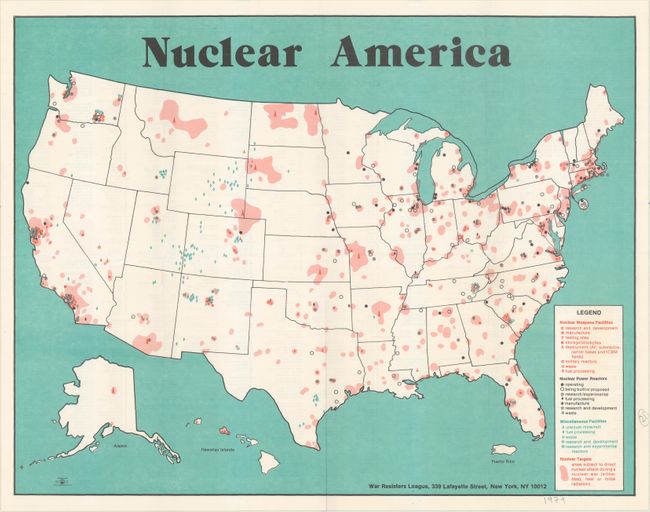
Auction 174, Lot 130
Subject: United States
Nuclear America, 1979
Size: 21.1 x 16.3 inches (53.6 x 41.4 cm)
Estimate: $150 - $180
Sold for: $160
Closed on 9/11/2019
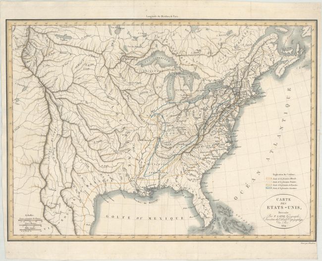
Auction 174, Lot 131
Subject: Eastern United States
Bonne, Rigobert
Etats Unis de l'Amerique, 1788
Size: 17.1 x 11.6 inches (43.4 x 29.5 cm)
Estimate: $250 - $325
Sold for: $180
Closed on 9/11/2019
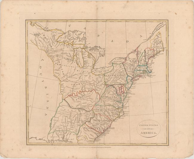
Auction 174, Lot 132
Subject: Eastern United States
United States of America, 1808
Size: 15.3 x 13.6 inches (38.9 x 34.5 cm)
Estimate: $275 - $350
Sold for: $150
Closed on 9/11/2019
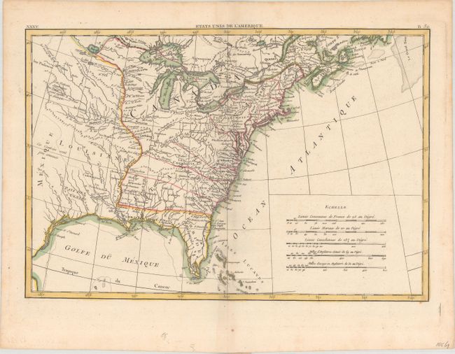
Auction 174, Lot 133
Subject: Eastern United States
Lapie, Alexander Emile & Pierre
Carte des Etats-Unis, 1814
Size: 17.8 x 12.8 inches (45.2 x 32.5 cm)
Estimate: $475 - $600
Sold for: $350
Closed on 9/11/2019
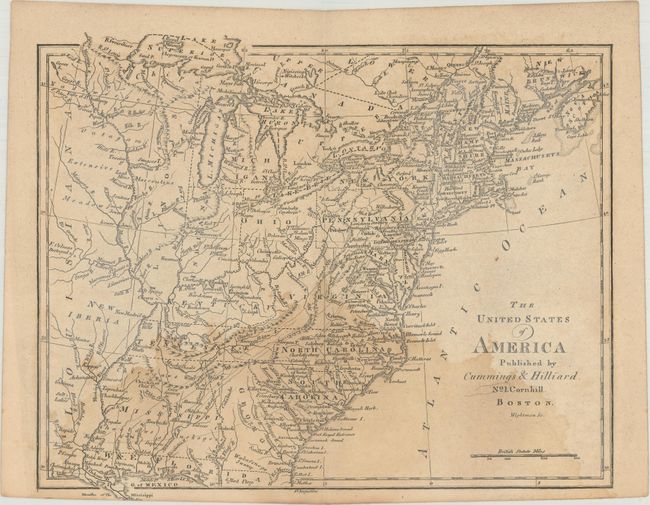
Auction 174, Lot 134
Subject: Eastern United States
Cummings & Hilliard
The United States of America, 1816
Size: 10.9 x 8.8 inches (27.7 x 22.4 cm)
Estimate: $250 - $325
Sold for: $120
Closed on 9/11/2019
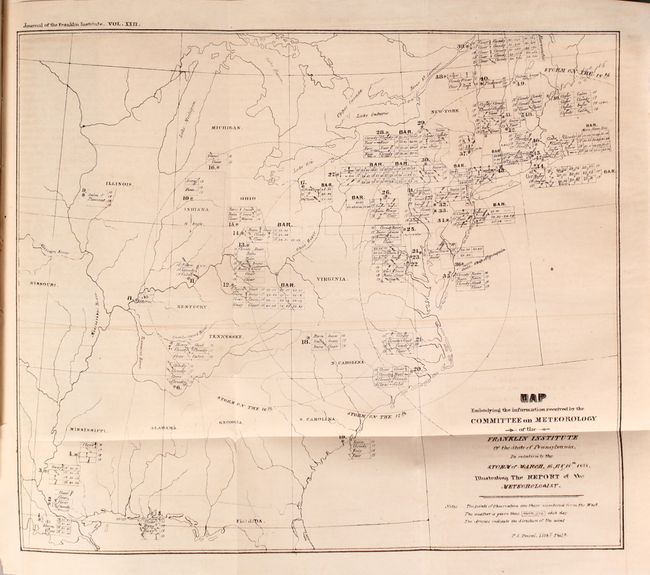
Auction 174, Lot 135
Subject: Eastern United States, Weather
Map Embodying the Information Received by the Committee on Meteorology of the Franklin Institute... [bound in] Journal of the Franklin Institute of the State of Pennsylvania ... Vol. XXII, 1838
Size: 10.8 x 9.1 inches (27.4 x 23.1 cm)
Estimate: $250 - $325
The First Weather Map Printed in the United States
Sold for: $150
Closed on 9/11/2019
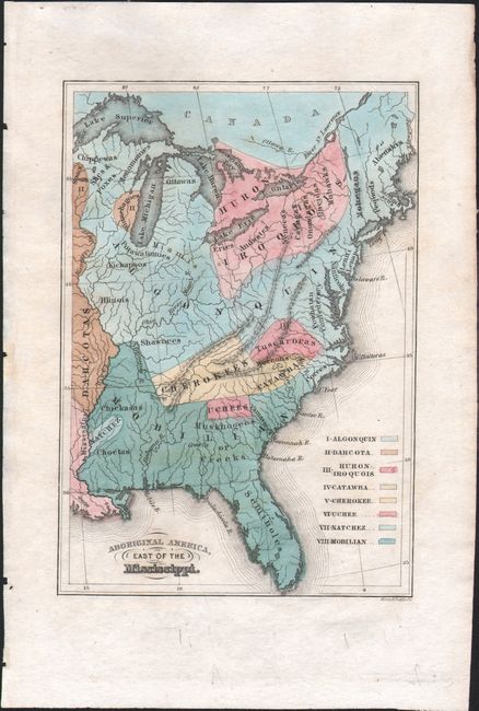
Auction 174, Lot 136
Subject: Eastern United States
Aboriginal America, East of the Mississippi, 1844
Size: 4.3 x 6.2 inches (10.9 x 15.7 cm)
Estimate: $100 - $130
Sold for: $70
Closed on 9/11/2019
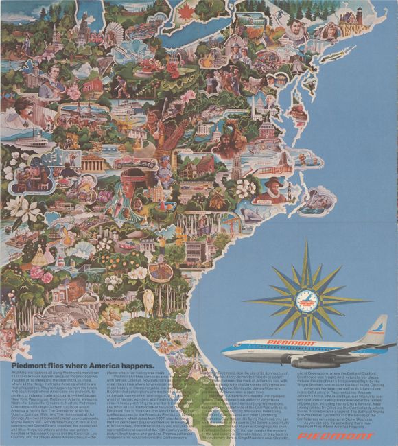
Auction 174, Lot 137
Subject: Eastern United States
[Lot of 3] Piedmont Airlines - Route Map [and] The Capital Way to Go Places... [and] North Central Airlines - Route of the Northliners, 1950-60
Size: See Description
Estimate: $120 - $150
Sold for: $100
Closed on 9/11/2019
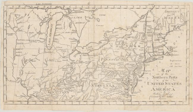
Auction 174, Lot 138
Subject: Northeastern United States
Bradley, Abraham Jr.
Map of the Northern Parts of the United States of America, 1804
Size: 15.6 x 8.5 inches (39.6 x 21.6 cm)
Estimate: $250 - $325
Sold for: $180
Closed on 9/11/2019
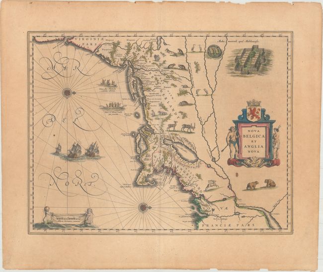
Auction 174, Lot 139
Subject: Colonial New England & Mid-Atlantic United States
Blaeu, Willem
Nova Belgica et Anglia Nova, 1643
Size: 19.8 x 15.1 inches (50.3 x 38.4 cm)
Estimate: $1,900 - $2,200
Important Map of Colonial New England and the Mid-Atlantic
Sold for: $1,150
Closed on 9/11/2019
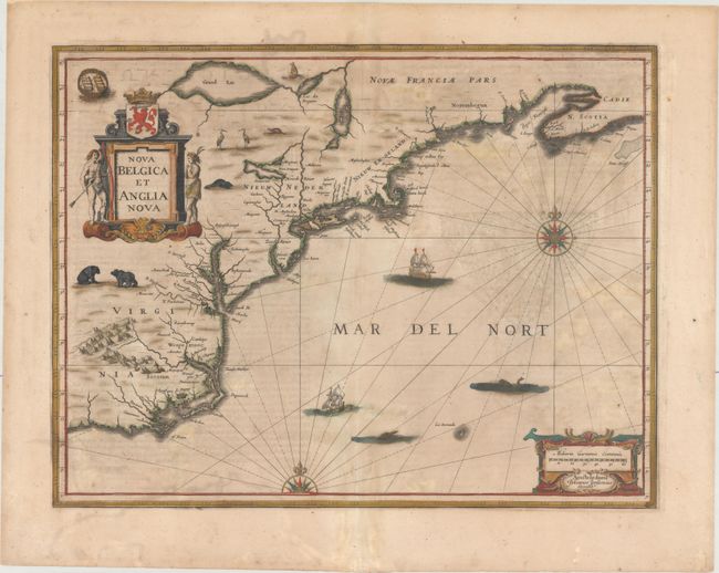
Auction 174, Lot 140
Subject: Colonial New England & Mid-Atlantic United States
Jansson, Jan
Nova Belgica et Anglia Nova, 1647
Size: 19.8 x 15.2 inches (50.3 x 38.6 cm)
Estimate: $1,500 - $1,800
Jansson's Influential Map of the East Coast
Sold for: $1,000
Closed on 9/11/2019
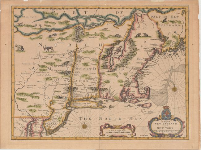
Auction 174, Lot 141
Subject: Colonial New England & Mid-Atlantic United States
Speed/Lamb
A Map of New England and New York, 1676
Size: 19.8 x 14.9 inches (50.3 x 37.8 cm)
Estimate: $4,000 - $5,000
"Speed" Map of New England
Sold for: $2,500
Closed on 9/11/2019
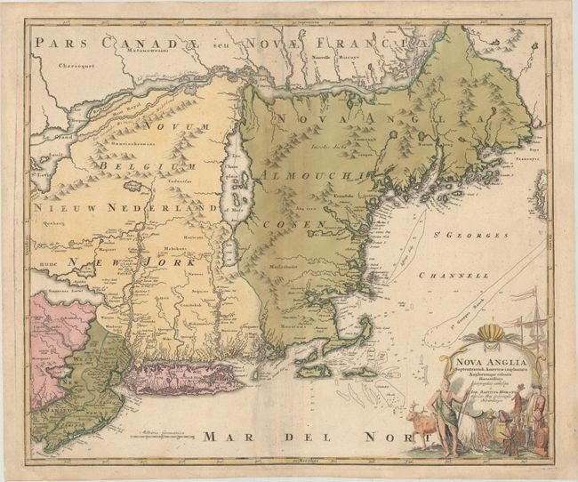
Auction 174, Lot 142
Subject: Colonial New England & Mid-Atlantic United States
Homann, Johann Baptist
Nova Anglia Septentrionali Americae Implantata Anglorumque Coloniis Florentissima, 1730
Size: 22.8 x 19.1 inches (57.9 x 48.5 cm)
Estimate: $900 - $1,100
Sold for: $650
Closed on 9/11/2019
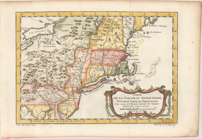
Auction 174, Lot 143
Subject: Colonial New England & Mid-Atlantic United States
Bellin, Jacques Nicolas
Carte de la Nouvelle Angleterre, Nouvelle Yorck, et Pensilvanie. Pour Servir a l'Histoire Generale des Voyages, 1757
Size: 11.8 x 8.1 inches (30 x 20.6 cm)
Estimate: $230 - $275
Sold for: $170
Closed on 9/11/2019
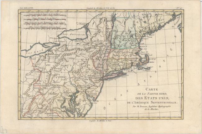
Auction 174, Lot 144
Subject: Colonial New England & Mid-Atlantic United States
Bonne, Rigobert
Carte de la Partie Nord, des Etats Unis, de l'Amerique Septentrionale, 1782
Size: 12.6 x 8.4 inches (32 x 21.3 cm)
Estimate: $120 - $150
Sold for: $90
Closed on 9/11/2019
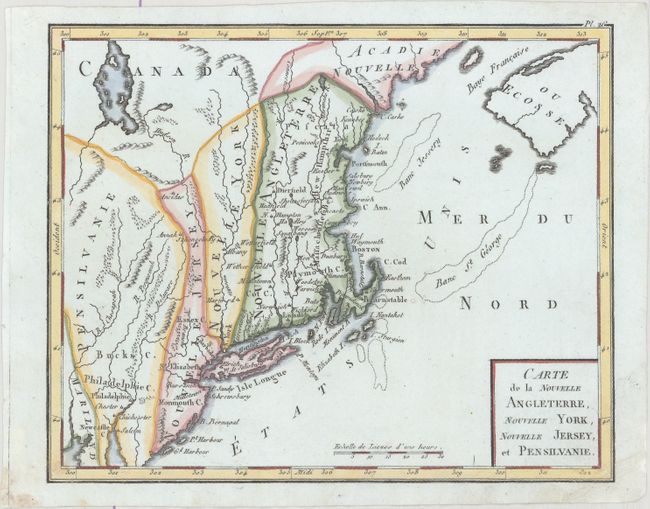
Auction 174, Lot 145
Subject: New England - United States
Bertholon, C.
Carte de la Nouvelle Angleterre, Nouvelle York, Nouvelle Jersey, et Pensilvanie, 1799
Size: 8.7 x 7 inches (22.1 x 17.8 cm)
Estimate: $150 - $180
Sold for: $170
Closed on 9/11/2019

Auction 174, Lot 146
Subject: New England - United States
Phillips, Richard (Sir)
Map of the Northern Provinces of the United States, 1804
Size: 20.1 x 12.8 inches (51.1 x 32.5 cm)
Estimate: $250 - $325
Sold for: $150
Closed on 9/11/2019
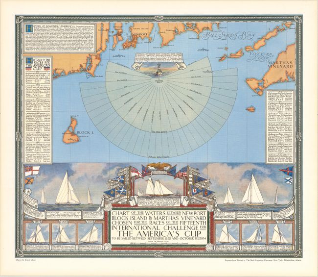
Auction 174, Lot 147
Subject: New England - United States
Chart of the Waters Between Newport Block Island & Marthas Vineyard Chosen for the Races of the Fifteenth International Challenge for the America's Cup..., 1934
Size: 20 x 16.9 inches (50.8 x 42.9 cm)
Estimate: $550 - $700
Map Promoting the 1934 America's Cup Race
Sold for: $1,200
Closed on 9/11/2019
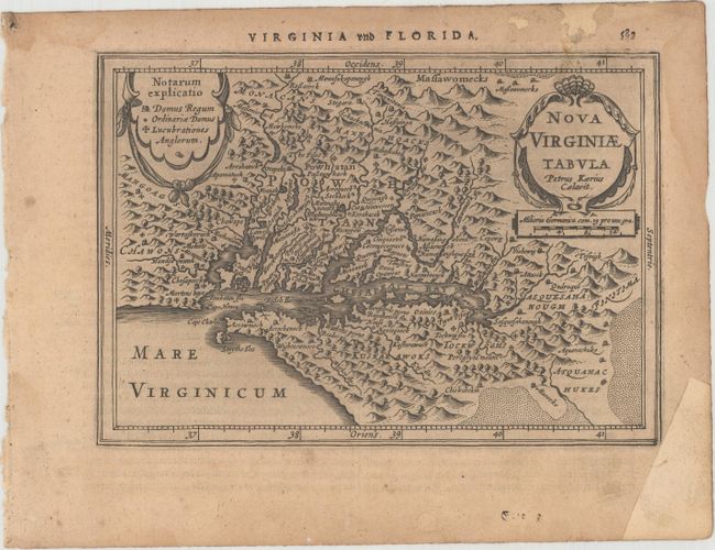
Auction 174, Lot 148
Subject: Colonial Mid-Atlantic United States
Mercator/Cloppenburgh
Nova Virginiae Tabula, 1630
Size: 10 x 7.3 inches (25.4 x 18.5 cm)
Estimate: $750 - $900
First Edition
Unsold
Closed on 9/11/2019
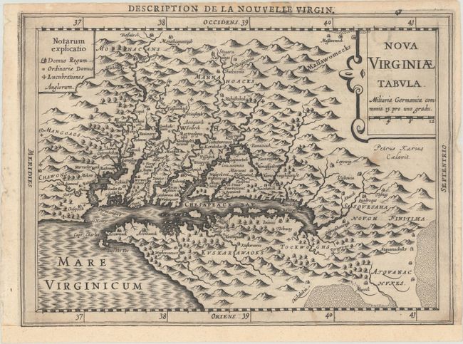
Auction 174, Lot 149
Subject: Colonial Mid-Atlantic United States
Jansson, Jan
Nova Virginiae Tabula, 1631
Size: 7.5 x 5.2 inches (19.1 x 13.2 cm)
Estimate: $550 - $700
Unsold
Closed on 9/11/2019
Auction 174, Lot 150
Subject: Colonial Mid-Atlantic United States
Mallet, Alain Manesson
Virginie, 1685
Size: 4 x 5.8 inches (10.2 x 14.7 cm)
Estimate: $275 - $350
Sold for: $140
Closed on 9/11/2019
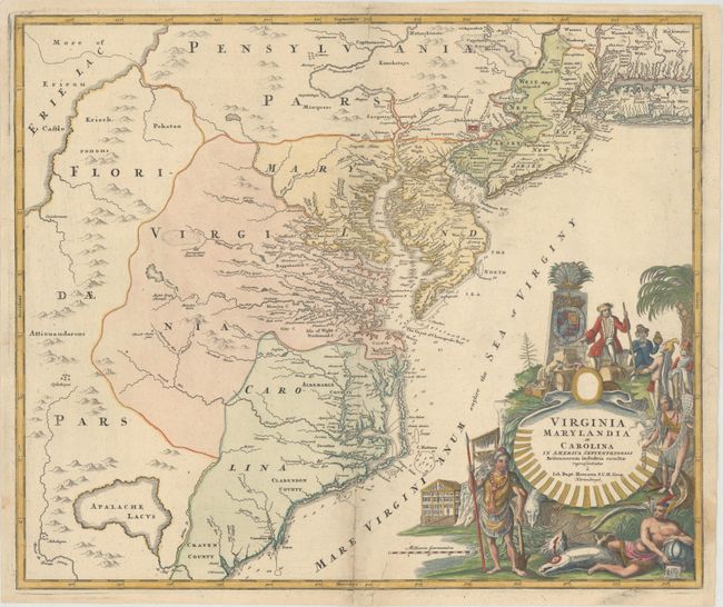
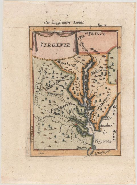
Auction 174, Lot 151
Subject: Colonial Mid-Atlantic United States
Homann, Johann Baptist
Virginia Marylandia et Carolina in America Septentrionali Britannorum Industria Excultae Repraesentatae, 1730
Size: 22.8 x 19.1 inches (57.9 x 48.5 cm)
Estimate: $1,600 - $2,000
Map Created to Promote German Immigration to the New World
Sold for: $1,200
Closed on 9/11/2019
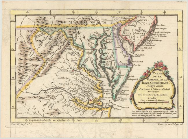
Auction 174, Lot 152
Subject: Colonial Mid-Atlantic United States
Bellin, Jacques Nicolas
Carte de la Virginie, de la Baye Chesapeack, et Pays Voisins pour Servir a l'Histoire Generale des Voyages, 1758
Size: 11.3 x 7.4 inches (28.7 x 18.8 cm)
Estimate: $230 - $275
Sold for: $150
Closed on 9/11/2019
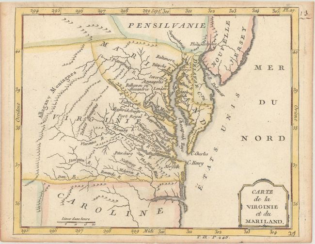
Auction 174, Lot 153
Subject: Colonial Mid-Atlantic United States
Brion de la Tour, Louis
Carte de la Virginie, du Maryland et de l'Etat de Delaware, 1782
Size: 12.8 x 9 inches (32.5 x 22.9 cm)
Estimate: $250 - $325
Sold for: $210
Closed on 9/11/2019
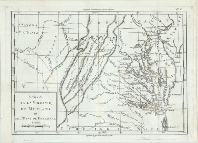
Auction 174, Lot 154
Subject: Mid-Atlantic United States
Laporte, Joseph de
Carte de la Virginie et du Mariland, 1783
Size: 8.7 x 7 inches (22.1 x 17.8 cm)
Estimate: $190 - $220
Sold for: $120
Closed on 9/11/2019
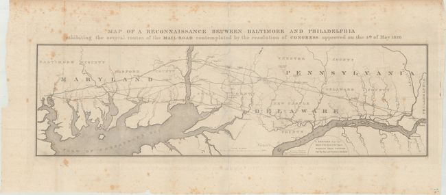
Auction 174, Lot 155
Subject: Mid-Atlantic United States
U.S. Government
Map of a Reconnaissance Between Baltimore and Philadelphia Exhibiting the Several Routes of the Mail-Road Contemplated by the Resolution of Congress Approved on the 4th of May 1826, 1828
Size: 31.1 x 8.9 inches (79 x 22.6 cm)
Estimate: $180 - $220
NO RESERVE
Unsold
Closed on 9/11/2019
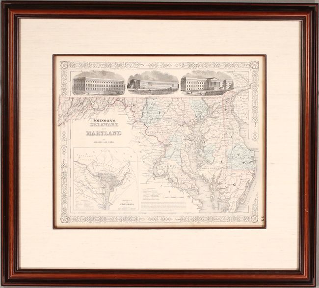
Auction 174, Lot 156
Subject: Maryland & Delaware
Johnson & Ward
Johnson's Delaware and Maryland, 1863
Size: 16.4 x 12.8 inches (41.7 x 32.5 cm)
Estimate: $140 - $170
Sold for: $100
Closed on 9/11/2019
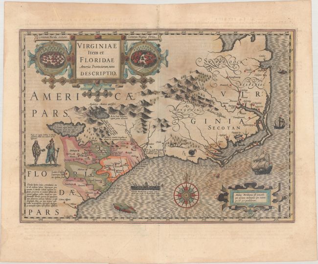
Auction 174, Lot 157
Subject: Colonial Southeastern United States
Hondius, Jodocus
Virginiae Item et Floridae Americae Provinciarum, Nova Descriptio, 1613
Size: 19 x 13.4 inches (48.3 x 34 cm)
Estimate: $1,800 - $2,100
A Seminal Map of the Southeast and Early American Cartography
Sold for: $1,000
Closed on 9/11/2019
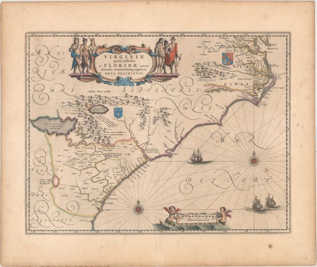
Auction 174, Lot 158
Subject: Colonial Southeastern United States
Blaeu, Willem
Virginiae Partis Australis, et Floridae Partis Orientalis, Interjacentiumq Regionum Nova Descriptio, 1643
Size: 19.8 x 15.1 inches (50.3 x 38.4 cm)
Estimate: $1,100 - $1,400
Blaeu's Decorative Map of the Southeast
Sold for: $800
Closed on 9/11/2019
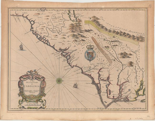
Auction 174, Lot 159
Subject: Colonial Southeastern United States
Speed/Lamb
A New Description of Carolina, 1676
Size: 20.1 x 14.8 inches (51.1 x 37.6 cm)
Estimate: $3,000 - $3,750
Speed's Map of the Carolinas Based Upon the Lords Proprietor's Map
Sold for: $2,000
Closed on 9/11/2019
160 lots
Page 1 of 4