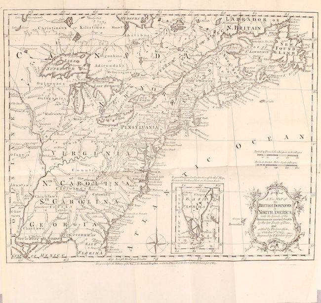
Subject: Colonial Eastern United States & Canada
Period: 1765 (published)
Publication:
Color: Black & White
Size:
11.9 x 9.6 inches
30.2 x 24.4 cm
This very historical map illustrates the British colonies after the Treaty of Paris and at the conclusion of the French and Indian War in America. The treaty ended French colonial ambitions in North America with minor exceptions. As a result, Spain ceded East and West Florida to Great Britain, France relinquished the title to the Louisiana Territory to Spain, and the Mississippi River was established as the British-Spanish Boundary. The map reflects the claims of the southern colonies that their charters extended to the Mississippi River. Also of interest are the names and locations of many Indian tribes and nations located away from the more populated areas of English settlements. An inset of East Florida on the same scale lies between the coastline and the decorative rococo-style title cartouche. A simple compass rose rests in the Atlantic.
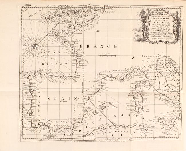
The map is still bound into the second edition of The Annual Register, or a View of the History, Politicks, and Literature, for the Year 1763, published in 1765. The 307 pages of text includes a review of the major events of the year, state papers, "characters," natural history, antiquities, and more. The volume also includes three additional maps:
A New and Correct Chart of the Seat of War, on the Coasts of France, Spain, Portugal and Italy... (11.6 x 9.6")
A New Map of the Seat of War on the Coast of Malabar & Coromandel, in the Empire of the Great Mogol. (8.9 x 9.5")
An Accurate Map of the Seat of War in the Kingdom of Prussia. (9.0 x 7.9")
Printed for J. Dodsley in London. Jolly notes that this is the only volume of the Annual Register to contain maps, and it went through a number of editions (at least 8). Octavo, hardbound in full contemporary leather with gilt decorations and raised bands on spine.
References: McCorkle #763.5; Sellers & Van Ee #103; Jolly #ANNREG 1-4.
Condition: A
The maps and text are near fine with just a hint of pleasant light toning. There is light external wear with bumped edges and the hinges are starting. Spine title label is missing.