Catalog Archive
Auction 174, Lot 113

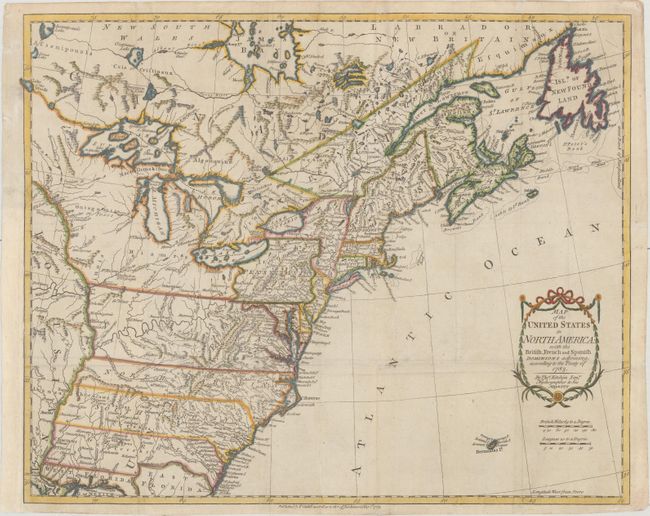
One of the Earliest English-Produced Maps to Acknowledge the United States

"Map of the United States in North America: with the British, French and Spanish Dominions Adjoining, According to the Treaty of 1783", Kitchin, Thomas

Subject: Eastern United States & Canada

Period: 1783 (dated)

Publication:

Color: Hand Color

Size:
19.9 x 16.1 inches
50.5 x 40.9 cm
Download High Resolution Image
(or just click on image to launch the Zoom viewer)

This is one of the earliest English-produced maps to officially acknowledge the United States. It depicts the new nation with its western border on the Mississippi River. The states of Georgia, South Carolina, North Carolina, and Virginia stretch from the Atlantic to the Mississippi. The map is filled with information on early settlements, forts, Indian villages, and fishing banks. The title is enclosed in a simple garland cartouche, with the island of Bermuda below. Kitchin, Hydrographer to the King, prepared the map for a special publication by Thomas Cadell. It was subsequently issued in Raynal's history (1783-98) and possibly other publications.

References: McCorkle #783-11; Phillips (M) p. 862.

Condition: B+

Issued folding, now flat, and backed with thin tissue. There are minor creases and some very light soiling. A binding trim in the left margin has been replaced with old paper.

Estimate: $1,400 - $1,700

Sold for: $1,400

Closed on 9/11/2019

Archived