Subject: United States
Period: 1932 (dated)
Publication:
Color: Printed Color
Size:
43.1 x 33 inches
109.5 x 83.8 cm
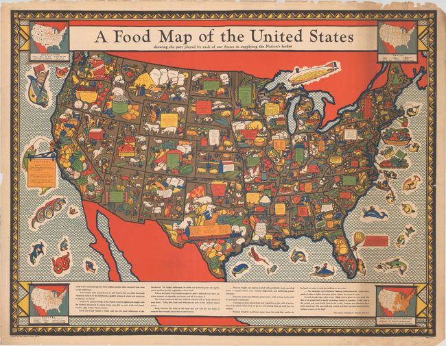
This remarkable large map was drawn by Louis Fancher and published by The Great Atlantic & Pacific Tea Company, better known as A&P (grocery store chain). The map is absolutely filled with illustrations demonstrating each state's key agricultural products and accompanied by a table listing. Inset maps in the corners show grain, meat & fish, and poultry production in the country as well as a map showing the territory of the A&P stores. Text below the map touts the food supply in the U.S. where "we can reach out a hand and draw our daily food from the farthest corners of the land."
This 1932 edition was followed by a 1933 edition that was commissioned for the World's Fair where it was sold (see Rumsey reference).
References: Rumsey #9754.
Condition: B+
A colorful example with a number of small edge tears and edge chips mostly in the margins. Longer tears that enter 6" into the image at right and 14" into the image at left have been closed on verso with archival tape.