Catalog Archive
Auction 174, Lot 124

NO RESERVE

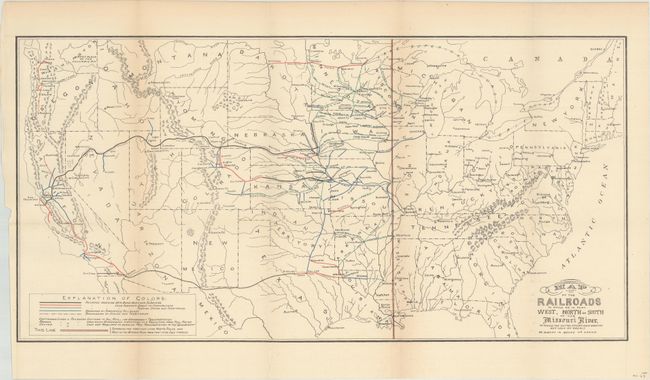
"Map of the Railroads in Whole or in Part West, North or South of the Missouri River...", Donaldson, Thomas

Subject: United States

Period: 1883 (circa)

Publication: Public Domain

Color: Printed Color

Size:
24 x 12 inches
61 x 30.5 cm
Download High Resolution Image
(or just click on image to launch the Zoom viewer)

This map was issued in Thomas Donaldson's Public Domain and shows the railroad lines west of the Missouri River that had received some form of assistance from the United States government. Assistance took the form of bond issuance and land subsidies, with the bulk being land grants.

Public Domain Land, the largest land give-away ever, was granted by Congress to 19th century railroad barons to pay for construction of the railroad lines. Most of these grants were west of the Mississippi River and ultimately totaled more than 174 million acres. This contentious practice was a major issue during the 1884 presidential election between Grover Cleveland (Democrat) and former Speaker of the House, James G. Blaine (Republican). Blaine was considered to be in the pocket of the railroad companies and Cleveland's campaign used maps to further turn public opinion. For a more inflammatory example of this practice, see this 1884 campaign poster by Democrats.

References:

Condition: B+

Issued folding with faint toning along the fold lines and a tiny edge tear at left that just touches the map border that has been closed on verso with archival tape.

Estimate: $70 - $90

Sold for: $49

Closed on 9/11/2019

Archived