Filtered by Category:United States(Show All Categories)
Showing results for:Auction 161
Catalog Archive
274 lots
Page 1 of 6
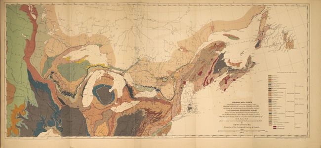
Auction 161, Lot 125
Subject: Canada & United States
Lovell, John
Geological Survey of Canada. Report of Progress from Its Commencement to 1863. Atlas of Maps and Sections, with an Introduction and Appendix, 1865
Size: 6.6 x 10 inches (16.8 x 25.4 cm)
Estimate: $140 - $170
Sold for: $210
Closed on 2/8/2017
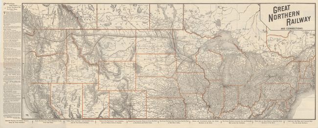
Auction 161, Lot 126
Subject: Northern United States & Canada
Railroad Companies, (Various)
Great Northern Railway and Connections, 1895
Size: 36.9 x 14.7 inches (93.7 x 37.3 cm)
Estimate: $150 - $180
Sold for: $250
Closed on 2/8/2017
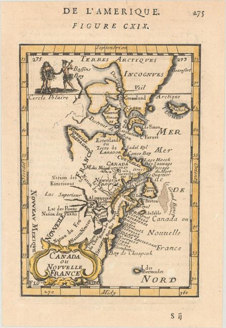
Auction 161, Lot 127
Subject: Colonial Eastern United States & Canada
Mallet, Alain Manesson
Canada ou Nouvelle France, 1683
Size: 4 x 5.6 inches (10.2 x 14.2 cm)
Estimate: $180 - $210
Sold for: $200
Closed on 2/8/2017
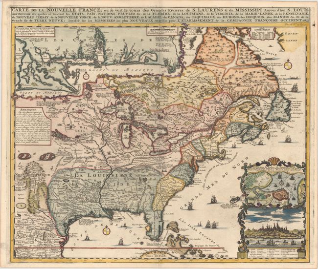
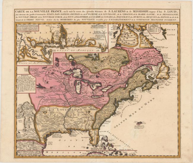
Auction 161, Lot 128
Subject: Colonial Eastern United States & Canada
Chatelain, Henry Abraham
Carte de la Nouvelle France, ou se voit le Cours des Grandes Rivieres de S. Laurens & de Mississipi Aujour d'hui S. Louis, aux Environs des-quelles se Trouvent les Etats, Pais, Nations, Peuples &c..., 1719
Size: 19.3 x 16.6 inches (49 x 42.2 cm)
Estimate: $3,000 - $3,750
One of the Most Informative 18th Century Maps of the French Possessions in North America
Sold for: $2,200
Closed on 2/8/2017
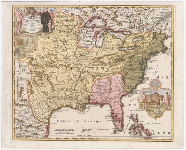
Auction 161, Lot 129
Subject: Colonial Eastern United States & Canada
Homann, Johann Baptist
Amplissimae Regionis Mississipi seu Provinciae Ludovicianae a R.P. Ludovico Hennepin Francisc Miss in America Septentrionali Anno 1687..., 1720
Size: 22.6 x 19.1 inches (57.4 x 48.5 cm)
Estimate: $2,200 - $2,500
Striking Map of Colonial America with Buffalo Vignette
Sold for: $2,300
Closed on 2/8/2017
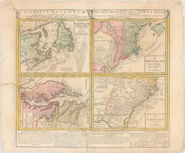
Auction 161, Lot 130
Subject: Colonial Eastern United States & Canada
Homann Heirs
Dominia Anglorum in America Septentrionali... / Die Gros-Britannische Colonie-Laender in Nord-America..., 1740
Size: 22 x 19.9 inches (55.9 x 50.5 cm)
Estimate: $400 - $500
Sold for: $300
Closed on 2/8/2017
Auction 161, Lot 131
Subject: Colonial Eastern United States & Canada
Ottens/De Fer
Carte de la Nouvelle France, ou se voit le Cours des Grandes Rivieres de S. Laurens & de Mississipi Aujour d'hui S. Louis, aux Environs des-quelles se Trouvent les Etats, Pais, Nations, Peuples &c..., 1745
Size: 21.8 x 19.7 inches (55.4 x 50 cm)
Estimate: $2,300 - $2,750
Reduced Version of De Fer's Influential Map of French Possessions in North America
Sold for: $1,200
Closed on 2/8/2017
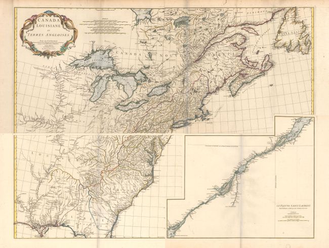
Auction 161, Lot 132
Subject: Colonial Eastern United States & Canada
Anville, Jean Baptiste Bourguignon d'
[On 4 Sheets] Canada Louisiane et Terres Angloises, 1755
Size: 44.5 x 18.8 inches (113 x 47.8 cm)
Estimate: $1,600 - $2,000
D'Anville's Spectacular Map of Eastern Seaboard
Sold for: $800
Closed on 2/8/2017
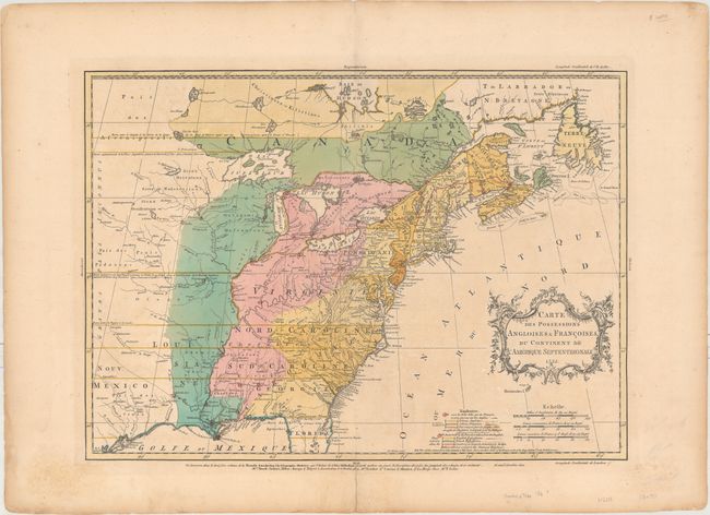
Auction 161, Lot 133
Subject: Colonial Eastern United States & Canada
Palairet, Jean
Carte des Possessions Angloises & Francoises du Continent de l'Amerique Septentrionale, 1755
Size: 22.7 x 16.4 inches (57.7 x 41.7 cm)
Estimate: $2,400 - $3,000
Important Map of French and English Territorial Claims at the Outset of the French and Indian War
Unsold
Closed on 2/8/2017
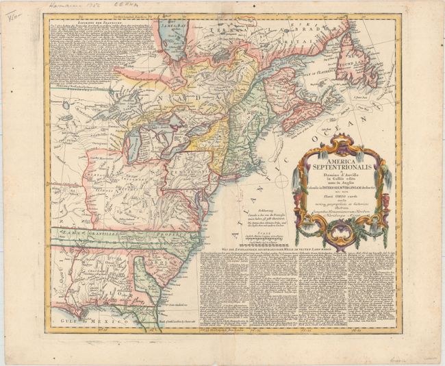
Auction 161, Lot 134
Subject: Colonial Eastern United States & Canada
Homann Heirs
America Septentrionalis a Domino d'Anville in Galliis Edita nunc in Anglia Coloniis in Interiorem Virginiam Deductis nec non Fluvii Ohio Cursu..., 1756
Size: 20.1 x 18 inches (51.1 x 45.7 cm)
Estimate: $600 - $750
Sold for: $375
Closed on 2/8/2017
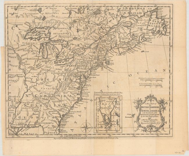
Auction 161, Lot 135
Subject: Colonial Eastern United States & Canada
Kitchin, Thomas
A New Map of the British Dominions in North America; with the Limits of the Governments Annexed Thereto by the Late Treaty of Peace, and Settled by Proclamation, October 7th, 1763, 1763
Size: 11.8 x 9.5 inches (30 x 24.1 cm)
Estimate: $350 - $425
Sold for: $200
Closed on 2/8/2017
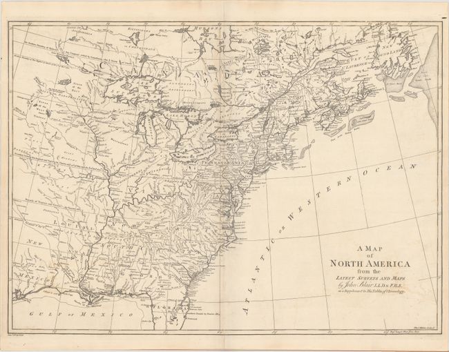
Auction 161, Lot 136
Subject: Colonial Eastern United States & Canada
Blair, Rev. John
A Map of North America from the Latest Surveys and Maps, 1768
Size: 22.4 x 16.3 inches (56.9 x 41.4 cm)
Estimate: $700 - $850
Sold for: $400
Closed on 2/8/2017
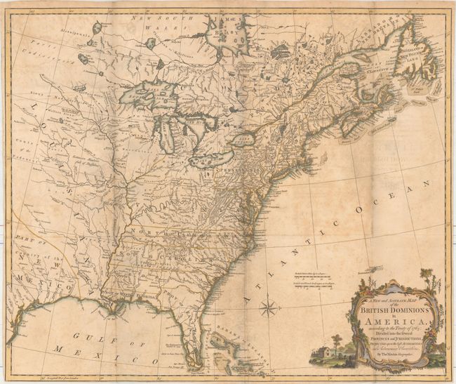
Auction 161, Lot 137
Subject: Colonial Eastern United States & Canada
Kitchin, Thomas
A New and Accurate Map of the British Dominions in America, According to the Treaty of 1763; Divided into the Several Provinces and Jurisdictions..., 1769
Size: 24.6 x 20.6 inches (62.5 x 52.3 cm)
Estimate: $1,400 - $1,700
Rare Map of the British Colonies Just After the French & Indian War
Sold for: $800
Closed on 2/8/2017
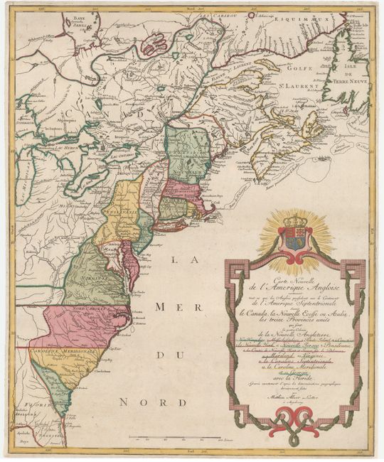
Auction 161, Lot 138
Subject: Colonial Eastern United States & Canada
Lotter, Mathias Albrecht
Carte Nouvelle de l'Amerique Angloise Contenant tout ce que les Anglois Possedent sur le Continent de l'Amerique Septentrionale Savoir le Canada..., 1776
Size: 19.4 x 23.7 inches (49.3 x 60.2 cm)
Estimate: $1,200 - $1,500
Unsold
Closed on 2/8/2017
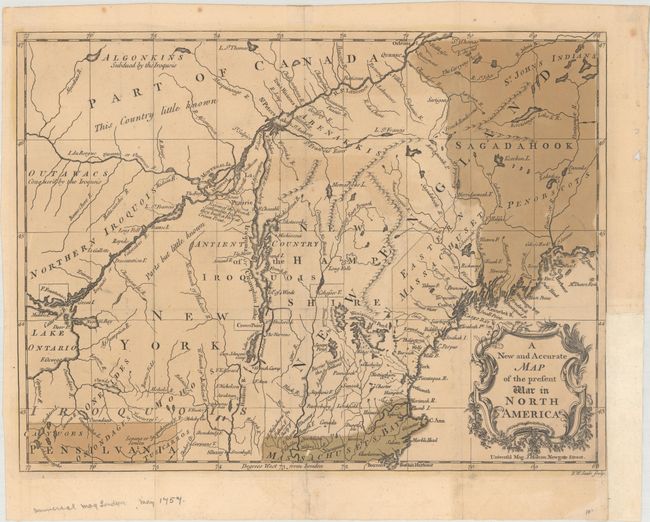
Auction 161, Lot 139
Subject: Eastern United States & Canada
Stockdale, John
A Map of the Northern and Middle States; Comprehending the Western Territory and the British Dominions in North America. From the Best Authorities, 1792
Size: 15.7 x 12.5 inches (39.9 x 31.8 cm)
Estimate: $600 - $750
Unsold
Closed on 2/8/2017
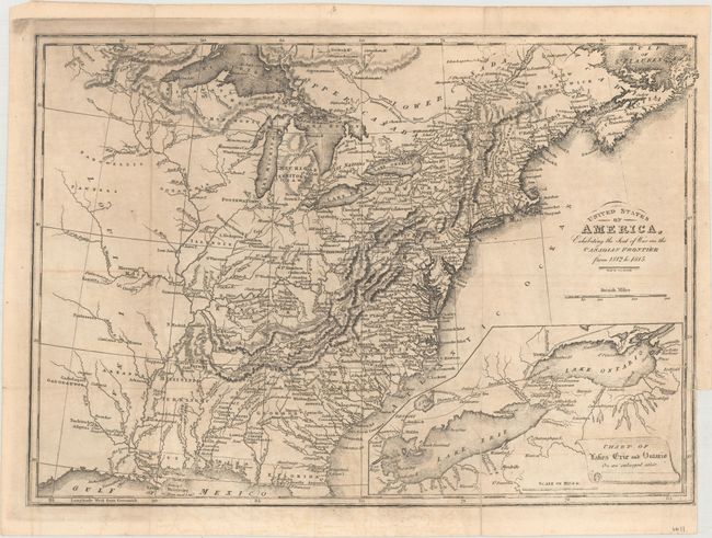
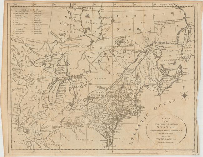
Auction 161, Lot 140
Subject: Eastern United States & Canada
Baines, Edward
United States of America, Exhibiting the Seat of War on the Canadian Frontier from 1812 to 1815, 1816
Size: 13.6 x 9.7 inches (34.5 x 24.6 cm)
Estimate: $300 - $375
Sold for: $150
Closed on 2/8/2017
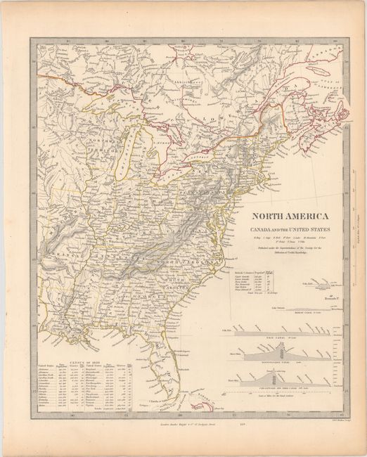
Auction 161, Lot 141
Subject: Eastern United States & Canada
SDUK Society for the Diffusion of Useful Knowledge
[Lot of 15 - United States & Canada], 1835
Size: See Description
Estimate: $1,000 - $1,300
Matching Set of SDUK Maps
Sold for: $700
Closed on 2/8/2017
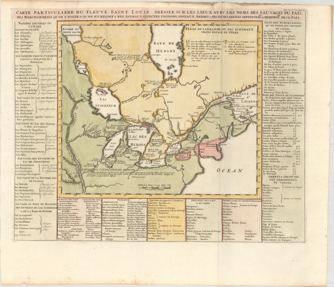
Auction 161, Lot 142
Subject: Colonial Northeastern United States & Canada, Great Lakes
Chatelain, Henry Abraham
Carte Particuliere du Fleuve Saint Louis Dressee sur les Lieux avec les Noms des Sauvages du Pais..., 1719
Size: 17.9 x 14.4 inches (45.5 x 36.6 cm)
Estimate: $650 - $800
Sold for: $375
Closed on 2/8/2017
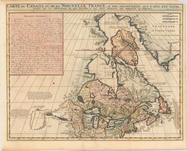
Auction 161, Lot 143
Subject: Colonial Northeastern United States & Canada
Chatelain, Henry Abraham
Carte du Canada ou de la Nouvelle France, & des Decouvertes qui y ont ete Faites, Dressee sur les Observations les Plus Nouvelles, & sur Divers Memoires tant Manuscrits qu' Imprimez, 1719
Size: 20.5 x 16.1 inches (52.1 x 40.9 cm)
Estimate: $600 - $750
Unsold
Closed on 2/8/2017
Auction 161, Lot 144
Subject: Colonial Northeastern United States & Canada
Hinton, John
A New and Accurate Map of the Present War in North America, 1757
Size: 14.3 x 10.8 inches (36.3 x 27.4 cm)
Estimate: $400 - $500
Unsold
Closed on 2/8/2017
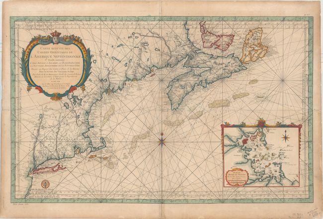
Auction 161, Lot 145
Subject: Colonial Northeastern United States & Canada
Bellin, Jacques Nicolas
Carte Reduite des Costes Orientales de l'Amerique Septentrionale 1re. Feuille Contenant l'Isle Royale, l'Accadie, la Bay Francoise, la Nouvelle Angleterre et la Nouvelle Yorc..., 1757
Size: 34.9 x 21.6 inches (88.6 x 54.9 cm)
Estimate: $1,700 - $2,000
Scarce Large-Scale Chart of the Coast of New England
Sold for: $1,200
Closed on 2/8/2017
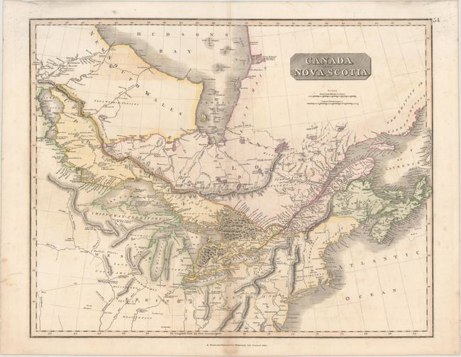
Auction 161, Lot 146
Subject: Northeastern United States & Canada
Thomson, John
Canada and Nova Scotia, 1817
Size: 23.5 x 19.1 inches (59.7 x 48.5 cm)
Estimate: $140 - $170
Unsold
Closed on 2/8/2017
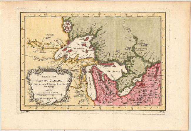
Auction 161, Lot 147
Subject: Colonial Great Lakes
Bellin, Jacques Nicolas
Carte des Lacs du Canada pour Servir a l'Histoire Generale des Voyages, 1757
Size: 11.5 x 7.8 inches (29.2 x 19.8 cm)
Estimate: $400 - $500
Sold for: $425
Closed on 2/8/2017
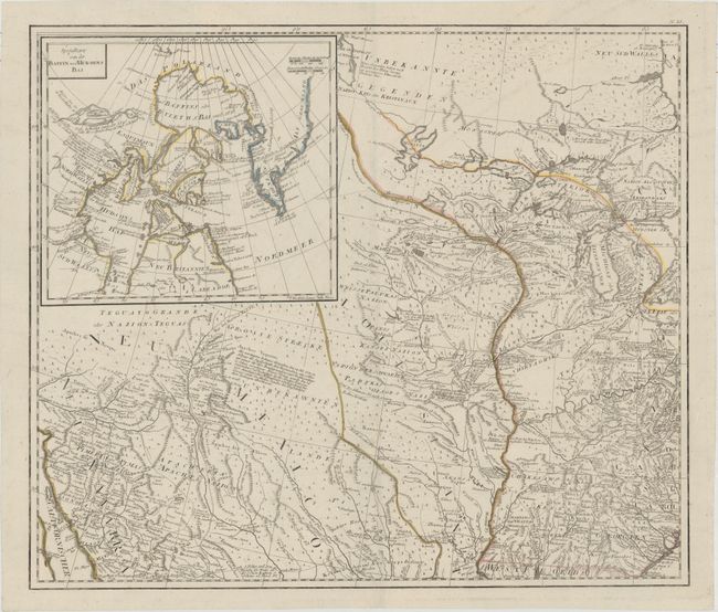
Auction 161, Lot 148
Subject: Central United States & Canada
Schraembl, Franz Anton
[General Karte von Nordamerica samt den West Indischen Inseln Verasst von Herrn Pownall (Northwest Sheet)], 1790
Size: 23.4 x 20 inches (59.4 x 50.8 cm)
Estimate: $600 - $750
Sold for: $400
Closed on 2/8/2017
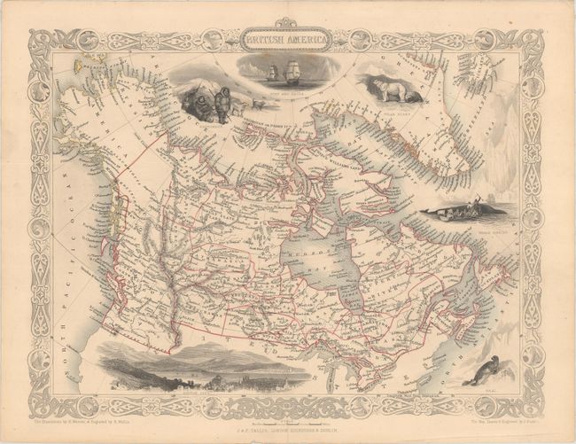
Auction 161, Lot 149
Subject: Canada & Alaska
Tallis, John
British America, 1850
Size: 12.9 x 10.1 inches (32.8 x 25.7 cm)
Estimate: $130 - $170
NO RESERVE
Sold for: $350
Closed on 2/8/2017
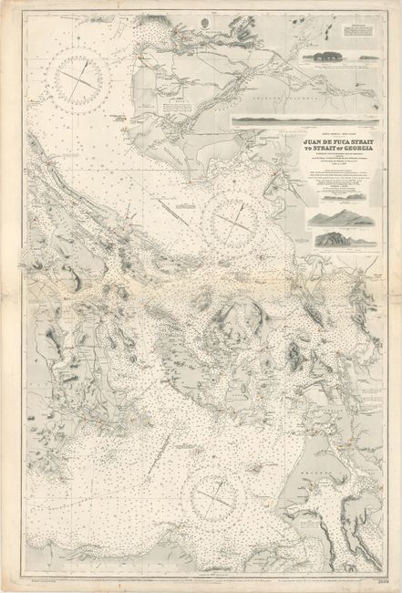
Auction 161, Lot 150
Subject: Washington & British Columbia
U.S. Hydrographic Office
Juan de Fuca Strait to Strait of Georgia..., 1910
Size: 25.4 x 38.6 inches (64.5 x 98 cm)
Estimate: $700 - $850
Sold for: $550
Closed on 2/8/2017
Auction 161, Lot 151
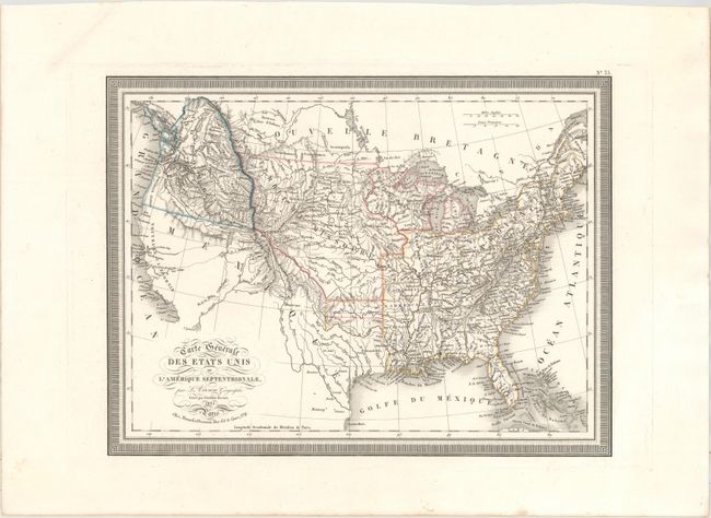
Subject: United States
Vivien de Saint Martin, Louis
Carte Generale des Etats Unis de l'Amerique Septentrionale, 1825
Size: 16.1 x 12.3 inches (40.9 x 31.2 cm)
Estimate: $220 - $250
Sold for: $120
Closed on 2/8/2017
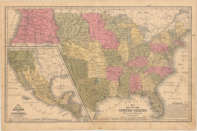
Auction 161, Lot 152
Subject: United States, Texas, Mexico
Mitchell, Samuel Augustus
No. 5 Map of the United States Engraved to Illustrate Mitchell's School and Family Geography, 1839
Size: 16.6 x 10.4 inches (42.2 x 26.4 cm)
Estimate: $250 - $325
Sold for: $250
Closed on 2/8/2017
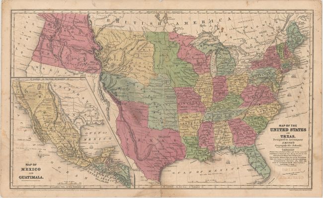
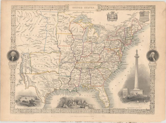
Auction 161, Lot 153
Subject: United States
Burgess, Daniel
[Lot of 5] Map of the United States and Texas, Designed to Accompany Smith's Geography for Schools [and] Map of the Eastern States... [and] Map of the Middle States... [and] Map of the Southern States... [and] Map of the Western States..., 1839
Size: See Description
Estimate: $300 - $375
Sold for: $375
Closed on 2/8/2017
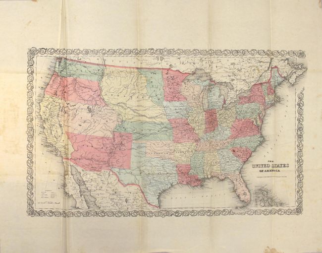
Auction 161, Lot 154
Subject: United States
Colton, Joseph Hutchins
[Map in Book] The United States of America [in] The World as It Is, and as It Has Been; or a Comprehensive Geography and History Ancient and Modern , 1856
Size: 26 x 15.3 inches (66 x 38.9 cm)
Estimate: $450 - $550
Sold for: $250
Closed on 2/8/2017
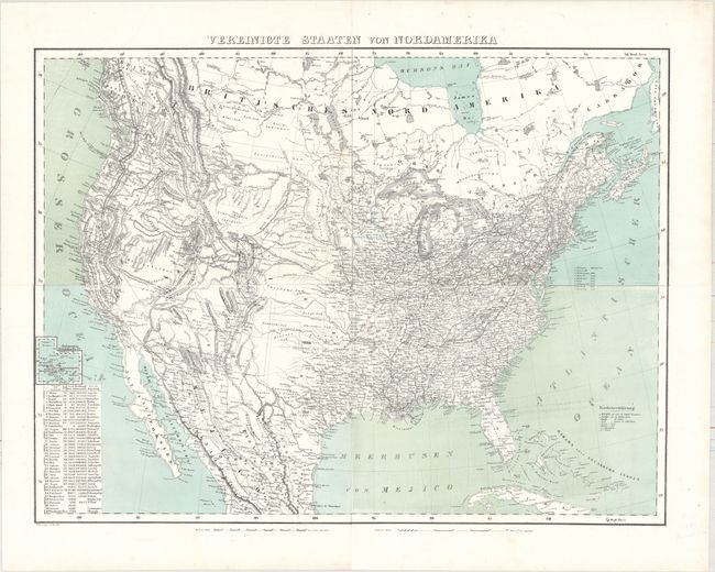
Auction 161, Lot 155
Subject: United States
Flemming, Carl
Vereinigte Staaten von Nordamerika, 1857
Size: 27.2 x 20.5 inches (69.1 x 52.1 cm)
Estimate: $200 - $240
Unsold
Closed on 2/8/2017
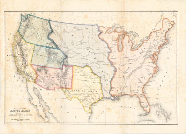
Auction 161, Lot 156
Subject: United States
U.S. Government
Map of the United States Exhibiting the Military Depts. & Posts, 1860
Size: 19.7 x 13 inches (50 x 33 cm)
Estimate: $200 - $250
Sold for: $425
Closed on 2/8/2017
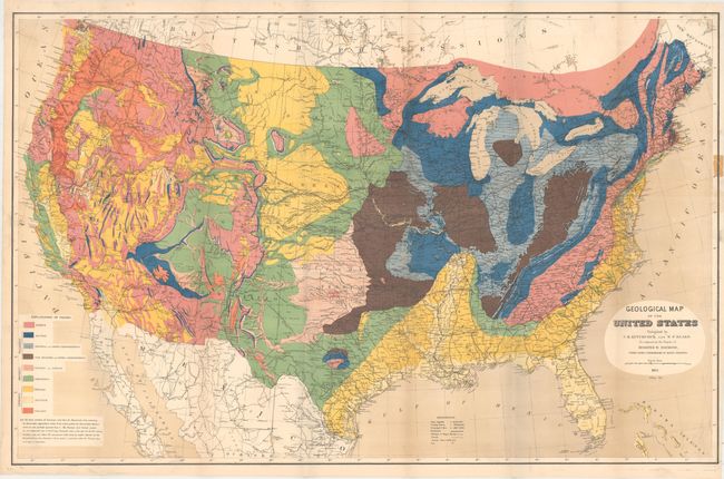
Auction 161, Lot 157
Subject: United States
Hitchcock, Charles Henry
Geological Map of the United States Compiled by C.H. Hitchcock and W. P. Blake…, 1873
Size: 33.5 x 21.5 inches (85.1 x 54.6 cm)
Estimate: $400 - $500
Sold for: $100
Closed on 2/8/2017
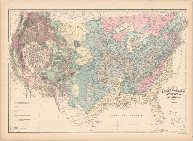
Auction 161, Lot 158
Subject: United States
Asher & Adams
Asher & Adams' Geological Map. United States and Territories, 1874
Size: 23.8 x 15.9 inches (60.5 x 40.4 cm)
Estimate: $100 - $130
Sold for: $75
Closed on 2/8/2017
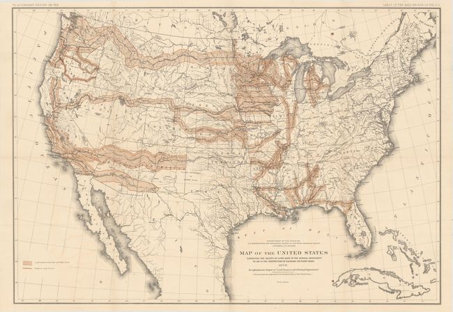
Auction 161, Lot 159
Subject: United States
U.S. Department of Interior
Map of the United States Exhibiting the Grants of Lands Made by the General Government to Aid in the Construction of Railroads and Wagon Roads, 1878
Size: 28.3 x 19.7 inches (71.9 x 50 cm)
Estimate: $200 - $230
Sold for: $425
Closed on 2/8/2017
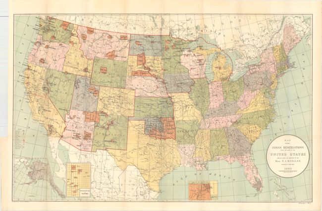
Auction 161, Lot 160
Subject: United States
U.S. Bureau of Indian Affairs
Map Showing Indian Reservations Within the Limits of the United States..., 1892
Size: 33.4 x 21 inches (84.8 x 53.3 cm)
Estimate: $140 - $170
Sold for: $100
Closed on 2/8/2017

Auction 161, Lot 161
Subject: Colonial Eastern United States
Mueller/Bodenehr
[Untitled - Eastern United States], 1702
Size: 3.1 x 2.6 inches (7.9 x 6.6 cm)
Estimate: $275 - $350
Sold for: $200
Closed on 2/8/2017
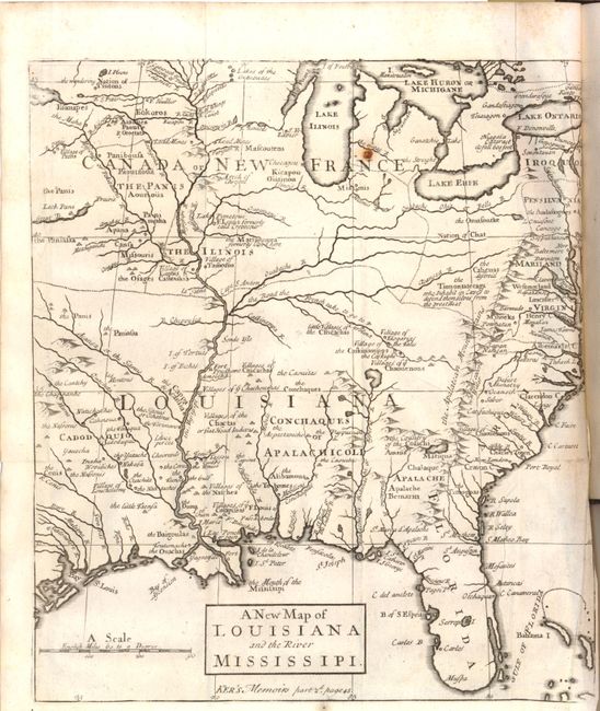
Auction 161, Lot 162
Subject: Colonial Eastern United States
Anon.
A New Map of Louisiana and the River Mississipi [within book] The Memoirs and Secret Negotiations of John Ker, 1726
Size: 9 x 10.2 inches (22.9 x 25.9 cm)
Estimate: $800 - $1,000
Unsold
Closed on 2/8/2017
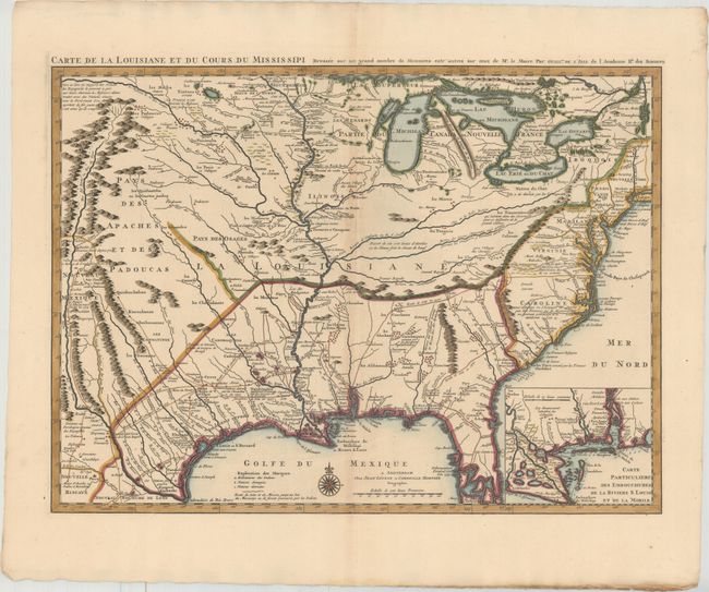
Auction 161, Lot 163
Subject: Colonial Eastern United States, Louisiana Territory
Delisle/Covens & Mortier
Carte de la Louisiane et du Cours du Mississipi Dressee sur un Grand Nombre de Memoires Entr'autres sur ceux de Mr. le Maire, 1730
Size: 23.7 x 17.3 inches (60.2 x 43.9 cm)
Estimate: $2,400 - $3,000
Delisle's Influential Map of the Louisiana Territory
Unsold
Closed on 2/8/2017
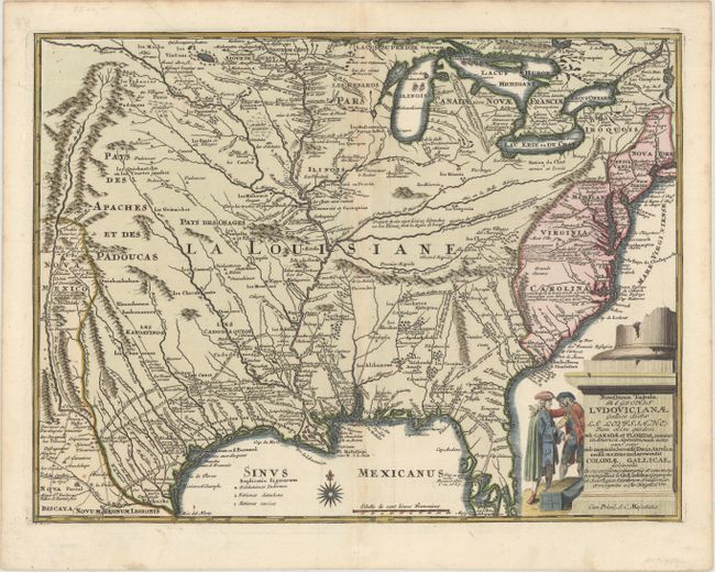
Auction 161, Lot 164
Subject: Colonial Eastern United States
Weigel, Christopher
Novissima Tabula Regionis Ludovicianae Gallice Dictae la Louisiane tam olim Quidem sub Canadae et Floridae Nomine in America Septentrionali..., 1734
Size: 16.5 x 12.5 inches (41.9 x 31.8 cm)
Estimate: $1,400 - $1,700
Uncommon Map of French Louisiana with a Title Cartouche Referencing the Mississippi Bubble Scheme
Unsold
Closed on 2/8/2017
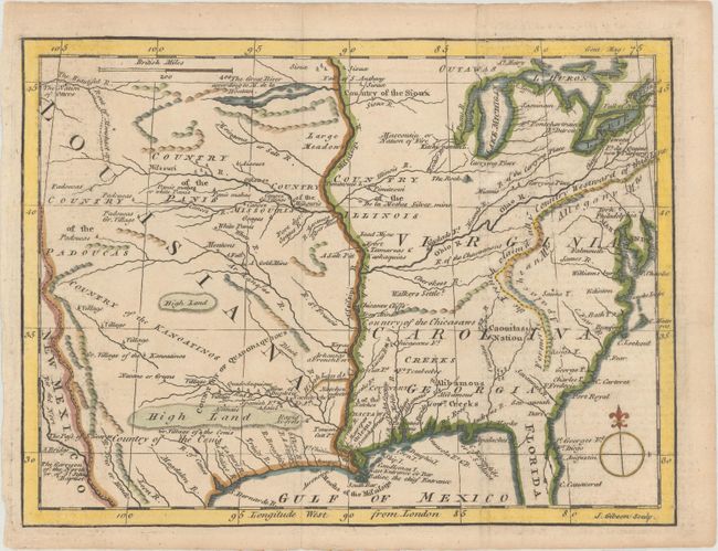
Auction 161, Lot 165
Subject: Colonial Eastern United States
Gibson, John
[Untitled - North America, Louisiana, Virginia & Carolina], 1763
Size: 9.5 x 7.1 inches (24.1 x 18 cm)
Estimate: $275 - $350
Sold for: $180
Closed on 2/8/2017
Auction 161, Lot 166
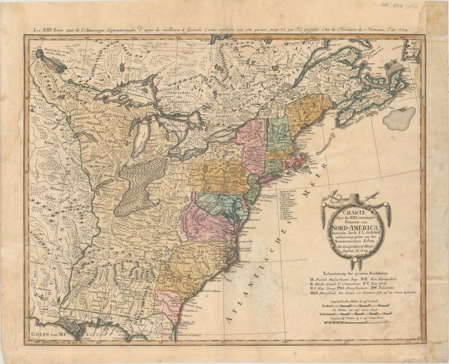
Subject: Eastern United States
Gussefeld/Homann Heirs
Charte uber die XIII Vereinigte Staaten von Nord-America..., 1784
Size: 22.6 x 17.6 inches (57.4 x 44.7 cm)
Estimate: $500 - $650
Sold for: $375
Closed on 2/8/2017
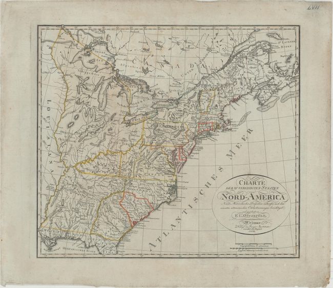
Auction 161, Lot 167
Subject: Eastern United States
Gussefeld, Franz Ludwig
Charte der XV Vereinigten Staaten von Nord-America nach Murdochischer Projection..., 1804
Size: 20.7 x 18.4 inches (52.6 x 46.7 cm)
Estimate: $1,200 - $1,500
Map Depicting the Proposed State of Franklin
Sold for: $900
Closed on 2/8/2017
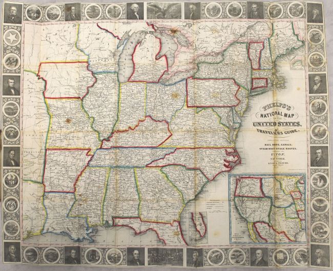
Auction 161, Lot 168
Subject: Eastern United States
Phelps, Ensigns & Thayer
Phelps's National Map of the United States, a Travellers Guide. Embracing the Principal Rail Roads, Canals, Steam Boat & Stage Routes, Throughout the Union, 1850
Size: 25.8 x 20.4 inches (65.5 x 51.8 cm)
Estimate: $600 - $750
Sold for: $450
Closed on 2/8/2017
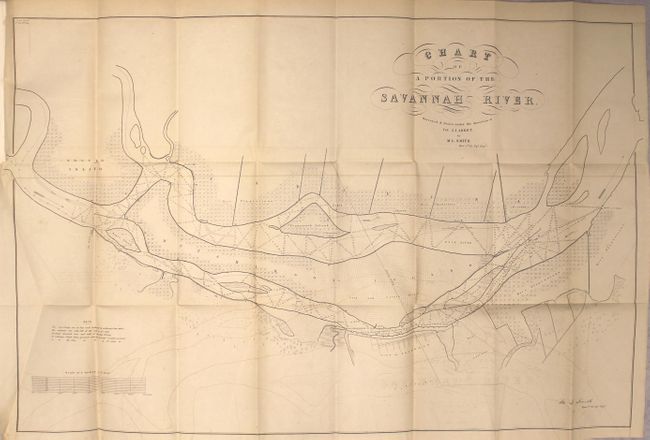
Auction 161, Lot 169
Subject: Eastern United States
U.S. Corps of Engineers
[Report with 5 Maps] Chart of a Portion of the Savannah River... [with] Report of the Secretary of War Communicating a Copy of Lieut. Smith's Survey and Examination of the Savannah River, 1850
Size: 5.8 x 9.1 inches (14.7 x 23.1 cm)
Estimate: $180 - $220
Unsold
Closed on 2/8/2017
Auction 161, Lot 170
Subject: Eastern United States
Tallis, John
United States, 1851
Size: 13.4 x 9.7 inches (34 x 24.6 cm)
Estimate: $250 - $325
Sold for: $275
Closed on 2/8/2017
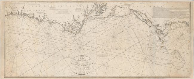
Auction 161, Lot 171
Subject: Eastern United States
Norie, John William
To the Independent Mariners of America, This Chart of their Coast from Savannah to Boston is most Respectfully Dedicated…, 1852
Size: 61 x 25.3 inches (154.9 x 64.3 cm)
Estimate: $2,000 - $2,300
Rare Blue-Back Chart of the East Coast
Unsold
Closed on 2/8/2017
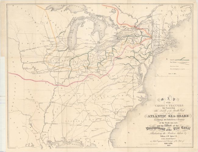
Auction 161, Lot 172
Subject: Eastern United States
Vaughan, David
Map of the Various Channels for Conveying the Trade of the North West to the Atlantic Sea-Board Exhibiting the Tributaries & Drainage of the Trade into Each..., 1853
Size: 26.1 x 20.7 inches (66.3 x 52.6 cm)
Estimate: $275 - $350
NO RESERVE
Unsold
Closed on 2/8/2017
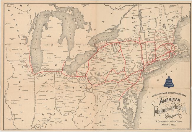
Auction 161, Lot 173
Subject: Northeastern United States
Lines and Metallic Circuit Connections American Telephone and Telegraph Company, 1893
Size: 15.7 x 10.7 inches (39.9 x 27.2 cm)
Estimate: $300 - $375
Early and Scarce AT&T Advertising Piece
Sold for: $425
Closed on 2/8/2017
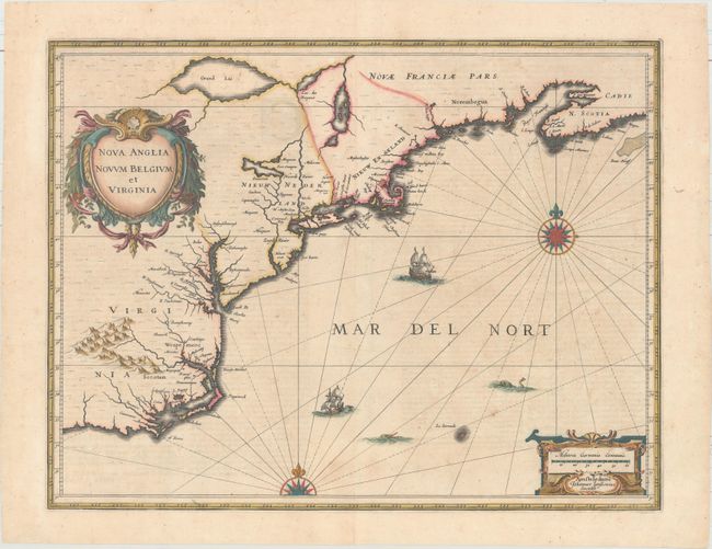
Auction 161, Lot 174
Subject: Colonial New England & Mid-Atlantic
Jansson, Jan
Nova Anglia Novum Belgium et Virginia, 1639
Size: 19.9 x 15.3 inches (50.5 x 38.9 cm)
Estimate: $1,600 - $1,900
Jansson's Influential Map of the East Coast
Sold for: $1,000
Closed on 2/8/2017
274 lots
Page 1 of 6