Subject: Canada & United States
Period: 1865 (published)
Publication:
Color: Hand Color
Size:
6.6 x 10 inches
16.8 x 25.4 cm
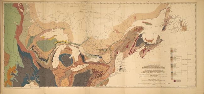
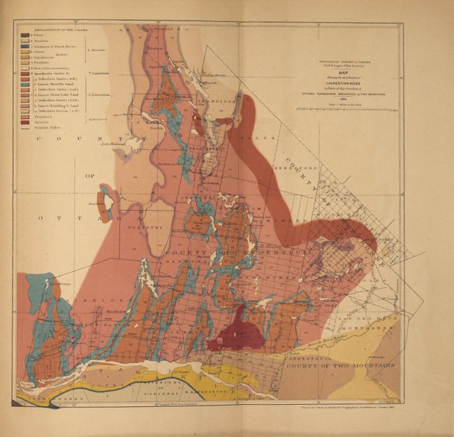
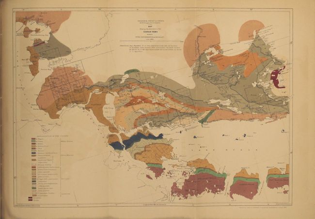
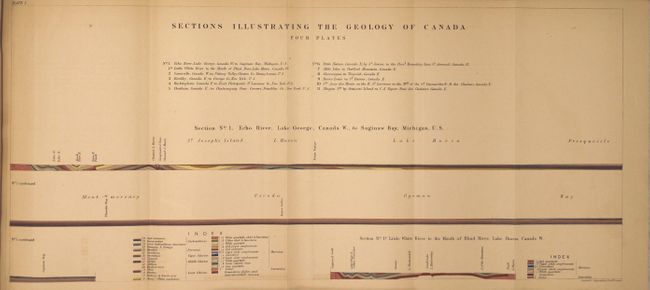
This volume was issued to accompany the Geology of Canada (1863) and contains 6 maps and 4 folding geologic sections. Of particular interest is the Geological Map of Canada (19.2 x 8.5") which, despite its name, covers the region from Virginia north to Newfoundland and west to Kansas and Lake Winnipeg. The map shows 27 different geological groups in bold color and is derived from compilations made by James Hall. Additional maps include Map Showing the Distribution of Laurentian Rocks in Part of Counties of Ottawa Terrebonne Argenteuil (8.3 x 8.0"), Map Showing the Distribution of the Huronian Rocks Between Rivers Batchehwahnung and Mississagui (11.5 x 8.3"), and Map Showing the Distribution of Rocks Belonging to the Potsdam Quebec & Trenton Groups... (14.5 x 7.8"). Includes 42 pages of explanatory text. Octavo, hardbound in brown cloth boards with title on spine.
References: Marcou & Marcou #59.
Condition: B+
The maps and profiles are very good with light toning and faint color offsetting. Text has pleasant light toning. Covers have small chips along the top edge, and the spine is chipped at top and bottom.