Filtered by Category:Canada(Show All Categories)
Showing results for:Auction 161
Catalog Archive
30 lots
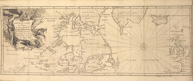
Auction 161, Lot 121
Subject: Canada & North Atlantic
Ellis, Henry
[2 Volumes] Voyage de la Baye de Hudson. Fait en 1746 & 1747, pour la Decouverte du Passage de Nord-Ouest ... Tome Premier [and] ... Tome Second, 1749
Size: 4.4 x 7.6 inches (11.2 x 19.3 cm)
Estimate: $1,000 - $1,300
Unsold
Closed on 2/8/2017
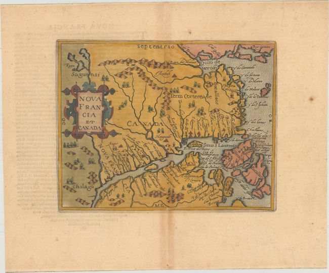
Auction 161, Lot 122
Subject: Eastern Canada
Metellus, Natalius Sequanus
Nova Francia et Canada, 1598
Size: 9.3 x 7.4 inches (23.6 x 18.8 cm)
Estimate: $1,300 - $1,600
Metellus's Rare Reduced Version of Wytfliet's Map of Eastern Canada
Unsold
Closed on 2/8/2017
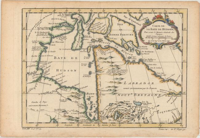
Auction 161, Lot 123
Subject: Eastern Canada, Hudson Bay
Bellin, Jacques Nicolas
Carte de la Baye de Hudson, pour Servir a l'Histoire Generale des Voyages, 1757
Size: 12 x 8.8 inches (30.5 x 22.4 cm)
Estimate: $100 - $130
Unsold
Closed on 2/8/2017
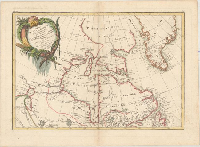
Auction 161, Lot 124
Subject: Eastern Canada, Greenland
Bonne/Lattre
Partie de l'Amerique Septentrionale, qui Comprend le Canada, la Louisiane le Labrador, le Groenland, les Etats-Unis et la Floride..., 1783
Size: 17.3 x 11.9 inches (43.9 x 30.2 cm)
Estimate: $200 - $230
Unsold
Closed on 2/8/2017
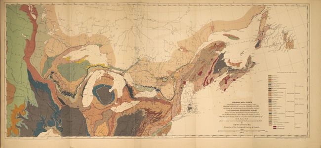
Auction 161, Lot 125
Subject: Canada & United States
Lovell, John
Geological Survey of Canada. Report of Progress from Its Commencement to 1863. Atlas of Maps and Sections, with an Introduction and Appendix, 1865
Size: 6.6 x 10 inches (16.8 x 25.4 cm)
Estimate: $140 - $170
Sold for: $210
Closed on 2/8/2017
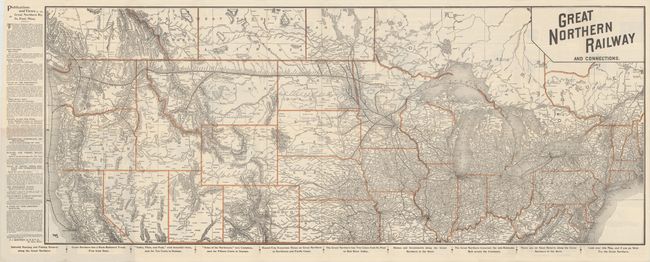
Auction 161, Lot 126
Subject: Northern United States & Canada
Railroad Companies, (Various)
Great Northern Railway and Connections, 1895
Size: 36.9 x 14.7 inches (93.7 x 37.3 cm)
Estimate: $150 - $180
Sold for: $250
Closed on 2/8/2017
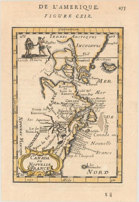
Auction 161, Lot 127
Subject: Colonial Eastern United States & Canada
Mallet, Alain Manesson
Canada ou Nouvelle France, 1683
Size: 4 x 5.6 inches (10.2 x 14.2 cm)
Estimate: $180 - $210
Sold for: $200
Closed on 2/8/2017
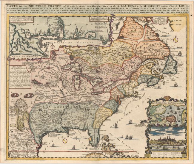
Auction 161, Lot 128
Subject: Colonial Eastern United States & Canada
Chatelain, Henry Abraham
Carte de la Nouvelle France, ou se voit le Cours des Grandes Rivieres de S. Laurens & de Mississipi Aujour d'hui S. Louis, aux Environs des-quelles se Trouvent les Etats, Pais, Nations, Peuples &c..., 1719
Size: 19.3 x 16.6 inches (49 x 42.2 cm)
Estimate: $3,000 - $3,750
One of the Most Informative 18th Century Maps of the French Possessions in North America
Sold for: $2,200
Closed on 2/8/2017
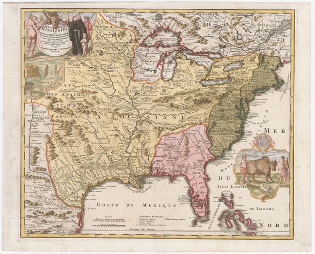
Auction 161, Lot 129
Subject: Colonial Eastern United States & Canada
Homann, Johann Baptist
Amplissimae Regionis Mississipi seu Provinciae Ludovicianae a R.P. Ludovico Hennepin Francisc Miss in America Septentrionali Anno 1687..., 1720
Size: 22.6 x 19.1 inches (57.4 x 48.5 cm)
Estimate: $2,200 - $2,500
Striking Map of Colonial America with Buffalo Vignette
Sold for: $2,300
Closed on 2/8/2017
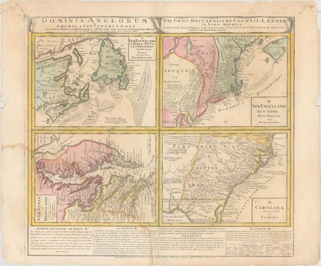
Auction 161, Lot 130
Subject: Colonial Eastern United States & Canada
Homann Heirs
Dominia Anglorum in America Septentrionali... / Die Gros-Britannische Colonie-Laender in Nord-America..., 1740
Size: 22 x 19.9 inches (55.9 x 50.5 cm)
Estimate: $400 - $500
Sold for: $300
Closed on 2/8/2017
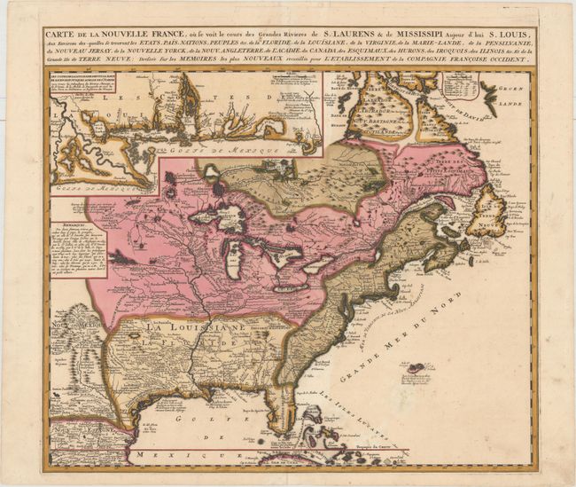
Auction 161, Lot 131
Subject: Colonial Eastern United States & Canada
Ottens/De Fer
Carte de la Nouvelle France, ou se voit le Cours des Grandes Rivieres de S. Laurens & de Mississipi Aujour d'hui S. Louis, aux Environs des-quelles se Trouvent les Etats, Pais, Nations, Peuples &c..., 1745
Size: 21.8 x 19.7 inches (55.4 x 50 cm)
Estimate: $2,300 - $2,750
Reduced Version of De Fer's Influential Map of French Possessions in North America
Sold for: $1,200
Closed on 2/8/2017
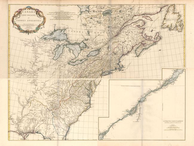
Auction 161, Lot 132
Subject: Colonial Eastern United States & Canada
Anville, Jean Baptiste Bourguignon d'
[On 4 Sheets] Canada Louisiane et Terres Angloises, 1755
Size: 44.5 x 18.8 inches (113 x 47.8 cm)
Estimate: $1,600 - $2,000
D'Anville's Spectacular Map of Eastern Seaboard
Sold for: $800
Closed on 2/8/2017
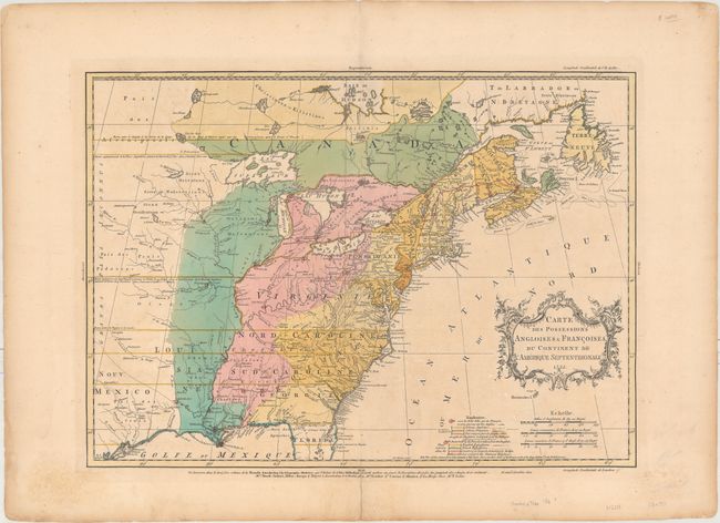
Auction 161, Lot 133
Subject: Colonial Eastern United States & Canada
Palairet, Jean
Carte des Possessions Angloises & Francoises du Continent de l'Amerique Septentrionale, 1755
Size: 22.7 x 16.4 inches (57.7 x 41.7 cm)
Estimate: $2,400 - $3,000
Important Map of French and English Territorial Claims at the Outset of the French and Indian War
Unsold
Closed on 2/8/2017
Auction 161, Lot 134
Subject: Colonial Eastern United States & Canada
Homann Heirs
America Septentrionalis a Domino d'Anville in Galliis Edita nunc in Anglia Coloniis in Interiorem Virginiam Deductis nec non Fluvii Ohio Cursu..., 1756
Size: 20.1 x 18 inches (51.1 x 45.7 cm)
Estimate: $600 - $750
Sold for: $375
Closed on 2/8/2017
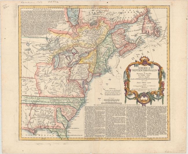
Auction 161, Lot 135
Subject: Colonial Eastern United States & Canada
Kitchin, Thomas
A New Map of the British Dominions in North America; with the Limits of the Governments Annexed Thereto by the Late Treaty of Peace, and Settled by Proclamation, October 7th, 1763, 1763
Size: 11.8 x 9.5 inches (30 x 24.1 cm)
Estimate: $350 - $425
Sold for: $200
Closed on 2/8/2017
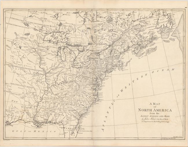
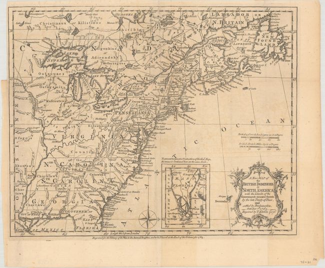
Auction 161, Lot 136
Subject: Colonial Eastern United States & Canada
Blair, Rev. John
A Map of North America from the Latest Surveys and Maps, 1768
Size: 22.4 x 16.3 inches (56.9 x 41.4 cm)
Estimate: $700 - $850
Sold for: $400
Closed on 2/8/2017
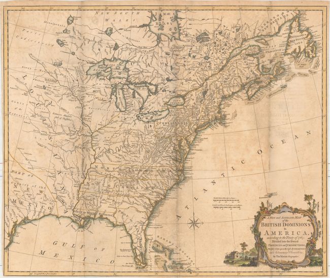
Auction 161, Lot 137
Subject: Colonial Eastern United States & Canada
Kitchin, Thomas
A New and Accurate Map of the British Dominions in America, According to the Treaty of 1763; Divided into the Several Provinces and Jurisdictions..., 1769
Size: 24.6 x 20.6 inches (62.5 x 52.3 cm)
Estimate: $1,400 - $1,700
Rare Map of the British Colonies Just After the French & Indian War
Sold for: $800
Closed on 2/8/2017
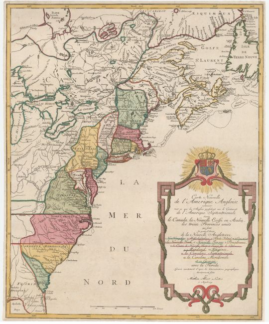
Auction 161, Lot 138
Subject: Colonial Eastern United States & Canada
Lotter, Mathias Albrecht
Carte Nouvelle de l'Amerique Angloise Contenant tout ce que les Anglois Possedent sur le Continent de l'Amerique Septentrionale Savoir le Canada..., 1776
Size: 19.4 x 23.7 inches (49.3 x 60.2 cm)
Estimate: $1,200 - $1,500
Unsold
Closed on 2/8/2017
Auction 161, Lot 139
Subject: Eastern United States & Canada
Stockdale, John
A Map of the Northern and Middle States; Comprehending the Western Territory and the British Dominions in North America. From the Best Authorities, 1792
Size: 15.7 x 12.5 inches (39.9 x 31.8 cm)
Estimate: $600 - $750
Unsold
Closed on 2/8/2017
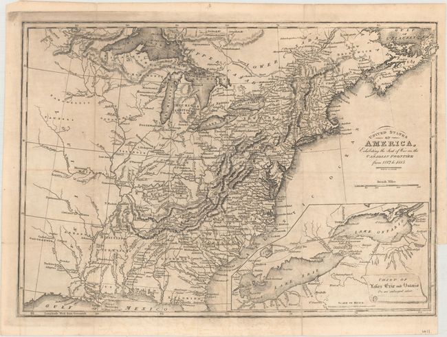
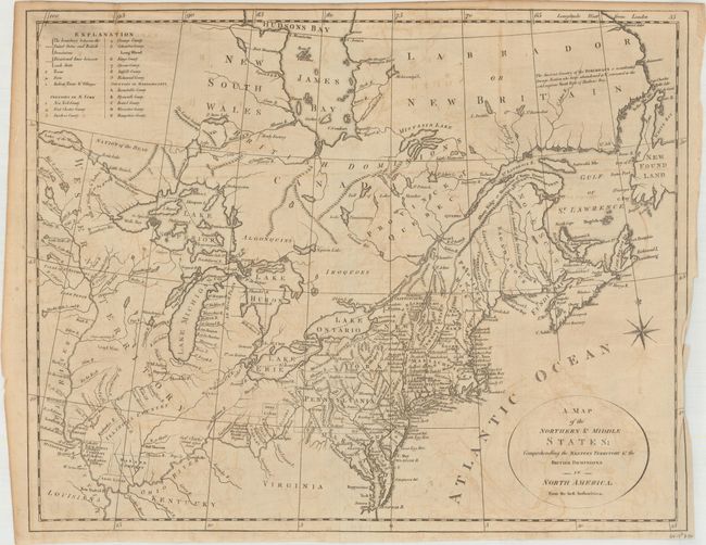
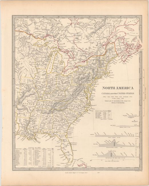
Auction 161, Lot 140
Subject: Eastern United States & Canada
Baines, Edward
United States of America, Exhibiting the Seat of War on the Canadian Frontier from 1812 to 1815, 1816
Size: 13.6 x 9.7 inches (34.5 x 24.6 cm)
Estimate: $300 - $375
Sold for: $150
Closed on 2/8/2017
Auction 161, Lot 141
Subject: Eastern United States & Canada
SDUK Society for the Diffusion of Useful Knowledge
[Lot of 15 - United States & Canada], 1835
Size: See Description
Estimate: $1,000 - $1,300
Matching Set of SDUK Maps
Sold for: $700
Closed on 2/8/2017
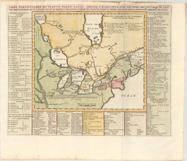
Auction 161, Lot 142
Subject: Colonial Northeastern United States & Canada, Great Lakes
Chatelain, Henry Abraham
Carte Particuliere du Fleuve Saint Louis Dressee sur les Lieux avec les Noms des Sauvages du Pais..., 1719
Size: 17.9 x 14.4 inches (45.5 x 36.6 cm)
Estimate: $650 - $800
Sold for: $375
Closed on 2/8/2017
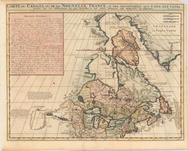
Auction 161, Lot 143
Subject: Colonial Northeastern United States & Canada
Chatelain, Henry Abraham
Carte du Canada ou de la Nouvelle France, & des Decouvertes qui y ont ete Faites, Dressee sur les Observations les Plus Nouvelles, & sur Divers Memoires tant Manuscrits qu' Imprimez, 1719
Size: 20.5 x 16.1 inches (52.1 x 40.9 cm)
Estimate: $600 - $750
Unsold
Closed on 2/8/2017
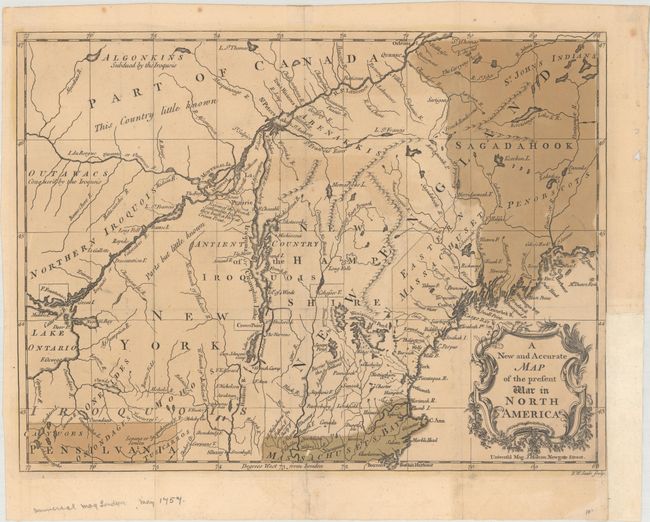
Auction 161, Lot 144
Subject: Colonial Northeastern United States & Canada
Hinton, John
A New and Accurate Map of the Present War in North America, 1757
Size: 14.3 x 10.8 inches (36.3 x 27.4 cm)
Estimate: $400 - $500
Unsold
Closed on 2/8/2017
Auction 161, Lot 145
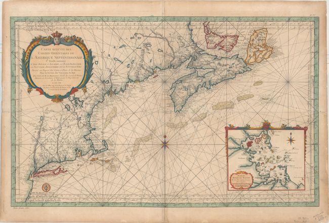
Subject: Colonial Northeastern United States & Canada
Bellin, Jacques Nicolas
Carte Reduite des Costes Orientales de l'Amerique Septentrionale 1re. Feuille Contenant l'Isle Royale, l'Accadie, la Bay Francoise, la Nouvelle Angleterre et la Nouvelle Yorc..., 1757
Size: 34.9 x 21.6 inches (88.6 x 54.9 cm)
Estimate: $1,700 - $2,000
Scarce Large-Scale Chart of the Coast of New England
Sold for: $1,200
Closed on 2/8/2017
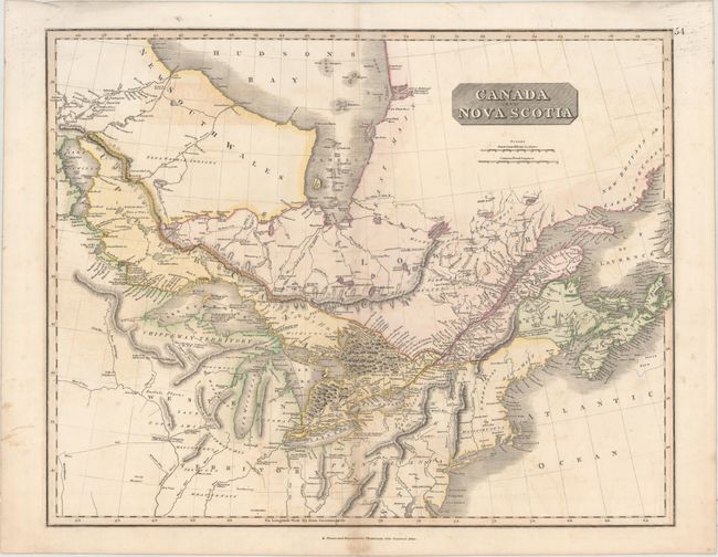
Auction 161, Lot 146
Subject: Northeastern United States & Canada
Thomson, John
Canada and Nova Scotia, 1817
Size: 23.5 x 19.1 inches (59.7 x 48.5 cm)
Estimate: $140 - $170
Unsold
Closed on 2/8/2017
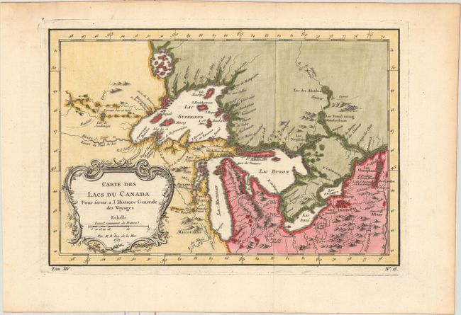
Auction 161, Lot 147
Subject: Colonial Great Lakes
Bellin, Jacques Nicolas
Carte des Lacs du Canada pour Servir a l'Histoire Generale des Voyages, 1757
Size: 11.5 x 7.8 inches (29.2 x 19.8 cm)
Estimate: $400 - $500
Sold for: $425
Closed on 2/8/2017
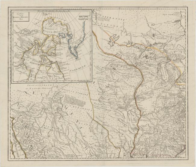
Auction 161, Lot 148
Subject: Central United States & Canada
Schraembl, Franz Anton
[General Karte von Nordamerica samt den West Indischen Inseln Verasst von Herrn Pownall (Northwest Sheet)], 1790
Size: 23.4 x 20 inches (59.4 x 50.8 cm)
Estimate: $600 - $750
Sold for: $400
Closed on 2/8/2017
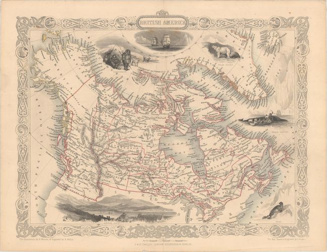
Auction 161, Lot 149
Subject: Canada & Alaska
Tallis, John
British America, 1850
Size: 12.9 x 10.1 inches (32.8 x 25.7 cm)
Estimate: $130 - $170
NO RESERVE
Sold for: $350
Closed on 2/8/2017
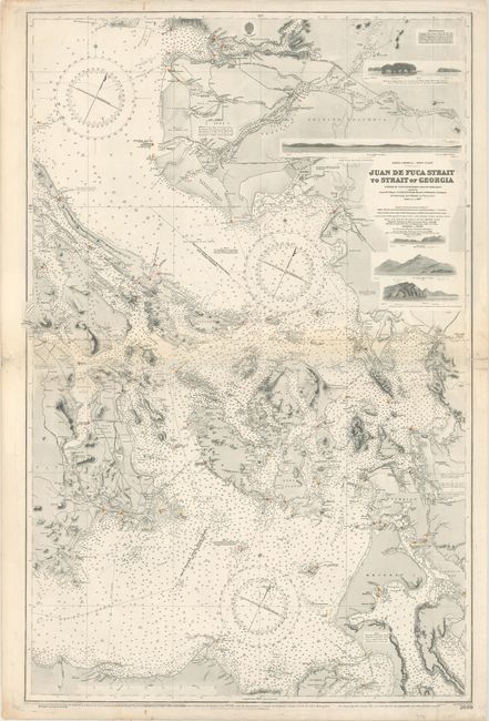
Auction 161, Lot 150
Subject: Washington & British Columbia
U.S. Hydrographic Office
Juan de Fuca Strait to Strait of Georgia..., 1910
Size: 25.4 x 38.6 inches (64.5 x 98 cm)
Estimate: $700 - $850
Sold for: $550
Closed on 2/8/2017
30 lots