Catalog Archive
Auction 161, Lot 167

Map Depicting the Proposed State of Franklin

"Charte der XV Vereinigten Staaten von Nord-America nach Murdochischer Projection...", Gussefeld, Franz Ludwig

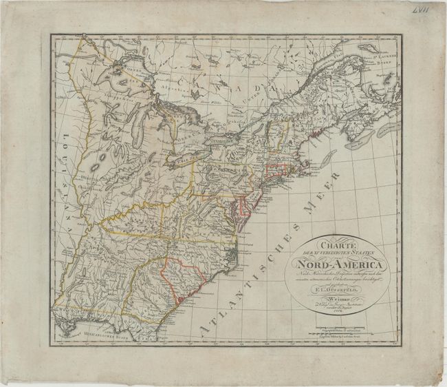
Subject: Eastern United States

Period: 1804 (dated)

Publication:

Color: Hand Color

Size:
20.7 x 18.4 inches
52.6 x 46.7 cm
Download High Resolution Image
(or just click on image to launch the Zoom viewer)

One of the most interesting and scarce features on early maps of the United States is the appearance of the proposed State of Franklin. In 1784 settlers in the frontier west of the Appalachian Mountains organized a state government with the state to be named in honor of Benjamin Franklin. Congress turned down their appeal but the state maintained a legislature and governor until 1788. This ephemeral state appeared on a small number of maps into the early part of the 19th century. On this map, and other continental European maps, Franklin is misplaced in the region that is now West Virginia and eastern Kentucky, instead of eastern Tennessee. Elsewhere on this interesting map, the region north of the Ohio River is labeled Indiana and includes locations of Indian villages and a few early settlements and forts. Maine extends well into New Brunswick. This is the second state of this map, first published in 1800. See our June 2015 newsletter article on the State of Franklin here, and our updated carto-bibliography here.

References: Baynton-Williams (TMC-72) #12; Dotson & Baker (OWA) #15.2.

Condition: B+

On wide margined bluish paper with very light soiling.

Estimate: $1,200 - $1,500

Sold for: $900

Closed on 2/8/2017

Archived