Filtered by Category:United States(Show All Categories)
Showing results for:Auction 102
Catalog Archive
138 lots
Page 1 of 3
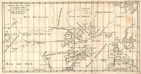
Auction 102, Lot 95
Subject: North America - Arctic
Robert de Vaugondy, Didier
Partie de la Carte du Capitaine Cluny Auteur d'un ouvrage anglois intitule American Traveller, 1769
Size: 16.3 x 8.3 inches (41.4 x 21.1 cm)
Estimate: $160 - $200
Sold for: $80
Closed on 3/5/2003
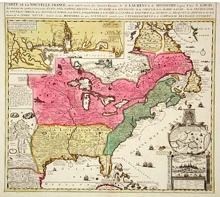
Auction 102, Lot 102
Subject: Colonial North America
Ottens/De Fer
Carte de la Nouvelle France, ou se voit le cours des Grandes Rivieres de S. Laurens & de Mississipi, Aujour d'hui S. Louis…, 1720
Size: 21.5 x 18 inches (54.6 x 45.7 cm)
Estimate: $2,750 - $3,250
Unsold
Closed on 3/5/2003
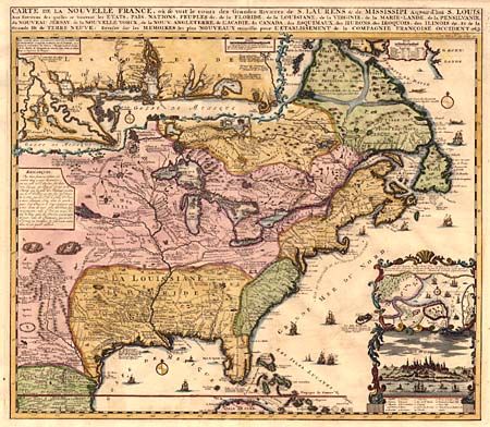
Auction 102, Lot 103
Subject: Colonial North America
Chatelain, Henry Abraham
Carte de la Nouvelle France, ou se voit le cours des Grandes Rivieres de S. Laurens & de Mississipi Aujour d'hui S. Louis, Aux Environs des-quelles se trouvent les Etats, Pais, Nations, Peuples &c., 1732
Size: 18.9 x 16.5 inches (48 x 41.9 cm)
Estimate: $2,400 - $2,750
Sold for: $1,900
Closed on 3/5/2003
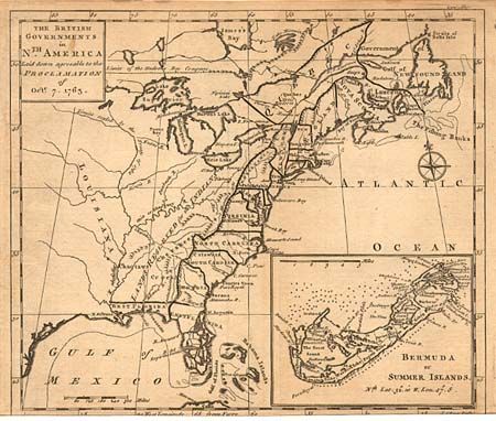
Auction 102, Lot 104
Subject: Colonial North America
Gibson, John
The British Governments in Nth. America laid down agreeable to the Proclamation of Octr. 7, 1763, 1763
Size: 9.3 x 8 inches (23.6 x 20.3 cm)
Estimate: $250 - $300
Sold for: $190
Closed on 3/5/2003
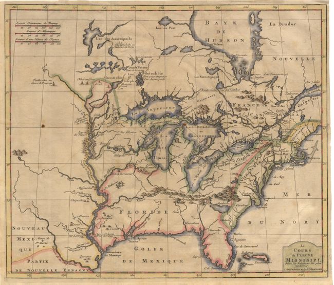
Auction 102, Lot 105
Subject: Colonial United States and Canada - Great Lakes
Bernard, Jean Frederic
Le Cours du Fleuve Missisipi Selon les Relations les plus modernes, 1737
Size: 17.2 x 14.6 inches (43.7 x 37.1 cm)
Estimate: $2,300 - $2,500
Unsold
Closed on 3/5/2003
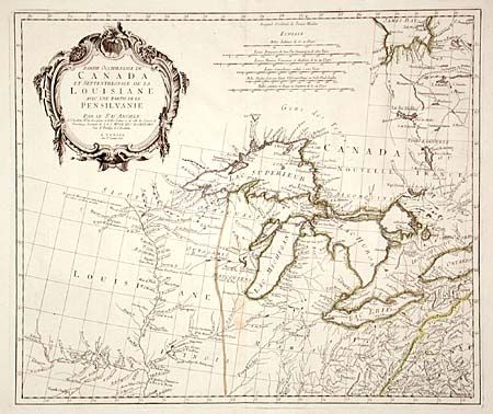
Auction 102, Lot 106
Subject: Colonial North America - Great Lakes
D'Anville/Santini
Partie Occidentale du Canada et Septentrionale de la Louisiane avec une Partie de la Pensilvanie, 1775
Size: 22.5 x 19 inches (57.2 x 48.3 cm)
Estimate: $1,200 - $1,400
Sold for: $950
Closed on 3/5/2003
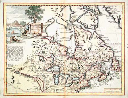
Auction 102, Lot 107
Subject: Colonial New England and Canada
Albrizzi, Girolamo
Carta Geografica del Canada Nell'America Settentrionale, 1742
Size: 16.8 x 12.9 inches (42.7 x 32.8 cm)
Estimate: $600 - $800
Sold for: $650
Closed on 3/5/2003
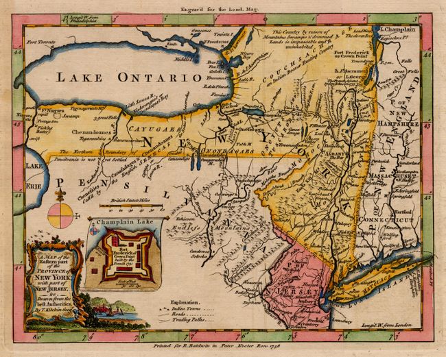
Auction 102, Lot 108
Subject: Colonial Mid-Atlantic
Kitchin, Thomas
A Map of the Eastern Part of the Province of New York with Part of New Jersey, &c. Drawn from the best Authorities, 1756
Size: 8.5 x 6.5 inches (21.6 x 16.5 cm)
Estimate: $375 - $475
Sold for: $425
Closed on 3/5/2003
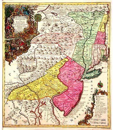
Auction 102, Lot 109
Subject: Colonial Mid- Atlantic
Seutter/Lotter
Pensylvania Nova Jersey et Nova York cum Regionibus ad Fluvium Delaware in America Sitis…, 1760
Size: 19.7 x 22.7 inches (50 x 57.7 cm)
Estimate: $2,000 - $2,400
Sold for: $1,400
Closed on 3/5/2003
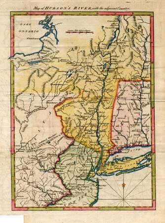
Auction 102, Lot 110
Subject: Colonial New England
Anon.
Map of Hudson's River with the Adjacent Country, 1778
Size: 8.5 x 11.8 inches (21.6 x 30 cm)
Estimate: $275 - $325
Sold for: $220
Closed on 3/5/2003

Auction 102, Lot 111
Subject: Colonial North America
Montanus, Arnoldus
Novi Belgii, quod nunc Novi Jorck Vocatur, Novae qz. Angliae & Partis Virginiae Accuratissima et Novissima Delineatio, 1671
Size: 14.3 x 11.5 inches (36.3 x 29.2 cm)
Estimate: $1,800 - $2,000
Sold for: $1,500
Closed on 3/5/2003
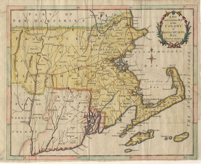
Auction 102, Lot 112
Subject: Colonial Northeast
Anon.
A New and accurate Map of the Colony of Massachusets Bay, in North America from a Late Survey, 1780
Size: 12.8 x 10.2 inches (32.5 x 25.9 cm)
Estimate: $325 - $375
Sold for: $220
Closed on 3/5/2003

Auction 102, Lot 113
Subject: Colonial Maryland
Ogilby, John
Nova Terrae-Mariae Tabula, 1671
Size: 15 x 11.5 inches (38.1 x 29.2 cm)
Estimate: $7,000 - $8,000
Sold for: $6,500
Closed on 3/5/2003
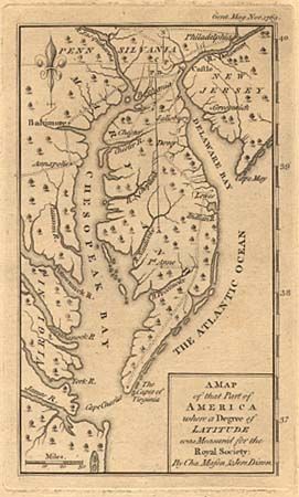
Auction 102, Lot 114
Subject: Colonial Maryland and Pennsylvania
Anon.
A Map of that Part of America where a Degree of Latitude was Measured for the Royal Society: By Cha. Mason, & Jere. Dixon, 1769
Size: 3.8 x 6.5 inches (9.7 x 16.5 cm)
Estimate: $250 - $350
Sold for: $230
Closed on 3/5/2003
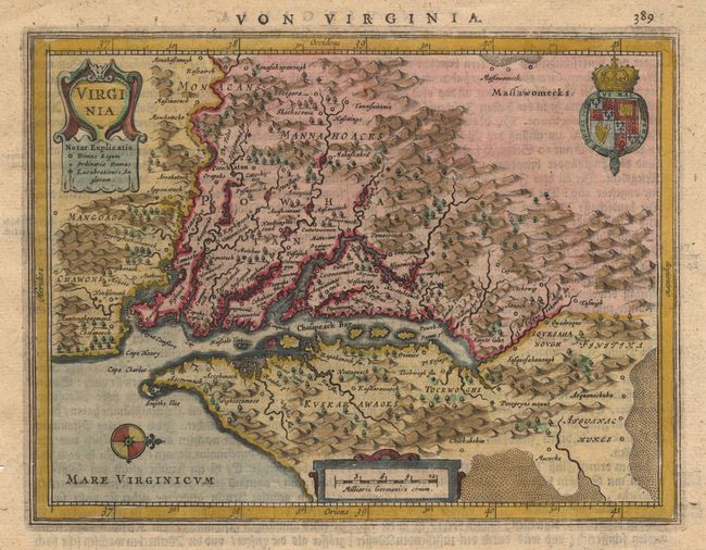
Auction 102, Lot 115
Subject: Colonial Virginia
Jansson, Jan
Virginia, 1648
Size: 7.5 x 5.6 inches (19.1 x 14.2 cm)
Estimate: $700 - $800
Sold for: $500
Closed on 3/5/2003
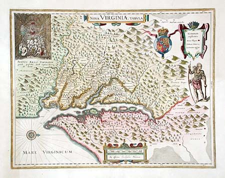
Auction 102, Lot 116
Subject: Colonial Virginia
Hondius/Blaeu
Nova Virginiae Tabula, 1662
Size: 19 x 14.6 inches (48.3 x 37.1 cm)
Estimate: $2,500 - $3,000
Sold for: $2,000
Closed on 3/5/2003
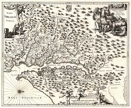
Auction 102, Lot 117
Subject: Colonial Virginia
Montanus/Ogilby
Nova Virginiae Tabula, 1671
Size: 13.7 x 11.5 inches (34.8 x 29.2 cm)
Estimate: $1,400 - $1,600
Sold for: $1,000
Closed on 3/5/2003
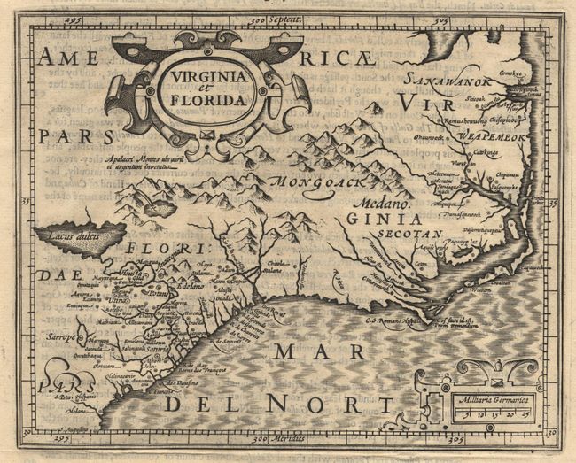
Auction 102, Lot 118
Subject: Colonial Southeast
Hondius/Purchas
Virginia et Florida, 1625
Size: 7.2 x 5.7 inches (18.3 x 14.5 cm)
Estimate: $550 - $600
Sold for: $550
Closed on 3/5/2003
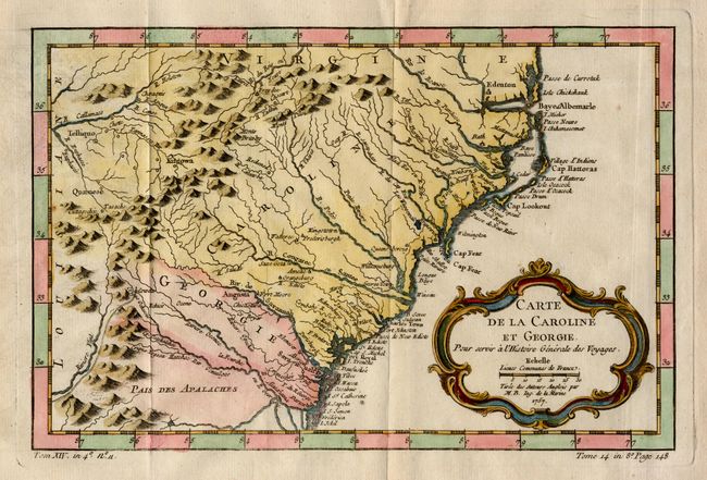
Auction 102, Lot 119
Subject: Colonial Southeast
Bellin, Jacques Nicolas
Carte de la Caroline et Georgie, 1757
Size: 11.3 x 7.5 inches (28.7 x 19.1 cm)
Estimate: $350 - $400
Sold for: $350
Closed on 3/5/2003
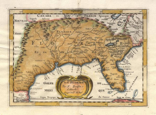
Auction 102, Lot 120
Subject: Colonial South
Sanson, Nicolas
La Floride, 1682
Size: 9.9 x 6.9 inches (25.1 x 17.5 cm)
Estimate: $400 - $450
Sold for: $450
Closed on 3/5/2003
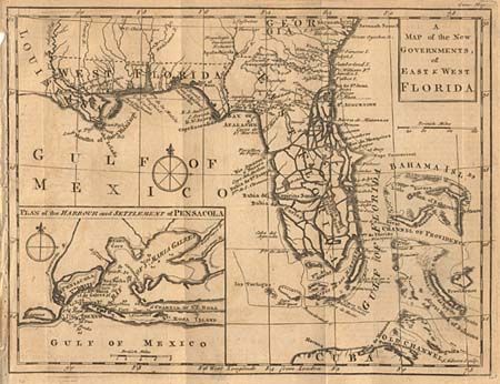
Auction 102, Lot 121
Subject: Colonial South
Gibson, John
A Map of the New Governments, of East & West Florida, 1763
Size: 9.9 x 7.5 inches (25.1 x 19.1 cm)
Estimate: $400 - $500
Sold for: $300
Closed on 3/5/2003
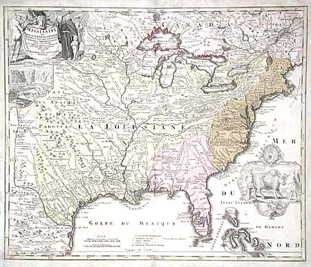
Auction 102, Lot 123
Subject: Colonial Louisiana
Homann, Johann Baptist
Amplissimae Regionis Mississipi Seu Provinciae Ludovicianae…, 1730
Size: 23 x 19.5 inches (58.4 x 49.5 cm)
Estimate: $2,000 - $2,200
Unsold
Closed on 3/5/2003
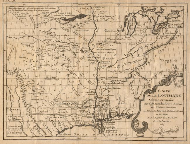
Auction 102, Lot 124
Subject: Colonial Louisiana
Le Page du Pratz
Carte de la Louisiane Colonie Francaise avec le Cours du Fleuve St. Louis, les Rivieres Adjacentes, les Nations des Naturels, les Stablissems. Franciase et les Mines, 1757
Size: 13.2 x 10 inches (33.5 x 25.4 cm)
Estimate: $400 - $500
Sold for: $400
Closed on 3/5/2003
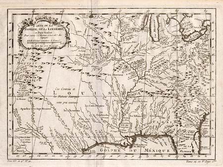
Auction 102, Lot 125
Subject: Colonial Louisiana
Bellin, Jacques Nicolas
Carte de la Floride, de la Louisiane et Pays Voisins…, 1757
Size: 12 x 9 inches (30.5 x 22.9 cm)
Estimate: $450 - $550
Sold for: $325
Closed on 3/5/2003
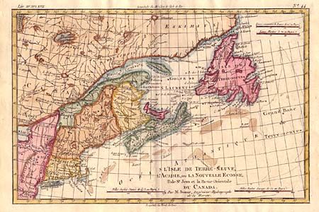
Auction 102, Lot 131
Subject: New England and Canada
Bonne, Rigobert
L'Isle de Terre-Neuve, L'Acadie, ou la Nouvelle Ecosse, l'Isle St Jean et la Partie Orientale du Canada, 1782
Size: 12.5 x 8.2 inches (31.8 x 20.8 cm)
Estimate: $200 - $240
Sold for: $300
Closed on 3/5/2003
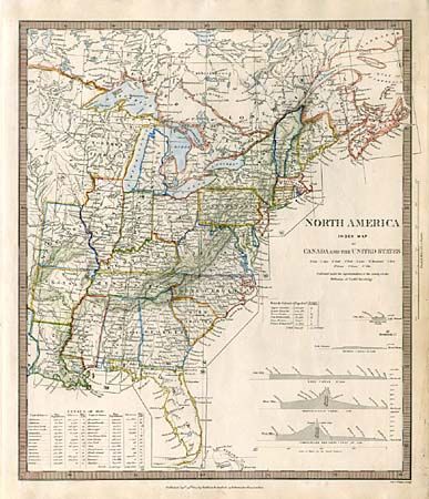
Auction 102, Lot 132
Subject: Eastern United States and Canada
SDUK Society for the Diffusion of Useful Knowledge
North America Index Map to Canada and the United States, 1844
Size: 12.3 x 14.5 inches (31.2 x 36.8 cm)
Estimate: $100 - $140
Sold for: $130
Closed on 3/5/2003
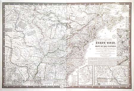
Auction 102, Lot 133
Subject: Eastern United States and Canada
Brue, Adrien Hubert
Nouvelle Carte des Etats-Unis, des Haut et Bas-Canada de la Nouv. Le Escosse, du Nouv. au Brunswick, de Terre-Neuve…, 1836
Size: 36.5 x 24.5 inches (92.7 x 62.2 cm)
Estimate: $1,500 - $1,700
Unsold
Closed on 3/5/2003
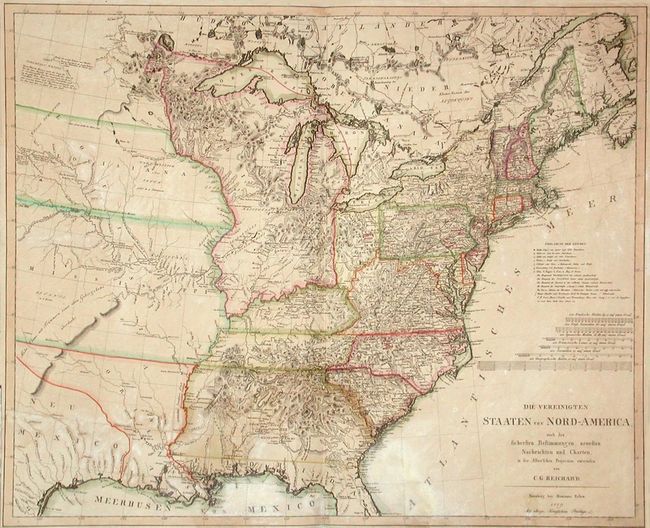
Auction 102, Lot 134
Subject: Eastern United States and Canada
Reichard, Christian Gottlieb Theoph
Die Vereinigten Staaten Von Nord-America, nach den sichersten Bestimmung en, neuesten Nachrichten und Charten, in der Alber'schen Projection entworsen Von C.G. Reichard., 1809
Size: 28 x 23 inches (71.1 x 58.4 cm)
Estimate: $1,800 - $2,200
Sold for: $1,200
Closed on 3/5/2003
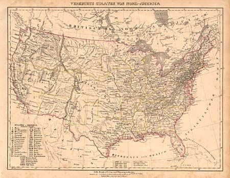
Auction 102, Lot 135
Subject: United States
Flemming, Carl
Vereinigte Staaten von Nord-America, 1852
Size: 16.2 x 12.2 inches (41.1 x 31 cm)
Estimate: $140 - $180
Sold for: $120
Closed on 3/5/2003
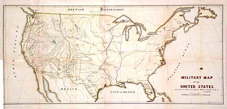
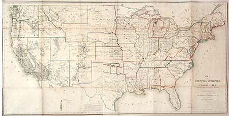
Auction 102, Lot 136
Subject: United States
U.S. War Department
Military Map of the United States, 1857
Size: 30 x 13.5 inches (76.2 x 34.3 cm)
Estimate: $180 - $220
Sold for: $190
Closed on 3/5/2003
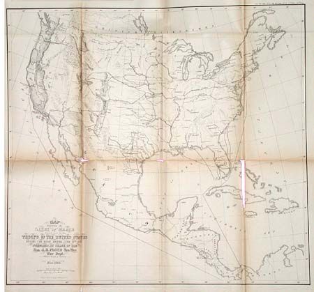
Auction 102, Lot 137
Subject: United States
U.S. War Department
Map Exhibiting the Lines of March passed over by troops of the United States during the year ending June 30th, 1858, 1858
Size: 18.8 x 17.4 inches (47.8 x 44.2 cm)
Estimate: $80 - $100
Sold for: $40
Closed on 3/5/2003
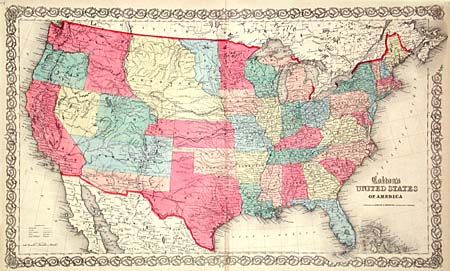
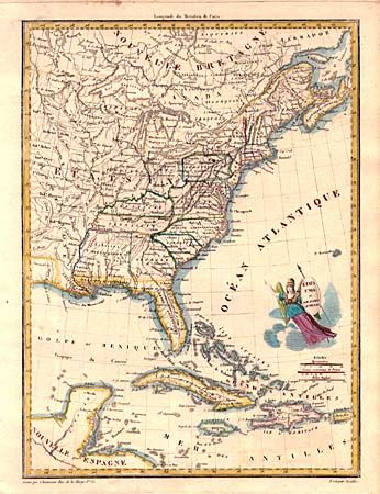
Auction 102, Lot 138
Subject: United States
Colton, Joseph Hutchins
United States of America, 1859
Size: 26.2 x 15.6 inches (66.5 x 39.6 cm)
Estimate: $750 - $850
Sold for: $800
Closed on 3/5/2003
Auction 102, Lot 139
Subject: United States
General Land Office
Map of the United States and Territories Showing the extent of Public Surveys and other details constructed from the Plats and official sources of the General Land Office…, 1866
Size: 54.5 x 28 inches (138.4 x 71.1 cm)
Estimate: $400 - $500
Sold for: $375
Closed on 3/5/2003
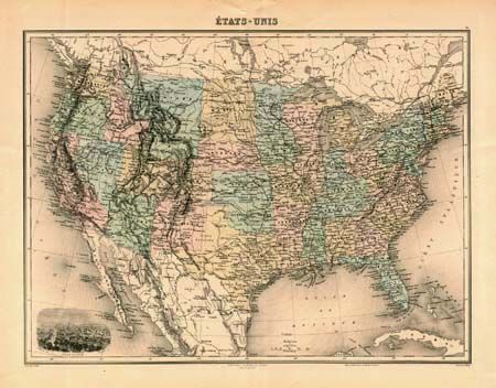
Auction 102, Lot 140
Subject: United States
Migeon, J.
Etats-Unis, 1885
Size: 16.5 x 12.1 inches (41.9 x 30.7 cm)
Estimate: $60 - $80
Sold for: $30
Closed on 3/5/2003
Auction 102, Lot 141
Subject: Eastern United States
Chamouin, Jean Baptiste Marie
Etats Unis et Grandes Antilles, 1805
Size: 8.6 x 11.7 inches (21.8 x 29.7 cm)
Estimate: $160 - $220
Sold for: $120
Closed on 3/5/2003
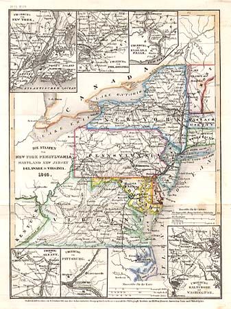
Auction 102, Lot 142
Subject: United States - Eastern
Stahlstich, D.
Die Staaten von New York Pensylvania Maryland New Jersey Delaware & Virginia, 1846
Size: 7.9 x 10.5 inches (20.1 x 26.7 cm)
Estimate: $90 - $120
Sold for: $75
Closed on 3/5/2003
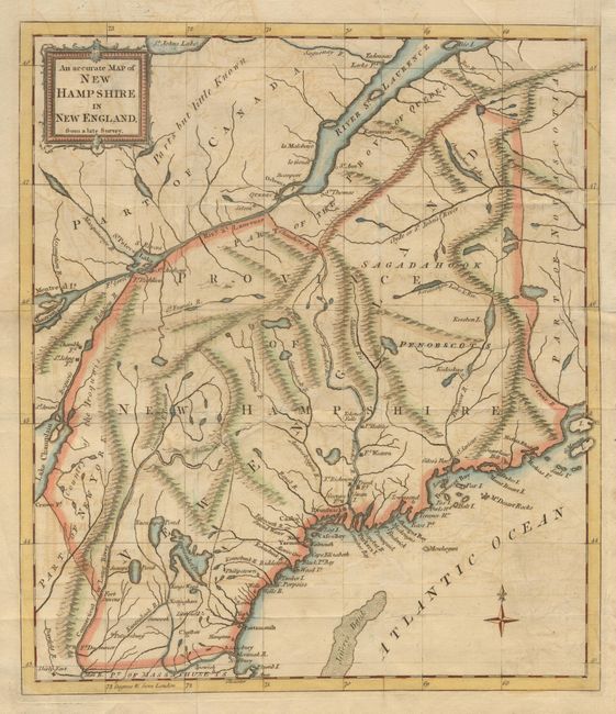
Auction 102, Lot 143
Subject: New England
Anon.
An accurate Map of New Hampshire in New England, from a late Survey, 1781
Size: 11.2 x 12.7 inches (28.4 x 32.3 cm)
Estimate: $350 - $400
Sold for: $250
Closed on 3/5/2003
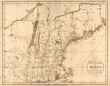
Auction 102, Lot 144
Subject: New England
Russell, John C.
Map of the Northern, or, New England States of America, Comprehending Vermont, New Hampshire, District of Main, Massachusetts, Rhode Island, and Connecticut, 1795
Size: 18.2 x 14.5 inches (46.2 x 36.8 cm)
Estimate: $300 - $375
Sold for: $220
Closed on 3/5/2003
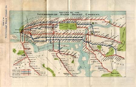
Auction 102, Lot 145
Subject: New England and New York
Various
A.C.A. Associated Tours [together with] Routes of the Interborough Rapid Transit Company, 1925
Size: See Description
Estimate: $50 - $60
Sold for: $140
Closed on 3/5/2003
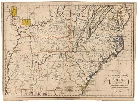
Auction 102, Lot 146
Subject: United States - Southern
Russell, John C.
Map of the Southern States of America, Comprehending Maryland, Virginia, Kentucky, Territory Sth. of the Ohio, North Carolina, Tennessee Governmt. South Carolina, & Georgia, 1795
Size: 19.6 x 14.3 inches (49.8 x 36.3 cm)
Estimate: $300 - $375
Sold for: $500
Closed on 3/5/2003
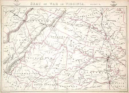
Auction 102, Lot 147
Subject: United States - Southern
Weller, E.
[Lot of 3 - Civil War], 1863
Size: 12 x 17.7 inches (30.5 x 45 cm)
Estimate: $300 - $400
Sold for: $240
Closed on 3/5/2003
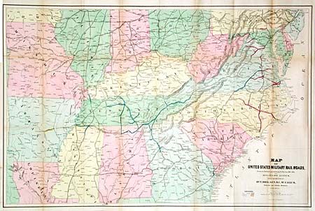
Auction 102, Lot 148
Subject: Southcentral United States
U.S. War Department
Map of United States Military Rail Roads, Showing the Rail Roads Operated during the War from 1862-1866, as Military Lines under the Direction of Bvt. Brig. Gen. B.C. McCallum, Director and General Manager, 1866
Size: 38.2 x 25 inches (97 x 63.5 cm)
Estimate: $300 - $350
Sold for: $200
Closed on 3/5/2003
Auction 102, Lot 149
Subject: United States - Central Midwest
Schraembl, Franz Anton
[General Karte von Nordamerica samt den West Indischen Inseln Verasst von Herrn Pownall (Northwest Sheet)], 1790
Size: 23.4 x 20 inches (59.4 x 50.8 cm)
Estimate: $700 - $900
Sold for: $500
Closed on 3/5/2003

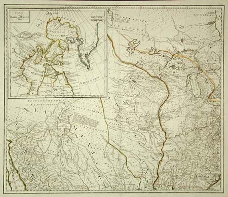
Auction 102, Lot 150
Subject: United States - Central Midwest
Fullarton, Archibald & Co.
United States North America … The North Central Section Comprising Michigan, Illinois, Wisconsin, Iowa, Indiana, Nebraska, Minnesota…, 1845
Size: 20.1 x 15.9 inches (51.1 x 40.4 cm)
Estimate: $100 - $120
Sold for: $95
Closed on 3/5/2003
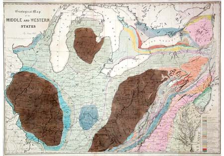
Auction 102, Lot 151
Subject: Midwest and Mid Atlantic
Hall, James (Sir)
Geological Map of the Middle and Western States, 1850
Size: 32.7 x 23 inches (83.1 x 58.4 cm)
Estimate: $200 - $250
Unsold
Closed on 3/5/2003
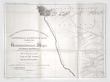
Auction 102, Lot 152
Subject: United States - Northern Midwest
U.S. Government
Reconnaissance Maps (Six Sheets and Profile) Showing the general features of the topography adjacent to the 49th Parallel from the Lake of the Woods to the Rocky Mountains, 1878
Size: 21 x 15.3 inches (53.3 x 38.9 cm)
Estimate: $350 - $450
Sold for: $250
Closed on 3/5/2003
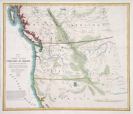
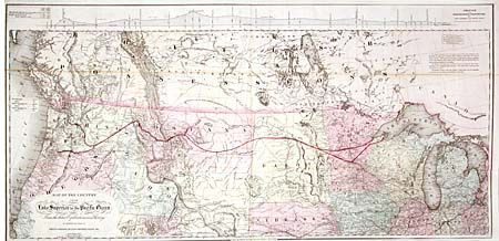
Auction 102, Lot 153
Subject: United States - Northwestern
U.S. Government
Map of the United States Territory of Oregon West of the Rocky Mountains Exhibiting the vaious Trading Depots or Forts occupied by the British Hudson Bay Company connected with the Western and Northwestern Fur Trade, 1838
Size: 20.5 x 17.3 inches (52.1 x 43.9 cm)
Estimate: $350 - $400
Sold for: $550
Closed on 3/5/2003
Auction 102, Lot 154
Subject: United States - Western
U.S. Army
[Lot of 4 - Pacific Wagon Roads], 1863
Size: See Description
Estimate: $600 - $800
Sold for: $375
Closed on 3/5/2003
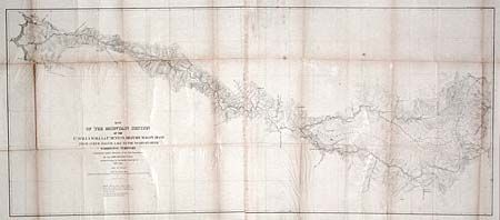
Auction 102, Lot 155
Subject: United States - Northwestern
Colton, G.W. & C.B.
Map of the Country from Lake Superior to the Pacific Ocean. From the latest Explorations and Surveys to accompany the Report of Edwin F. Johnson Chf. Engr. Northern Pacific R.R., 1867
Size: 45 x 21.8 inches (114.3 x 55.4 cm)
Estimate: $500 - $600
Sold for: $450
Closed on 3/5/2003
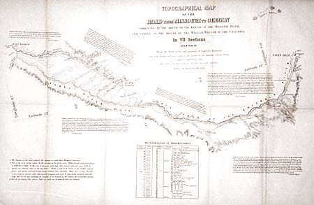
Auction 102, Lot 156
Subject: United States - Western
Fremont/Preuss
Topographical Map of the Road from Missouri to Oregon in Seven Sections, 1846
Size: See Description
Estimate: $2,000 - $3,000
Sold for: $2,000
Closed on 3/5/2003
138 lots
Page 1 of 3