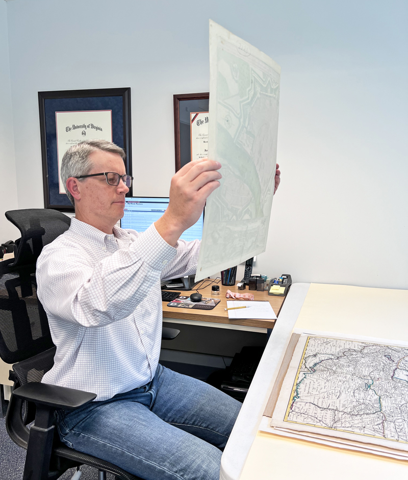
As small business owners, Eliane and I wear many different hats ranging from handling consignment inquiries, marketing, accounting, shipping and web design, down to mundane tasks including cleaning, vacuuming and taking out the trash. Fortunately, the part of our jobs where we spend the most amount of time is also the area that we are most passionate about: cataloging maps. This article gives a brief overview into our guiding principles at Old World Auctions (OWA) and our approach to cataloging, divided into three distinct areas.
Physical Inspection/Condition Report
The first step in the cataloging process is to assess the physical map. This includes both evaluating condition and verifying authenticity. Our goal with condition is to describe any positive characteristics (crisp impression, sturdy paper, wide margins, etc.), call out any noticeable imperfections primarily in the map image, and assign a grade. Understanding that most of our material is centuries old (excluding pictorial maps and reference books), we do not attempt to call out every little imperfection. There are five steps in our physical assessment process:
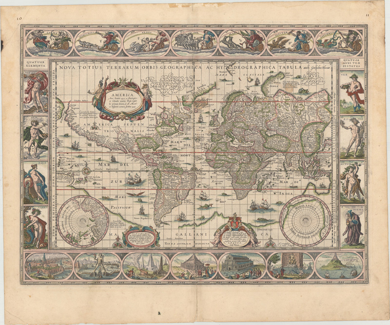
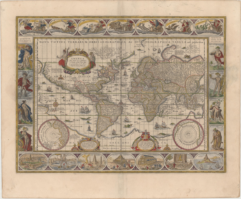
Color/Format: We will always specify if a map has contemporary color (meaning the color was applied at the time of publication). In some cases, we will mention that there is a combination of both contemporary color and modern color (usually in the decorative elements). If contemporary color is not called out, either we are uncertain (we do not speculate) or it is modern color. Pocket maps or maps in books are always called out as “issued folding.” We do not call out maps that only have a centerfold as this is the norm.
Full contemporary color (top image) and modern color (bottom image). Notice the different color palates and how the modern map is more liberal in the application of color.
Issues in the Map Image: We always start with any problem areas in the engraved image and focus on specificity. Tears and fold separations larger than an inch are typically measured and stated. Areas of loss are always called out and noted whether any facsimile work was done to restore the loss. The extent of any toning or foxing is also mentioned if noticeable.
The top image has a crisp impression on a bright sheet resulting in an “A” condition grade. The bottom image has moderate toning and staining, which downgraded it to “B” condition.
Repairs: We call out any repair work that has been done and note whether the repairs were done properly or not. Proper repairs will be noted as either “professional” or “expert” (best) or “archival” (good). The use of cello tape, masking tape, or other acidic mediums slowly break down paper over time. If any of these materials are present in the image, we will call them out as such. As a general rule, if we see this sort of material on a map – even if it doesn’t show up in the image – we will downgrade the map at least one grade level. If a map appears to be a “B+”, the presence of non-archival repairs will downgrade it to a “B.” We feel strongly that a condition grade should hold up 50 years from now.
This map has contemporary color, which is evident from the color bleed-through on verso. The pigments in contemporary color can sometimes cause paper to become brittle and crack. Unfortunately, these cracks were partially repaired with non-archival masking tape and will slowly degrade the paper over time.
Issues in the Blank Margins: Any noticeable imperfections in the blank margins will be called out, but typically don’t impact the condition grade. The most common issues in the blank margins include light toning, scattered foxing, and edge tears/chips. Trimmed margins or loss of margin that would make it difficult to frame a map would generally impact the condition grade by one level.
Verifying Authenticity: While assessing condition, we always keep a watchful eye for forgeries to screen them out of the catalog. Suspicion usually begins as a gut feeling that something is not quite right and is confirmed by evaluating the type of paper (is it correct for the period?), quality of engraving, and platemark. For more on this topic, check out Eliane’s newsletter from October 2020.
All of the items in our catalog are assigned a letter grade based upon the criteria above ranging from fine condition (A+) to fair (C), with the vast majority being in very good condition (B+) or better. Additionally, Eliane and I have been using the same approach for years now, so there is consistency in grading regardless of the cataloger. Because we have rigor around this process, we are able to offer bidders a 100% money-back guarantee on the condition and authenticity of every item. In fact, over the last 5 years, we have had two items (out of about 20,000 items) returned to us under this policy.
Catalog Description
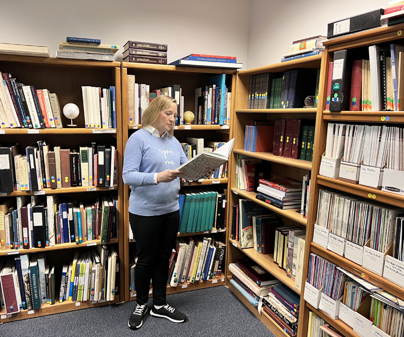
Our catalog is organized geographically beginning with the World, then travelling through the Americas, Europe, Asia, Africa, Australia, and ending with atlases and reference books. In this second step, each lot is assigned a geographic region and some basic information is recorded including the title, creator, size and color. The other attributes, which often take additional research, include the date of publication, state/edition, and ultimately the map’s significance. When these attributes are compiled, the map’s story comes to light. Much of this information is derived from our extensive reference library, which features hundreds of titles on maps, mapmakers, publishers, regions of the world, and the history of cartography, including whole runs of many prominent magazines and journals. A few of our most visited reference works while writing a map description include Koeman's Atlantes Neerlandici, Burden’s The Mapping of North America, Rodney Shirley’s The Mapping of the World and Maps in the Atlases of the British Library, and Carl Wheat’s Mapping the Transmississippi West to name a few. The contents of these volumes, and most in our library, have not been digitized and are therefore not viewable online (for a review of our top reference books, click here). One book that we use frequently, Philip Lee Phillip’s A List of Geographical Atlases in the Library of Congress, is available on the web here. Please note that in the lot descriptions, our references are shown in an abbreviated format, but our full list of references cited can always be found here.
What about an internet search? While searching the web for a given map title can certainly yield a large number of results very quickly, the challenge comes in sifting through all the data to find relevant, trustworthy information. For this reason, we only use library and institution websites for research purposes including Library of Congress, Rumsey Collection, Boston Public Library, Newberry Library, Osher Map Library and WorldCat, among many others.
Items that we find particularly interesting or noteworthy will also include a “tagline,” which is shown in red text at the top of the lot detail page and is also visible on the lot list pages under the estimate. Items that shouldn’t be missed will be included in our list of “Featured Lots,” which is located on the left navigation menu.
To date, Eliane and I have collectively cataloged over 50,000 maps, and our descriptions are a combination of our experience and the scholarship contained within our reference library.
Auction Estimates
The last component, which is one of our most important responsibilities, is to provide a fair auction estimate for each lot. Our philosophy differs from most auction companies that typically provide very low estimates in the hope that their auction results will outperform their estimates. At OWA, we feel strongly that auction estimates should instead be a reflection of the current market. In order to establish a current estimate, we use a four-step procedure:
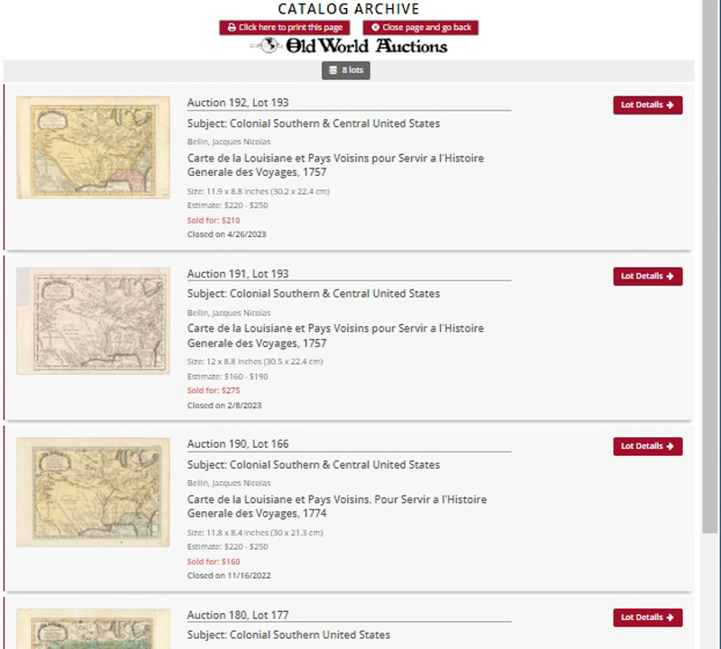
OWA Auction Results: One of the most important predictors of how an item will perform at auction is to review how other examples have performed in past auctions. Our online archive features over 80,000 lot listings covering the last 25 years and is the first place we check. More often than not, we have listed a given map before, so we have a good baseline from which to begin. When gathering prices from our own archive, we put a greater weight on results occurring in the last 5 years as they are a better reflection of the current market. Looking at these data points over time also tells us if prices for a given map are increasing or decreasing.
External Pricing: To get results from other auction houses, we use RareBookHub.com and OldMaps.com, which together include past sales records for over 13 million listings (both are subscription services). As with our own data, we typically focus only on the last few years of auction results (if available), as they are most relevant to today's market. In addition to auction houses, we also regularly check to see what a map is worth on the market today via dealers’ websites. This data needs to be interpreted however, taking into account where the dealer is located (big city or not), whether or not they have a storefront, and whether they focus on cartography, as these factors will impact how they price their maps.
Condition: The old saying that “condition is king” certainly holds true in the map world. In fact, if you take three examples of the same map in A, B and C+ condition, we typically find that the difference in value between the A example and the B example is between 25-35%, and that the C+ example may only be worth 40-50% of the A example. Understanding how much certain issues -- such as toning, foxing, damp stains, worm holes or tears -- impact the overall value of the map is critical when developing estimates. It is important to note that the condition of all comparable examples needs to be considered when collecting relevant pricing. For example, if we sold a lot in “B” condition back in 2020 for $200, an “A” example on the market today (assuming everything else is equal) should be in the $250-$275 range.
Other Relevant Factors: More often than not, estimating value is not completely straightforward. There are several other factors that should be considered, including the state or edition of the map, color, format (atlas vs. pocket map), and provenance. Color can impact value either positively or negatively depending on how the map was originally issued, whether the color is contemporary, whether modern color was done properly and period correct, and whether old color has caused defects such as discoloration or cracking in the paper.
After collecting all the above information, we balance the relevant factors and establish an auction estimate and reserve price. The estimate is given as a range from low to high and represents possible prices a bidder might expect in the current market. The reserve is then set at 50-75% of the low estimate, is set by OWA (with consignor approval), and kept confidential until the price is met. It is important to note that auction estimates are valid only for a specific point in time as market conditions constantly change. It is for this reason that we evaluate the auction estimate for every map in every auction.
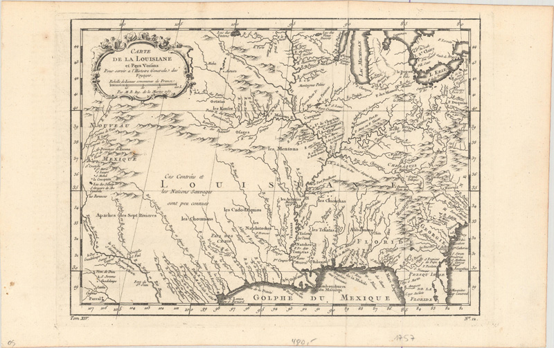
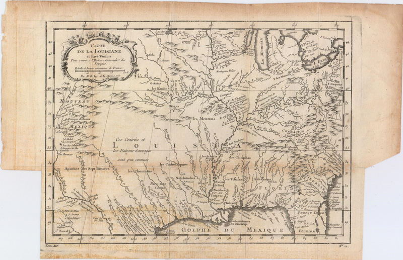
Bellin’s “Carte de la Louisiane et Pays Voisins” appears 8 times in our archive over the last 5 years, with hammer prices ranging from $100 to $275.
We hope you find this look “under the hood” to be informative and it gives you confidence in our process. If you have any questions, please let us know!