Bringing Cartography Back into Schoolsby Eliane Dotson
Jon and I believe it is important to bring geography and maps back into schools. On several occasions we have taught local elementary school kids about maps and how antique maps can help us better understand and visualize history. We also offer our digital images free to all educators, as we want to encourage the use of more historical artifacts in teaching. This fall our 12-year-old son, Callum, was excited to tell us about a long-term project he was working on in one of his classes that integrated maps and map-making.
The project was a real-world simulation in which students worked in groups and formed their own countries. Each student group had to create a government for their country, develop a history and culture, develop an economy based on natural resources, industry and agriculture, and trade with other nations. Maps played a large role in the simulation, and each group had to design multiple maps of their country to depict cities, industries, agriculture, and natural resources.
The students learned that nations have resources based on their climate and geography, and that most cities are located near rivers and natural harbors. They needed to use roads and navigable waters strategically to transport goods for importing and exporting. During the simulation, countries sent out diplomats to broker trade deals, military alliances, foreign aid deals, and more. After earning points for completed projects, countries went to war and negotiated peace treaties. Those countries who made the right alliances and earned enough points with their projects were victorious and were rewarded with tributes from the nations they defeated. The final step was to apply the new skills the students learned to real-world situations.
This project taught the kids how geography impacts natural resources, transportation, and agriculture, which in turn impacts trade, economy, and alliances. What a great way to get kids thinking about globalization and the numerous factors that make governing a country so challenging!
Below are a few of the maps the students created.
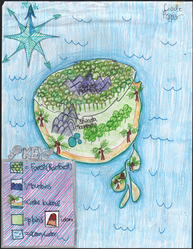
This map shows the country of Chocolatey Pineapple Legion, which features a mountain range surrounded by rainforest, plains, coastal lowlands, and even a volcano on one of the small surrounding islands.
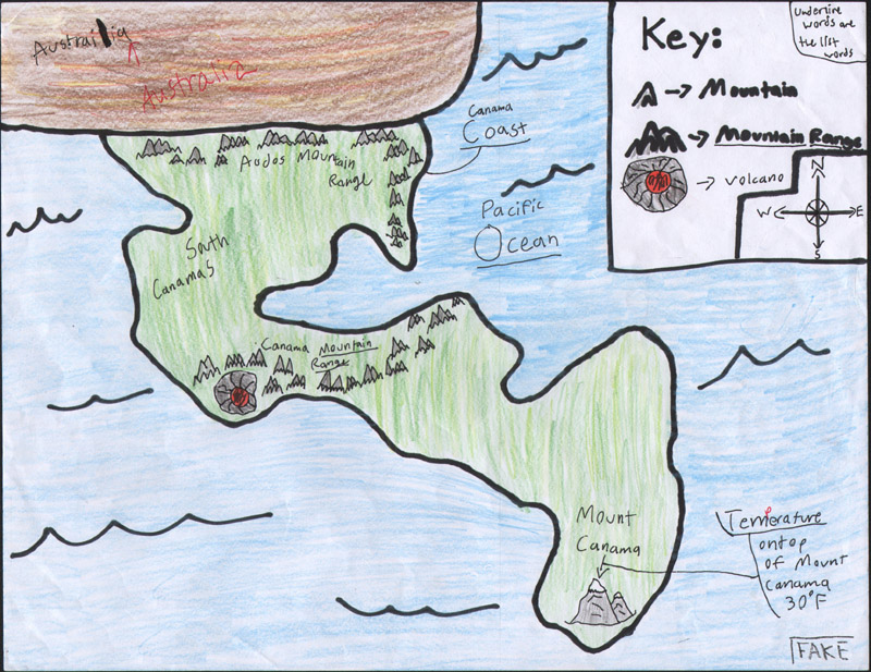
One of the more interesting features of this map of the country of South Canamas is the notation at bottom right that the map is a "fake." During the simulation, points would be awarded if a team successfully secured knowledge of another country's geographical features. This team created fake maps of their country to prevent competing teams from discovering too much information about South Canamas.
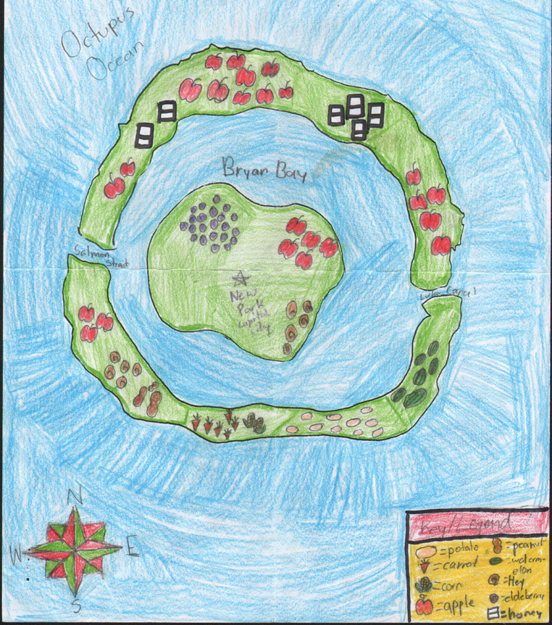
This is an agriculture map for the country of Animal Kingdom, which is centered on New Park Capital City. The central island is protected by Bryan Bay, and the country boasts an abundance of natural food sources, including potatoes, carrots, corn, apples, peanuts, watermelon, honey and elderberries.
Behind the Scenes at Old World Auctions
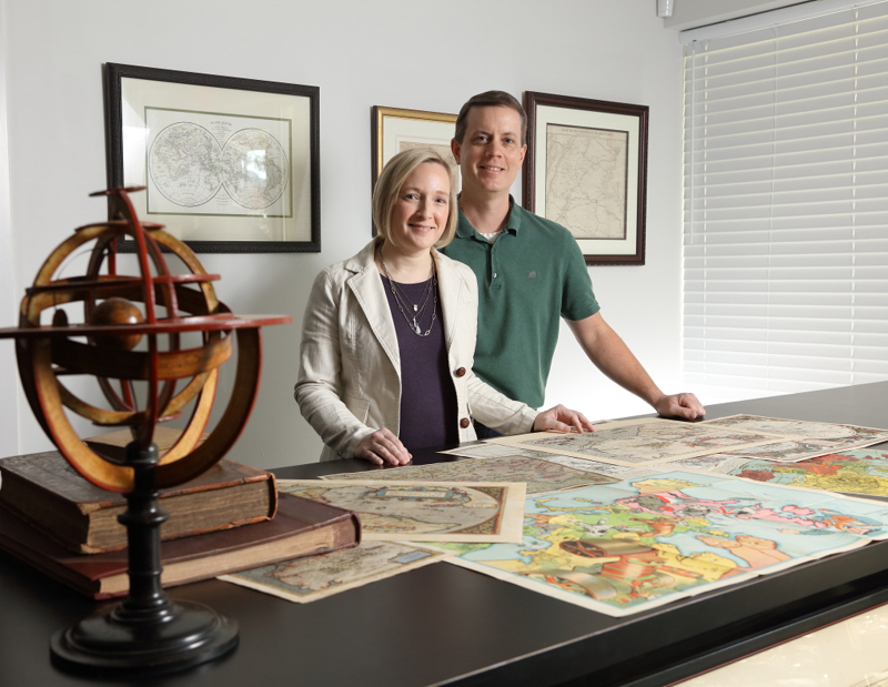
Have you ever wondered what it's like behind the scenes at Old World Auctions? Believe it or not, we are a small operation with only 3 full-time and 3 part-time employees. The five of us handle everything from cataloging, scanning, photography, packaging & shipping, invoicing, bookkeeping, website maintenance & enhancements, and marketing, to working with consignors, writing newsletter articles, answering the phone, attending map fairs, and a plethora of administrative tasks. Jon and Eliane Dotson were recently featured in a photo essay in The Darden Report, the publication of the Darden School of Business at the University of Virginia, the Dotsons' alma mater. Click here to view the article and take a sneak peak behind the scenes at OWA!