One of the most frequent questions that we receive from people not familiar with our line of business is "do you sell treasure maps?" While we have yet to encounter a true treasure map where "X" marks the spot, we do occasionally uncover mysterious gems while cataloging. Tucked away in the pages of antique books, atlases, and folding maps are artifacts left behind by previous owners. These extras can provide additional context to an item's intended purpose or simply offer the lucky finder a fun bonus. Over the last year we have been collecting these "treasures" and wanted to share a small sampling with you.
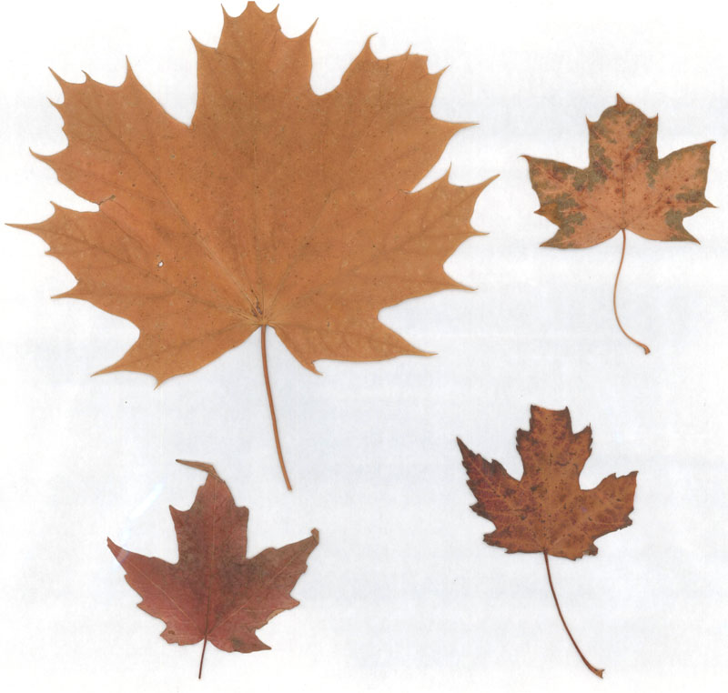
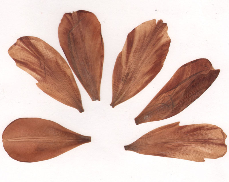
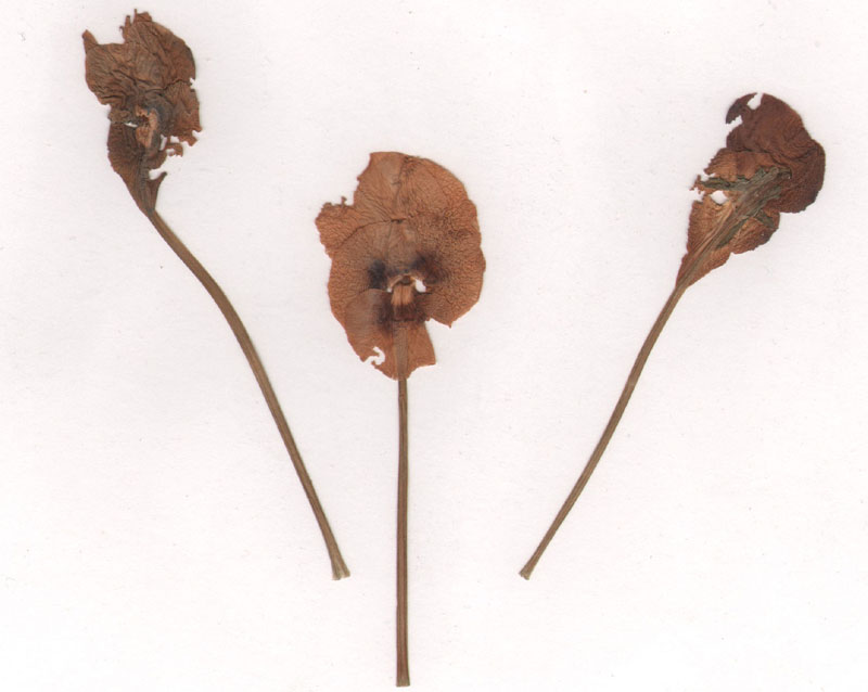
Pressed for Time - Pressed Plants/Flowers One of the more common items that we find in antique books is pressed plants and flowers. Collecting plants was a popular pastime in the mid to late 19th century, where flowers were a key design element. During this Victorian era, both men and women pressed leaves and flowers in books for a variety of reasons including household decorations, personal journals, and botanical scrapbooks. While a serious collector would likely use a field press to preserve specimens, an amateur hobbyist would typically press them between pages in a book. A few examples we have discovered include:
A set of maple leaves in Johnson's New Illustrated Family Atlas, circa 1861
Flowers in a Brookes' General Gazetteer published in 1796 and in Colton's General Atlas published in 1868.
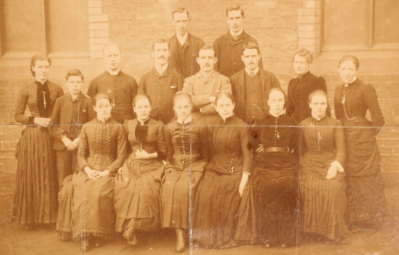
Say Cheese - Anonymous Photograph The photograph below was adhered to the front pastedown of William Chamber's Atlas of Modern and Ancient Geography. For Use in Schools, published in 1853. It captures a school group including teachers, a few students, and a clergyman in Victorian era attire, presumably somewhere in Britain given that Edinburgh is the publication city. The photograph is a bit of a mystery to us as there are no additional notations in the endpapers about it or a previous owner's signature. The only manuscript found in the atlas is on a blank page opposing the map of England & Wales listing various place names in what appears to be a student's hand. This is the first photograph that Eliane or I have encountered being pasted into an antique book.
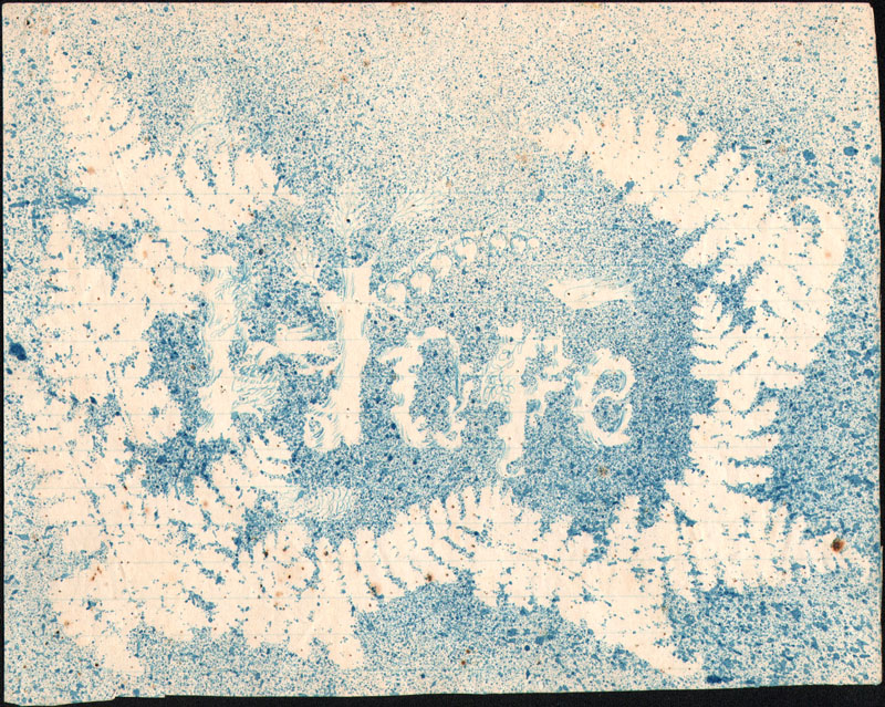
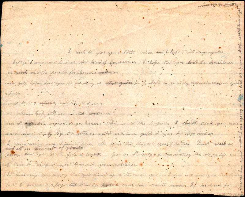
A Picture Is Worth a Thousand Words - Splatter Art & Poem This "splatter" art was discovered in a copy of David Burr's A New Universal Atlas, published circa 1835. The word "Hope" is revealed at center and is surrounded by ferns, with a small dove perched above the letter "p."
The verso contains a poem that is rather difficult to decipher, but the first few lines reveal the author is clearly new to verse and forces some rhymes:
"I wish to give you a little lecture and I hope it will do you good-er but as I am a new hand at that kind of business-er I hope you will be chorible-er [charitable?] as much as it is possible for humone netter [human nature?]. Now gole-keeper don't you be winking at that girl-er or I shall be entirely discouraged-er and give up-er."
The illustration/poem was composed on ruled paper with a thin blue line, and I initially assumed that this was a 20th century addition. To my surprise, however, ruled paper started appearing on the marked in the early 19th century, so its insertion date is "unclear-er."
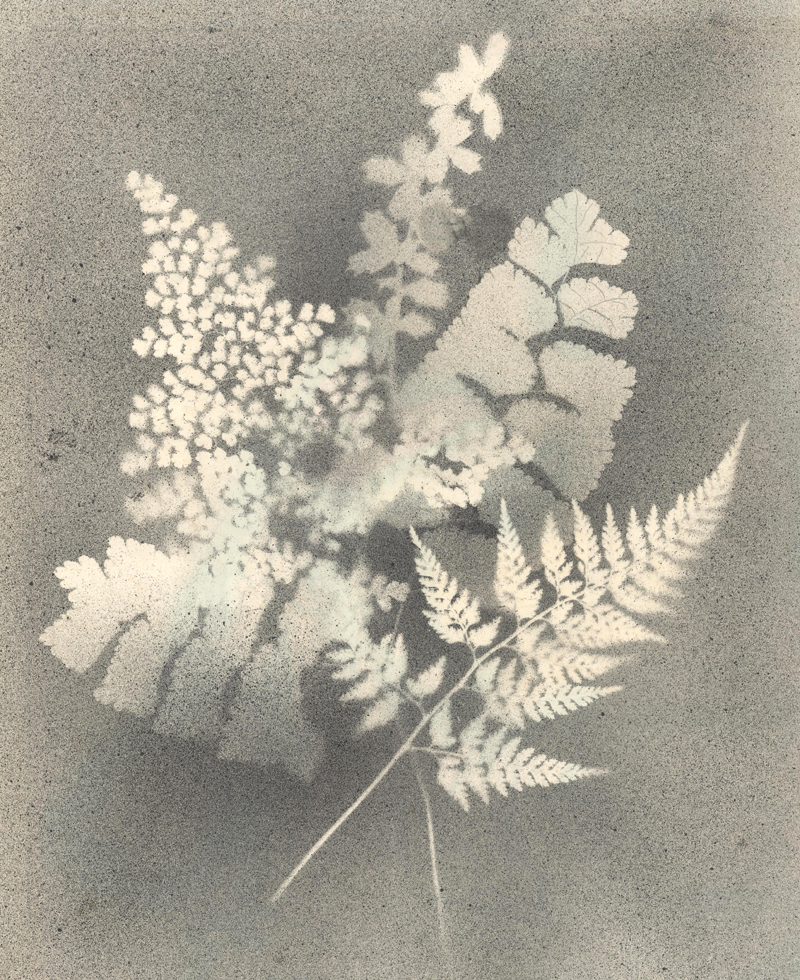
Another beautiful example of splatter art was recently discovered on the verso of a map of the eastern United States that was originally issued in Charles Smith's General Atlas. A variety of ferns were laid on the verso and paint was applied to the sheet, leaving a detailed outline. Somehow the map on recto was unaffected by this lovely illustration.
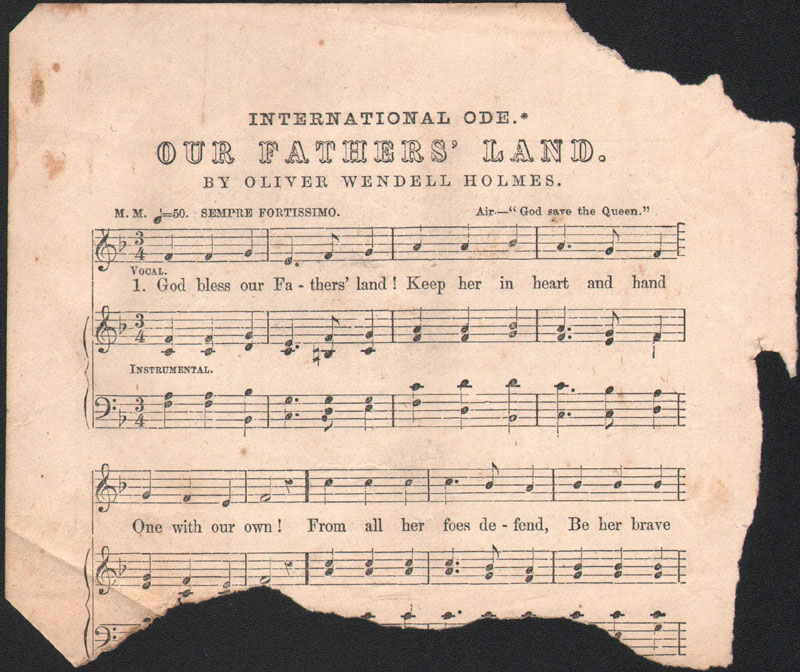
The Better Half - Half a Song Sheet This torn sheet likely became a bookmark in an example of D.W. Beadle's The American Lawyer, and Business-Man's Form Book for 1852. The obscure song is entitled "International Ode. Our Fathers' Land" and is based upon the tune to "God Save the Queen" (as well as "America"). It was written by the famous physician and writer, Oliver Holmes Sr.
The first verse, which would have been present on the full sheet, reads:
God bless our Fathers' Land! Keep her in heart and hand One with our own! From all her foes defend, Be her brave People's Friend, On all her realms descend, Protect her Throne!
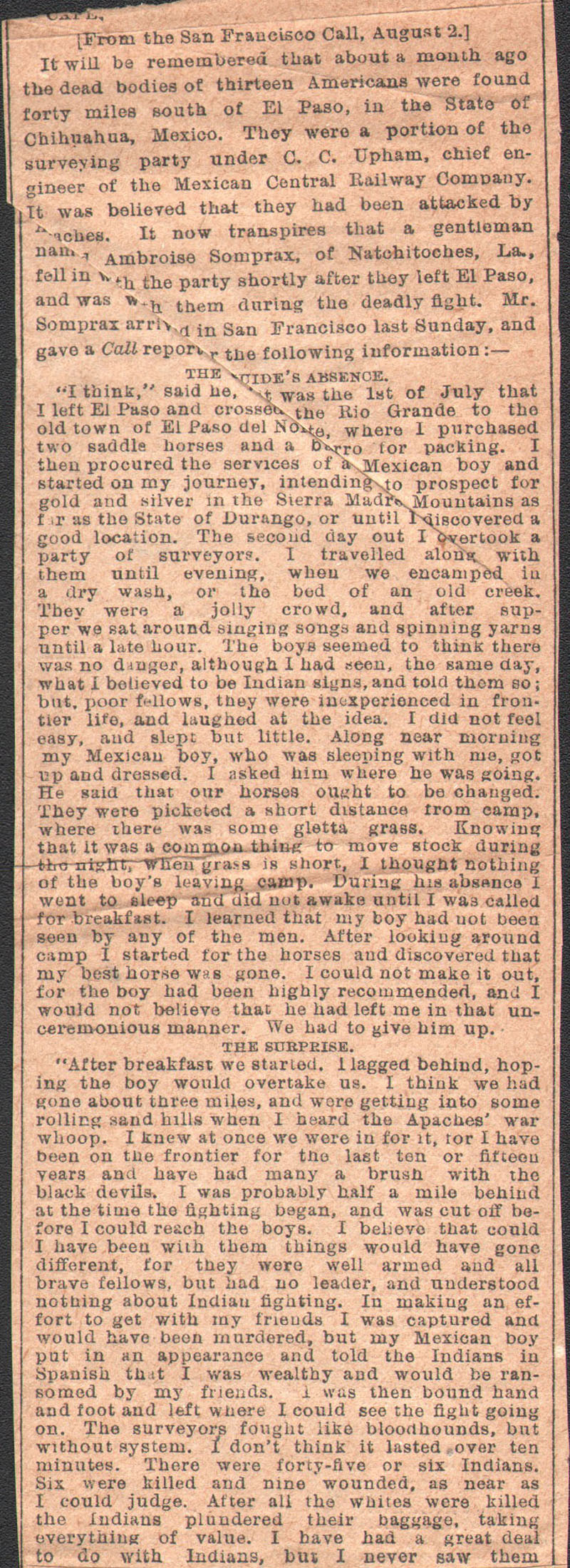
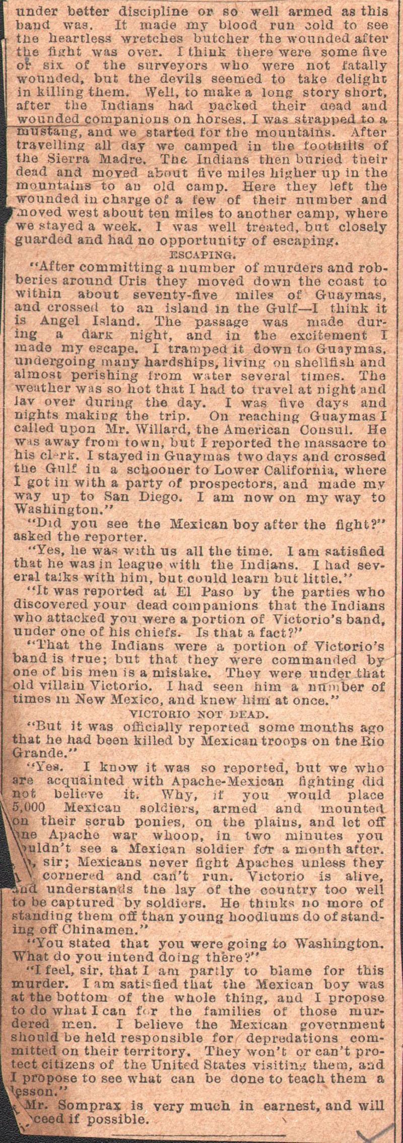
Before the Border Patrol - News Clipping, Indian Encounter This fascinating article was first issued in the San Francisco Call on August 2, 1881 and was picked up here by another unidentified newspaper. The account describes an encounter between an American party, consisting of a gold prospector and a surveying crew for the Mexican Central Railway (incorporated in Massachusetts in 1880), and a band of Apache Indians approximately 30 miles south of El Paso. The Apaches attacked the Americans, killing the entire 13-person surveying crew and stealing their supplies. The lone prospector, Ambroise Somprax of Natchitoches (LA), was spared as they believed he had hostage value. Somprax eventually escaped to California where he recounted his story to a reporter. The article ends with Somprax stating that he was headed to Washington "to see what can be done to teach them a lesson."
This clipping was found with the two southern sheets of a large western map entitled Map of the Territory of the United States, West of the Mississippi River that was published two years prior to the article (1879) by the U.S. Army. The map would certainly be useful in avoiding this hostile area of Chihuahua!
More to Come These little extras are not only entertaining in themselves, but help an object come to life. Personalization is timeless and can make a 200-year old artifact seem like it was handled just yesterday. So keep your eye out for hidden treasure, and please let us know if you find anything of interest. We will continue to collect samples over the coming months and hope to have a new entry in this series next year.
Collector's Cornerby Eliane Dotson
The "Collector's Corner" is a new, recurring segment that will highlight one collector's journey through map collecting in their own words.
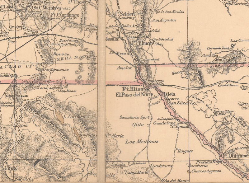
Dennis G. "Well I always liked maps. I was a Boy Scout and I used maps for hiking and things like that, but the real thing was when I was in Hawaii on vacation and I saw a map of Washington, DC, and it was well framed (over-framed actually) with a nice Hawaiian Koa wood. It was an 1845 map of Washington, so I said, 'I need that for the office so it looks like we've been here for a while' [we had just opened up an office in Spring Valley, which was inside the District of Columbia]. So that was the first one. And then a few years later I had a little more money and was on vacation in Hawaii and bought a Hondius 1650 map of Virginia, really gaudily framed in Koa wood. That was more expensive and I wanted to know what I had purchased (this was pre-Internet) so I actually got them to send me copies of books. And then there was a third map, but I forget what that is, but that means you have "old map pox" and you have to have all the maps that were ever done of Washington, D.C. In the beginning my collecting interest focused on Washington, DC. That was broadened out to DC, Virginia and Maryland, because DC didn't exist until 1792 so if you want old maps you've got to get Maryland and Virginia. Now I'm actually trying to cut it back to just Washington DC, so it's a very complete collection at this point. My favorite map is map #1 of Washington DC that was printed in 1792 in 'The Universal Asylum and Columbia Magazine' and it was the first printed plan of the city."
If you would like to share your story, please reply to this email explaining (in 200-500 words) how you first became interested in collecting maps, how you decided on your collecting interest, and what is your favorite map and why. Hopefully we will feature your collecting journey soon!