A Brief History of Surveying Tools in North Americaby Jon Dotson
The need for land surveys dates back to ancient times. According to William Gillespie’s Treatise on Land-Surveying, it “is perhaps the oldest of the mathematical arts. Indeed, Geometry itself, as its name ‘Land-measuring’ implies, is said to have arisen from the efforts of the Egyptian sages to recover and to fix the land-marks annually swept away by the inundations of the Nile” (p. xb). Throughout history, a vast array of tools were invented to engineer marvels like the Great Pyramids and Stonehenge, and to delineate pieces of land for ownership purposes. Although a variety of tools has been used over the centuries, the focus of this brief article is to provide a sampling of several instruments that were important in the development of surveying in the United States.
In colonial North America, there was tremendous demand for both surveyors and equipment as early settlements (especially in Virginia and Maryland) evolved into small communities. Boundaries needed to be established for land grants, villages, roads, and common property. Additionally, the coastal waters and the vast network of inland rivers, where most of these land grants were located, needed surveying. Complicating the situation was the fact that the American continent was completely wild and filled with dense virgin forests. According to Silvio Bedini’s Thinkers and Tinkers – Early American Men of Science, “Land had to be cleared for settlements and roadways and rivers opened up for navigation, and surveying required techniques and instruments quite different from those traditionally used in England where the majority of areas were open” (p. 52).
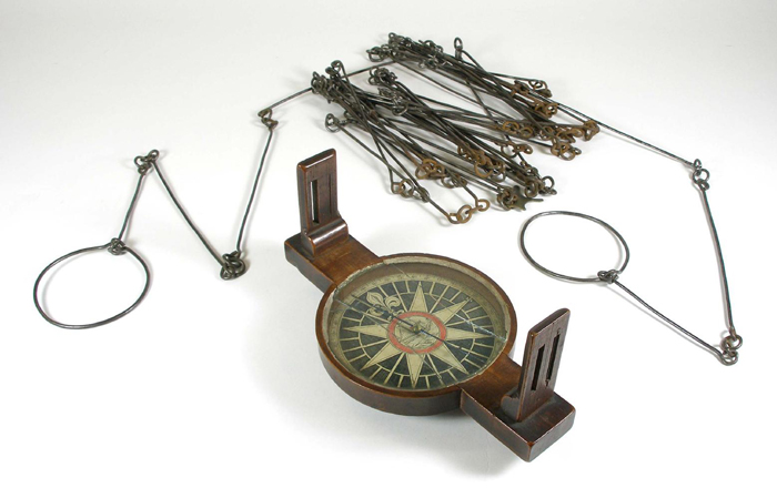
Many of the land grants in the colonies required the individual owner to stake their own property, which led to a host of errors in both location and measurement. Early on there was little text available to the untrained surveyor, but in 1688 John Love published the very popular Geodaesia: or, The Art of Surveying and Measuring Land Made Easier. He states in the preface, “I have seen Young men, in America, often nonplus'd so, that their Books would not help them forward, particularly in Carolina, about Laying out Lands, when a certain quantity of Acres has been given to be laid out five or six times as broad as long.” Love had surveyed in both North Carolina and Jamaica and took a practical, rather than scientific, approach to land surveying techniques. For the North American continent with its vast wooded regions, he recommended two tools: Gunter's chain and a surveyor's compass.
Gunter’s Chain & Surveyor’s Compass. Courtesy of the New Hampshire Historical Society
Gunter’s chain was developed in 1620 and consisted of 100 links, each measuring 7.92 inches, for a total of 66 feet of measurement. The chain included brass rings at every 10 links to facilitate partial measurements. In practice, the chain is stretched out along a defined path and secured to the ground with steel pins. The measurement is then recorded and the process is repeated until the surveyor reaches the final endpoint.
The surveyor’s compass, also known as the circumferentor, was a tool used to measure horizontal angles. The compass consists of a circular box housing a magnetic needle floating above a compass marking 360 degrees. A wooden arm extends from the compass and includes sights located at north and south. By sighting two points from the same location, a surveyor could determine the interior angle. This approach was commonly used for establishing the corner boundaries of a given parcel.
During the majority of the 18th century, the surveyor’s toolset did not change significantly. George Washington, who had considerable training and experience surveying Lord Fairfax’s property and the western frontier of Virginia, owned a surveying compass, a Jacob's staff (essentially a tripod), and set of chains and poles. It was not until the conclusion of the Revolutionary War that significant advances in surveying were developed, no doubt in large part to formal establishment of the new United States and the need to finalize its borders.
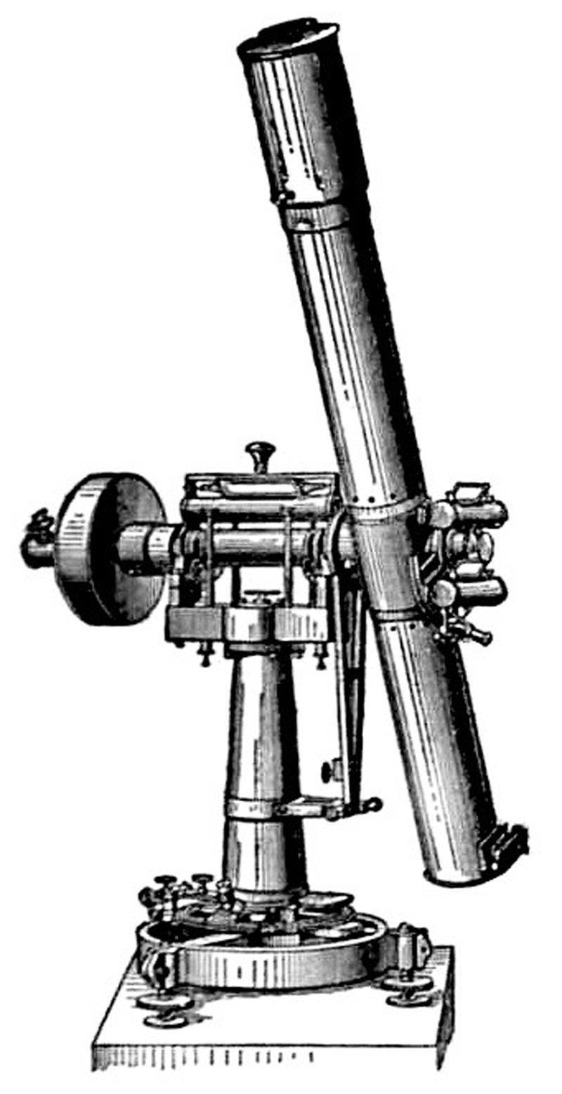
Leading the charge was Andrew Ellicott, who participated in many important surveys of the time including the southern boundary of the United States and the western boundary of Pennsylvania. This later survey was of particular importance as it was the beginning point of the Public Land Survey System, where land west of the Pennsylvania/Ohio border was systematically divided into square townships. Ellicott employed several sophisticated tools in the process, but none were more important than the zenith telescope, which “was the most accurate and sophisticated scientific instrument on the North American continent in that period, and the only instrument then known having sufficient accuracy to trace a parallel of latitude” (Bedini, p. 323).
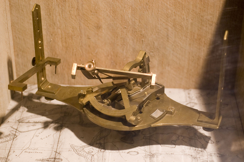
Bedini explains that this instrument was “used to determine the parallels of latitude by observing six or seven stars near the zenith as they crossed the meridian at different hours of the night” (p. 324). Among the many other tools utilized by Elicott were pole chains, an astronomical clock for accurate timing, and three sextants which were used to determine the position of stars.
Zenith Telescope constructed by Hermann Wanschaff, Berlin. Courtesy of Wikimedia Commons
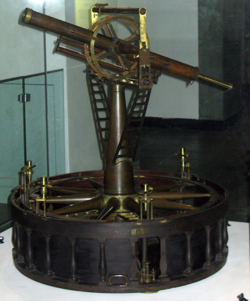
It is worth noting that several other important and accurate instruments were produced during this time period (primarily in Europe), including Jesse Ramsden’s great theodolites, which were used in the Principal Triangulation of Great Britain. However, the size, weight and cost of these instruments made them impractical for field surveys in the young United States.
Ramsden’s theodolite used during the Principal Triangulation of Great Britain. Courtesy of Wikimedia Commons
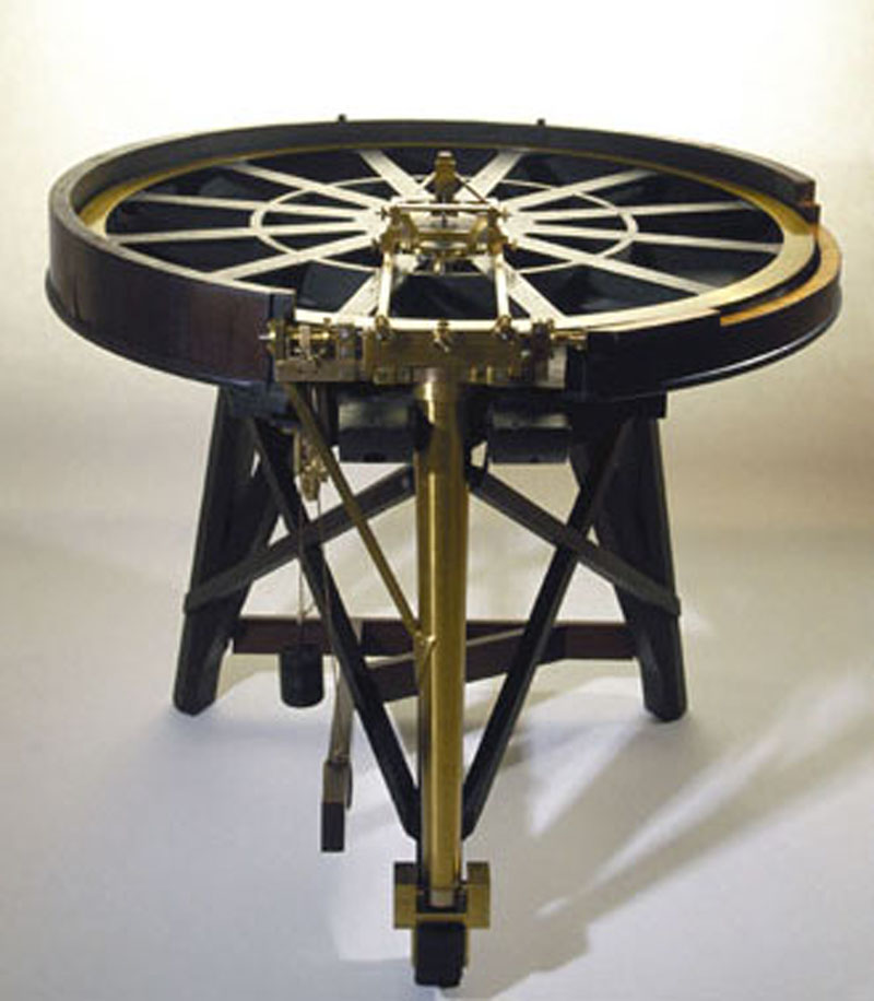
Dividing Engine by John Troughton, similar to Ramsden’s first engine. Courtesy of The Science Museum, UK
At the beginning of the 19th century, with Jefferson’s authorization, the Army Corp of Engineers was established. This highly trained group was responsible for surveying the new territory in the West and required precision tools to provide accurate surveying and mapping. This demand was made possible by the dividing machine, which was invented by Ramsden in the 1770’s, but was not widely available in the United States until the early 19th century. A dividing engine is a device that marks graduations, or indicators of measurement, on various mathematical instruments. By shifting from hand “dividing” to mechanized markings, the accuracy of surveying equipment improved drastically. This process started out only on small pieces of equipment, but by the middle of the 19th century, even the large astronomical telescopes were scaled with dividing machines.
William Burt Solar Compass. Courtesy of Wikimedia Commons
One final piece of equipment that had a significant impact on surveying public lands and the rich mineral sources within was the solar compass. Invented by United States Deputy Surveyor William Austin Burt in 1836, it “was designed to overcome the difficulties experienced with magnetic declination in areas where iron deposits were prevalent. The solar compass…[had] a solar apparatus which enabled the surveyor to determine the meridian from the declination of the sun instead of by means of the magnetic needle” (Bedini, p. 371). Burt’s invention received a medal at the Crystal Palace Exhibition in 1851 and was also responsible for locating the Calumet and Hecla Mine in the upper peninsula of Michigan, which became one of the largest copper producing mines of its time.
In today’s world of GPS and 3-D scanning, these tools might seem insignificant. But these instruments and their dedicated surveyors played an invaluable role in the development of today’s boundaries and the establishment of land ownership in the United States. Without them, the country’s extensive infrastructure, resource management, and western settlement would not have been possible.
References:
Bedini, Silvio, Thinkers and Tinkers – Early American Men of Science, Charles Scribner’s Sons, New York, 1975.
Delaney, John, Nova Caesarea, Princeton University Library, Princeton, New Jersey, 2014.
Gillespie, William, Treatise on Land-Surveying, D. Appleton & Co., New York, 1865. Available on Google Books.
L’Estrage Turner, Gerard, Scientific Instruments, 1500-1900: An Introduction, University of California Press, Oakland, California, 1998.
Love, John, Geodaesia: or, The Art of Surveying and Measuring Land Made Easier, John Taylor, London, 1688. Available on Google Books.
“Surveying”, George Washington’s Mount Vernon website, Mount Vernon Ladies’ Association. < http://www.mountvernon.org/research-collections/digital-encyclopedia/article/surveying/> (accessed August 3, 2015)