Catalog Archive
191 lots
Page 1 of 4
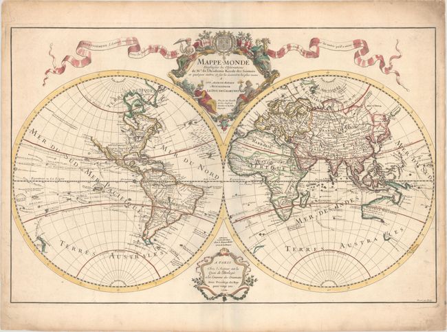
Auction 197, Lot 9
Subject: World
Delisle, Guillaume
Mappe-Monde Dressee sur les Observations de Mrs. de l'Academie Royale des Sciences et Quelques Autres et sur les Memoires les Plus Recens..., 1700
Size: 26 x 16.9 inches (66 x 42.9 cm)
Estimate: $1,000 - $1,300
Unsold
Closed on 4/24/2024
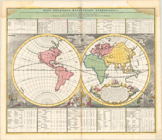
Auction 197, Lot 10
Subject: World
Doppelmayr/Homann
Basis Geographiae Recentioris Astronomica in qua Situs Locorum Insigniorum Geographici ea Exactitudine, qua Celeberrimi Astronomi Eosdem per Observationes..., 1720
Size: 22.8 x 19.1 inches (57.9 x 48.5 cm)
Estimate: $550 - $700
Price reduced by $50
Unsold
Closed on 4/24/2024
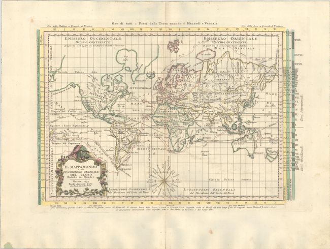
Auction 197, Lot 12
Subject: World
Zatta, Antonio
Il Mappamondo o sia Descrizione Generale del Globo Ridotto in Quadro, 1774
Size: 16 x 10.7 inches (40.6 x 27.2 cm)
Estimate: $475 - $600
Unsold
Closed on 4/24/2024
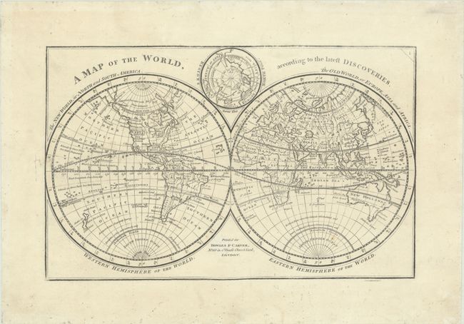
Auction 197, Lot 14
Subject: World
Bowles & Carver
A Map of the World, According to the Latest Discoveries, 1785
Size: 11.1 x 7 inches (28.2 x 17.8 cm)
Estimate: $325 - $400
Price reduced by $45
Unsold
Closed on 4/24/2024
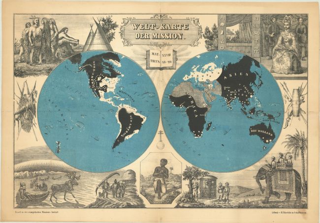
Auction 197, Lot 19
Subject: World
Welt-Karte der Mission, 1850
Size: 18.1 x 12 inches (46 x 30.5 cm)
Estimate: $325 - $400
Price reduced by $100
Unsold
Closed on 4/24/2024
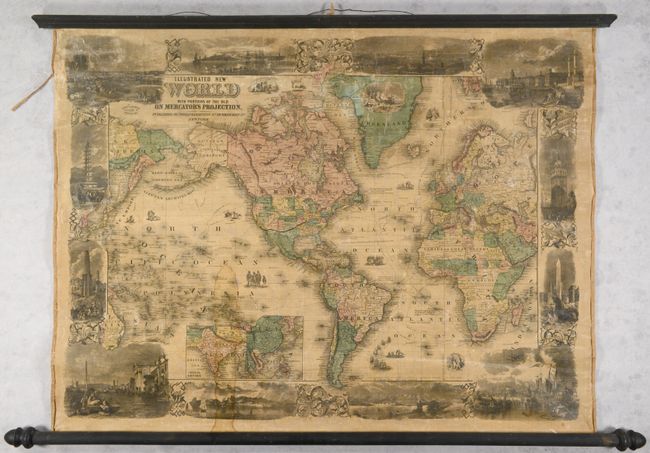
Auction 197, Lot 21
Subject: World
Phelps & Watson
Illustrated New World with Portions of the Old on Mercator's Projection, 1860
Size: 34.4 x 25.6 inches (87.4 x 65 cm)
Estimate: $1,400 - $1,700
Price reduced by $150
Unsold
Closed on 4/24/2024
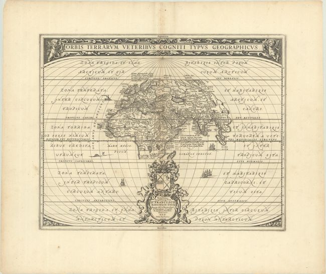
Auction 197, Lot 26
Subject: Ancient World
Jansson, Jan
Orbis Terrarum Veteribus Cogniti Typus Geographicus, 1680
Size: 19.9 x 15.9 inches (50.5 x 40.4 cm)
Estimate: $400 - $475
Price reduced by $50
Unsold
Closed on 4/24/2024
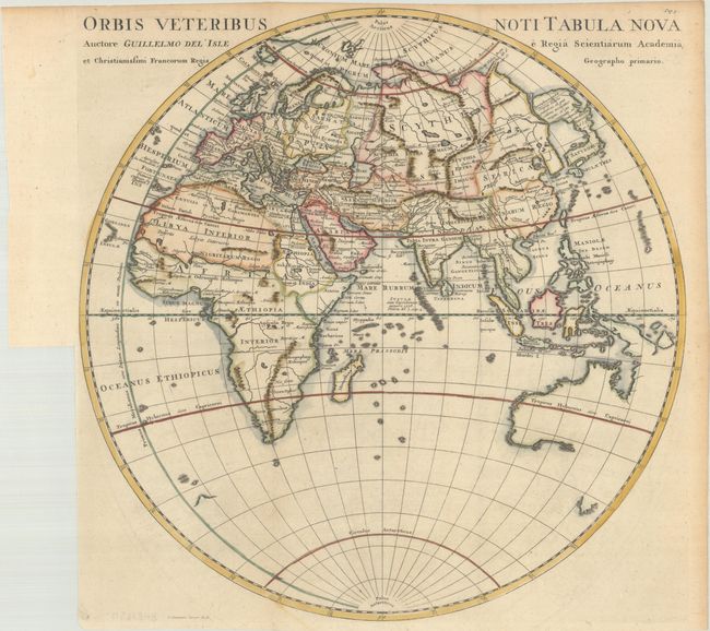
Auction 197, Lot 30
Subject: Eastern Hemisphere
Cluver, Philipp
Orbis Veteribus Noti Tabula Nova Auctore Guillelmo del' Isle..., 1729
Size: 15 x 15.1 inches (38.1 x 38.4 cm)
Estimate: $200 - $230
Unsold
Closed on 4/24/2024
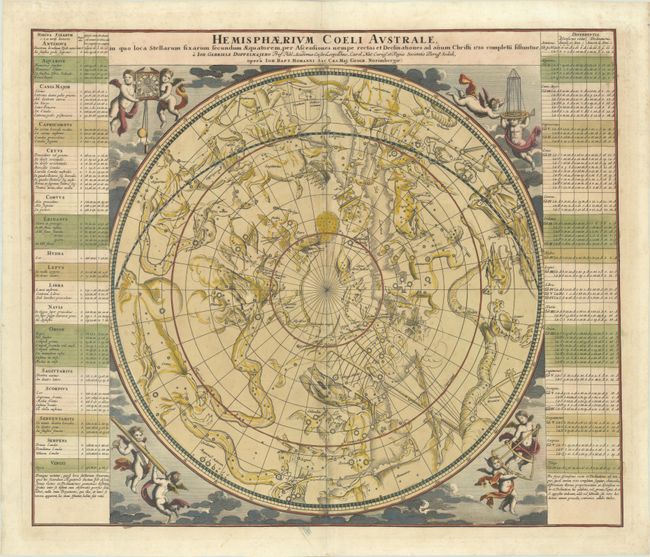
Auction 197, Lot 36
Subject: Celestial
Doppelmayr/Homann
Hemisphaerium Coeli Australe, in quo Loca Stellarum Fixarum Secundum Aequatorem, per Ascensiones Nempe Rectas et Declinationes ad Anum Christi 1730..., 1742
Size: 22.6 x 19.1 inches (57.4 x 48.5 cm)
Estimate: $900 - $1,100
Unsold
Closed on 4/24/2024
Auction 197, Lot 37
Subject: Celestial Atlas
Goldbach, Christian Friedrich
Neuester Himmels-Atlas zum Gebrauche sur Schul- und Akademischen Unterricht, nach Flamsteed, Bradley, Tob. Mayer, De la Caille, Le Francais de la Lande und v. Zach..., 1803
Size: 11.5 x 10 inches (29.2 x 25.4 cm)
Estimate: $2,000 - $2,400
Unique Celestial Atlas with Stars in Relief Against a Black Sky
Unsold
Closed on 4/24/2024
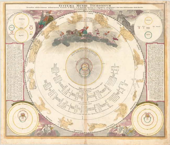
Auction 197, Lot 39
Subject: Solar System
Doppelmayr/Homann
Systema Mundi Tychonicum Secundum Celeberrimorum Astronomorum Tychonis de Brahe et Io. Baptistae Riccioli..., 1742
Size: 22.6 x 19.1 inches (57.4 x 48.5 cm)
Estimate: $400 - $475
Unsold
Closed on 4/24/2024
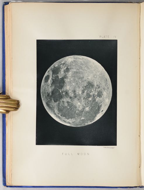
Auction 197, Lot 41
Subject: Moon
The Moon: Considered as a Planet, a World, and a Satellite, 1885
Size: 6.6 x 9.3 inches (16.8 x 23.6 cm)
Estimate: $1,000 - $1,300
Price reduced by $50 - Selenology with 25 Woodburytypes
Unsold
Closed on 4/24/2024
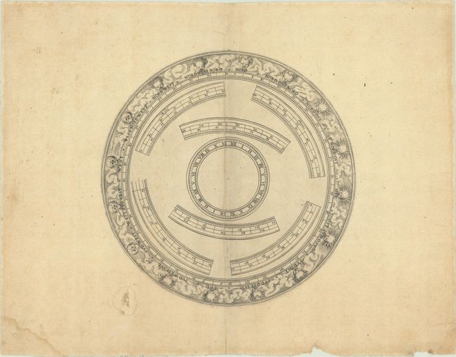
Auction 197, Lot 42
Subject: Cartographic Miscellany, Globe
Anon.
[Globe Horizon Ring], 1750
Size: 8.6 x 8.6 inches (21.8 x 21.8 cm)
Estimate: $325 - $400
Unsold
Closed on 4/24/2024
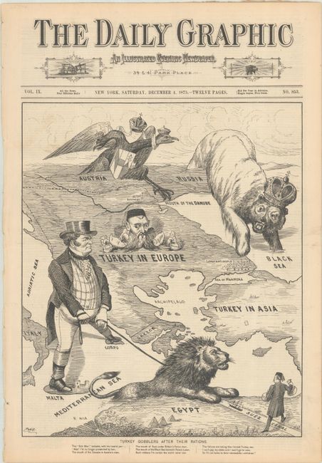
Auction 197, Lot 47
Subject: Cartographic Miscellany, Ottoman Empire
Daily Graphic
Turkey Gobblers After Their Rations, 1875
Size: 12.4 x 14.8 inches (31.5 x 37.6 cm)
Estimate: $500 - $700
Price reduced by $100! 12-Page Issue with Satiric Image of Great Eastern Crisis
Unsold
Closed on 4/24/2024

Auction 197, Lot 50
Subject: Cartographic Miscellany, Literary Map
The Ian Fleming Thriller Map, 1987
Size: 27.1 x 20.6 inches (68.8 x 52.3 cm)
Estimate: $140 - $170
Price reduced by $15
Unsold
Closed on 4/24/2024

Auction 197, Lot 51
Subject: Cartographic Miscellany, Technology
The Ultimate PC [on verso] The Ultimate Specs, 1995
Size: 24.8 x 37.5 inches (63 x 95.3 cm)
Estimate: $1,000 - $1,300
Price reduced by $100! Scarce Map of the Inner Workings of a PC
Unsold
Closed on 4/24/2024
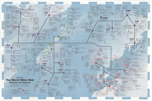
Auction 197, Lot 52
Subject: Cartographic Miscellany, Internet
Road Map to the World Wide Web - The World Wide Web Business and Beyond, 1995
Size: 36.5 x 24 inches (92.7 x 61 cm)
Estimate: $2,000 - $2,300
Price reduced by $100! Scarce Map of the Early World Wide Web
Unsold
Closed on 4/24/2024
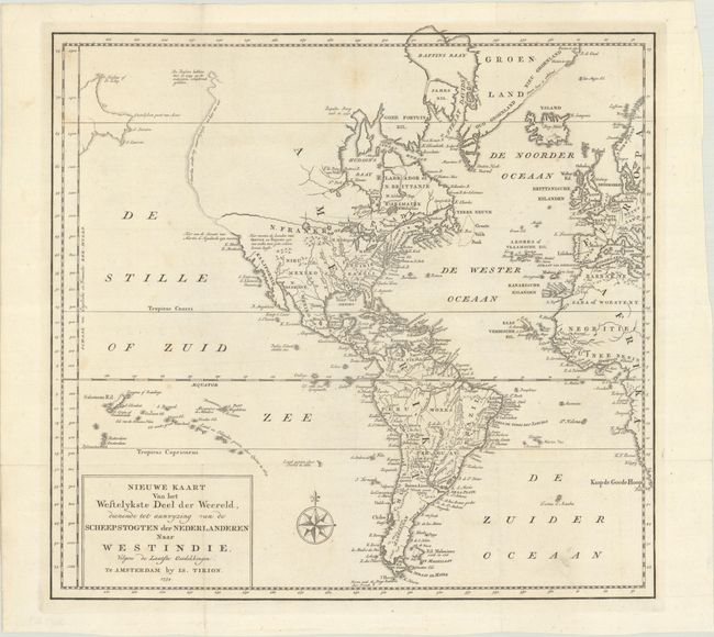
Auction 197, Lot 58
Subject: Western Hemisphere - America
Tirion, Isaac
Nieuwe Kaart van het Wesetlykste Deel der Weereld, Dienende tot Aanwyzing van de Scheepstogten der Nederlanderen naar Westindie…, 1754
Size: 14.2 x 13.5 inches (36.1 x 34.3 cm)
Estimate: $180 - $220
Unsold
Closed on 4/24/2024
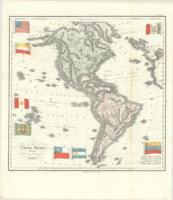
Auction 197, Lot 66
Subject: Western Hemisphere - America
Marmocchi, Francesco
Il Nuovo Mondo Diviso Nelle sue Principali Contrade, 1838
Size: 20.1 x 19.8 inches (51.1 x 50.3 cm)
Estimate: $400 - $475
Price reduced by $50
Unsold
Closed on 4/24/2024
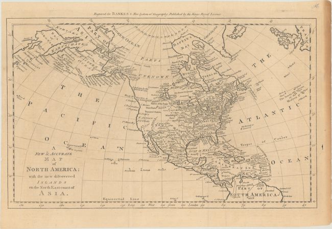
Auction 197, Lot 74
Subject: North America
Bowen, Thomas
A New & Accurate Map of North America; with the New Discovered Islands on the North East Coast of Asia, 1787
Size: 17.1 x 10.6 inches (43.4 x 26.9 cm)
Estimate: $275 - $350
Price reduced by $25
Unsold
Closed on 4/24/2024
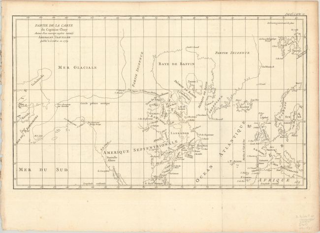
Auction 197, Lot 95
Subject: Colonial United States & Canada, Arctic
Robert de Vaugondy, Didier
Partie de la Carte du Capitaine Cluny Auteur d'un Ouvrage Anglois Intitule American Traveller Publie a Londres en 1769, 1773
Size: 19.6 x 11.6 inches (49.8 x 29.5 cm)
Estimate: $120 - $150
Price reduced by $30
Unsold
Closed on 4/24/2024
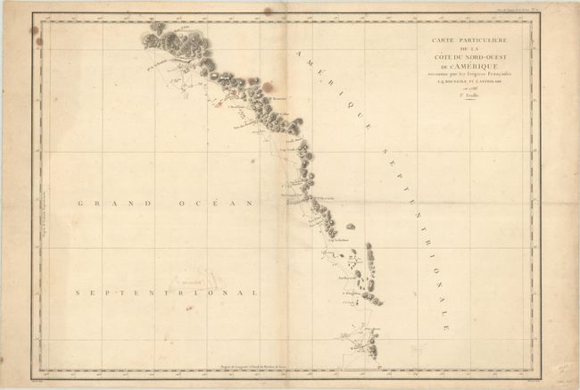
Auction 197, Lot 107
Subject: Western United States & Canada, Alaska
La Perouse, Comte Jean F. Galoup, de
[Lot of 2] Carte Particuliere de la Cote du Nord-Ouest de l'Amerique Reconnue par les Fregates Francaises la Boussole et l'Astrolabe en 1786. 1e Feuille [and] ... 2e Feuille, 1797
Size: 27.1 x 19.5 inches (68.8 x 49.5 cm)
Estimate: $300 - $375
Price reduced by $45
Unsold
Closed on 4/24/2024
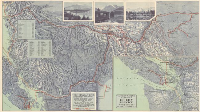
Auction 197, Lot 110
Subject: Northwestern United States & Canada
Railroad Companies, (Various)
The Triangle Tour of British Columbia - Jasper National Park Mount Robson Park Canadian Rockies and the Scenic Seas of the North Pacific Coast [on verso] Alaska and the Yukon, 1930
Size: 29.8 x 16.8 inches (75.7 x 42.7 cm)
Estimate: $150 - $180
Price reduced by $30
Unsold
Closed on 4/24/2024
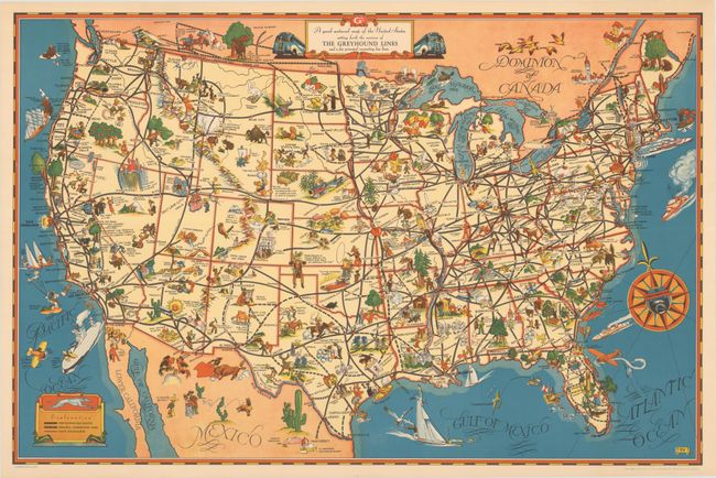
Auction 197, Lot 126
Subject: United States
A Good-Natured Map of the United States Setting Forth the Services of the Greyhound Lines and a Few Principal Connecting Bus Lines, 1939
Size: 29 x 19.1 inches (73.7 x 48.5 cm)
Estimate: $160 - $190
Price reduced by $45
Unsold
Closed on 4/24/2024
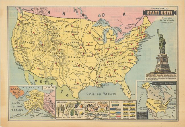
Auction 197, Lot 131
Subject: United States
Stati Uniti - Grande Atlante dei Paesi d'America Seconda Tavola, 1958
Size: 21 x 14.3 inches (53.3 x 36.3 cm)
Estimate: $120 - $150
Unsold
Closed on 4/24/2024
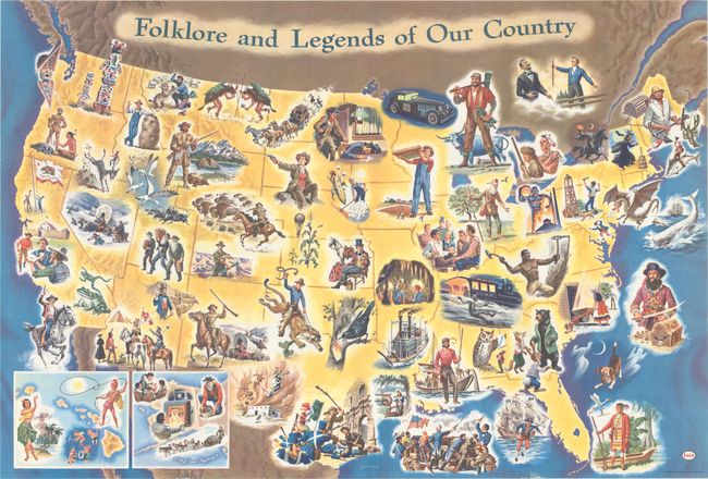
Auction 197, Lot 132
Subject: United States
Folklore and Legends of Our Country, 1960
Size: 35.5 x 24 inches (90.2 x 61 cm)
Estimate: $160 - $190
Price reduced by $30
Unsold
Closed on 4/24/2024
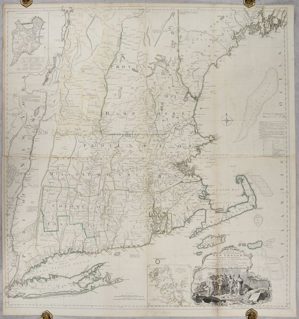
Auction 197, Lot 145
Subject: Colonial New England United States
Jefferys, Thomas
A Map of the Most Inhabited Part of New England, Containing the Provinces of Massachusets Bay and New Hampshire, with the Colonies of Conecticut and Rhode Island..., 1755
Size: 39.1 x 40.8 inches (99.3 x 103.6 cm)
Estimate: $4,750 - $6,000
Rare State of Jefferys' Influential Map of New England in Contemporary Color
Unsold
Closed on 4/24/2024
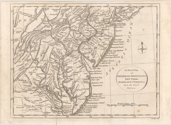
Auction 197, Lot 150
Subject: Colonial Mid-Atlantic United States
Lodge, John
An Exact Map of New Jersey, Pensylvania, New York, Maryland & Virginia, from the Latest Surveys, 1777
Size: 9.8 x 7.6 inches (24.9 x 19.3 cm)
Estimate: $400 - $475
Price reduced by $25
Unsold
Closed on 4/24/2024
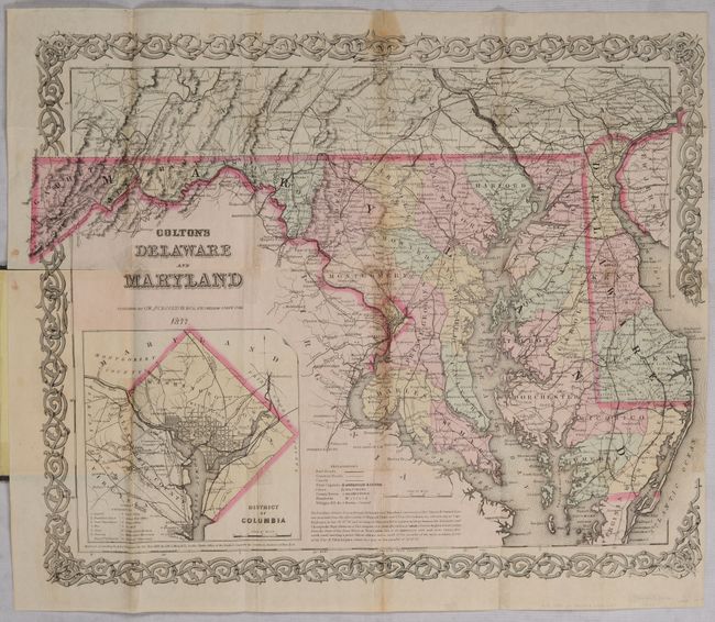
Auction 197, Lot 153
Subject: Delaware & Maryland
Colton, G.W. & C.B.
Colton's Delaware and Maryland, 1877
Size: 15.9 x 12.9 inches (40.4 x 32.8 cm)
Estimate: $100 - $130
Price reduced by $15
Unsold
Closed on 4/24/2024
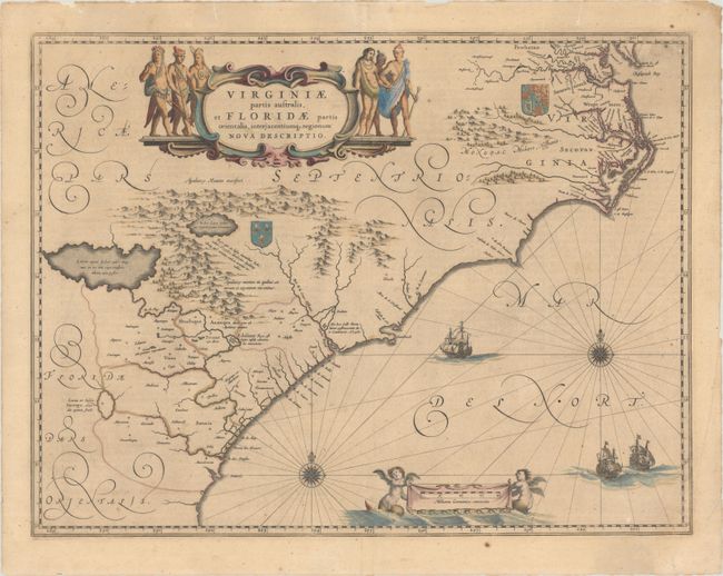
Auction 197, Lot 154
Subject: Colonial Southeastern United States
Blaeu, Willem
Virginiae Partis Australis, et Floridae Partis Orientalis, Interjacentiumq Regionum Nova Descriptio, 1647
Size: 20 x 15.3 inches (50.8 x 38.9 cm)
Estimate: $1,000 - $1,300
Blaeu's Decorative Map of the Southeast in Contemporary Color
Unsold
Closed on 4/24/2024
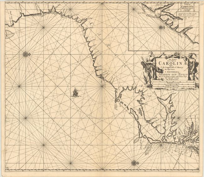
Auction 197, Lot 155
Subject: Colonial Southeastern United States
Keulen, Johannes van
Pas Kaart van de Kust van Carolina Tusschen C de Canaveral en C Henry, 1702
Size: 23 x 20.3 inches (58.4 x 51.6 cm)
Estimate: $2,400 - $3,000
Dutch Chart of the Carolinas
Unsold
Closed on 4/24/2024
Auction 197, Lot 157
Subject: Southeastern United States
Bartram, William
Travels Through North & South Carolina, Georgia, East & West Florida, the Cherokee Country, the Extensive Territories of the Muscogulges, or Creek Confederacy, and the Country of the Chactaws..., 1791
Size: 5.9 x 9.8 inches (15 x 24.9 cm)
Estimate: $10,000 - $12,000
Price reduced by $750! Complete First Edition of Bartram's Work on the American Southeast
Unsold
Closed on 4/24/2024
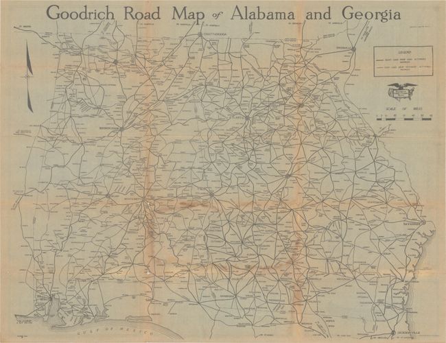
Auction 197, Lot 159
Subject: Georgia & Alabama
Goodrich Road Map of Alabama and Georgia, 1920
Size: 23.3 x 18.3 inches (59.2 x 46.5 cm)
Estimate: $140 - $170
Price reduced by $50
Unsold
Closed on 4/24/2024
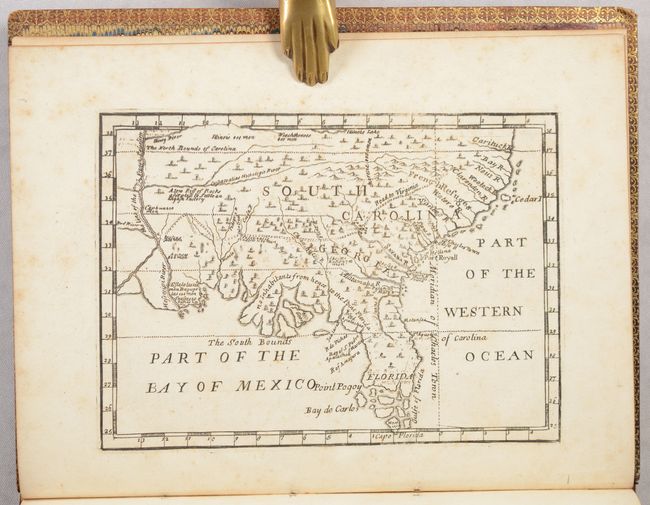
Auction 197, Lot 162
Subject: Colonial Southern United States
[Map in Book] [New Map of Georgia] [in] Reasons for Establishing the Colony of Georgia, with Regard to the Trade of Great Britain..., 1733
Size: 7.3 x 5.3 inches (18.5 x 13.5 cm)
Estimate: $5,500 - $6,500
First Printed Map to Name Georgia
Unsold
Closed on 4/24/2024
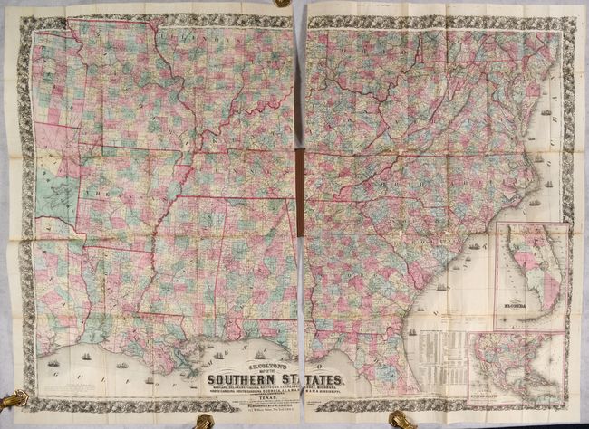
Auction 197, Lot 166
Subject: Southern United States, Civil War
Colton, Joseph Hutchins
J.H. Colton's Map of the Southern States. Maryland, Delaware, Virginia, Kentucky, Tennessee, Missouri, North Carolina, South Carolina, Georgia, Alabama, Mississippi, Arkansas, Louisiana and Texas..., 1864
Size: 52.7 x 38 inches (133.9 x 96.5 cm)
Estimate: $2,500 - $3,250
Price reduced by $100! Large-Scale Map of the South Issued During the Civil War
Unsold
Closed on 4/24/2024
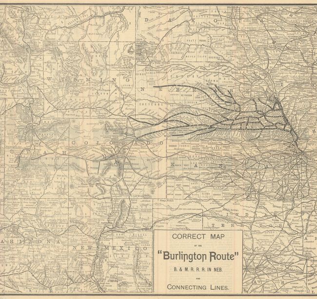
Auction 197, Lot 185
Subject: Western United States
Railroad Companies, (Various)
Correct Map of the "Burlington Route" B. & M. R. R. R. in Neb. and Connecting Lines, 1888
Size: 26.6 x 13.3 inches (67.6 x 33.8 cm)
Estimate: $160 - $190
Price reduced by $35
Unsold
Closed on 4/24/2024
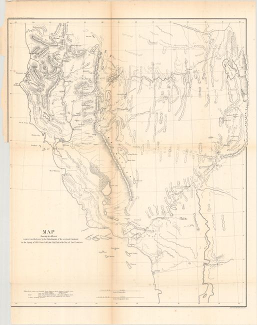
Auction 197, Lot 192
Subject: Southwestern United States
U.S. Army
Map Showing the Different Routes Travelled Over by the Detachments of the Overland Command in the Spring of 1855 from Salt Lake City, Utah to the Bay of San Francisco, 1856
Size: 18.8 x 22.3 inches (47.8 x 56.6 cm)
Estimate: $160 - $190
Price reduced by $35
Unsold
Closed on 4/24/2024
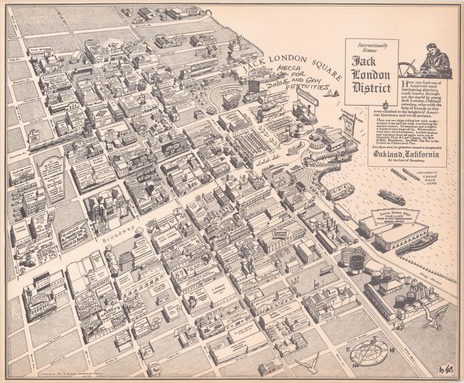
Auction 197, Lot 202
Subject: Oakland, California
Internationally Famous Jack London District, 1952
Size: 18.5 x 15.4 inches (47 x 39.1 cm)
Estimate: $160 - $190
Price reduced by $40
Unsold
Closed on 4/24/2024
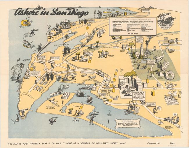
Auction 197, Lot 208
Subject: San Diego, California
Ashore in San Diego, 1943
Size: 20.9 x 16.1 inches (53.1 x 40.9 cm)
Estimate: $350 - $425
Unsold
Closed on 4/24/2024
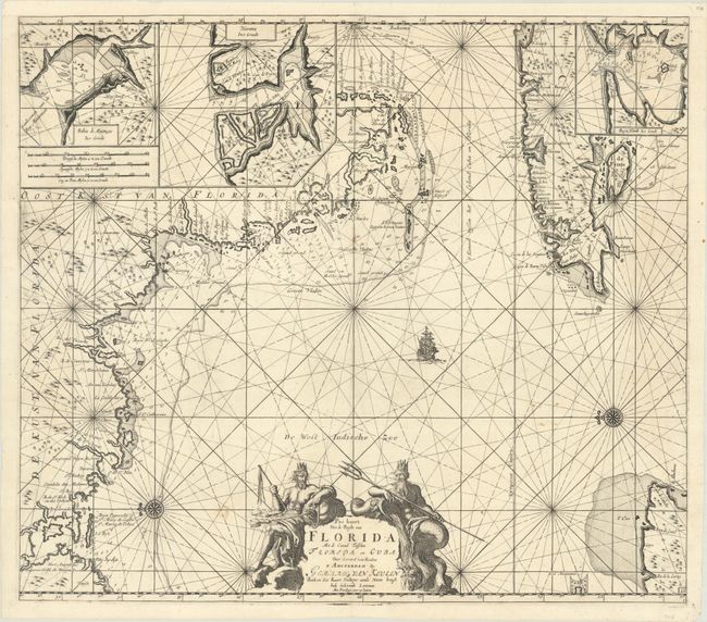
Auction 197, Lot 226
Subject: Western Florida & Cuba
Keulen, Gerard van
Pas Kaart van de Boght van Florida met de Canaal Tusschen Florida en Cuba , 1734
Size: 22.8 x 20.1 inches (57.9 x 51.1 cm)
Estimate: $2,400 - $3,000
Price reduced by $200! One of the First Charts of the Florida Gulf Coast
Unsold
Closed on 4/24/2024
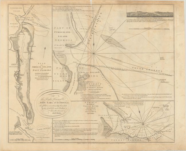
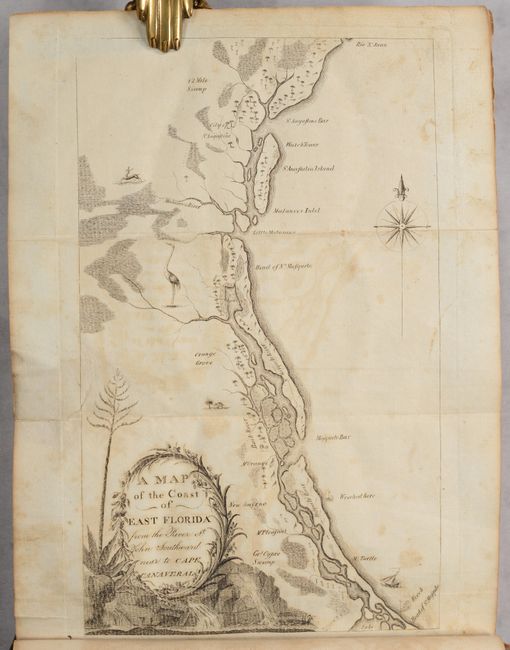
Auction 197, Lot 228
Subject: Amelia Island, Florida
Jefferys, Thomas
A Chart of the Entrance into St. Mary's River Taken by Captn. W. Fuller in November 1769 [on sheet with] Plan of Amelia Island in East Florida [and] A Chart of the Mouth of Nassau River... , 1770
Size: 24.1 x 20 inches (61.2 x 50.8 cm)
Estimate: $3,000 - $3,750
Important Charts Detailing Amelia Island and Surrounding Rivers
Unsold
Closed on 4/24/2024
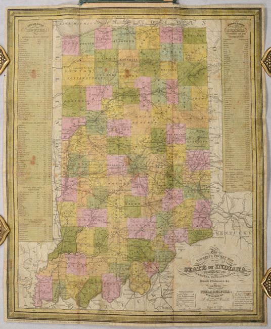
Auction 197, Lot 238
Subject: Indiana
Mitchell/Young
The Tourist's Pocket Map of the State of Indiana Exhibiting Its Internal Improvements Roads Distances &c., 1837
Size: 12.5 x 15.1 inches (31.8 x 38.4 cm)
Estimate: $300 - $375
Price reduced by $35
Unsold
Closed on 4/24/2024
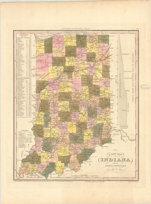
Auction 197, Lot 239
Subject: Indiana
Tanner, Henry Schenck
A New Map of Indiana with Its Roads & Distances, 1841
Size: 10.8 x 12.9 inches (27.4 x 32.8 cm)
Estimate: $110 - $140
Unsold
Closed on 4/24/2024
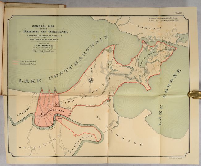
Auction 197, Lot 246
Subject: New Orleans, Louisiana
[4 Maps in Report] Report on the Drainage of the City of New Orleans..., 1895
Size: 7.2 x 10.3 inches (18.3 x 26.2 cm)
Estimate: $140 - $170
Price reduced by $40
Unsold
Closed on 4/24/2024
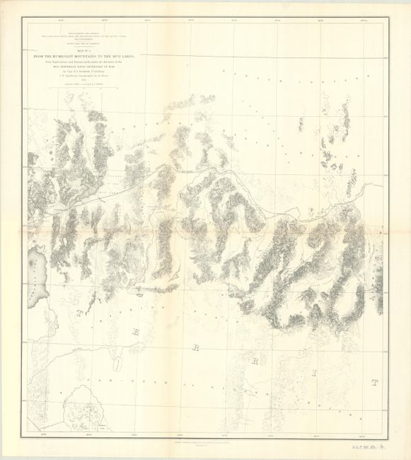
Auction 197, Lot 260
Subject: Nevada
Beckwith, E. G., Capt.
Map No. 3 From the Humboldt Mountains to the Mud Lakes, from Explorations and Surveys Made Under the Direction of the Hon. Jefferson Davis Secretary of War, 1855
Size: 18.1 x 20.8 inches (46 x 52.8 cm)
Estimate: $100 - $130
Unsold
Closed on 4/24/2024
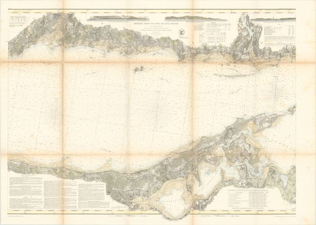
Auction 197, Lot 268
Subject: Long Island, New York
U.S. Coast Survey
[Lot of 2] Middle Part of Long Island Sound from a Trigonometrical Survey... [and] Eastern Part of Long Island Sound..., 1855
Size: 35.2 x 25.8 inches (89.4 x 65.5 cm)
Estimate: $275 - $350
Price reduced by $25
Unsold
Closed on 4/24/2024
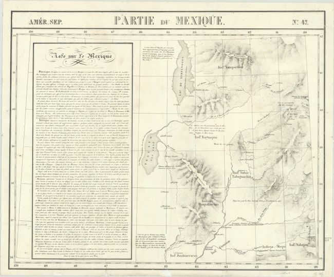
Auction 197, Lot 291
Subject: Utah
Vandermaelen, Philippe Marie Guillaume
Amer. Sep. Partie du Mexique. No. 47, 1825-27
Size: 22.6 x 18.6 inches (57.4 x 47.2 cm)
Estimate: $350 - $425
Price reduced by $50
Unsold
Closed on 4/24/2024
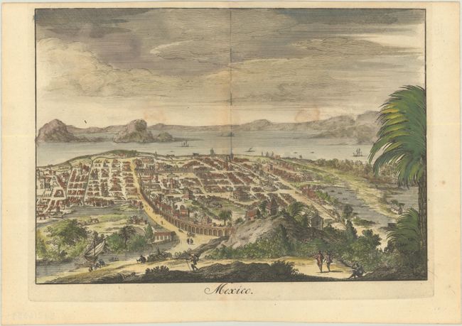
Auction 197, Lot 319
Subject: Mexico City, Mexico
Halma, Francois
Mexico, 1705
Size: 10.6 x 7.4 inches (26.9 x 18.8 cm)
Estimate: $200 - $230
Unsold
Closed on 4/24/2024
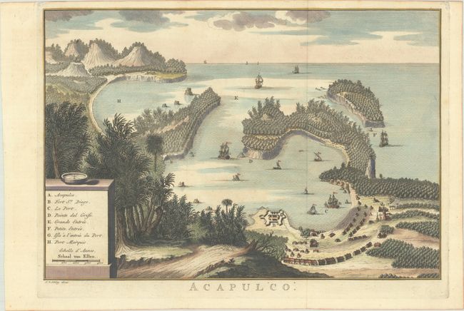
Auction 197, Lot 320
Subject: Acapulco, Mexico
Van der Schley, Jacob
Acapulco, 1762
Size: 13.1 x 9 inches (33.3 x 22.9 cm)
Estimate: $200 - $230
Unsold
Closed on 4/24/2024
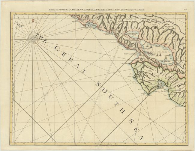
Auction 197, Lot 323
Subject: Nicaragua & Costa Rica
Jefferys/Laurie & Whittle
Part of the Provinces of Costa-Rica and Nicaragua with the Lagunas, 1794
Size: 24.7 x 18.5 inches (62.7 x 47 cm)
Estimate: $190 - $220
Unsold
Closed on 4/24/2024
191 lots
Page 1 of 4