Subject: World
Period: 1860 (dated)
Publication:
Color: Hand Color
Size:
34.4 x 25.6 inches
87.4 x 65 cm
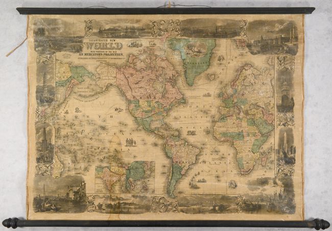
This elegant wall map on Mercator's projection is centered on the Americas with lovely vignettes forming the map borders including depictions of Alexandria, Constantinople, Venice, the Porcelain Tower in Nanking, Hong Kong Harbor, and more. In the United States, there are evolving western territorial configurations including Washington Territory in the inverted "L" shape, a huge Nebraska Territory stretching between the Continental Divide and the Missouri River, a large Utah Territory, and Kansas Territory encompassing eastern Colorado. The Overland Mail Route is prominently depicted from Cairo, Missouri to San Francisco, while numerous explorer routes are shown in the waters including the tracks of Cook, Vancouver, Ross, Parry, and more. An inset of the Chinese Empire is situated off the western coast of South America. The imprint for Rufus Blanchard at 32 Lasalle Street in Chicago is located at top left. Rollers are present and attached.
References:
Condition: B
Contemporary color with some light toning and soiling and a dampstain at bottom. There is some minor cracking and small abrasions in the image and minor edge chipping at left.