Showing Unsold Lots(remove filter)
Filtered by Category:Canada(Show All Categories)
Current Auction
10 lots
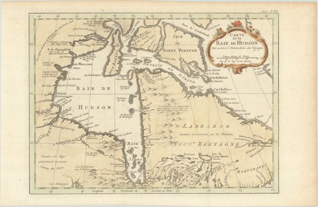
Lot 110
Subject: Eastern Canada
Bellin, Jacques Nicolas
Carte de la Baie de Hudson pour Servir a l'Histoire Gen. des Voyages, 1777
Size: 11.9 x 8.6 inches (30.2 x 21.8 cm)
Estimate: $110 - $140
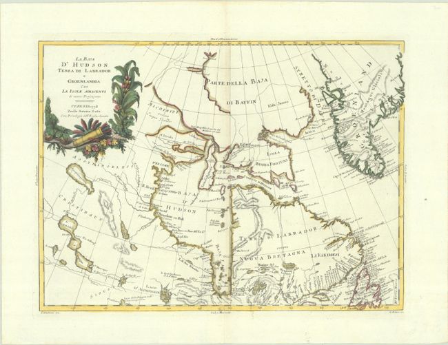
Lot 111
Subject: Eastern Canada & Greenland
Zatta, Antonio
La Baja d'Hudson Terra di Labrador e Groenlandia con le Isole Adiacenti di Nuova Projezione, 1778
Size: 16.1 x 11.8 inches (40.9 x 30 cm)
Estimate: $150 - $180
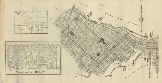
Lot 115
Subject: Vancouver, Canada
[4 Maps] T. Mathews' Vest Pocket Map of Vancouver, 1909
Size: 20.6 x 10.5 inches (52.3 x 26.7 cm)
Estimate: $550 - $700
Early Real Estate Plan of Vancouver
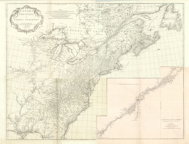
Lot 119
Subject: Colonial Eastern United States & Canada
Anville, Jean Baptiste Bourguignon d'
[On 4 Sheets] Canada Louisiane et Terres Angloises, 1755
Size: 21.9 x 18.8 inches (55.6 x 47.8 cm)
Estimate: $1,200 - $1,500
D'Anville's Spectacular Map of Eastern Seaboard
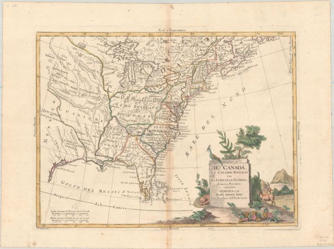
Lot 121
Subject: Colonial Eastern United States & Canada
Zatta, Antonio
Il Canada, le Colonie Inglesi con la Luigiana, e Florida di Nuova Projezione, 1778
Size: 15.9 x 11.9 inches (40.4 x 30.2 cm)
Estimate: $400 - $475
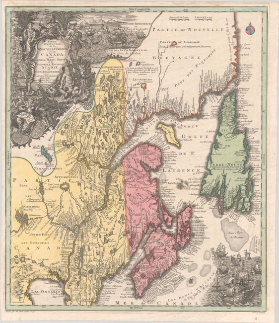
Lot 126
Subject: Colonial Northeastern United States & Canada
Seutter/Lotter
Partie Orientale de la Nouvelle France ou du Canada avec l'Isle de Terre-Neuve et de Nouvelle Escosse, Acadie et Nouv. Angleterre avec Fleuve de St. Laurence, 1756
Size: 19.4 x 22.6 inches (49.3 x 57.4 cm)
Estimate: $1,200 - $1,500
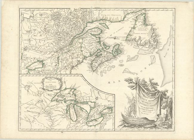
Lot 127
Subject: Colonial Northeastern United States & Canada, Great Lakes
Robert de Vaugondy, Didier
Partie de l'Amerique Septent? qui Comprend la Nouvelle France ou le Canada, 1784
Size: 23.8 x 19 inches (60.5 x 48.3 cm)
Estimate: $475 - $600
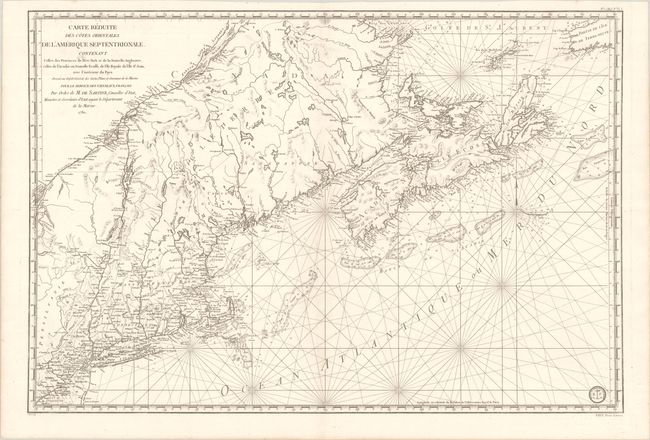
Lot 128
Subject: Colonial Northeastern United States & Canada
Sartine
Carte Reduite des Cotes Orientales de l'Amerique Septentrionale Contenant Celles des Provinces de New-York et de la Nouvelle Angleterre, Celles de l'Acadie ou Nouvelle Ecosse, de l'Ile Royale de l'Ile St. Jean..., 1780
Size: 34.3 x 23.1 inches (87.1 x 58.7 cm)
Estimate: $1,100 - $1,400
Revolutionary War-Era Sea Chart Covering New England & Eastern Canada
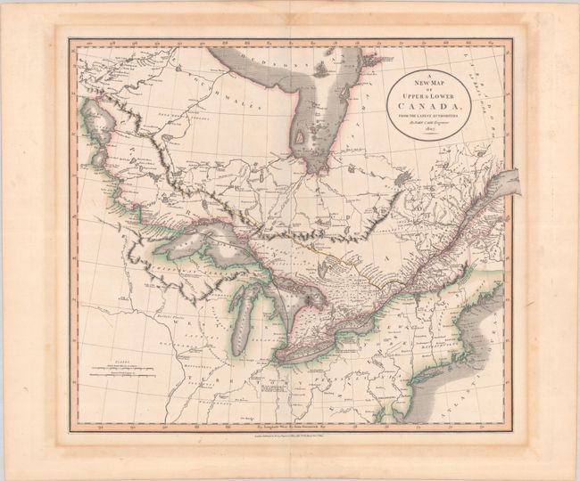
Lot 129
Subject: Northeastern United States & Canada
Cary, John
A New Map of Upper & Lower Canada, from the Latest Authorities, 1807
Size: 20.6 x 18.1 inches (52.3 x 46 cm)
Estimate: $475 - $600
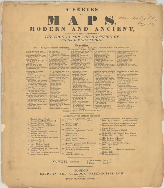
Lot 130
Subject: Northeastern United States & Canada
SDUK Society for the Diffusion of Useful Knowledge
[2 Maps] A Series of Maps, Modern and Ancient ... No. XXVI. Containing... North America, Part 3 - Ditto, Part 6, 1832
Size: 14.6 x 16.7 inches (37.1 x 42.4 cm)
Estimate: $180 - $220
10 lots