Subject: Vancouver, Canada
Period: 1909 (dated)
Publication:
Color: Black & White
Size:
20.6 x 10.5 inches
52.3 x 26.7 cm
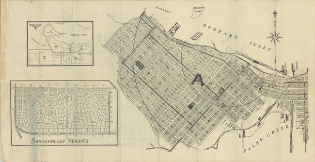
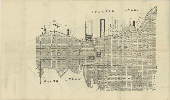
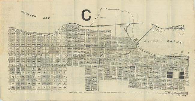
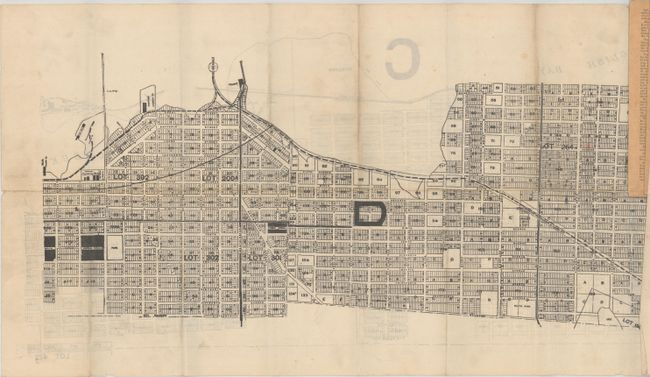
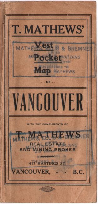
This early real estate plan of Vancouver was published by Thomson Stationery Company and sold with compliments of Thomas Matthews, Real Estate and Mining Broker. The plan is laid out on four sheets, roughly breaking the city into quadrants, with an index map on the "A" sheet. Each quadrant is divided into lots and then subsequently into blocks and individual parcels. The plan locates schools, parks, hotels, businesses, and most importantly to Vancouver's growth, the terminus of the recently completed Canadian Pacific Railway (CPR) that was completed in the late 1880s. Vancouver had suffered a devastating fire in 1886 that entirely wiped out the city, but starting over with a blank slate and the CPR positioned itself for exponential growth. In fact, the city's population grew from 14,000 in 1891 to 120,000 by 1911. Text on the inside cover touts the city and encourages further settlement: "Handsome blocks of buildings of granite and brick are rapidly taking the place of smaller and less pretentious structures of its pioneer days" and "Vancouver has the most delightful climate to be found anywhere within the boundaries of Canada." The maps fold into paper wrappers.
We found no past sales records for this map and only one institutional example for the 1909 edition (University of British Columbia). OCLC locates four other examples from different editions.
References:
Condition: A
Issued folding on clean sheets with a few faint spots. There is some minor staining in the side margins where the maps were glued to the wrappers, which have some minor soiling and a crease on the front wrapper.