Showing No Reserve Lots(remove filter)
Showing results for:Auction 92
Catalog Archive
60 lots
Page 1 of 2
Auction 92, Lot 53
Subject: Astronomy
Braun & Hogenberg
Topograhia Insulae Huenae celebri porthmo Regni Daniae, quem Vulgo Oersunt uocant, 1586
Size: 18.8 x 13.3 inches (47.8 x 33.8 cm)
Estimate: $900 - $1,000
Sold for: $1,100
Closed on 9/13/2000
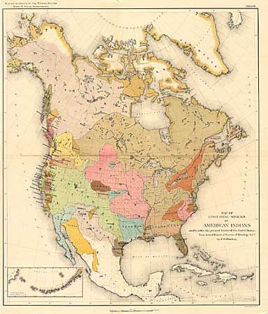
Auction 92, Lot 98
Subject: North America
Powell, John Wesley
Map of the Linguistic Stocks of American Indians, 1890
Size: 17.5 x 20 inches (44.5 x 50.8 cm)
Estimate: $75 - $100
Sold for: $400
Closed on 9/13/2000
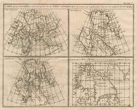
Auction 92, Lot 104
Subject: Canada
Robert de Vaugondy, Gilles
Carte qui represente les differentes connoissance que l on a eues des Terres Arctiques despuis 1650 jusqui en 1747 assqie es o fait comparer la carte Suivant, 1777
Size: 15 x 12 inches (38.1 x 30.5 cm)
Estimate: $150 - $180
Sold for: $60
Closed on 9/13/2000
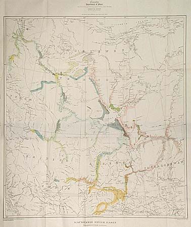
Auction 92, Lot 106
Subject: Canada
Collins, William Sons & Co.
MacKenzie River Basin Northwestern Canada, 1922
Size: 29 x 29 inches (73.7 x 73.7 cm)
Estimate: $50 - $60
Sold for: $40
Closed on 9/13/2000
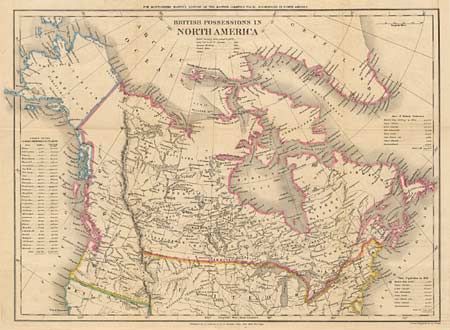
Auction 92, Lot 112
Subject: Canada and United States
Walker, J & C
British Possessions in North America, 1834
Size: 17.8 x 12.4 inches (45.2 x 31.5 cm)
Estimate: $120 - $150
Sold for: $150
Closed on 9/13/2000
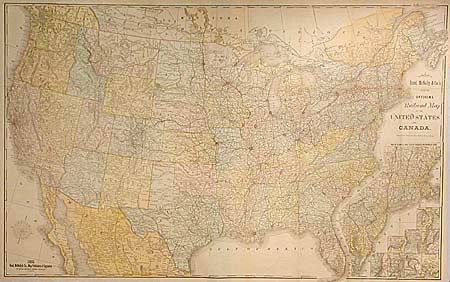
Auction 92, Lot 132
Subject: United States
Rand McNally & Co.
New Official Railroad Map of the United States and Canada, 1885
Size: 42.5 x 26.5 inches (108 x 67.3 cm)
Estimate: $250 - $350
Sold for: $425
Closed on 9/13/2000
Auction 92, Lot 141
Subject: Central United States
Lot of 3 maps; Micigan, Iowa & Arkansas, 1854
Size: See Description
Estimate: $40 - $50
Sold for: $65
Closed on 9/13/2000
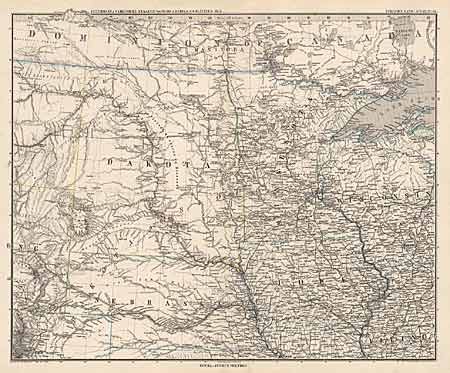
Auction 92, Lot 144
Subject: North-central United States
Petermann, Augustus Herman
[Dakota Territory], 1880
Size: 16 x 13 inches (40.6 x 33 cm)
Estimate: $60 - $80
Sold for: $0
Closed on 9/13/2000
Auction 92, Lot 146
Subject: South-central United States
Petermann, Augustus Herman
[South-central United States], 1887
Size: 16 x 13 inches (40.6 x 33 cm)
Estimate: $70 - $90
Sold for: $55
Closed on 9/13/2000
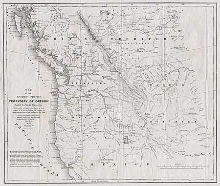
Auction 92, Lot 147
Subject: Pacific Northwest
Abert/Hood
Map of the United States Territory of Oregon West of the Rocky Mountains Exhibiting the various Trading Depots or Forts occupied by the British Hudson Bay Company connected with the Western and Northwestern Fur Trade., 1838
Size: 20.4 x 17.5 inches (51.8 x 44.5 cm)
Estimate: $400 - $475
Sold for: $400
Closed on 9/13/2000
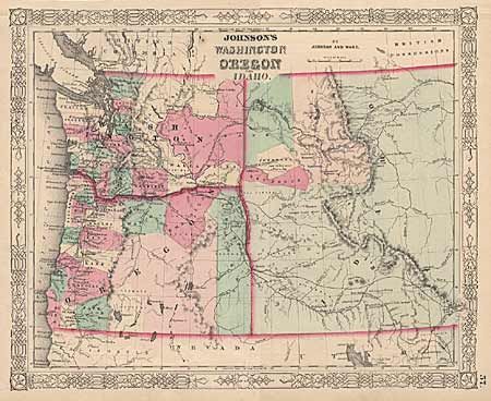
Auction 92, Lot 148
Subject: Pacific Northwest
Johnson & Ward
Johnson's Washington, Oregon and Idaho, 1863
Size: 15.5 x 12.5 inches (39.4 x 31.8 cm)
Estimate: $70 - $100
Sold for: $160
Closed on 9/13/2000
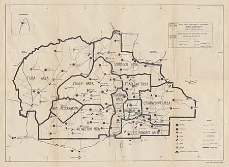
Auction 92, Lot 149
Subject: Southwestern United States
U.S. Bureau of Indian Affairs
Navajo Reservation - Educational Facilities - Arizona - New Mexico - Utah, 1954
Size: 25.5 x 18.2 inches (64.8 x 46.2 cm)
Estimate: $40 - $60
Sold for: $20
Closed on 9/13/2000
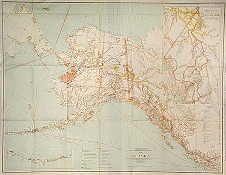
Auction 92, Lot 152
Subject: Alaska
General Land Office
Map of Alaska, 1898
Size: 32 x 24.7 inches (81.3 x 62.7 cm)
Estimate: $100 - $130
Sold for: $160
Closed on 9/13/2000
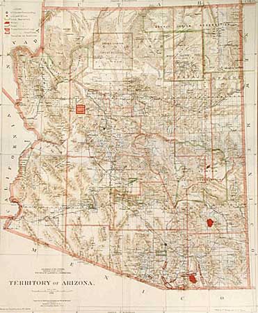
Auction 92, Lot 155
Subject: Arizona
General Land Office
Territory of Arizona, 1896
Size: 16.8 x 20.4 inches (42.7 x 51.8 cm)
Estimate: $170 - $200
Sold for: $275
Closed on 9/13/2000
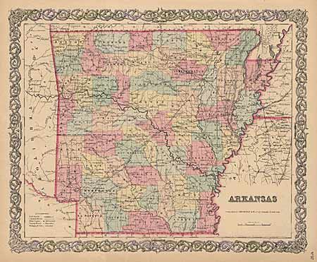
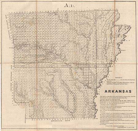
Auction 92, Lot 156
Subject: Arkansas
Colton, Joseph Hutchins
Arkansas, 1855
Size: 15.5 x 12.6 inches (39.4 x 32 cm)
Estimate: $70 - $100
Sold for: $130
Closed on 9/13/2000
Auction 92, Lot 157
Subject: California & Gold Rush
U.S. Government
[Lot of 2], 1848
Size: 18.3 x 9.3 inches (46.5 x 23.6 cm)
Estimate: $325 - $400
Sold for: $350
Closed on 9/13/2000
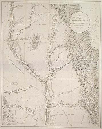
Auction 92, Lot 158
Subject: California & Gold Rush
Derby, George Horatio (Lt)
The Sacramento Valley from the American River to Butte Creek…, 1849
Size: 17.5 x 22.5 inches (44.5 x 57.2 cm)
Estimate: $275 - $325
Sold for: $275
Closed on 9/13/2000
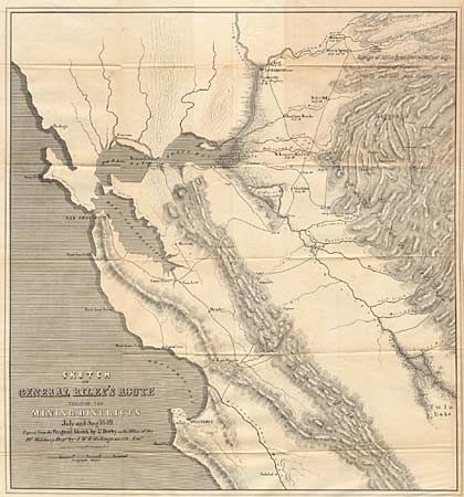
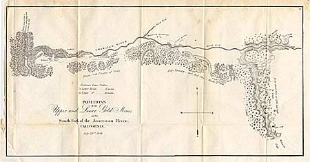
Auction 92, Lot 159
Subject: California & Gold Rush
Derby, George Horatio (Lt)
Sketch of General Riley's Route Through the Mining Districts July and Aug. 1849, 1850
Size: 19.8 x 21 inches (50.3 x 53.3 cm)
Estimate: $600 - $700
Sold for: $450
Closed on 9/13/2000
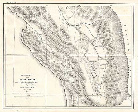
Auction 92, Lot 160
Subject: California & Gold Rush
Derby, George Horatio (Lt)
Reconnaissance of the Tulares Valley, 1850
Size: 18.2 x 14.6 inches (46.2 x 37.1 cm)
Estimate: $120 - $150
Sold for: $70
Closed on 9/13/2000
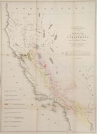
Auction 92, Lot 162
Subject: California
Williamson, R. S. (Lt.)
Geological Map of a Part of the State of California, 1855
Size: 16 x 22 inches (40.6 x 55.9 cm)
Estimate: $90 - $120
Sold for: $80
Closed on 9/13/2000
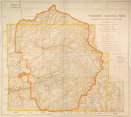
Auction 92, Lot 164
Subject: California
U.S. Government
Yosemite National Park showing the change in boundaries recommended by Commission appointed pursuant to Act of Congress approved April 28 1904, 1904
Size: 27 x 24 inches (68.6 x 61 cm)
Estimate: $100 - $130
Sold for: $375
Closed on 9/13/2000
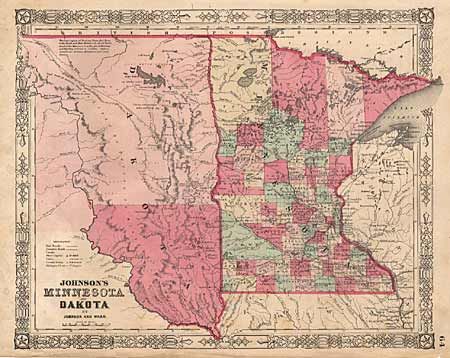
Auction 92, Lot 165
Subject: Dakota Territory and Minnesota
Johnson & Ward
Johnson's Minnesota and Dakota, 1864
Size: 15.5 x 12.5 inches (39.4 x 31.8 cm)
Estimate: $50 - $60
Sold for: $0
Closed on 9/13/2000
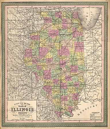
Auction 92, Lot 170
Subject: Illinois
Thomas, Cowperthwait & Co.
A New Map of the State of Illinois, 1850
Size: 13 x 15.7 inches (33 x 39.9 cm)
Estimate: $120 - $140
Sold for: $170
Closed on 9/13/2000
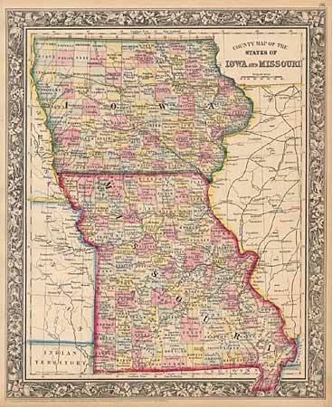
Auction 92, Lot 174
Subject: Iowa & Missouri
Mitchell, Samuel Augustus
County Map of the States of Iowa & Missouri, 1860
Size: 11.5 x 14 inches (29.2 x 35.6 cm)
Estimate: $50 - $60
Sold for: $0
Closed on 9/13/2000
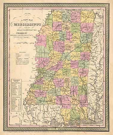
Auction 92, Lot 181
Subject: Mississippi
Thomas, Cowperthwait & Co.
A New Map of the State of Mississippi with its Roads and Distances, 1850
Size: 11.6 x 14 inches (29.5 x 35.6 cm)
Estimate: $90 - $110
Sold for: $70
Closed on 9/13/2000
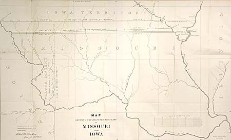
Auction 92, Lot 182
Subject: Missouri & Iowa
U.S. Government
Map Showing the Disputed Boundary of Missouri and Iowa, 1839
Size: 29 x 18 inches (73.7 x 45.7 cm)
Estimate: $200 - $250
Sold for: $325
Closed on 9/13/2000
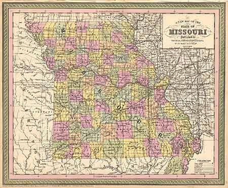
Auction 92, Lot 183
Subject: Missouri
Thomas, Cowperthwait & Co.
A New Map of the State of Missouri, 1850
Size: 16.2 x 13.2 inches (41.1 x 33.5 cm)
Estimate: $110 - $130
Sold for: $50
Closed on 9/13/2000
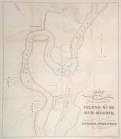
Auction 92, Lot 184
Subject: Mississippi
U.S. War Dept.
Map Showing the System of Rebel Fortifications on the Mississippi River at Island No. 10 and New Madrid , Also the Operations of the U. S. Forces under General John Pope Against These Positions, 1866
Size: 17.2 x 20 inches (43.7 x 50.8 cm)
Estimate: $250 - $300
Sold for: $250
Closed on 9/13/2000
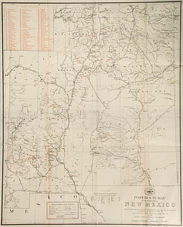
Auction 92, Lot 185
Subject: New Mexico
Anon.
Post Route Map of the Territory of New Mexico, 1903
Size: 17 x 21 inches (43.2 x 53.3 cm)
Estimate: $75 - $100
Sold for: $90
Closed on 9/13/2000
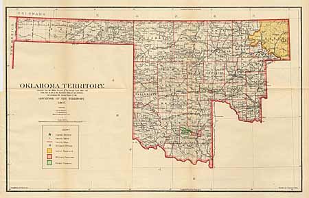
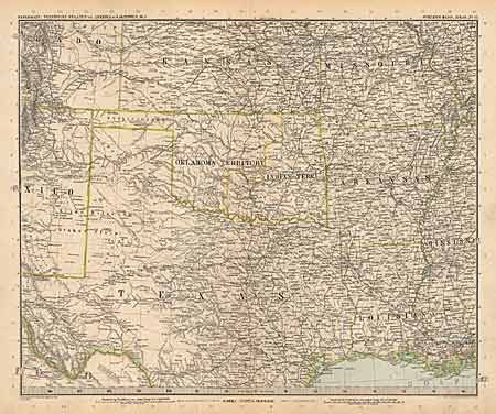
Auction 92, Lot 188
Subject: Oklahoma
General Land Office
Oklahoma Territory, 1907
Size: 22 x 13.8 inches (55.9 x 35.1 cm)
Estimate: $130 - $160
Sold for: $200
Closed on 9/13/2000
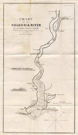
Auction 92, Lot 189
Subject: Oregon and Washington
U.S. Government
Chart of the Columbia River for 90 miles from its mouth, 1838
Size: 9 x 16.3 inches (22.9 x 41.4 cm)
Estimate: $80 - $100
Sold for: $100
Closed on 9/13/2000
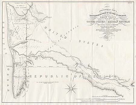
Auction 92, Lot 200
Subject: California & Mexico
Gray, Andrew B.
Topographical Sketch of the Southernmost Part of the Port of San Diego, and measurement of the Marine League for determining Initial Point of Boundary between the United States and Mexican Republic as Surveyed by The United States Commission…, 1849
Size: 22.5 x 17.5 inches (57.2 x 44.5 cm)
Estimate: $350 - $400
Sold for: $160
Closed on 9/13/2000
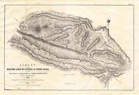
Auction 92, Lot 205
Subject: Mexico
U.S. Government
Survey of the Mexican Lines of Defense at Cerro Gordo and the Lines of Attack of the American Army under Maj. Gen. Scott on the 17th & 18th of April 1847, 1847
Size: 19 x 12.5 inches (48.3 x 31.8 cm)
Estimate: $100 - $120
Sold for: $95
Closed on 9/13/2000
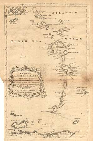
Auction 92, Lot 215
Subject: Lesser Antilles
Jefferys, Thomas
A Map of the Caribbee Islands; Shewing which belong to England, France, Spain, Dutch & Danes, Collected from the best Authorities, 1756
Size: 8 x 13 inches (20.3 x 33 cm)
Estimate: $40 - $60
Sold for: $0
Closed on 9/13/2000
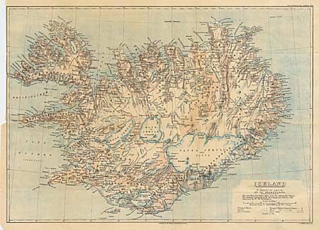
Auction 92, Lot 236
Subject: Iceland
Anon.
Iceland, 1899
Size: 22 x 15.5 inches (55.9 x 39.4 cm)
Estimate: $70 - $100
Sold for: $95
Closed on 9/13/2000
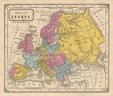
Auction 92, Lot 242
Subject: Europe
Mitchell, S. A.
Map of Europe, 1863
Size: 6.4 x 5.3 inches (16.3 x 13.5 cm)
Estimate: $20 - $25
Sold for: $15
Closed on 9/13/2000
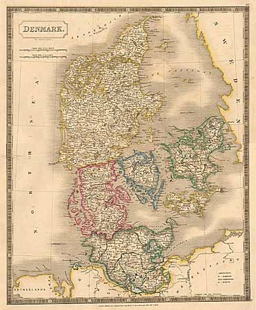
Auction 92, Lot 261
Subject: Denmark
Hall
Denmark, 1828
Size: 16 x 19.6 inches (40.6 x 49.8 cm)
Estimate: $70 - $100
Sold for: $30
Closed on 9/13/2000
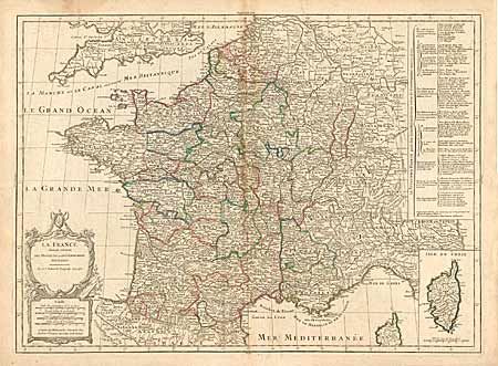
Auction 92, Lot 275
Subject: France
Robert de Vaugondy, Gilles
La France divisee suivant Ses Provinces ou Gouvernements Militaires, 1750
Size: 26.9 x 19.8 inches (68.3 x 50.3 cm)
Estimate: $100 - $150
Sold for: $50
Closed on 9/13/2000
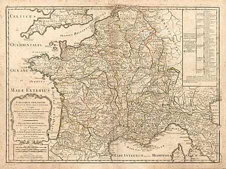
Auction 92, Lot 278
Subject: France
Robert de Vaugondy, Gilles
Gallarium Descriptio, 1795
Size: 26.5 x 19.5 inches (67.3 x 49.5 cm)
Estimate: $120 - $150
Sold for: $50
Closed on 9/13/2000
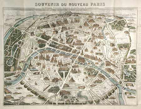
Auction 92, Lot 279
Subject: France
Logerot, Auguste
Souvenir du Nouveau Paris, 1890
Size: 21 x 16.5 inches (53.3 x 41.9 cm)
Estimate: $40 - $50
Sold for: $275
Closed on 9/13/2000
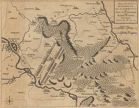
Auction 92, Lot 286
Subject: Germany
Anon.
Map of that Part of Hannover where the late Battle between the Duke of Cumberland and Marshal D'Etrees was fought July 25-26-27, 1757
Size: 10 x 7.7 inches (25.4 x 19.6 cm)
Estimate: $30 - $40
Sold for: $18
Closed on 9/13/2000
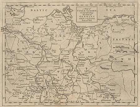
Auction 92, Lot 287
Subject: Germany
Anon.
A Map of Upper saxony Comprehending that part of Germany which is the Present Seat of War, 1757
Size: 10 x 7.7 inches (25.4 x 19.6 cm)
Estimate: $30 - $40
Sold for: $15
Closed on 9/13/2000
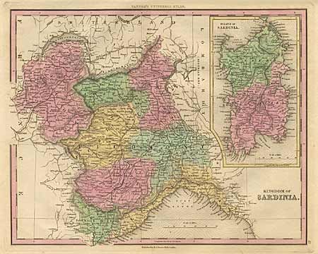
Auction 92, Lot 303
Subject: Italy - Sardinia
Tanner, Henry Schenck
Kingdom of Sardinia, 1836
Size: 14.7 x 11.7 inches (37.3 x 29.7 cm)
Estimate: $50 - $70
Sold for: $25
Closed on 9/13/2000
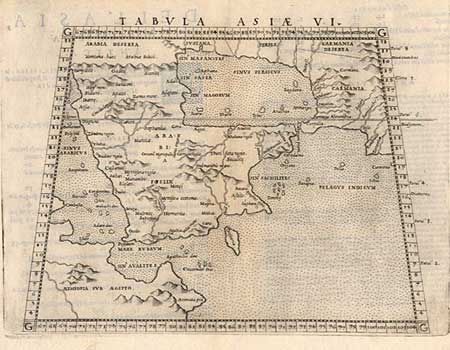
Auction 92, Lot 307
Subject: Asia
Ruscelli, Girolamo
Tabula Asiae VI, 1561
Size: 7.5 x 10 inches (19.1 x 25.4 cm)
Estimate: $200 - $250
Sold for: $120
Closed on 9/13/2000
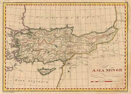
Auction 92, Lot 315
Subject: Turkey
Anon.
Asia Minor, 1790
Size: 15.7 x 11.2 inches (39.9 x 28.4 cm)
Estimate: $30 - $40
Sold for: $25
Closed on 9/13/2000
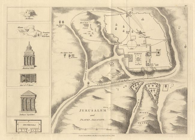
Auction 92, Lot 319
Subject: Holy Land
Holdsworth, Samuel
Jerusalem and Places Adjacent, 1836
Size: 12 x 8.5 inches (30.5 x 21.6 cm)
Estimate: $40 - $45
Sold for: $20
Closed on 9/13/2000
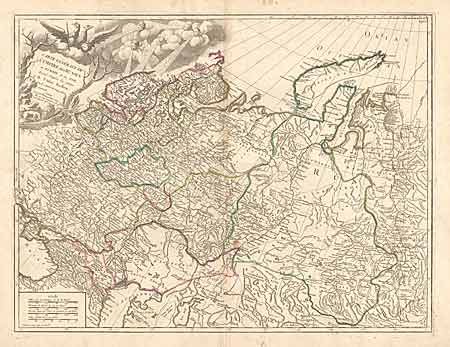
Auction 92, Lot 326
Subject: Russian Empire
Robert de Vaugondy, Gilles
Carte Generale de l'Empire des Russes en Europe et en Asie, 1786
Size: 23.8 x 18.2 inches (60.5 x 46.2 cm)
Estimate: $200 - $250
Sold for: $95
Closed on 9/13/2000
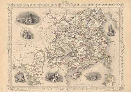
Auction 92, Lot 328
Subject: China and Myanmar
Tallis, John
China and Birmah, 1850
Size: 13 x 9.5 inches (33 x 24.1 cm)
Estimate: $50 - $60
Sold for: $110
Closed on 9/13/2000
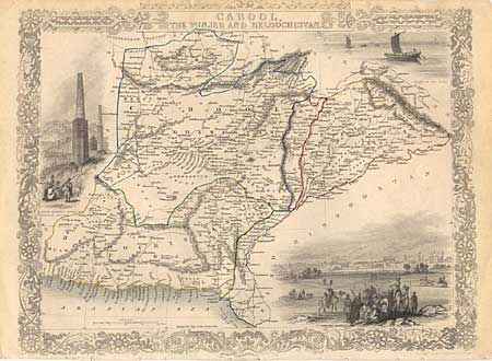
Auction 92, Lot 335
Subject: Pakistan and Afghanistan
Tallis, John
Cabool, the Punjab and Beloochistan, 1850
Size: 12 x 8.5 inches (30.5 x 21.6 cm)
Estimate: $40 - $50
Sold for: $0
Closed on 9/13/2000
Auction 92, Lot 343
Subject: Africa
Lot of 64 Maps and Engravings, 1748-49
Size: See Description
Estimate: $50 - $60
Sold for: $240
Closed on 9/13/2000
60 lots
Page 1 of 2