Catalog Archive
Auction 92, Lot 215
"A Map of the Caribbee Islands; Shewing which belong to England, France, Spain, Dutch & Danes, Collected from the best Authorities", Jefferys, Thomas
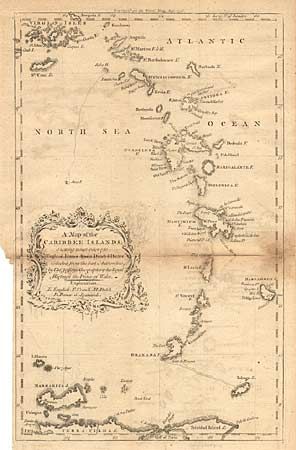
Subject: Lesser Antilles
Period: 1756 (published)
Publication: Gentlemen's Magazine
Color: Black & White
Size:
8 x 13 inches
20.3 x 33 cm
Download High Resolution Image
(or just click on image to launch the Zoom viewer)
(or just click on image to launch the Zoom viewer)