Showing No Reserve Lots(remove filter)
Showing results for:Auction 158
Catalog Archive
26 lots
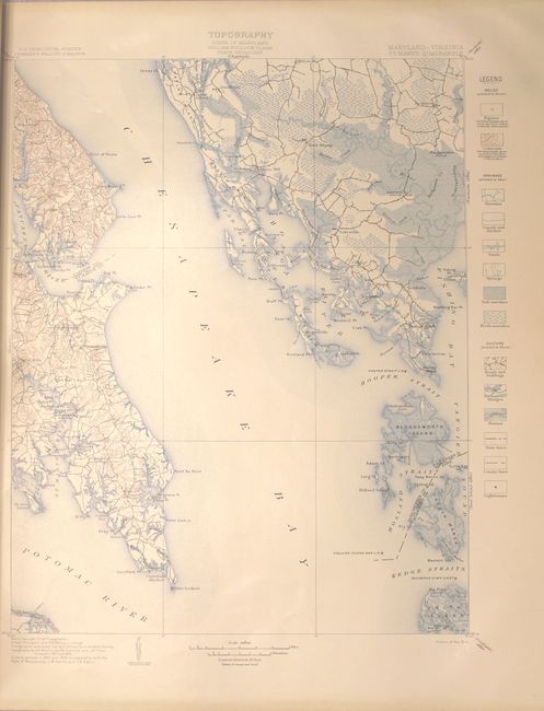
Auction 158, Lot 103
Subject: Maryland, Virginia
U.S. Geological Survey (USGS)
Geologic Atlas of the United States - St. Marys Folio Maryland-Virginia, 1906
Size: 18.6 x 21.8 inches (47.2 x 55.4 cm)
Estimate: $50 - $70
NO RESERVE
Sold for: $22
Closed on 6/22/2016
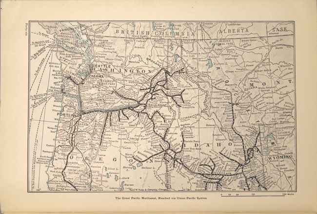
Auction 158, Lot 121
Subject: Northwestern United States
Railroad Companies, (Various)
The Pacific Northwest and Alaska, 1928
Size: 6.9 x 10.1 inches (17.5 x 25.7 cm)
Estimate: $40 - $50
NO RESERVE
Sold for: $15
Closed on 6/22/2016
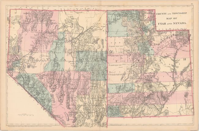
Auction 158, Lot 124
Subject: Southwestern United States
Mitchell, Samuel Augustus
County and Township Map of Utah and Nevada, 1880
Size: 22.1 x 14.1 inches (56.1 x 35.8 cm)
Estimate: $70 - $90
NO RESERVE
Sold for: $9
Closed on 6/22/2016
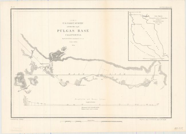
Auction 158, Lot 126
Subject: California
U.S. Coast Survey
Pulgas Base California, 1854
Size: 12.3 x 8.3 inches (31.2 x 21.1 cm)
Estimate: $40 - $50
NO RESERVE
Sold for: $28
Closed on 6/22/2016
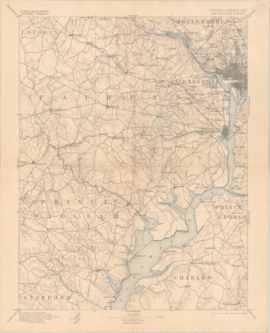
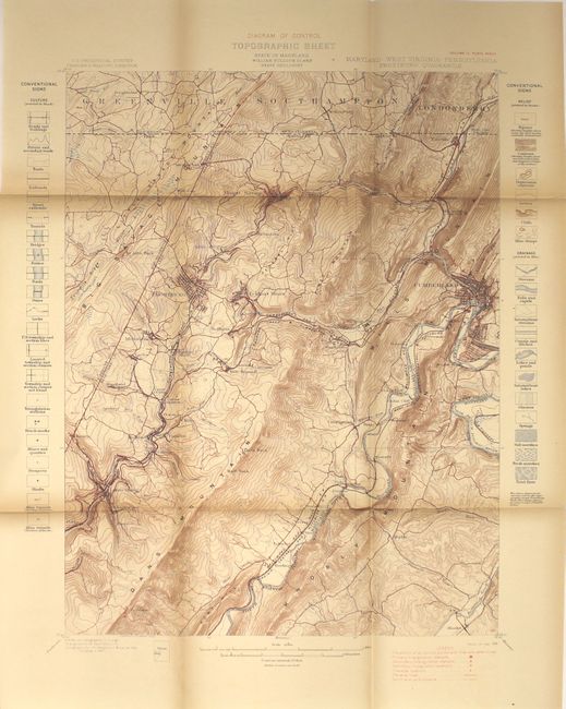
Auction 158, Lot 133
Subject: Washington, D.C.
U.S. Geological Survey (USGS)
[Lot of 4] Maryland - District of Columbia Patuxent Quadrangle [and] Virginia - Maryland Mt Vernon Sheet [and] Maryland - Virginia Nomini Sheet [and] Virginia - Maryland Fredericksburg Sheet, 1894-1905
Size: 13.5 x 17.5 inches (34.3 x 44.5 cm)
Estimate: $180 - $220
NO RESERVE
Sold for: $26
Closed on 6/22/2016
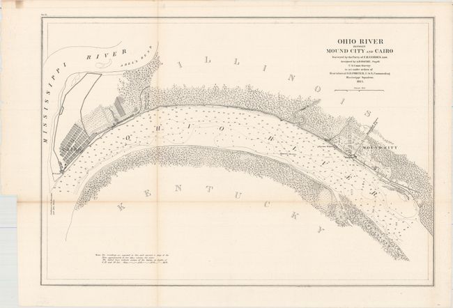
Auction 158, Lot 136
Subject: Southern Illinois
U.S. Coast Survey
Ohio River between Mound City and Cairo…, 1864
Size: 22 x 15 inches (55.9 x 38.1 cm)
Estimate: $70 - $100
NO RESERVE
Sold for: $4
Closed on 6/22/2016
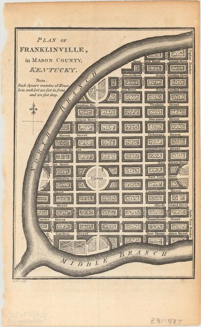
Auction 158, Lot 137
Subject: Kentucky
Russell, John C.
[Lot of 2] Plan of Franklinville, in Mason County, Kentucky [and] Plan of Lystra, in Nelson-County; Kentucky, 1795
Size: 4.8 x 6.5 inches (12.2 x 16.5 cm)
Estimate: $140 - $170
NO RESERVE
Sold for: $5
Closed on 6/22/2016
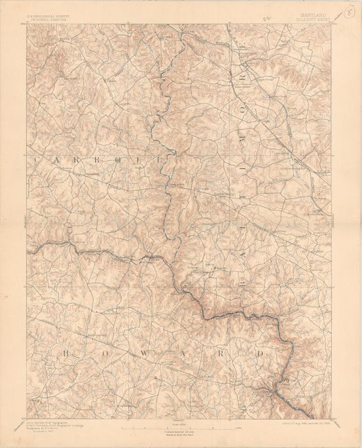
Auction 158, Lot 139
Subject: Maryland
U.S. Geological Survey (USGS)
[Lot of 4] Ellicott Sheet [and] Baltimore Quadrangle [and] Laurel Sheet [and] Relay Sheet, 1894-1905
Size: 13.5 x 17.5 inches (34.3 x 44.5 cm)
Estimate: $180 - $220
NO RESERVE
Sold for: $5
Closed on 6/22/2016
Auction 158, Lot 140
Subject: Maryland
Maryland Geological Survey Volume Two, 1898
Size: 7 x 10.3 inches (17.8 x 26.2 cm)
Estimate: $50 - $75
NO RESERVE
Unsold
Closed on 6/22/2016
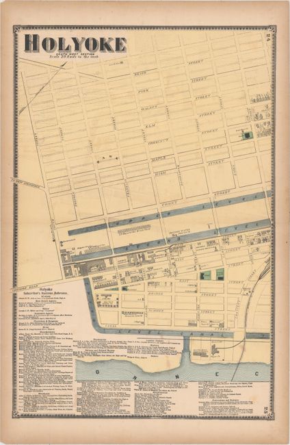
Auction 158, Lot 141
Subject: Central Massachusetts
[Lot of 3] Holyoke South West Section [and] Holyoke North East Section [and] Massachusetts - Connecticut Springfield Sheet, 1870-90
Size: See Description
Estimate: $70 - $90
NO RESERVE
Unsold
Closed on 6/22/2016
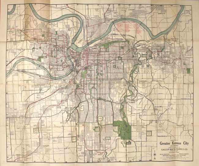
Auction 158, Lot 143
Subject: Kansas City, Missouri
Gallup, F.E.
Gallup's Map of Greater Kansas City and Suburbs, 1922
Size: 31.5 x 26.4 inches (80 x 67.1 cm)
Estimate: $80 - $100
NO RESERVE
Sold for: $22
Closed on 6/22/2016
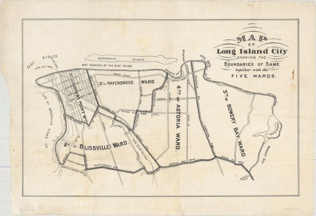
Auction 158, Lot 144
Subject: Long Island, New York
Anon.
Map of Long Island City Showing the Boundaries of Same Together with the Five Wards, 1870
Size: 14.3 x 9.3 inches (36.3 x 23.6 cm)
Estimate: $90 - $120
NO RESERVE
Sold for: $36
Closed on 6/22/2016
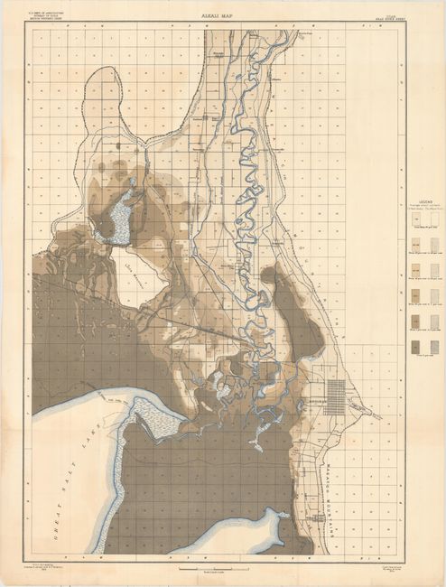
Auction 158, Lot 146
Subject: Utah
U.S. Department of Interior
Alkali Map - Utah Bear River Sheet, 1904
Size: 22.1 x 31.1 inches (56.1 x 79 cm)
Estimate: $40 - $50
NO RESERVE
Sold for: $5
Closed on 6/22/2016
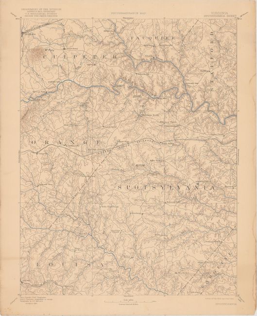
Auction 158, Lot 152
Subject: Central Virginia
U.S. Geological Survey (USGS)
Reconnaissance Map - Virginia Spotsylvania Sheet, 1922
Size: 14.1 x 18.9 inches (35.8 x 48 cm)
Estimate: $30 - $40
NO RESERVE
Unsold
Closed on 6/22/2016
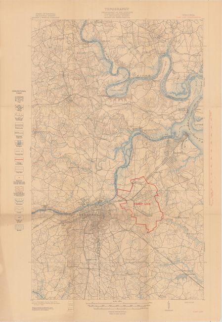
Auction 158, Lot 153
Subject: Eastern Virginia
The Country About Camp Lee, Virginia, 1918
Size: 7.1 x 10.1 inches (18 x 25.7 cm)
Estimate: $50 - $65
NO RESERVE
Unsold
Closed on 6/22/2016
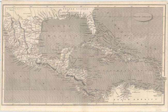
Auction 158, Lot 170
Subject: Caribbean
Rees, Abraham
West Indies, 1806
Size: 16 x 9.8 inches (40.6 x 24.9 cm)
Estimate: $90 - $120
NO RESERVE
Sold for: $46
Closed on 6/22/2016
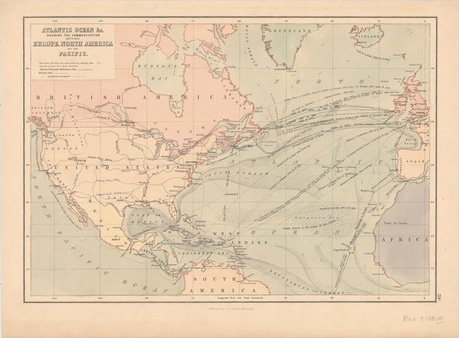
Auction 158, Lot 211
Subject: North Atlantic
Black, Adam & Charles
Atlantic Ocean &c. Shewing the Communication between Europe, North America and the Pacific, 1881
Size: 15.1 x 10.4 inches (38.4 x 26.4 cm)
Estimate: $40 - $50
NO RESERVE
Sold for: $33
Closed on 6/22/2016
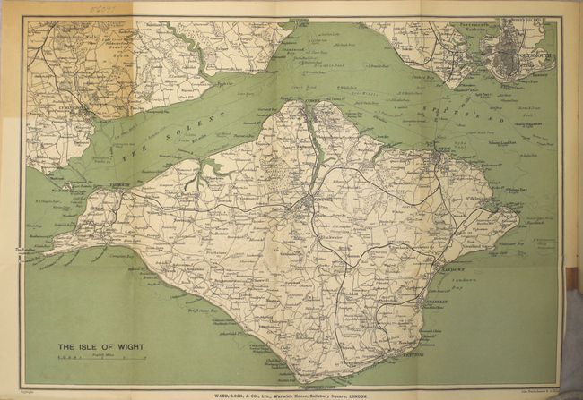
Auction 158, Lot 241
Subject: Isle of Wight, England
A Pictorial and Descriptive Guide to the Isle of Wight, in Six Sections, with Walks and Excursions by Road, Rail and Steamer from Each Centre..., 1908
Size: 4.3 x 6.8 inches (10.9 x 17.3 cm)
Estimate: $25 - $35
NO RESERVE
Sold for: $17
Closed on 6/22/2016
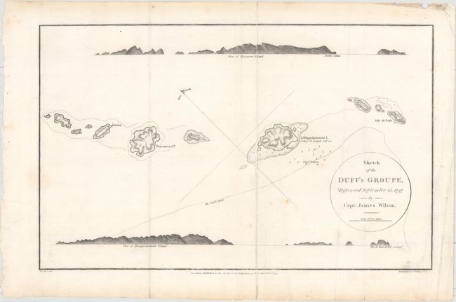
Auction 158, Lot 438
Subject: South Pacific Ocean
Wilson, James
Sketch of the Duff's Groupe, Discovered September 25, 1797 by Capt. James Wilson, 1799
Size: 14.8 x 9.3 inches (37.6 x 23.6 cm)
Estimate: $60 - $80
NO RESERVE
Sold for: $30
Closed on 6/22/2016
Auction 158, Lot 451
Subject: History Books
Swinton, William
A Condensed School History of the United States, Constructed for Definite Results in Recitation and Containing a New Method of Topical Reviews, 1875
Size: 4.8 x 7.2 inches (12.2 x 18.3 cm)
Estimate: $40 - $50
NO RESERVE
Sold for: $50
Closed on 6/22/2016
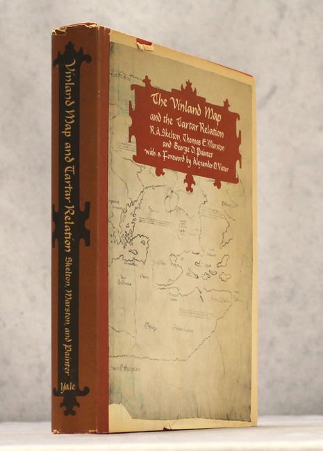
Auction 158, Lot 453
Subject: References
Skelton, Marston and Painter
The Vinland Map and the Tartar Relation, 1965
Size: 9.4 x 11.8 inches (23.9 x 30 cm)
Estimate: $25 - $40
NO RESERVE
Sold for: $26
Closed on 6/22/2016
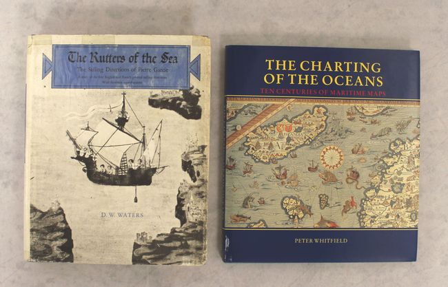
Auction 158, Lot 456
Subject: References
[Lot of 2] The Rutters of the Sea - The Sailing Directions of Pierre Garcie... [and] The Charting of the Oceans - Ten Centuries of Maritime Maps, 1967-96
Size: See Description
Estimate: $70 - $90
NO RESERVE
Sold for: $25
Closed on 6/22/2016
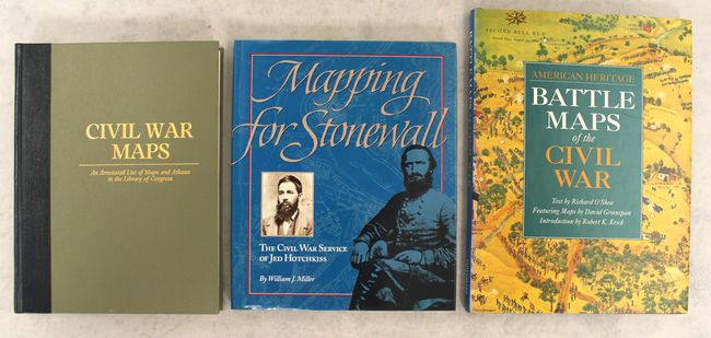
Auction 158, Lot 466
Subject: References
[Lot of 3] Civil War Maps - An Annotated List of Maps and Atlases in the Library of Congress [and] Mapping for Stonewall - The Civil War Service of Jed Hotchkiss [and] American Heritage - Battle Maps of the Civil War, 1989-93
Size: See Description
Estimate: $50 - $70
NO RESERVE
Sold for: $41
Closed on 6/22/2016
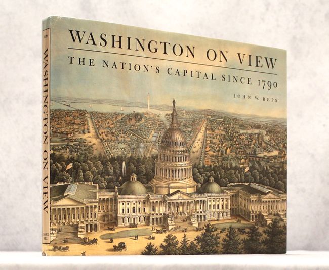
Auction 158, Lot 467
Subject: References
Reps, John W.
Washington on View - The Nation's Capital Since 1790, 1991
Size: 15.3 x 11.7 inches (38.9 x 29.7 cm)
Estimate: $40 - $60
NO RESERVE
Sold for: $24
Closed on 6/22/2016

Auction 158, Lot 468
Subject: References
[Lot of 2] Virginia Cartography - A Bibliographical Description [and] Virginia - Mapping the Old Dominion State Through History - Rare and Unusual Maps from the Library of Congress, 1995-2010
Size: See Description
Estimate: $60 - $80
NO RESERVE
Sold for: $26
Closed on 6/22/2016
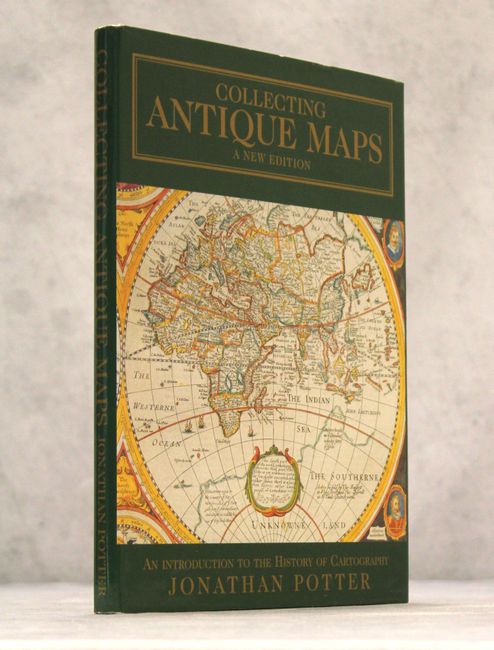
Auction 158, Lot 469
Subject: References
Potter, Jonathan
Collecting Antique Maps - An Introduction to the History of Cartography, 1999
Size: 8.9 x 12.1 inches (22.6 x 30.7 cm)
Estimate: $25 - $40
NO RESERVE
Sold for: $20
Closed on 6/22/2016
26 lots