Subject: Utah
Period: 1904 (dated)
Publication:
Color: Printed Color
Size:
22.1 x 31.1 inches
56.1 x 79 cm
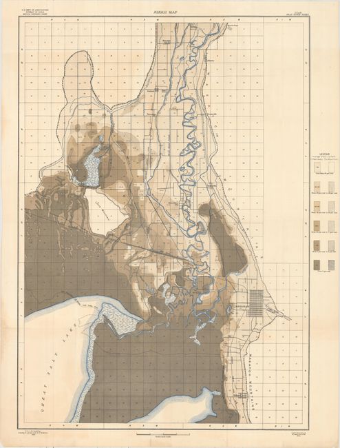
This large-scale map depicts a portion of Utah near the Great Salt Lake (Bear River Sheet). The alkali content of the soil is shown by color code for six levels of concentration. The rivers and streams are colored blue. Brigham City is located near the lower right of the map. The Southern Pacific Railroad passes from the middle of the left side of the map southeast to Brigham City. Promontory, Utah, where the "Golden Spike" was set at the junction of the Southern Pacific and Union Pacific Railroads in 1869 is just off the map at the left. The Great Salt Lake takes up the lower left of the map. The shoreline of 1868 is shown with the lake occupying considerably more area at that time. Published by the U.S. Department of Agriculture.
References:
Condition: B+
Issued folding with light color offsetting and a few tiny splits at fold intersections. One small tear adjacent to a fold has been closed on verso with archival tape.