Subject: Central Massachusetts
Period: 1870-90 (circa)
Publication:
Color:
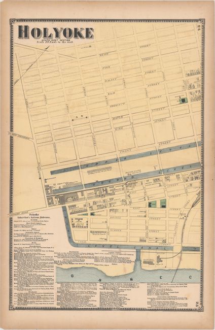
A. [Lot of 2] Holyoke South West Section and Holyoke North East Section, by J.H. Beers & Co., from Atlas of Hampden County Massachusetts, circa 1870, hand color (each 14.4 x 21.3"). These two sheets together show the city of Holyoke with individual buildings drawn and named. The Connecticut River is depicted along the right and bottom portion of the map along with three canals flowing through the city. Below the map are the tables "Holyoke Subscriber's Business Reference" and "Holyoke References." Condition: Light offsetting in the image, a few faint spots, and light toning along sheet edges. (B+)
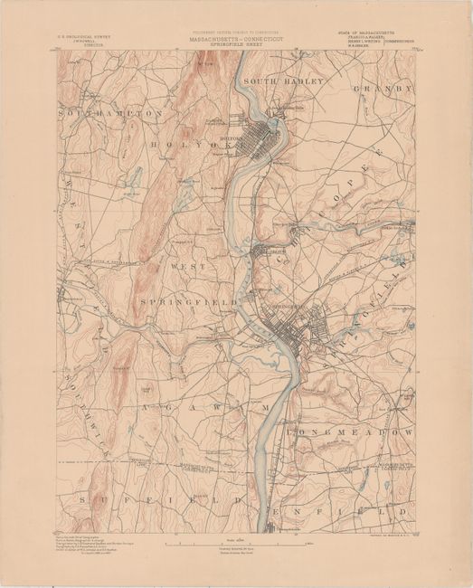
B. Massachusetts - Connecticut Springfield Sheet, by U.S. Geological Survey, circa 1890, printed color (13.4 x 17.7"). This sheet shows central Massachusetts including the cities of Holyoke and Springfield bordering the Connecticut River. Features highly detailed topography via contour lines and several railroads. Condition: Pleasant light toning with a few tiny edge tears. (A)
References:
Condition:
See description above.